Saturday, February 6, 2021

Barnegat Branch Trail, NJ - Dudley Park to Hebrew Park


ABOUT THE PARK: 
Barnegat Branch Trail - Ocean County Parks

DIRECTIONS: 
GPS Coordinates 39.869722, -74.170319
Parking at William J. Dudley Park

TRAIL MAP: 
Barnegat Branch Trail Map - Ocean County Parks (we hiked from number 8 to number 9 on the green section)

HIKE DISTANCE:  2.75 miles (can be made longer staying on the Barnegat Branch Trail)

THE HIKE: 
With 18 inches of snow in my neck of the woods, I had to find a snow-free place. After consulting the snow depth map, I headed to just south of Toms River where it was 95% snow free!  As a bonus, there is so much parking space yet there were very few people around on a sunny and warm 49 degree day.


A trail from the parking lot leads to the Barnegat Branch Trail.
But first I spotted a side trail to the right at a fork and took that to see where it went.
Little did I know it would loop me around to the main park road.
We just had to continue on and start again.
Back through the parking lot to the trail.
A short side trail to the left leads to Cedar Creek.
Then a pretty boardwalk ...
... to the Cedar Creek Trestle.
Turning right here leads to additional miles of the Barnegat Branch Trail in this completed section but we turned left ...
... over the trestle.
Coming up on the South Street parking lot on the left and Hebrew Park on the right.
This section of the Barnegat Branch Trail ends just to the left but to the right an opening in the fence to the trail around Hebrew Park.
We turned right to loop counter clockwise.
Having completed the loop, back through the opening in the fence to retrace on the Barnegat Branch Trail.
Back at the parking lot.
From the parking lot, a short walk over to Cedar Creek for a look.
Two mallards that don't look the same.  Apparently the one of the left is called a bibbed mallard.

Saturday, January 30, 2021

Great Swamp National Wildlife Refuge, NJ - Pleasant Plains Road

ABOUT THE PARK:
Great Swamp National Wildlife Refuge - U.S. Fish and Wildlife Service (be sure to check web site for hunting closures)
Wildlife Tour Route Brochure (did not see any numbered posts to correspond to the brochure)
Dogs are not allowed on trails but they are allowed on Pleasant Plains Road and in the parking lots.

DIRECTIONS: 
GPS Coordinates 40.709284, -74.502932
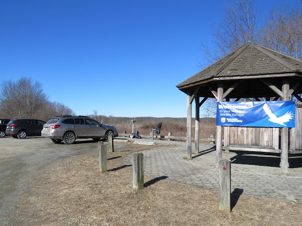
Bluebird Parking Lot

TRAIL MAP:
Great Swamp National Wildlife Refuge Map - U.S. Fish and Wildlife Service

HIKE DISTANCE:  2 miles (1 mile each way)

THE HIKE:

Turning right on Pleasant Plains Road from the parking lot.
It's a gravel road, somewhat chunky gravel but not all that unpleasant to walk on.
A huge old tree down.
And another old tree down.
I was surprised at how many cars were driving along on a 27 degree day in the dead of winter with really no wildlife to be seen on the wildlife tour.  When they actually went 15 miles per hour it wasn't that bad but some inconsiderate clods sped by and this is what that looked like.
Coming up on the overlook to the right.
This is where all those cars go.
Nobody home at the overlook today.
Continuing on ...
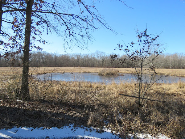
... a pond on the left ...
... with a balloon way over at the other end.
A woods road would have led to that balloon and I totally would have gone to get it but as is the case with many of the federal wildlife refuges, area closed (and there are lots of those) means area closed so couldn't go there to get the balloon.
Coming up on a bridge over ...
Great Brook
After the bridge the road becomes paved but my 1-mile alert dinged on my app so time to turn back.  The 2.6 miles I did the weekend before was a bit too much too soon so I needed to back it down to 2 miles and no more for now.
Heading back through the north gate.
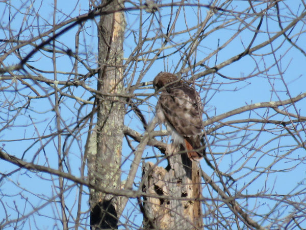
Some wildlife!  A red-tailed hawk.
I lost sight of him when he flew into a different tree.
But he changed trees once more so I got to see him show off his red tail.
Coming back up on the overlook.
It was less crowded this time ...
... but still nothing to see.
Back at the parking lot.