Saturday, October 27, 2018

George Washington National Forest, VA - Kepler Overlook


ABOUT THE PARK:
George Washington National Forest - USDA

DIRECTIONS:
GPS Coordinates 38.970117, -78.565305
Driving in, pass one gate (if closed park there and walk in) then turn left just before the second gate and park at the camp site.  That second gate is where the hike starts.

TRAIL MAP:
Map F: Great North Mountain-North Half (VA/WV) - Potomac Appalachian Trail Club
Powered by Wikiloc

HIKE DISTANCE:  6 miles (3 miles each way)

THE HIKE:
Followed the hike as described by Hiking Upward.
From parking at the camp site, walk back out to the road that you drove in on ...
... and turn left through the gate (that apparently was permanently closed at some point) ...
... on the yellow-blazed Cedar Crest Trail.
We had just driven through 5 hours of heavy rain but fortunately it stopped right when we started hiking.
Where the blue-blazed Tuscarora Trail crosses over, turn left.
Just beyond an old "road closed" gate ...
... a rock hop over Cedar Creek.  I was concerned the water might be too deep after so much rain but it was passable.
Cedar Creek
Crossing a little creek where a bridge would not have been necessary at all.
Yay, some blue sky peeking through.
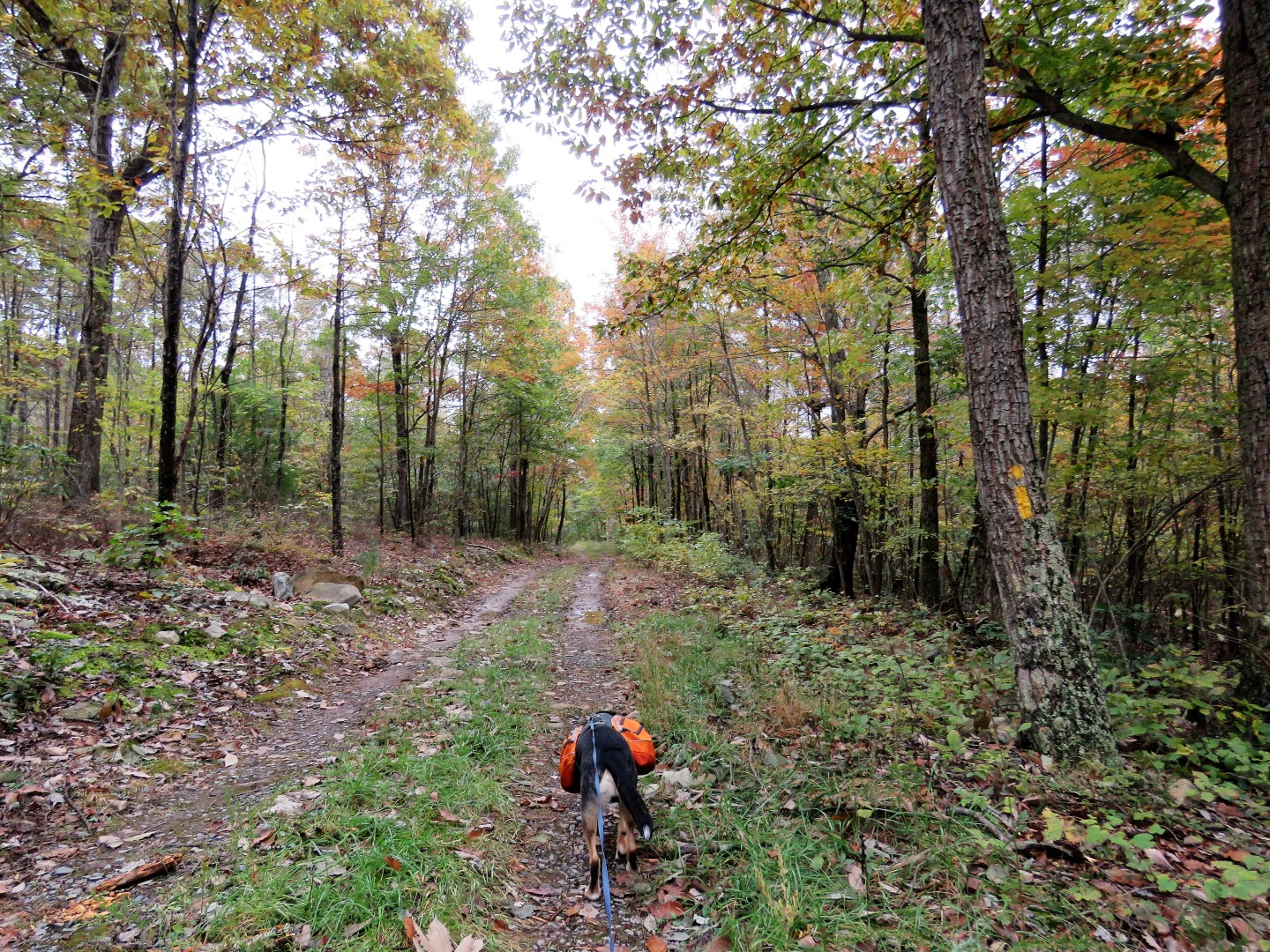
Up to this point the trail had been mostly woods road but becomes a more rugged footpath after this turn.
It's always gradual uphill, never steep.
Blue-headed Vireo
A short side trail to an overlook on Tea Mountain.
The trail to the left led to a rock scramble so Brodie had to be tethered at the bottom while I climbed up.  He was not pleased about this.
A little bit of a view from the top.
Went around the rocks to the next left ...
... to an overlook Brodie could get to.
Unfortunately, still lots of low clouds from the remnants of Hurricane Willa passing through.
Continuing on the Tuscarora Trail.
Once on the ridge of Little North Mountain, it's a short distance to a clearing on the right with camping sites and ...
... Kepler Overlook where I think you should be able to see the Shenandoah Mountains but not with these low clouds.
It was still a pretty view.
Heading back the way we came.
A right on the yellow Cedar Creek Trail ...
... then a right back to the parking area.
Five more hours of driving ...
... to the motel in Charleston, WV.

Sunday, October 21, 2018

Tiadaghton State Forest, PA - Waterville to Little Pine State Park


ABOUT THE PARK:
Tiadaghton State Forest - Pennsylvania DCNR
Mid State Trail Woolrich Region - Mid State Trail Association

DIRECTIONS:
GPS Coordinates 41.31207, -77.37766
Waterville Recreational Parking Lot

TRAIL MAPS:
Tiadaghton Trail and Mid State Trail Map and Brochure - Pennsylvania DCNR
Pine Creek Map - Pennsylvania Grand Canyon - Lizard Maps
Powered by Wikiloc

HIKE DISTANCE:  12.4 miles

THE HIKE:
I had followed the hike as described on the Purple Lizard Map site.  It was very helpful with one exception - the description was based on a hike done in the winter so some of the views described are not there when leaves are on the trees.
The hike starts at the far end of the parking lot on the Pine Creek Rail Trail to the left of the kiosk.
There are the yellow blazes of the Tiadaghton Trail and orange blazes that I don't see on any maps.
Just a short distance in, the trail leaves to the right on a mowed path (no turn blazes).
A short distance ahead is the trail sign.  Orange is probably for the Old Wagon Road.
The trail ascends next to the rail trail.
Yellow makes a sharp right turn (no blazes) when orange goes straight.
Now going up yellow steeply on switchbacks.
The rail trail down below.
Views as the trail climbs higher.
Pine Creek down below.
The trail becomes a woods road ascending more gradually.
I had been noticing a lot of orange ribbons.  Turns out the Call of the Wilds 25K race was taking place and the ribbons marked the route.  Runners started coming towards us just when we got to the easy, flat section of this hike which meant that about every 5-10 steps we had to step off trail to let runners pass.  This went on for almost 1 1/2 miles and slowed us down tremendously. I was concerned we might not finish the 12-mile hike before sunset.  It was a 3 3/4 hour drive to get here so even with leaving home at 5:30 AM we did not start hiking until 9:30 AM.
Coming up on Huntley Road where there was a check point for runners and a couple of kids who were lavishing all kinds of attention on Brodie.  He loved that!  How could I deny him or the kids?  Now even farther behind schedule.
Continuing on the other side of Huntley Road where we ran into the last person of the race who was taking down the ribbons.  Now we could make up some time.  Or could we?
The trail started going down steeply just before the view.
An original Tiadaghton Trail blaze before the trail was blazed yellow.
The trail descends extremely steeply on loose rocks.  Even the large rocks wobbled. The picture does not do justice to how steep it was.  It was painfully slow going all the way down, one step at a time testing each footing first.  And I still slid and fell once.  Now even way more behind schedule.
Finally the grade flattens some and there are fewer rocks as the trail follows a pretty creek.
A little winter wren singing from alongside the creek.
The trail rock hops over the creek and continues on the other side.
Looking back up at the creek while rock hopping over.
Nice, smooth trail now and making up some time.
It's a little confusing where to turn just before this house but it's ...
... to the left of the picnic table and to the right of the piped spring.
The trail descends and crosses the creek again.
Looking back for a better view of where the trail turned before the picnic table.
Now we climb again but on a smoother trail surface.
Happy Acres Resort down below.
At Boone Run Road I had to make a decision.  Turning right and road walking to Little Pine State Park would knock 2 miles off of the hike and we would definitely finish before dark.
To assist in my decision I reread the description of the 2-mile section I was going to cut off that continues the other side of Boone Run Roa.  When it said that once at the top when you turn right on the Mid State Trail "the ridge is narrow and filled with rock outcroppings and fantastic views" I just had to keep going.  After all, I figured worst case scenario, the last 2 1/2 miles were road walk and rail trail so as long as we were out of the woods by dark, the end would be OK by flashlight, wouldn't it?  So on we went.
Boone Run
Another steep uphill on mostly smooth trail.
Almost at the top where views await us.
A right on the Mid State Trail ...
... where there will be views any minute now.
There were no views.  Looking back, that description was based on a hike done in January when there were no leaves on the trees.  With leaves still on the trees, no views.  But from this point forward, the rest was on much gentler terrain than we had been on so far and we were able to speed it up and make up some time. And it was a very pretty ridge.
Descending on switchbacks.
Coming up on Little Pine Creek Road.
Straight across towards Little Pine State Park campgrounds.
These grated bridges were never doable for Shawnee but at only 50 pounds, I could carry Brodie across.
Fortunately that was not necessary since there is a smooth walkway.
Little Pine Creek
The other side of the campground the trail continues on a mowed path.
The campground now below us.
Looking back down the mowed path.
This section of the Mid State Trail mostly follows up above Little Pine Creek.
A little rock hop ...
... in Parker Hollow.
The trail veers left away from Little Pine Creek ...
... and follows Dam Run ...
... to a bridge.
Dam Run
Then it's up to Dam Run Road where our road walk begins and it's still light out!
We are staying on Dam Run Road.  The continuation of the Mid State Trail is for another day.
The first dark-eyed junco I have seen this season.  They are arriving from Canada for the winter.
Dam Run Road becomes paved as it passes more homes and nears Waterville.
At the end, cross Route 44 and turn right.
We followed the sidewalk along Route 44 for about a block then turned left on Second Street.
A short distance ahead the Pine Creek Rail Trail crosses over.  We turned right.
Pine Creek
Back at the parking lot with 15 minutes to spare before sundown.  Whew!