

ABOUT THE PARK:
Harriman State Park - The Palisades Parks Conservancy
Harriman State Park - New York State Parks
DIRECTIONS:
GPS Coordinates to Reeves Meadow Visitor Center parking 41.173744,-74.168567
View Larger Map
 |
| This parking lot fills up quickly, even during the week. Monday at 7:30 AM... |
 |
| ... Monday at 2:30 PM, lot packed and people hovering for spots. Everyone tends to go to Pine Meadow Lake - ran into very few hikers on this hike. |
TRAIL MAP: NY/NJ Trail Conference Southern Harriman Bear Mountain Trails Map 118
PEAK BAGGING:
Diamond Mountain - Peakery.com
HIKE DISTANCE: 6.5 miles
THE HIKE:
 |
| Start on the red on white Pine Meadow Trail from the parking lot for a short distance then turn right on the white-blazed Reeves Brook Trial. |
 |
| Only 9 days ago there was very little color in this area - now past peak with lots of leaf drop but still very nice color at the views. |
 |
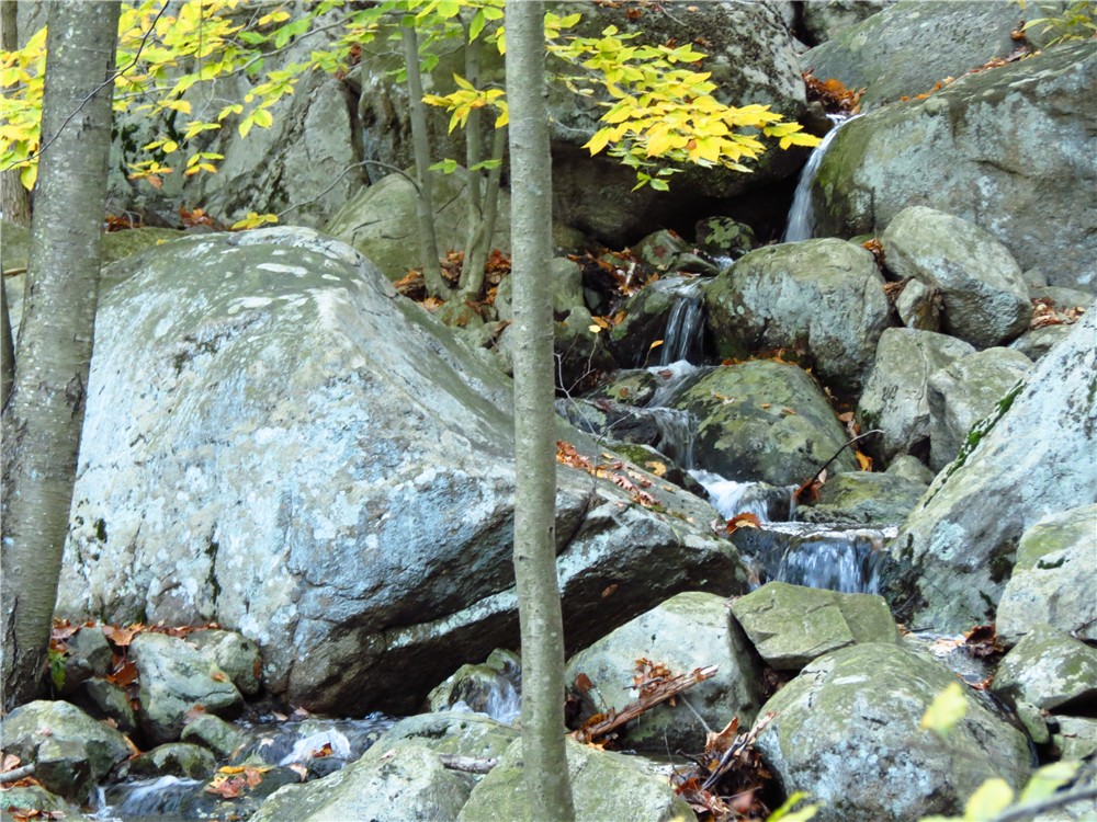
| The white trail follows along pretty Reeves Brook. |

 |
| An abandoned home on the trail. |
 |
| Immediately after turning left on the blue on white Seven Hills Trail, a steep uphill scramble that can present a huge challenge for dogs. |
 |
| Checking to be sure I am really serious about going this way. |
 |
| Some incentive part of the way up. |
 |
| Almost there... |
 |
| Now that was worth the climb! |
 |
| After crossing a gas pipeline cut, up to more panoramic views. |
 |
| Views continue along the Seven Hills Trail. |
 |
| A brand new bridge replaces the one destroyed by Hurricane Irene where the Seven Hills and Kakiat Trails cross over Pine Meadow Creek. (Shown as "bridge out" on the 2012 map.) |
 |
| Pine Meadow Creek |
 |
| Not at all amused at yet another claw-biting vertical scramble. |
 |
| But there is a chicken jerky reward at the top for her... |
 |
| ... and more views for both of us. |

 |
| Lake Sebago comes into view. |
 |
| The descent on the red line on white Tuxedo-Mt. Ivy Trail was much gentler than the climb up. |
 |
| The Tuxedo-Mt. Ivy Trail crosses Diamond Creek before ending at the orange trail. |


 |
| The yellow-blazed trail runs along scenic Stony Brook. |

 |
| Foliage in the gas pipeline cut. |
 |
| It was an amazing crystal clear day. |
 |
| Now that feels good! |
 |
| Stony Brook |
HIKE SUMMARY:
[ 0.00] Take red square on white trail Pine Meadow Trail to right of kiosk and visitor center
[ 0.05] Turn right on white Reeves Brook Trail
[ 1.20] Left on blue on white Seven Hills Trail; steep vertical scramble
[ 1.50] Rock hop creek then cross gas pipeline cut
[ 1.75] Orange merges in from the right then leaves to the left; stay on blue on white
[ 2.05] Right on blue on white/red on white combined
[ 2.10] Left on blue on white/red on white when white joins in from the right, cross bridge then turn left on blue on white/white when red on white goes right
[ 2.20] Right on blue on white when white goes straight (turn hard to see - blaze on large boulder)
[ 2.75] Orange comes in from left; stay on blue on white/orange when yellow starts to the right
[ 3.00] Orange leaves to the left, stay on blue on white
[ 3.05] Yellow starts on the right, stay on blue on white
[ 3.45] Keep left on blue on white when grassy woods road goes right
[ 3.70] Turn left on red line on white Tuxedo-Mt. Ivy Trail
[ 4.10] Rock hop Diamond Creek
[ 4.25] Left on orange when red line on white goes straight
[ 4.30] Right on yellow Stony Brook Trail when orange goes straight
[ 4.50] Rock hop over Diamond Creek
[ 5.60] White joins in from right, cross bridge, right on white/yellow after bridge
[ 5.95] Cross gas pipeline
[ 6.00] Cross bridge
[ 6.10] Turn right on red square on white Pine Meadow Trail
[ 6.50] Back at parking lot


