ABOUT THE PARK:
Ringwood State Park - NJ Department of Environmental Protection
Ringwood Manor - The Forges and Manor of Ringwood
DIRECTIONS:
GPS Coordinates 41.130536, -74.241810
View Larger Map
 |
| Paved parking lot by bridge with room for about 5 cars. This is a free parking area - seasonal fees are charged to park in most other lots. |
TRAIL MAP:
North Jersey Trails Map 115 - NY/NJ Trail Conference
HIKE DISTANCES:
Cooper Union Trail - 5.9 miles
Manor Trail Loop - 6.3 miles
Cooper Union Trail and Manor Trail Loop - 11.4 miles
THE HIKE:
 |
| Start on the white-blazed Crossover Trail at the other side of the bridge from the parking area. |
 |
| At the beginning of the white trail there were huge blowdowns with berries and a ton of birds that stayed to be photographed. (White-throated Sparrow and female Cardinal) |
 |
| Another find on the yellow-blazed Cooper Union Trail |
 |
| The Cooper Union Trail splits and loops back around in 1.6 miles. To the left is steeper than straight. |
 |
| The Cooper Union Trail ascends Governor Mountain. |
 |
| View from the Cooper Union Trail. |
 |
| On the combined white/red rectangle on white trail, cross Sloatsburg Road, hop guardrail then proceed across two bridges over Ringwood River towards the parking lot. |
 |
| Walk along the park road towards Ringwood Manor |
 |
| Ringwood Manor |
 |
| Although there are no yellow trail blazes for a while, the trail continues beyond Ringwood Manor between the free standing gates. |
 |
| Old cemetery on the left off of the blue-blazed Manor Trail. |
 |
| The blue-blazed Manor Trail starts out as an unattractive gravel road but turns into a pleasant foot trail with several creek crossings. |
 |
| Seasonal views from Cupsaw Mountain |
HIKE SUMMARIES:
Cooper Union and Manor Combined
0.00 From parking lot walk along road across bridge; turn right on white-blazed Crossover Trail just after bridge
0.30 Left on white/yellow when the yellow-blazed Cooper Union Trail comes in from the right
0.40 Keep left on yellow when right leaves to the right
0.45 Cross paved Morris Road
0.55 Keep straight when unmarked trail not on map comes in from left
0.80 Cross pipeline
0.85 Keep right on yellow when unmarked comes in from left (make note of this intersection for return route - very easy to miss going the other way)
Be sure to stay on yellow as it intersects with several unmarked trails along the way
1.00 Cross small creek on a log
1.70 Rock hop over creek
1.85 Cross paved Carletondale Road
2.00 Cross creek on small bridge, building on left
2.10 Turn left at trail split (left side is steeper than right side if you prefer steeper ascent and more gradual descent)
2.80 Short side trail to left to view
2.95 View to left at top of steep ascent
3.70 Keep straight on yellow at completion of loop
3.80 Cross creek on small bridge, building on right
3.95 Cross paved Carletondale Road
4.85 Cross small creek on a log
5.00 Yellow trail turns left at blowdown - easy to miss
5.10 Cross pipeline
5.45 Cross paved Morris Road
5.50 Left on white when white/yellow goes right
6.00 Left on white/red rectangle on white as red rectangle on white comes in from left; cross Sloatsburg Road, hop guardrail, cross two bridges
6.05 Turn left on paved road and walk on road parallel to creek
6.15 Keep left on pavement at yield sign
6.30 At DO NOT ENTER sign straight ahead, turn right between 2 pillars towards parking lot and large tree with 3 yellow blazes; turn left at tree towards mansion
No yellow blazes in mansion area but continue straight beyond mansion between 2 free standing iron gates; blazes pick up again after crossing creek on gravel road; after crossing creek turn left on blue when yellow goes right
6.65 Old cemetery on left
7.00 Blue trail turn right on gravel road other side of gate
7.30 At house on left, blue trail leaves gravel road to the right on woods road
7.80 Blue trail turns right and crosses woods road just to the right of a power cut
8.10 Blue trail turn right at creek and follows creek
8.15 Rock hop to left over creek
8.20 Straight on blue when yellow crosses over
8.60 Cross swampy area on log then rock hop over creek
8.70 Rock hop over 2 creeks
9.00 At woods road turn left on white when blue goes right
9.25 White trail rejoins woods road
9.45 White trail leaves woods road to the right
10.05 White trail ends at parking lot, take white/red rectangle on white trail across 2 bridges, hop guardrail, cross Sloatsburg Road
10.20 Turn left on red rectangle on white as white goes right
10.45 At top of ascent, turn right on yellow when red rectangle on white goes left
10.75 Rock outcrop with seasonal view to left as yellow trail turns right
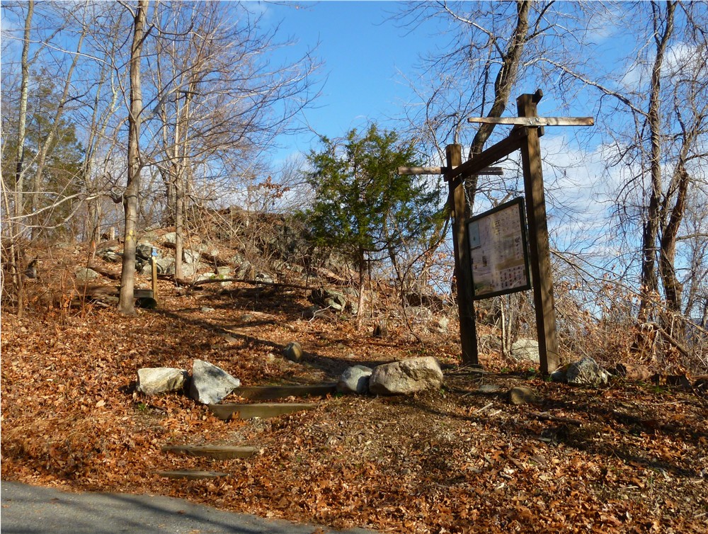
10.95 Keep right at large boy scout sign when blue goes left
11.00 Left on white when white/yellow goes right
11.40 Back at parking
Cooper Union Trail Only:
0.00 From parking lot walk along road across bridge; turn right on white-blazed Crossover Trail just after bridge
0.30 Left on white/yellow when the yellow-blazed Cooper Union Trail comes in from the right
0.40 Keep left on yellow when right leaves to the right
0.45 Cross paved Morris Road
0.55 Keep straight when unmarked trail not on map comes in from left
0.80 Cross pipeline
0.85 Keep right on yellow when unmarked comes in from left (make note of this intersection for return route - very easy to miss going the other way)
Be sure to stay on yellow as it intersects with several unmarked trails along the way
1.00 Cross small creek on a log
1.70 Rock hop over creek
1.85 Cross paved Carletondale Road
2.00 Cross creek on small bridge, building on left
2.10 Turn left at trail split (left side is steeper than right side if you prefer steeper ascent and more gradual descent)
2.80 Short side trail to left to view
2.95 View to left at top of steep ascent
3.70 Keep straight on yellow at completion of loop
3.80 Cross creek on small bridge, building on right
3.95 Cross paved Carletondale Road
4.85 Cross small creek on a log
5.00 Yellow trail turns left at blowdown - easy to miss
5.10 Cross pipeline
5.45 Cross paved Morris Road
5.50 Right on yellow/white when white goes left
5.60 Right on white when yellow leaves to the left
5.90 Back at parking lot
Manor Trail Loop Only:
0.00 From parking lot walk along road across bridge; turn right on white-blazed Crossover Trail just after bridge
0.30 Left on white/yellow when the yellow-blazed Cooper Union Trail comes in from the right
0.40 Right on white when yellow goes left
0.90 Left on white/red rectangle on white as red rectangle on white comes in from left; cross Sloatsburg Road, hop guardrail, cross two bridges
0.95 Turn left on paved road and walk on road parallel to creek
1.05 Keep left on pavement at yield sign
1.20 At DO NOT ENTER sign straight ahead, turn right between 2 pillars towards parking lot and large tree with 3 yellow blazes; turn left at tree towards mansion
No yellow blazes in mansion area but continue straight beyond mansion between 2 free standing iron gates; blazes pick up again after crossing creek on gravel road; after crossing creek turn left on blue when yellow goes right
1.55 Old cemetery on left
1.90 Blue trail turn right on gravel road other side of gate
2.10 At house on left, blue trail leaves gravel road to the right on woods road
2.70 Blue trail turns right and crosses woods road just to the right of a power cut
3.00 Blue trail turn right at creek and follows creek
3.05 Rock hop to left over creek
3.10 Straight on blue when yellow crosses over
3.50 Cross swampy area on log then rock hop over creek
3.60 Rock hop over 2 creeks
3.90 At woods road turn left on white when blue goes right
4.15 White trail rejoins woods road
4.35 White trail leaves woods road to the right
4.95 White trail ends at parking lot, take white/red rectangle on white trail across 2 bridges, hop guardrail, cross Sloatsburg Road
5.10 Turn left on red rectangle on white as white goes right
5.35 At top of ascent, turn right on yellow when red rectangle on white goes left
5.65 Rock outcrop with seasonal view to left as yellow trail turns right
5.85 Keep right at large boy scout sign when blue goes left
5.90 Left on white when white/yellow goes right
6.30 Back at parking