Sunday, May 22, 2011

Bear Mountain State Park, NY - Popolopen Torne over Bear Mountain Bridge to Anthony's Nose


ABOUT THE PARK: 
Bear Mountain State Park - NY State Office of Parks, Recreation and Historic Preservation

DIRECTIONS:
GPS coordinates 41.324232, -74.007425

View Larger Map
There is room for 2-3, maybe 4 cars depending on how people park. Turn into the parking area at the mailbox with number 284.

TRAIL MAP:
Northern Harriman Bear Mountain Trails Map #119 - NY/NJ Trail Conference

HIKE DISTANCE:  9.65 miles
Some shorter versions:
5 miles - Popolopen Torne and Popolopen Gorge Loop - NY/NJ Trail Conference
4.3 miles - Camp Smith Trail to Anthony's Nose - NY/NJ Trail Conference

HIKE DESCRIPTION:

PLEASE NOTE:  TRAILS USED FOR PART OF THIS HIKE WILL BE CLOSED FROM FALL 2011 THROUGH SPRING 2012 AND THE BRIDGE OVER POPOLOPEN CREEK WAS DESTROYED BY HURRICANE IRENE - CLICK HERE FOR MORE INFORMATION

UPDATE:  As of 12/6/2012 a new bridge is in placeCLICK HERE FOR DETAILS. 

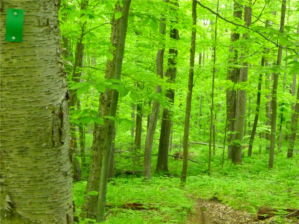
The hike starts by crossing Mine Road and ascending Popolopen Torne on the blue-blazed trail.
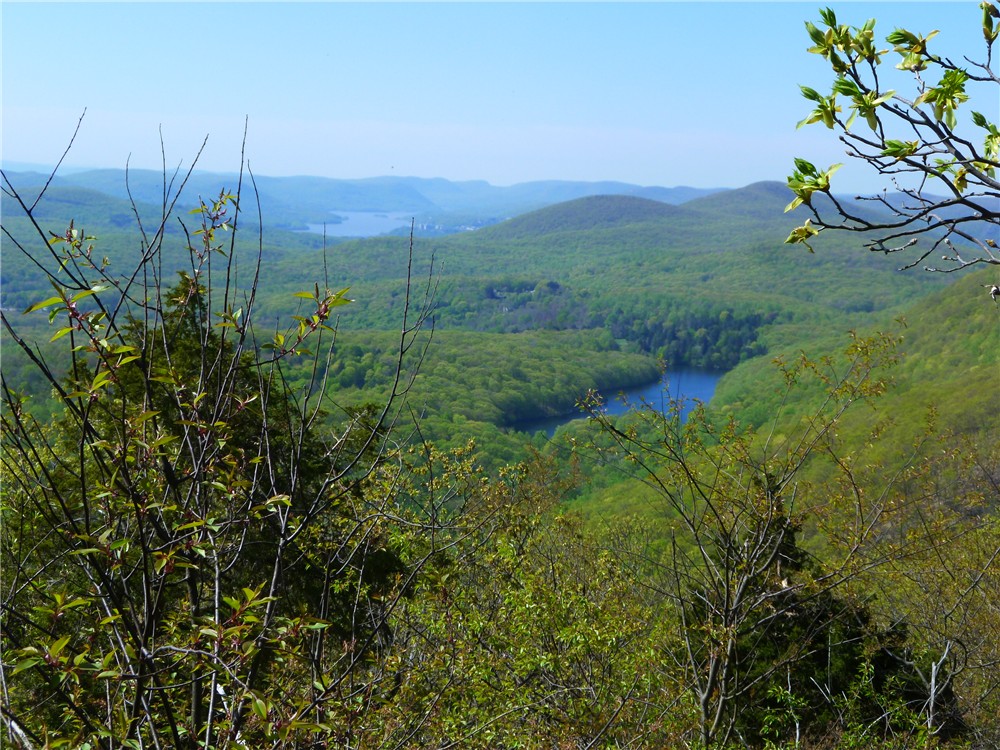
Bear Mountain Bridge and Anthony's Nose from Popolopen Torne
Tribute to American Soldiers on Popolopen Torne
 The trail descends very steeply into Poplopen Gorge, also known as Hell Hole.
Raging water after 5 days of rain completely drowns out nearby traffic noise.


Red on White Popolopen Gorge Trail Along Popolopen Creek
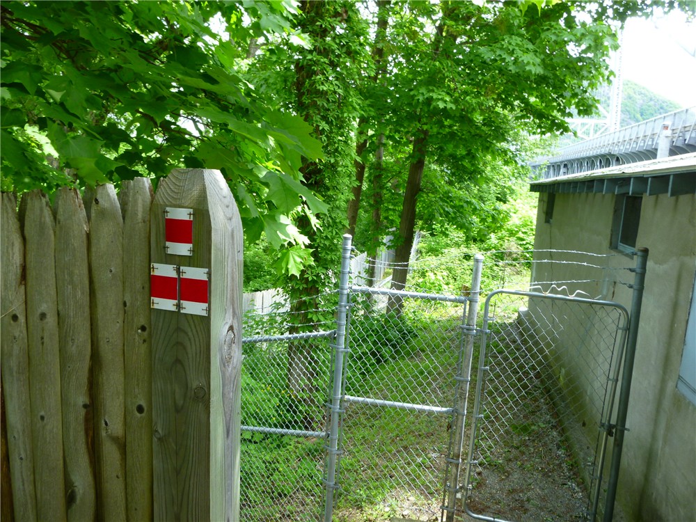
Appalachian Trail Sign at Bear Mountain Bridge Tollbooths
Crossing Bear Mountain Bridge on the Appalachian Trail
Hudson View from Bear Mountain Bridge
Appalachian Trail Leaves Rt. 9D and Ascends Anthony's Nose
View From First Side Trail on Anthony's Nose
View From Anthony's Nose
View South From Anthony's Nose
After retracing and crossing back over Bear Mountain Bridge, make a sharp right turn just beyond the end of the bridge railing opposite the toll booths and descend on the red on white trail.
Left on the blue line on white trail brings you to the suspension footbridge.

View From Suspension Footbridge
The blue line on white trail ends at Fort Montogomery where you pick up the historic 1777/1779/blue-blazed trails.
A scenic loop around Brooks Lake brings you back to the 1777/1779/blue trail to finish up above along the Popolopen Gorge.

HIKE SUMMARY:
[  0.00]  Cross Mine Road, turn left and walk along Mine Road 50 feet, turn right on blue-blazed trail up stone steps
[  0.60]  American Soldiers Tribute on top of Popolopen Torne
[  0.80]  Cross straight over paved Mine Road and continue under guardrail on blue-blazed trail
[  0.90]  Cross straight over dirt road; after short distance right on 1777/1779/blue-blazed trail parallel to Popolopen Creek
[  1.00]  Trail turns left down rock steps to bridge over Popolopen Creek
[  1.05]  Turn left on red on white-blazed Popolopen Gorge Trail
[  1.80]  Trail turns left before small creek and switchbacks down towards Popolopen Creek
[  2.30]  Clearing to left with view of falls
[  2.45]  Come out at small clearing and veer left towards Route 9W; right on Route 9W, at end of guardrail turn left and carefully cross side street then VERY CAREFULLY cross 9W - traffic zooms FAST here; continue on sidewalk towards traffic circle following around to the left to Bear Mountain Bridge
[  2.70]  Tollbooths on Bear Mountain Bridge; continue across Bridge following white Appalachian Trail blazes
[  3.20]  Veer left on 9D after crossing bridge; stay on left side
[  3.30]  Cross over to right at pedestrian crossing sign
[  3.40]  Turn right into woods where white-blazed A.T. leaves Route 9W at the A.T. sign and kiosk
[  3.75]  Turn right on woods road blue-blazed trail when white goes left; trail register on left after turn
[  4.25]  Side trail to right to views beyond old footings; retrace and continue right on blue trail
[  4.50]  Right to rock outcrop views; retrace and turn left on blue to proceed back to bridge
[  5.10]  Blue trail ends at register, left on white-blazed A.T.
[  5.55]  Left on Route 9W at kiosk, stay on left side of road; cross to other side when shoulder becomes wider where cars are parked
[  6.20]  Other side of bridge opposite toll booths at end of railing, make sharp right down steps on red on white trail
[  6.30]  Left on blue on white trail at NO TRESPASSING sign
[  6.40]  Cross small bridge over creek
[  6.50]  Cross suspension footbridge
[  6.70]  Fort Montgomery; keep to the left through the parking lot, veer left up stone steps on to 1777/1779/blue-blazed trail
[  6.80]  Trail goes under Route 9W
[  6.95]  Turn left on Mine Road briefly then keep straight on trail into woods as Mine Road turns right
[  7.15]  Turn left on Mine Road short distance then turn right as trail leaves Mine Road
[  7.25]  Keep straight on red square on white trail when 1777/1779/blue trails go left over boards; loop around Brooks Lake
[  8.20]  Right on 1777/1779/blue trail when left goes over boards
[  8.40]  Right on Mine Road
[  8.50]  Left on trail just past intersection with Wildwood Ridge Road
[  9.25]  A trail goes sharply to the right but blazes blacked out***;  a little farther along, blue trail leaves to the right up stone steps - have to watch carefully for turn (this is the trail from beginning of the hike}
[  9.45]  Cross gravel road
[  9.55]  Go under guardrail, turn right on Mine Road and follow back to parking area on right
[  9.65]  Arrive back at parking area

*** This might be the other side of the blue trail that comes out in the parking lot.  I did not take it since the blazes were blacked out at the intersection.

Sunday, May 15, 2011

Allamuchy Mountain State Park North, NJ - Cranberry Lake/Highlands Trail Loop


ABOUT THE PARK:  Allamuchy Mountain State Park - Village of Allamuchy

DIRECTIONS:
GPS coordinates 40.955553, -74.736748

View Larger Map
Heading north on Route 206 makes for a very awkward left turn into the parking lot.  A better approach might be to continue just past the parking lot, turn left on North Shore Road, use the gravel pull-out on the right to make a U-turn, turn right on Route 206, then use the right exit lane to smoothly enter the Cranberry Lake park and ride area. 
Park & Ride Lot between Route 206 and Cranberry Lake

TRAIL MAPS:
Jersey Highlands Trails, Trail Map 126 - NY/NJ Trail Conference
Allamuchy Mountain State Park - North - JORBA

HIKE DISTANCE:  9.8 miles

HIKE DESCRIPTION:
Although it does not look like it, the Sussex Branch Trail (a rail trail) goes right through the parking lot between Route 206 and Cranberry lake.  Facing the lake, turn left and walk beyond the barrier at the end of the parking lot.
Continue through the gravel lot of the Cranberry Lake Community Club passing the foot bridge on the right.
At the far end of this parking lot, the trail will become more defined and follow along Cranberry Lake.
The trail crosses a dam, turns left, crosses a paved road then the gravel overflow boat trailer parking lot before "officially" entering Allamuchy Mountain State Park as the Sussex Branch Trail .6 mile into the hike.  (The overflow boat trailer parking lot can also be used for this hike.)
Follow the rail trail about another half mile, then turn right on the blue-blazed Iron Mine Trail just after crossing a bridge.

A short, 1/10ths of a mile unmarked trail connects over to the red-blazed trail.
The red-blazed trail joins up with the more rugged and strenuous teal-blazed Highlands Trail which leads to a rock outcrop overlook with views 4 miles into the hike.

The loop completes by following yellow to white to green then a short section of the Sussex Branch Trail back to the parking lot.

The green trail, named the Waving Willie Trail after a man who waved at commuters on Route 206 for 40 years, terminates behind his house at the Sussex Branch Trail.  Click here for the Weird NJ story of Waving Willie.
Waving Willie sat in front of the white house in the background waving at traffic on Route 206.
Turn right on the Sussex Branch Trail which will run parallel to Route 206 a short distance back to the parking lot.

HIKE SUMMARY:
[  0.00]  Facing Cranberry Lake, turn left and proceed through parking lot, wooden barrier, gravel Cranberry Lake Club parking lot, continue along Cranberry Lake
[  0.35]  Cross dam
[  0.40]  Trail turns left as mowed grass trail
[  0.45]  Cross paved road at Overflow Boat Trailer Parking sign staying on gravel road
[  0.60]  Cross barrier at far end of the overflow boat trailer parking lot; keep straight on Sussex Branch Railtrail
[  1.05]  Immediately after crossing bridge, turn right on the blue-blazed Iron Mine Trail
[  1.35]  At rusty wood chipper, keep straight when unmarked comes in from right (unmarked trail not on map)
[  1.40]  Blue trail turns sharply to left when unmarked comes in from right (unmarked trail not on map)
[  1.50]  Blue trail turns right when unmarked goes straight
[  1.80]  After switchbacks blue trail turns left when unmarked comes in from right, trail straightens out
[  1.90]  Turn right on blue trail when unmarked goes left
[  2.05]  After trail snakes briefly, turn right on unmarked trail at T intersection when blue goes right (shown on map but not as a T intersection)
[  2.10]  Turn left on red-blazed trail when unmarked ends at the red trail
[  2.50]  Teal-blazed Highlands Trail merges in from the left, after 10 steps, turn right on the teal-blazed trail leaving red trail
[  3.10]  Teal trail turns left merging with other side of red loop trail
[  3.20]  Turn right on teal trail leaving the red trail
[  3.25]  Straight on teal as it crosses over yellow/white trail
[  3.90]  Straight on teal as it crosses over yellow trail
[  4.10]  Straight on teal to overlook as unmarked comes in from right; after overlook retrace and turn left on unmarked when teal goes right
[  4.30]  Unmarked trail ends at bend of yellow trail; keep straight/left on yellow trail
[  5.00]  Right on yellow when unmarked comes in from the left
[  5.30]  Left on white when yellow/white goes right
[  5.40]  Left on white when unmarked goes right, shortly thereafter unmarked comes in from left
[  5.50]  Keep right on white when unmarked goes left
[  5.65]  Keep straight on white when unmarked goes left
[  5.85]  Keep left on white at fork when unmarked goes right
[  5.90]  Cross wooden bridge
[  5.95]  Left at fork on white when unmarked goes right
[  6.45]  Left on what as unmarked comes in from right
[  6.60]  Shortly after crossing smooth rock section, right on white when unmarked (with old white circle blaze on tree) comes in from left
[  6.70]  Keep right on white when unmarked trail goes left marked with "Ice Cream Trail" sign
[  6.85]  Keep straight on right when unmarked comes in from right
[  7.00]  At intersection where many trails come together, green goes right but head straight towards tree with white blazes turning left AND green blazes turning right, follow these green blazes to the right
[  7.20]  At the next multi-trail intersection, keep straight turning right on the second to last trail on the right (green marker hard to see from intersection but it is a short distance ahead on tree on left)
[  7.70]  Keep left on green when unmarked goes right; at top of hill keep right on green when unmarked comes in from left
[  7.85]  Keep straight on green when crossing unmarked trail
[  8.60]  Keep left on green when unmarked comes in from right (unmarked trail not on map)
[  8.80]  Keep right on green when umarked comes in from left (trail not well defined at intersection)
[  8.95]  Keep straight on green trail over smooth rock section; at unmarked fork keep left (not on map); at next fork either right over rocks or left around rocks
[  9.10]  Trails merge back together and green markers continue
[  9.55]  Green trail ends as Sussex Branch railtrail; turn right on Sussex Branch trail
[  9.75]  Cross North Shore Road
[  9.80]  Arrive at parking lot

Monday, May 9, 2011

Fishkill Ridge Conservation Area, Beacon, NY


ABOUT THE PARK:  Fishkill Ridge Conservation Area - Scenic Hudson

DIRECTIONS:
GPS Coordinates to Pocket Road Parking 41.496824, -73.948988

View Larger Map
There is room for about 6 cars, 3 on either side of the dead end road.  There was only one other car parked here in the afternoon when I returned after the hike.

TRAIL MAP:
East Hudson Highlands Trails, Trail Map 102 - NY/NJ Trail Conference

HIKE DISTANCE:  9.4 miles with shorter 6.7 mile option

HIKE DESCRIPTION:
The hike starts by walking beyond the gate with the "NO TRESPASSING" sign.  Per the City of Beacon's website (scroll down to "The Hemlock Gorge" hike):
"Walk through the gate, and pass the City of Beacon water tank on your left. (Don’t worry about the no trespassing signs, hikers are allowed to pass through these gates)."
You'll be following the white-blazed Fishkill Ridge Trail (round white discs) all the way for 4.5 miles.  The trail starts out along Dry Creek and ascends to a beautiful multi-level waterfall.


The trail turns left over a bridge on a dirt road briefly then enters the woods to the right.  The return route of this hike comes in from the right on the dirt road so remember this intersection for later.
The Fishkill Ridge Trail continues up to views of the Hudson Valley and City of Beacon with the Shawangunks and Catskills in the distance.
A little farther along, the summit of Lambs Hill makes a nice break spot:
The intersection with the blue-blazed trail is affectionately named "Dozer Junction" for the old abandoned bulldozer that sits off to the side.  Remember this intersection for later if you decide to do the shortened version of this hike.
The Fishkill Ridge Trail now continues up to follow along the ridge with an assortment of views in all directions.
At the end of the white-blazed Fishkill Ridge Trail, continue on the yellow-blazed Wilkinson Memorial Trail along the Scofield Ridge. (Shortly along the yellow-blazed trail, the blue-blazed trail will come in from the right.  Turn right here back to the bulldozer, then left on the white-blazed trail to backtrack to the parking lot for the shorter 6.7 mile version of this hike.)
The yellow-blazed trail leads to multiple views along the way.  One of the last views, shortly before leaving the yellow-blazed trail, will include the fire tower and City of Beacon mountaintop water reservoir where this hike leads to next.
I did not climb the fire tower because of that little fear of heights thing, but another hiker who did go up told me the views from the top of the fire tower are the same as at the base, so nothing lost by not going up.  Word of caution for hikers with dogs:  There is a lot of broken glass around the base of the fire tower.
New York City skyline views from the base of the fire tower. (Click picture to enlarge)
At the City of Beacon water reservoir, skirt along rocky roads and paths to the right of the water. 

Beyond the dam turn right on the dirt road that leads back to where the white-blazed Fishkill Ridge Trail crossed over at the beginning of the hike.  Watch for the stone bridge beyond which the dirt road makes a sharp left turn.  Turn left on the trail before the bridge - you have to turn around to see the trail markers on the tree as they face the other way.  Alternately, if you don't feel like going steeply downhill along the creek you can stay on the dirt road which offers a gentler descent back to the parking area.

HIKE SUMMARY:
[  0.00]  Cross metal barrier, a power cut, pass a small reservoir on the left then enter the woods meeting up with Dry Creek on the left
[  0.45]  Keep straight when the yellow-blazed trail comes in from the right (no yellow blazes at intersection)
[  0.65]  Veer left towards creek at fork and rock hop over creek to waterfalls short distance ahead
[  0.85]  Go over small steep rise, turn left on dirt road, cross bridge, turn right into woods on white-blazed trail
[  0.90]  Keep straight at intersection with unmarked woods road
[  1.00]  Trail swithbacks up to views
[  1.15]  Keep right on white when red comes in from left
[  1.40]  Keep left on white at fork when unmarked goes right
[  1.50]  Lambs Hill
[  1.80]  Dozer Junction with bulldozer on right at intersection with blue trail
[  4.50]  White trail ends; keep straight on the yellow trail that comes in from the left
[  4.65]  Keep straight on yellow trail when unmarked trail goes right
[  4.70]  Left on yellow when blue goes right (OR right on blue to left on white for shorter version)
[  5.05]  Yellow trail turns left at intersection but first turn right on unmarked trail up the hill a short distance to views; retrace
[  5.25]  Back at intersection, keep straight on yellow
[  5.55]  Enter Hudson Highlands State Park at boundary marker
[  5.65]  Rock scramble up to view and scramble down other side
[  6.00]  Proceed across smooth rock surface following cairns and blazes painted on rock surface
[  6.15]  Rock hop across wet area
[  6.25]  360 degree views at top of rock scramble; views of fire tower and reservoir
[  6.30]  Cross unmarked trail
[  6.40]  View
[  6.65]  At intersection turn right on red trail; disregard various colors/shapes of old blazes painted on trees - follow the red discs
[  6.80]  Keep left on red but note grassy trail to right which will be route to reservoir after visiting fire tower; after short distance turn left on white trail to fire tower
[  7.00]  Fire tower; retrace steps on white trail
[  7.35]  White trail ends, turn right on red trail briefly then left on grassy road with various colors and shapes of old blazes on trees
[  7.60]  Follow rocky trail/road along right side of reservoir
[  7.90]  Continue on rocky road passing the back of the dam on the left
[  8.00]  Turn right on wide, well-defined dirt/gravel road
[  8.40]  Left on white-blazed Fishkill Ridge Trail before bridge where dirt road makes sharp left turn (or continue on dirt road for smoother descent back to parking area)
[  8.90]  Keep right on white when yellow trail goes left (no yellow blazes at intersection)
[  9.40]  Water tower and parking area