Saturday, December 11, 2010

Ward Pound Ridge Reservation, Westchester County, NY


ABOUT THE PARK:  Ward Pound Ridge Reservation, Westchester County Parks

DIRECTIONS:
GPS coordinates:  41.247751,-73.594673


View Larger Map

These directions take you into the park where you may need to pay a parking fee (currently $8) year round on weekends, every day from Memorial Day through Labor Day.  After the toll booth turn right at the sign for Michigan Road.
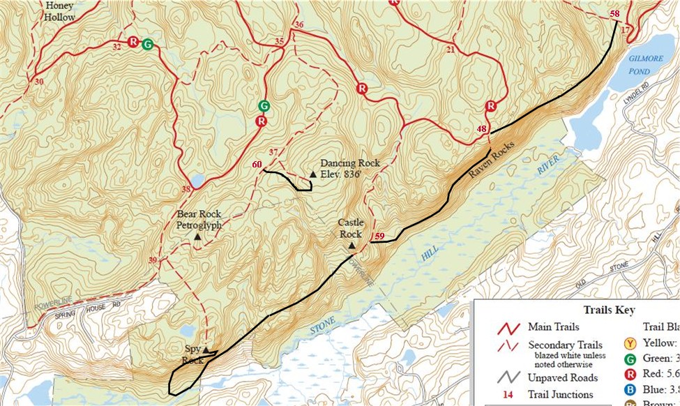
TRAIL MAP:
Online Trail Map
This map does not show newer trails within the park which are part of this hike.  Apparently you can get an updated version at the park but I was not able to locate one.  I crudely drew in the new parts of the Rock Trail (blazed black RT on white squares) in black along with new intersection numbers on the map below.

HIKE DISTANCE:
This hike of 10.35 miles incorporates both the Leatherman Trail and Rocks Trail.
Many loops of varying distances are possible.  Here are some other options:
6 miles - Leatherman's Cave and Spy Rock
7 miles - Rocks Trail

HIKE DESCRIPTION:
From the Michigan Road parking area, head towards the cul-de-sac where you will find the trailhead to the right.
Although this has been a park where hunting is prohibited, a sign on the information board indicates this has changed.

This hike captures most of the points of interest of the southern half of the park.
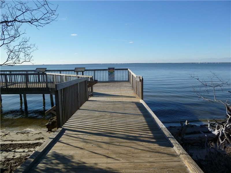
Overlook
Side trail to Leatherman's Cave
Leatherman's Cave
Click here to read about the Leatherman.  My dog in the cave - it's more spacious than it looks from the outside.

Most of the original trails are woods roads.

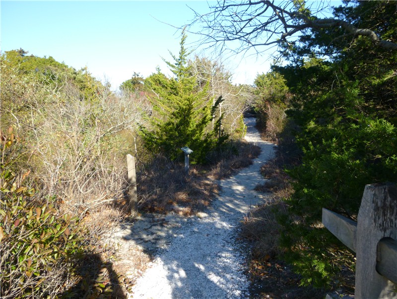
But once on the RT (Rock Trail), a newer trail, which incorporates 6 named rocks within the park, the woods roads will become footpaths which are more fun and challenging to hike and not heavily used like the woods roads.  This new part, drawn in on the map above, follows the ridge line so in the winter it's a scenic hike from high up above.
The named rocks the RT trail passes:
Spy Rock
Castle Rock
Raven Rocks
Indian Rock Shelter
Dancing Rock
Bear Rock Petroglyph

HIKE SUMMARY:
[  0.00]  Shortly beyond info board at the trailhead turn right on red/green at intersection 70
[  0.35]  Keep right on red/green at intersection 53 where green goes left
[  0.40]  Keep left on red/green at intersection 54 where white trail goes right
[  0.55]  Turn right on LL trail at intersection 31 where red/green goes left
[  0.85]  Keep straight on LL at intersection 26 where LL also goes left
[  1.05]  Turn left on LL at intersection 27 where white goes right
[  1.20]  Trail goes up rocks to bench at overlook
[  1.55]  Just before intersection 29 make a sharp right on white trail to Leatherman's cave
[  1.60]  Return all the way to intersection 29 and turn left on LL where unmarked goes right
[  1.75]  Turn right on white trail at intersection 28 where LL goes left
[  2.15]  Turn left on unmarked for short distance then right on red/green at intersection 30
[  2.40]  Keep straight on red/green at intersection 32 where white goes left
[  2.60]  Keep right on red/green at intersection 34 where white goes left
[  2.95]  Turn right on white at intersection 38 where red/green goes left
[  3.10]  Keep straight on RT at intersection 39 where RT also goes left
[  3.55]  Arrive at Spy Rock; continue down from Spy Rock on RT trail
             **From this point forward new sections of RT trail not shown on map.**
[  3.90]  After steep descent and through hemlock grove, left on RT which is woods road
[  4.10]  RT trail leaves woods road to right as foot path
[  4.15]  Cross over brook
[  4.55]  Cross over brook
[  4.65]  Cross over power cut; just after power cut Castle Rock on left
[  4.90]  Keep right on RT at intersection 59 where white goes left
[  5.55]  Raven Rocks
[  5.65]  Turn hard right on RT at intersection 48 where red goes left and right
[  6.20]  Turn left on RT at intersection 58 where right goes to a bridge
             **New portion of RT trail reconnects with trails on map.**
[  6.45]  Turn left on RT at intersection 49 where white goes right
[  6.60]  Turn right on RT at intersection 18 where white goes left; Indian Rock Shelter on right
[  6.75]  RT trail ends at intersection 19; left on yellow/red trail
[  6.85]  Straight on yellow/red at intersection 20 where white goes right
[  7.00]  Keep straight on yellow where red goes left (did not see intersection 33 sign)
[  7.25]  Turn left on beginning of RT at intersection 22 where yellow goes right
[  7.45]  Keep straight on RT at intersection 36 where red goes left and right
[  7.80]  Turn left on white at intersection 37 where RT goes straight
[  8.00]  Dancing Rock; continue following white to loop around back to RT
[  8.25]  Left on RT at intersection 60
[  8.40]  Trail follows power cut briefly
[  8.60]  Bear Rock Petroglyph on right
[  8.70]  Right on white at intersection 39 where RT goes left
[  8.90]  Turn right on red/green at intersection 38 where white goes left
[  9.35]  Left on green at intersection 35 where red goes right and white sharp left
[10.05]  Right on red/green at intersection 53 where red/green also goes left
[10.35]  Arrive back at Michigan Road parking lot

Monday, December 6, 2010

Belleplain State Forest, NJ


ABOUT THE PARK:  New Jersey Department of Environmental Protection

DIRECTIONS:

View Larger Map
GPS coordinates 39.244861,-74.857285 were for the correct location (Interpretive Center parking lot at Lake Nummy) but my GPS did not recognize some of the roads and kept taking me in circles trying to get me to turn on roads that were blocked off - plan on having to navigate to the Interpretive Center on your own once you reach the park.
There are 4 parking spots in front of the Interpretive Center with 3 additional spots on the opposite side of the road.

TRAIL MAP:
When I inquired at the park office I was told they were out of maps and they are due to be reprinted Spring 2011.  This is a picture of the map outside which is in a couple of locations throughout the park.  Click on the picture for a larger version.
This map shows the trails for this hike:

The online campground map shows other trails around Lake Nummy.

HIKE DISTANCE: 
East Creek Trail Loop - 6.75 miles 
East Creek Trail Loop with Ponds Trail out and back - 10.75 miles 
(Note:  Park map says East Creek Trail is 7.13 miles; I measured 6.75 miles.  Park map says Ponds Trail is 2.22 miles each way, I measured 2 miles each way. Since I am using a pedometer my measurements could be slightly off.)

HIKE DESCRIPTION:
Facing the Interpretive Center, walk along the road to the right of the building towards a sign that points to the left and says "Trash/Recycling Center Campers Only"
Turn left at that sign and you will see the white-blazed East Creek Trail on the right just before the trash/recycling area.
The trail is marked with square white disks, sometimes painted blazes and brown posts.  Trail surface is packed, no loose sand, often covered with pine needles or leaves.  Some areas have roots on the walking surface.
Trail briefly joins sand road skirting a field.
New section of boardwalk over swampy area.
Several paved roads are crossed along the trail.  Although traffic is allowed, I never saw a car except when arriving at Route 347 at 2.7 miles, where there is a large volume of high speed traffic.  Turn right at Route 347 and walk along the grassy shoulder towards East Creek Pond.
On the other side of the pond there is a small parking lot which might also be an option for this hike to avoid park fees in season.
To continue on the blue-blazed Ponds Trail, carefully cross over Route 347 from the parking lot.
The blue-blazed Ponds Trail has not been maintained and is overgrown.  It was passable at this time of year with a lot of ducking under branches, skirting around blow downs and picking through thorny growth.  I doubt it would be passable in the summer.  I also noted more deer stands in trees that I have ever seen in one place at one time so definitely not a place you want to hike on a hunting day.
Overgrown Trail
Blow Down Blocking Trail
Pickle Factory Pond at the end of the Ponds Trail.
If you do opt to hike the Ponds Trail, at the Pickle Factory Pond, turn around and retrace back to the small parking lot on Route 347 where you will find the continuation of the white-blazed East Creek Trail.
East Creek Trail skirts East Creek Pond

The trail will pass through a couple of attractive groves.
Arrive back at Lake Nummy at the end of the hike turning right on the paved road to return to the Interpretive Center parking lot.


HIKE SUMMARY:
[  0.00]  Follow road to right of Interpretive center; left at recycling sign; right at trail sign
[  0.90]  Wooden foot bridge
[  0.95]  Cross paved road (Sunset Road)
[  1.00]  Trail becomes gravel road skirting along edge of field
[  1.05]  Trail leaves gravel road at end of field to the right as foot trail
[  1.40]  Turn right at unmarked intersection; cross bridge
[  1.50]  Long boardwalk
[  1.90]  Bridge
[  1.95]  Bridge/boardwalk
[  2.00]  Trail goes through laurel tunnel
[  2.40]  Cross bridge; traffic sounds
[  2.60]  Left at fork
[  2.70]  Turn right on Route 347; proceed to parking area opposite side of East Creek Pond
[  3.00]  Cross busy road from parking area to blue-blazed Ponds Trail
[  3.25]  Right at fork
[  4.20]  Cross over paved road (Lehner Road)
[  4.50]  Turn left at T-intersection where double blue blaze on tree ahead indicates right turn
[  4.60]  Turn right at field; turn right at other end of field on woods road
[  5.00]  Arrive at Delsea Drive, the end of Ponds Trail at Pickle Factory Pond; retrace
[  7.00]  Cross over Route 347 to gravel parking lot for continuing East Creek Trail loop.
[  7.20]  Trail goes right up to lake before veering left
[  7.80]  Boardwalk then left to cross dirt road (Tom Field Trail)
[  8.90]  Cross paved road (Sunset Road)
[  9.40]  Cross over dirt road
[  9.50]  Cross over dirt road (Tom Field Trail)
[  9.90]  Cross paved road
[10.40]  Cross 4 bridges
[10.50]  Turn left at intersection with trail post but no turn directions; turn right on paved road; follow road along Lake Nummy
[10.75]  Arrive back at Interpretive Center parking lot

Sunday, November 28, 2010

Island Beach State Park, NJ


ABOUT THE PARK: 
New Jersey Department of Environmental Protection
Friends of Island Beach State Park

DIRECTIONS:

View Larger Map

TRAIL MAP:
Island Beach State Park 2010 Visitors Guide Map

HIKE DISTANCE:
My hike was 12 miles long by starting along the beach at access 6, looping around the southern inlet part of the island over to a bird ID interpretive sign, then through a network of sand roads which I did not know were restricted access until I saw the sign as I was almost back at the paved road (no signs by the inlet).  Hikes should probably be from a beach access point, around to the bird identification sign at the inlet/Sedge Island area and back.  Alternatively, you can backtrack along the beach then take access 20 (or 21 if you need a restroom) from the beach over to the paved road for access to various short interpretive trails out and back to the bay and/or beach sides.  Approximate hike distances from beach access parking lots out and back along the beach with no side trails would be as follows:
Driving south all parking/beach access points are on the left.  You will not see access numbers along the paved road.  You might have to turn into various parking lots to find which access numbers they are before you find the one you want to be at.

HIKE DESCRIPTION:
Based on the way I hiked it starting at access #6.
Four wheel drive vehicles used for fishing are allowed on the beach and there are a ton of them.  The easiest walking is along the water line on the sand but you will constantly be dodging fishing poles and trucks.  This lightens up some after access A16 but does continue the entire length of the beach.
Some prettier beach pictures with cars and tire tracks cropped out:

At the southern tip of the island a jetty goes off to the left...
...and the Barnegat Lighthouse is visible across the inlet...
Following along the inlet through a fence, it becomes much quieter with no vehicles around.
A bird identification interpretive sign at the southwest corner of the island is about as far as you can go.
In this area is where I noticed tire tracks and a network of sand roads so based on not seeing any signs saying access was prohibited, I followed the sand roads in the direction of a brown house.  The sand on this road was very loose and deep and made for difficult walking.
The sand road veers to the left of this house and passes a few more buildings.  It eventually becomes a gravel road and skirts along the bay.
It wasn't until an intersection with another gravel road that I saw the back of a sign which said access to where I had been was prohibited.
A right at that intersection brought  me to the paved Central Road at beach access A-21.  I then walked along the paved road and took various side trails.
Spizzle Creek was the first to the left but although there are no signs, I knew no dogs are allowed on this trail so we skipped it.
At A16 is the Interpretive Center which has a very interesting trail.  A right turn heads to the beach.

Once at the beach, backtrack continuing straight across the paved road on a wide mowed path towards the bay.

Back along the paved road, another interpretive trail at A13 heads towards the beach.

Another mile along the paved road comes to A7 which has beach buggy access. Tice's Shoal boardwalk trail to a viewing platform at the bay is to the left:
And the Fisherman's Walkway boardwalk to the right goes to a viewing platform at the beach:

Beach access 6, which is where I had parked, was adjacent to beach access 7 so this brought me back to my car at 12 miles.