Wawayanda State Park
Pochuck Boardwalk
Wawayanda Mountain (Stairway to Heaven and Pinwheel Vista)
DIRECTIONS:
Glenwood Road Parking (room for 2-3 cars):
View Larger Map
There are other parking options at Route 17 and Route 94 (much more crowded and heavily used) which shorten the hike .
 |
| Glenwood Road parking area - not heavily used |
 |
| Rt. 517 Parking - cars parked as far as you can see |
 |
| Rt. 94 Parking - lot full (7 cars) and cars parked along Rt. 94 |
Pochuck Boardwalk Online Map
NY/NJ Trail Conference North Jersey Trails Map #116 (Wawayanda Mountain)
NEW JERSEY 1K CLUB HIGH PEAK: Wawayanda Mountain
(summit not included in this hike - requires additional hiking)
HIKE DISTANCE:
Glenwood Road to Pinwheel Vista out and back - 10 miles
Route 517 (Pochuck Boardwalk) to Pinwheel Vista out and back - 7 miles
Route 94 to Pinwheel Vista out and back - 2.50 miles
HIKE DESCRIPTION:
From the Glenwood Road parking area, cross over Glenwood Road and proceed up the stone steps heading north on the Appalachian Trail. The first 1.5 miles of the trail travels up and down over Pochuck Mountain on foot trails through woods. Enjoy the solitude through this section because that will soon come to an end.
At 1.50 miles cross over Route 517 to the beginning of the easy and level Pochuck Boardwalk which runs for .9 miles. Expect this section to be very crowded unless you are there early in the morning.
At 2.2 miles cross over on the suspension bridge:
The boardwalk ends at 2.4 miles. At 2.8 miles arrive at Canal Road which is a gravel bike trail. Turn right following Canal Road and cross over the iron bridge.

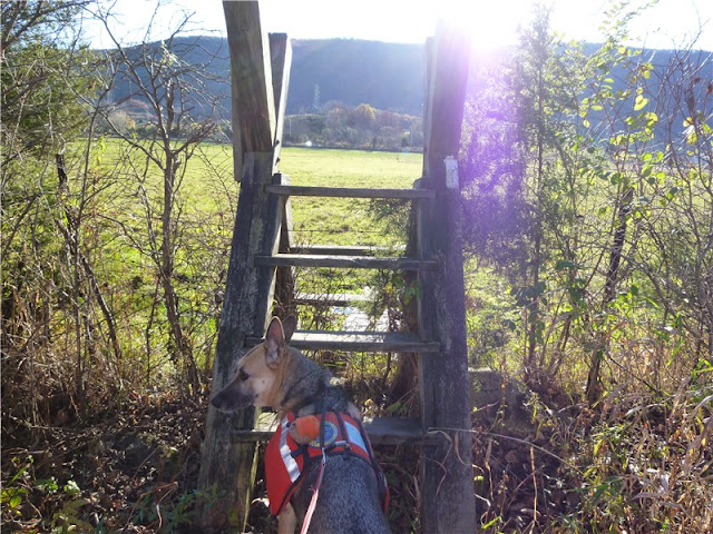
Turn left at 2.85 miles where the Appalachian Trail leaves Canal Road. Cross another bridge at 3.0 miles. At 3.4 miles climb over the first of four stiles. At 3.55 miles climb over the second stile, immediately cross railroad tracks, then climb over the third stile. You will be walking on boards through a swampy area, passing through a field with cows.

At 3.75 miles carefully climb over the 4th stile as it puts you directly on Route 94. Cross Route 94 and proceed through the AT parking lot continuing along the white-blazed Appalachian Trail towards Wawayanda Mountain straight ahead.
At the rocky base of the mountain, begin ascending rock steps on switchbacks (Stairway to Heaven) all the way up the side of the mountain.
At 4.9 miles watch for a blue-blazed side trail to the left which leads to Pinwheel Vista. It is very easy to miss as the blazes are painted in navy blue which is very difficult to see. Watch for the rocks piled up around the tree.
If you arrive at the Old AT Vista Trail, you have gone too far. (This is the trail I took to what I believe to be the actual summit of Wawayanda Mountain. If you want solitude, there will most likely be nobody on this trail. It follows mostly along the ridge of Wawayanda Mountain. This is an unmaintained trail but there are a few blue blazes here and there.)
Back at the blue-blazed side trail to Pinwheel Vista, take that out a short distance to views over the entire valley. This is a very popular vista so chances are you will have to share.
 |
| High Point Monument barely visible in the distance. |
 |
| New York, the Gunks and the Catskills to the North |
Retrace your steps back to the Glenwood Road parking area.
HIKE SUMMARY:
[ 0.00] Glenwood Road parking area; head north on white-blazed AT via stone steps
[ 1.50] Cross over Route 517; begin west end of Pochuck Boardwalk
[ 2.20] Suspension Bridge
[ 2.40] East end of Pochuck Boardwalk
[ 2.80] Right on Canal Road bike path; cross over iron bridge
[ 2.85] Appalachian Trail leaves Canal Road to the left
[ 3.00] Cross over bridge
[ 3.40] Climb over first stile
[ 3.55] Climb over second stile; cross railroad tracks; climb over third stile
[ 3.75] Climb over 4th stile; cross Route 94
[ 4.90] Left on blue-blazed side trail to Pinwheel Vista
[ 5.10] Right on white-blazed AT after retracing steps from Pinwheel Vista
[ 6.25] Cross over Route 94 and climb over first stile
[ 6.45] Climb over second stile; cross railroad tracks; climb over third stile
[ 6.60] Climb over forth stile
[ 7.00] Cross over bridge
[ 7.15] Right on Canal Road bike path; cross iron bridge
[ 7.20] White-blazed AT leaves Canal Road to the left
[ 7.60] Begin east end of Pochuck Boardwalk
[ 7.80] Suspension bridge
[ 8.50] Pochuck Boardwalk west end; cross Route 517
[10.00] Arrive at Glenwood Road parking


