 |
| $15 per person entrance fee to receive a band for hiking the trails. |
DIRECTIONS:
GPS Coordinates 41.79550, -74.12767
 |
| Spring Farm Trailhead Parking |
TRAIL MAP:
Shawangunk Trails Map 105 - New York New Jersey Trail Conference
HIKE DISTANCE: 10.2 miles
THE HIKE:
The first cooler, low humidity day in weeks warranted taking a vacation day for a hike I would otherwise not do on weekends because of the popularity.
 |
| From the parking lot continuing up the gravel road a short distance to ... |
 |
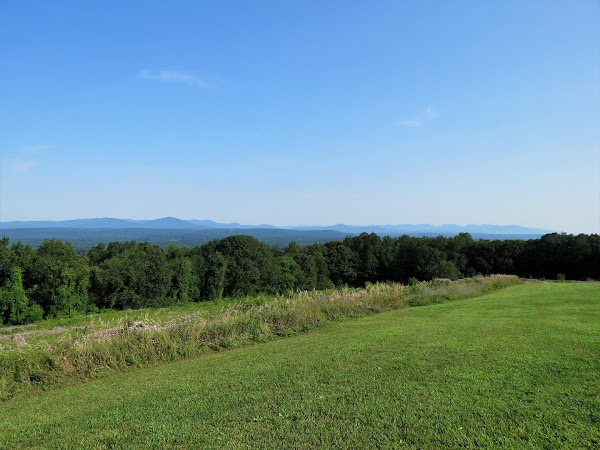
| Million Dollar View |
 |
| Turning back there is a side trail to ... |
 |
| ... Table Rocks Trail. |
 |
| More views of the Catskills from a little higher up. |
 |
| The Table Rocks Trail is blazed blue. |
 |
| At this intersection we turned left continuing on the Table Rocks Trail. Coming back we would be keeping straight which is to the right in this picture. |
 |
| The trail turns left off of the woods road. |
 |
| Table Rocks views. |
 |
| Retracing on blue. |
 |
| At that intersection with the map where Brodie wanted to continue retracing, we went straight on ... |
 |
| ... the red-blazed Clearwater Road Trail. |
 |
| Right on the blue-blazed Northeast Trail. |
 |
| This trail becomes considerably more rugged than the trails we had hiked so far. |
 |
| But it leads to view after view of the Catskills. |
 |
| On the yellow trail to Bonticou Crag which is the alternate trail to avoid a steep scramble. |
 |
| Hudson Valley views to the left. |
 |
| The red trail is the VERY steep scramble coming up from below. That was not going to happen with Brodie which is why I planned the yellow trail instead. |
 |
| Amazing views at Bonticou Crag |
 |
| Retracing on yellow then ... |
 |
| ... at the end of yellow ... |
 |
| ... left to continue on the Northeast Trail |
 |
| This leads to the bottom of the red trail. |
 |
| It would not have been possible to get Brodie up that scramble. |
 |
| Bonticou Crag from below. |
 |
| Continuing on the Northeast Trail, it is much more gentle and crosses a couple of small creeks. |
 |
| The Northeast Trail continues on for a bit but enters Mohonk Mountain House property where dogs are not allowed. We turned right on red. |
 |
| This is also the route of the Shawangunk Ridge Trail. |
 |
| From red we worked our way to the left to Bonticou Road. Several carriage road come together here so consulting the Gaia app helped navigate to the correct one. |
 |
| Smooth going now on carriage roads. |
 |
| Coming up on Mohonk Road ... |
 |
| ... where we crossed over. |
 |
| The path below to the right is Old Glen Anna Road where we would be heading next. |
 |
| A pretty brook along Old Glen Anna Road. |
 |
| Here we turned left on the red-blazed Rock Rift Trail. This turned out to be a big mistake. |
 |
| It starts out calm enough. Then ... |
 |
| ... SAY WHAT?!?!?!? |
 |
| Brodie whimpered pathetically and was afraid to come through. With some coaxing he finally did. I can't believe we actually fit through that tiny hole to get into there. |
 |
| Another one? |
 |
| This is more along the lines of what I was expecting it to be. |
 |
| Fortunately, at that point, we could see the carriage road down below so we bailed and bushwhacked down a steep hill a short distance. |
 |
| We came out at the end of Old Glen Anna Road (just stay on that to avoid the red trail) then turned right on Cedar Drive. |
 |
| Just as we made that right turn on Cedar Drive there was a loud CRASH that startled us both. That tree had just fallen over. |
 |
| A bridge with a bench. Break time! |
 |
| Going back this way there is a bridge over Mohonk Road. |
 |
| Left on the red-blazed Northwest Trail. |
 |
| This starts to parallel Upper 27 Knolls Road that we had driven in on. |
 |
| Back at the Spring Farm Trailhead ... |
 |
| ... and through the parking lot. |
 |
| On the way home I passed an organic farm stand. I always set my GPS to "no tolls" for a more scenic drive home and in hopes of passing by these small farm stands. |
 |
| Not certified organic but they don't spray and that works for me. Nice prices, too. |
 |
| This beats produce from the grocery store any day. |


