ABOUT THE PARK:
Shawangunk Ridge State Forest - New York DEC
DIRECTIONS:
GPS Coordinates 41.646202, -74.401688
 |
| Room for about 5 cars at Cox Road parking. |
TRAIL MAP:
Shawangunk Trails Map 106B - NYNJ Trail Conference
Shawangunk Ridge Trail Map 3 (free map) - NYNJ Trail Conference
Shawangunk Ridge State Forest - New York DEC
HIKE DISTANCE: 8.6 miles
THE HIKE:
 |
| The red trail starts at the kiosk in the parking lot. |
 |
| A short distance in the trail splits. We went left and would be returning from the right. |
 |
| Almost at the ridge ... |
 |
| ... where we turned left on the Long Path/Shawangunk Ridge Trail. I needed to meet up with where Shawnee and I had left off in Roosa Gap State Forest back in 2014. |
 |
| Cedar Waxwing |
 |
| This was the only Shawangunk Ridge Trail marker I saw along the way. |
 |
| At that huge boulder we had just overshot where Shawnee and I had turned around so ... |
 |
| ... we took a break on that boulder before heading back. We also packed out somebody's trash that they had left behind the boulder. |
 |
| Heading back. |
 |
| Prairie Warbler |
 |
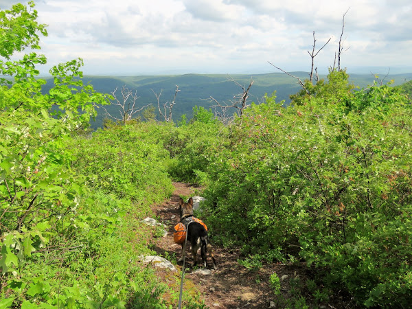
| The views in this direction are spectacular. The pictures don't do it justice. |
 |
| Passing by where we had come up on the red trail. |
 |
| I think I see a belly band on this hawk which would make it a red-tailed hawk hovering over the valley. |
 |
| More litter to pack out. Grrrrr. |
 |
| Future blueberries. |
 |
| This is the northern end of the red trail back down to where we parked but that would be our return route later. For now onward and downward (steeply at times) to the northern part of the forest. |
 |
| The Catskills coming into view in the distance. |
 |
| The trail descends for 1 mile. It's hard not to think about having to climb back up a mile on the return route. |
 |
| The trail comes out at an old woods road where the Long Path turns left. We would later return from the left. For now we turned right briefly then left on yellow. |
 |
| The trail continues to descend ... |
 |
| ... to a waterfall crossing. |
 |
| Looks like the Long Path followed this route in the past. |
 |
| When yellow turned left we went straight on an unmarked woods road for a short distance ... |
 |
| ... then turned left on yellow at the old woods road. (Brodie is going the wrong way.) |
 |
| I noticed a path to the right and it appeared it would cut over to the parking lot allowing me to make a loop so right we went for a very short uphill to ... |
 |
| ... the Route 52 parking lot. Here we turned left on ... |
 |
| red/yellow and ... |
 |
| ... continued right on yellow when red went left. |
 |
| This led to a great view of the Catskills, which would have been a better view had it not been a humid, hazy day. |
 |
| Survivor of the dirt bike onslaught. |
 |
| That rutted woods road led straight to old Route 52 and the Long Path where we turned left to loop back around ... |
 |
| ... to where we had started on the yellow trail. Now it was a mile uphill to retrace. |
 |
| It wasn't too bad when the sun was behind the clouds and when there was a nice breeze. |
 |
| But that didn't last long. The sun came out, the breeze stopped and it was pretty brutal. We took a break every quarter of a mile. |
 |
| Mountain Laurel starting to bloom. |
 |
| Finally at the top and Brodie wasting no time turning left on the red trail back down to the car. |
 |
| First a little more climbing ... |
 |
| ... then down into the rock formations where there was a blast of cold air. |
 |
| Then it it smooth going all the way back to the parking lot. |
 |
| Ice water for Brodie. |


