ABOUT THE PARK:
Garden of the Gods Wilderness - USDA
Garden of the Gods Recreation Area - USDA
DIRECTIONS:
GPS Coordinates 37.60492, -88.38467 (Using GPS to these coordinates is not recommended. I forgot I had read that somewhere and remembered when my GPS was leading me down rutted forest roads, telling me to turn on roads which did not even exist. GoogleMaps shows directions accurately)
 |
| When I arrived at t 9:30 AM on a Saturday there was plenty of parking. |
 |
| But the lot fills up and there will be a constant caravan of cars coming in vying for an open parking spot. |
TRAIL MAP:
Garden of the Gods Brochure - USDA
HIKE DISTANCE: 6.2 miles
THE HIKE:
Trails are not blazed and signs at intersections are infrequent. It was often very hard to tell where I was and which way to go not knowing what was a side path and what was a trail. Most trails are very muddy and rutted from heavy horse traffic.
 |
| The main attraction is the Observation Trail so we headed there first before the crowds arrived. |
 |
| Not like anything I have ever seen before. |
 |
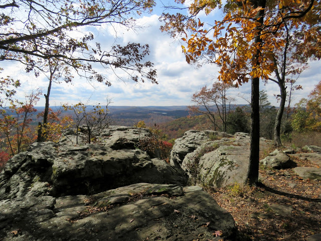
| Looking over Garden of the Gods Wilderness Area. |
 |
| There were people everywhere on top of rock formations. Not us! |
 |
| I get weak in the knees just seeing those people standing there. |
 |
| OK, enough of that, it was starting to get crowded. On to the Garden of the Gods Wilderness trails. |
 |
| We turned left onto a footpath at a trail marker - the only such trail marker we saw. |
 |
| Still lots of people in this area where there are more interesting rock formations. |
 |
| Anvil Rock |
 |
| Paths lead out to overlooks to the point where you can't tell if you are still on the trail or not. |
 |
| Finally a sign at an intersection. Looks like 108E is what I wanted so that is the way we went. |
 |
| In retrospect, looking at my track compared to the map, looks like we should have crossed the creek to the left here to do the loop I had planned. But with no sign and a very distinct trail along the right side of the creek, that is what we followed. |
 |
| This trail took us through gorgeous rock formations with nobody else around. |
 |
| The trail crossed the creek several times on rocks and was always easy to find on the other side. Yet it turns out this trail isn't even on the map. |
 |
| I eventually lost the trail at boundary markers. We bushwhacked a bit but could not find a trail and did not want to risk getting lost this far out so we retraced. |
 |
| All was not lost - was not the trail I had in mind but it was gorgeous and so remote with nobody else around. |
 |
| Back at the sign where we started, took 001A towards the parking lot. |
 |
| This sign totally confused me because the River to River Trail is not in this area, at least not on the map. The sign could have meant which way to go to meet up with the River to River Trail. I was going through the parking lot to get to that trail. |
 |
| Lots of horses arriving. |
 |
| Heading through the parking lot towards the entrance to pick up the River to River Trail (where it is on the map) to get over to the Indian Point Trail. |
 |
| After passing the parking lot entrance, the River to River Trail crosses the entrance road over a little way down the hill. We turned left and would be returning from the right. |
 |
| At the sign (there are new signs and more of them in this area) right on ... |
 |
| ... a River to River Trail spur (the blue "i" is the River to River Trail marker) ... |
 |
| ... through another crowded parking lot to ... |
 |
| ... the Indian Point Trail which is a hiker only trail. |
 |
| Coming up on the overlook and fortunately, for all the cars in the parking lot and other people on this trail, we had the views to ourselves. |
 |
| Looping around past more rock formations. |
 |
| Back at the parking lot where we went a short distance through the lot then left ... |
 |
| ... on spur to the River to River Trail. |
 |
| At the main River to River Trail (we were coming up on the back of the sign) we turned right as short distance ... |
 |
| ... then left on the main road back to the parking lot. |
 |
| While I was changing shoes at the back of my car, cars were stopping asking if I was leaving. One after another after another. I really wanted to sit a minute and have lunch before the 400 mile drive to the motel so Brodie and I ducked behind the seats where nobody could see us so we could lunch in peace before leaving and giving up our spot. |


