ABOUT THE PARK:
Big Pocono State Park - Pennsylvania DCNR
DIRECTIONS:
GPS Coordinates 41.04257, -75.34974
TRAIL MAP:
Big Pocono State Park Trail Map - Pennsylvania DCNR
HIKE DISTANCE: 3 miles
THE HIKE:
 |
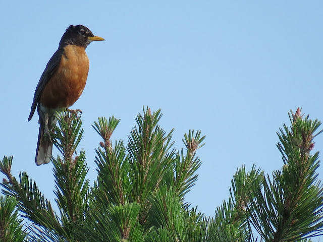
| The hike started with this robin singing her little heart out at the top of a pine tree. |
 |
| Taking the trail at the far end of the parking lot. |
 |
| Chipping Sparrow |
 |
| Keep right at a fork then cross the paved park road to the Indian Trail. |
 |
| At the next fork, the North Trail starts to the left; the Indian Trail continues to the right. |
 |
| At the bench, left on the loop part of the Indian Trail. |
 |
| Mountain laurel everywhere. |
 |
| When it start getting rockier, the views are nearby. |
 |
| The Delaware Water Gap in the distance. |
 |
| Continuing on the Indian Trail. |
 |
| Philadelphia Vireo |
 |
| I did not recall this scramble from years ago when I hiked this trail but then I had been hiking it in the opposite direction. It is a little steeper than it looks. |
 |
| It was challenging for the seniors (my 81-year-old mother and 15-year-old Shawnee) but they made it up with some assistance. |
 |
| Shawnee waiting from grandma when she is slower on the rocky terrain. |
 |
| When the Indian Trail turns right at the sign, the South Trail goes left and straight; keep straight. |
 |
| A red-tailed hawk soaring over ... |
 |
| ... views east across Pennsylvania towards New Jersey. |
 |
| Delaware Water Gap with Mt. Tammany on the left and Mt. Minsi on the right. |
 |
| Straight on South Trail at the Scout Trail, which leads back to the parking lot. |
 |
| A great break spot with a view. |
 |
| Right on the Vista Trail just beyond the overlook. |
 |
| At the end of the Vista Trail cross the paved park road, enter the parking lot and stay right in the parking lot to the other end. |
 |
| At the far end of the lot, a trail back to the parking lot at the summit. |
 |
| This crow headed towards... |
 |
| ... the communications tower where ... |
 |
| .... he communicated. CAW CAW CAW |
 |
| Cattell Cabin built in 1908. |
 |
| The Nature Trail ... |
 |
| ... goes down a flight of steps beyond this rock to the paved park road. Even though the sign from the parking lot says it is a 1.5 mile trail, there is no hint of where it continues at the paved park road. I asked a park maintenance person in the parking lot and he said the markers have been vandalized but it continues on the paved lower park road and loops around. Too hot and sunny with full exposure pavement so we passed. |
 |
| Heading back up to the parking lot. |
 |
| While Shawnee rested, we sat at a picnic table in the breeze where the park maintenance person showed us pictures of the wildlife he sees while working in the park. Rattlesnakes, hawks, bobcats and BABY bobcats! He also said a 500-pound bear lives there. |
 |
| On the way home we stopped at the overlook off of I-80 and took a shot of the Delaware Water Gap from the opposite direction, from New Jersey looking into Pennsylvania. |


