ABOUT THE PARK:
The BMECC Section of The Appalachian Trail - Blue Mountain Eagle Climbing Club
DIRECTIONS:
GPS coordinates to Reservoir Road Parking
40.583229, -75.941910
View Larger Map
.jpg) |
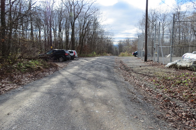
| The parking lot at 7:00 AM |
TRAIL MAP:
PA Appalachian Trail Map Sec. 1-6: Delaware Water Gap to Swatara Gap - Keystone Trails Association
Hiking Near the Pinnacle - Berks County, PA
HIKE DISTANCE:
9.35 miles
This site gives options for hikes of various lengths from different parking locations.
APPALACHIAN TRAIL SECTION HIKING:
TrailHeadFinder.com - AT section miles 1208.3 to 1214.9
THE HIKE:
.jpg) |
| The hikes starts on the gravel road beyond the yellow gates. |
.jpg) |
| The gravel road is blazed blue. |
.jpg) |
| A bridge over Furnace Creek just after turning right on the white-blazed Appalachian Trail at the site of the Windsor Furnace. |
.jpg) |
| The AT starts out nice and smooth... |
.jpg) |
| ... but it just wouldn't be the AT in PA without some rocks thrown in. |
.jpg) |
| The rocks bring you up to... |
.jpg) |
| ... an observatory on the left and |
.jpg) |
| Pulpit Rock on the right. |
.jpg) |
| Coming up on Pulpit Rock. |
.jpg) |
| It was a gorgeous sunny day but fog obstructed the views in the valley below. |
.jpg) |
| Over some more rocks and along the ridge ... |
.jpg) |
| ... to a blue side trail at the largest cairn you have probably ever seen. |
.jpg) |
| Still lots of fog down in the valley at the Pinnacle. |
.jpg) |
| I had the Pinnacle all to myself since I started so early. |
 |
| Picture from a clear day when I hiked to the Pinnacle from Eckville on November 8, 2009. |
.jpg) |
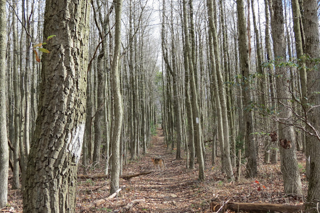
| The AT then continues on as a woods road with droves of people coming up to the Pinnacle as I was leaving. |
.jpg) |
| At a clearing known as the helipad, a blue trail leaves to the left for the 8.7 mile hike but we kept going on the AT to make the hike longer. |
.jpg) |
| Another blue-blazed trail leaves to the left as the AT makes a right turn... |
.jpg) |
| This blue-blazed woods road leads down to Hamburg Reservoir... |
.jpg) |
| Where I was mobbed by ladybugs! They were everywhere and all coming at me. |
.jpg) |
| The dam at Hamburg Reservoir. |
.jpg) |
| A gravel road leads from the reservoir to the AT briefly, then to the blue-blazed gravel road back to the parking lot with yet more people heading to the Pinnacle. |
.jpg) |
| One ladybug rode all the way back to the parking lot on my backpack. |
[ 0.00] Walk beyond yellow gate at the large map and continue on blue-blazed gravel road
[ 0.40] At intersection turn right on white-blazed Appalachian Trail, cross bridge, after bridge keep right on AT when gravel road goes left
[ 0.65] Rock hop over small creek
[ 0.70] Right on AT when blue side trail goes left to shelter
[ 1.70] Keep straight on AT when blue trail goes right to Blue Rocks Campground
[ 2.05] AT leaves woods road to the right and becomes rocky
[ 2.30] Observatory on left, Pulpit Rock on right
[ 2.45] Communications tower on left
[ 2.75] Keep straight on AT when red trail goes left
[ 4.20] Keep straight when yellow trail goes right to Blue Rocks Campground
[ 4.50] At giant cairn, turn right on blue trail to Pinnacle Overlook where AT turns sharply left; from overlook retract and keep right to resume on AT
[ 6.10] Keep straight on AT through helipad clearing when blue trail goes left
[ 6.40] Gold Spring
[ 7.00] Turn left on blue-blazed woods road when the AT turns right
[ 7.45] Keep straight when trail crosses over with Stephanie Spring on right
[ 8.35] Turn left at the reservoir and loop around
[ 8.55] At opposite corner of reservoir, turn right and continue around when blue trail comes in from the left
[ 8.70] Keep straight through yellow gate leaving reservoir
[ 8.80] Keep straight on gravel road when another gravel road comes in from the left
[ 8.85] Turn right on AT, cross bridge, then turn left on blue gravel road
[ 9.35] Back at parking lot

.jpg)
.jpg)

.jpg)
.jpg)
.jpg)
.jpg)
.jpg)
.jpg)


