ABOUT THE PARK:
Pequannock Watershed - Newark Watershed Conservation and Development Corporation
DIRECTIONS:
GPS Coordinates to parking P1: 41.075339,-74.445161
View Larger Map
 |
| There are several roadside pullouts near the trail head. The P1 sign is at the intersection of Clinton Road and Van Orden Road. |
IMPORTANT:
A permit is required to hike in the Pequannock Watershed. Permits must be purchased in person at the Newark Watershed office. Click here for information on obtaining permits.TRAIL MAPS:
North Jersey Trails Map #116 - NY/NJ Trail Conference
HIKE DISTANCE: 9.9 miles with 5.9 and 6.9 mile options
THE HIKE:
 |
| Trail head for the white trail at the corner of Clinton Road and Van Orden Road. |
 |
| For a closer look at the sign. |
 |
| The white-blazed trail starts out as a woods road... |
 |
| ... with a few glimpses of Hank's Pond on the left. |
 |
| These little red efts were all over the place so I had to watch my step! They weren't as vibrant orange as they usually are so it was more difficult to see them. |
 |
| The white trail eventually leaves the woods road and scrambles up to a rock ridge. |
 |
| Along the ridge with steep drops down either side. |
 |
| Watch for cairns that show the way - at this cairn with the painted blaze it does not look like the trail goes left but it does - it is more obvious on the other side of the vegetation. |
 |
| When the teal diamond-blazed Highlands Trail joins in from the right, there are seasonal views to the right. |
 |
| At a small power cut, the Bearfort Fire Tower is visible to the left. |
 |
| Blue-blazed trail in Wawayanda State Park. |
 |
| A tiny little frog on the trail. |
 |
| There were all kinds of birds along the blue trail but they were very elusive. I did manage to get a shot of this Northern Flicker. |
 |
| The blue trail skirts around a swamp through a rocky area... |
 |
| ... then meets up with the red-blazed trail. |
 |
| Looking back at the red-blazed trail from where it ends at Stephens Road. |
 |
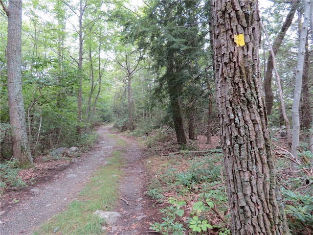
| The beginning of the yellow-blazed trail off of Stephens Road. |
 |
| The yellow-blazed trail is a gravel/woods road until it reaches the fire tower. |
 |
| Bearfort Fire Tower |
 |
| A quick shot from the first level of the fire tower... |
 |
| ... because it was a long, scary, steep climb to that level and well, it was scary and I needed to get back down ASAP! |
 |
| Limited views along the yellow/teal trail... |
 |
| ... of Cedar Pond. |
 |
| On the combined yellow/teal trail |
 |
| Looking back at the blowdown blocking the yellow/teal trail right at the turn for the blue trail - easy to miss if you don't turn around and look back at the blowdown if it is still there. |
 |
| On the blue/red and white trail. |
 |
| At the bottom of the loose rocks, the blue trail becomes a little overgrown and hard to follow, but only briefly... |
 |
| ... before descending to a pretty forest floor. |
 |
| Hank's Pond |
 |
| An old fireplace ruin along the blue and white trail at Hank's Pond. |
 |
| Hank's Pond from the other end. |
HIKE SUMMARY:
[ 0.00] Take the white-blazed trail from the P1 parking area
[ 0.15] Keep right on the white trail when the woods road continues straight and blue starts to the left
[ 1.45] Keep straight on white when blue goes left
[ 2.35] Teal diamond-blazed Highlands Trail comes in from the right; seasonal view to the right
[ 2.40] Teal diamond-blazed Highlands Trail leaves to the left (for 5.9 mile hike turn left following the teal diamond Highlands Trail to the fire tower then pick up at [7.05])
[ 2.70] Bearfort Fire Tower visible to the left in power cut
[ 3.15] Turn left on gravel Stephens Road when the white trail ends
[ 3.20] Turn right on blue-blazed trail into Wawayanda Park (for 6.9 mile hike, continue on Stephens Road to yellow trail on left - pick up at [6.45])
[ 4.00] Side trail on right not on map - goes out and back .15 mile total to seasonal view
[ 4.70] Blue trail makes sharp left at red arrow on tree ahead and trail not on map that leaves to the right with white blazes
[ 5.05] Skirt around swamp to the left, at T-intersection turn left, turn left on red when blue ends
[ 6.35] Red ends at Stephens Road, keep left on gravel Stephens Road
[ 6.45] Turn right on yellow trail at yellow metal gate
[ 7.00] Turn left on teal-blazed Highlands Trail - did not see blazes at intersection
[ 7.05] Bearfort Fire Tower; retrace on teal Highland Trail to yellow trail, turn left and follow combined teal/yellow
[ 7.10] Keep right on teal/yellow when red and white trail goes left
[ 7.30] Limited views of Cedar Pond to the right
[ 7.75] Bushwhack around large blowdown then immediately on the other side of the blowdown, take the blue side trail that leaves teal/yellow to the left
[ 7.90] Continue on blue/red and white when red and white comes in from the left
[ 8.10] Left on blue when red and white leaves to the right
[ 8.20] Turn right on blue and white when blue goes left
[ 8.85] Blue and white trail runs next to Hank's Pond
[ 9.40] Left on umarked woods road at end of Hank's Pond when blue and white goes right
[ 9.75] Keep straight on white when white comes in from the left and blue starts to the right
[ 9.90] Back at P1 parking


