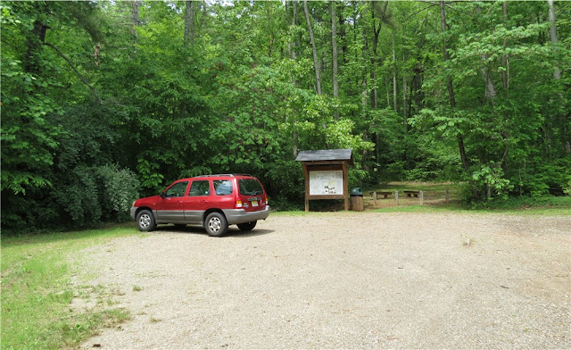
ABOUT THE PARK:
Hiking the AT in NY and NJ - New York New Jersey Trail Conference
Terrain by Region: New York - Appalachian Trail Conservancy
DIRECTIONS:
GPS Coordinates 41.244104, -74.286587
View Larger Map
 |
| (Heading West) There is an island between Continental Lane (left) and Route 17A (right) where there are a few parking spots along Continental Lane and also opposite the hot dog stand in the island. |
 |
| Parking in island at opposite end of hot dog stand. |
TRAIL MAP:
Sterling Forest Trails Map 100 - New York New Jersey Trail Conference
Note: Map does not show blue-blazed bypass trails that are used in this hike.
HIKE DISTANCE:
To Fitzgerald Falls and back - 8.25 miles
To Highlands Trail viewpoint and back - 10.65 miles
APPALACHIAN TRAIL SECTION HIKING:
TrailHeadFinder.com - AT section miles 1354.3 to 1359.3
THE HIKE:
 |
| Mountain laurel in bloom along the trail. |
 |
| Cat Rocks |
 |
| Blooming mountain laurel. |
 |
| Crossing Lakes Road to Fitzgerald Falls. |
 |
| Through a power cut with dense vegetation. |
 |
| Bridge over Trout Brook |
 |
| Fitzgerald Falls - the AT ascends steeply to the right of the falls. |
 |
| Looking back down the steep ascent. |
 |
| Smaller cascades at the top. |
 |
| There is more to see from this viewpoint but it was a very humid and hazy day so visibility was poor. |
 |
| The blue-blazed bypass trail around Fitzgerald Falls - a very pleasant trail as an alternative to making the steep descent along the falls. |
 |
| After crossing Lakes Road, it's a climb back up to the ridge with lots of water breaks on this hot and humid day. |
 |
| Taking the blue bypass trail around Cat Rocks on the way back to conserve energy for the Eastern Pinnacles which we bypassed on the way out because of thick fog and wet, slippery rock surfaces. |
 |
| Lots of mountain laurel on the blue bypass trail around Cat Rocks. |
 |
| New north from Eastern Pinnacles, again with poor visibility on a hazy and humid day. You can see Cat Rocks on the left, zoomed in, below. |
 |
| Cat Rocks from Eastern Pinnacle - you can see the white AT blaze on the right side of the rocks towards the top. |
 |
| Heading south over Eastern Pinnacles. |
 |
| Viewing platform at the end of the blue-blazed trail near Route 17A. |
 |
| Another hazy view from the platform. |
 |
| Somebody was very happy there was a hot dog stand in the parking lot. |
HIKE SUMMARY:
[ 0.00] Turn right from parking lot and walk along Route 17A
[ 0.10] Turn left on faint path into woods (or continue on Route 17A until AT turns left into woods)
[ 0.15] Turn right on blue-blazed trail
[ 0.20] Blue trail ends, turn left on white-blazed Appalachian Trail
[ 0.75] Rock hop creek then cross pipeline
[ 1.30] Left on blue-blazed bypass trail when AT goes right to Eastern Pinnacles
[ 1.50] Blue bypass trail ends, continue on white-blazed AT
[ 1.80] Stay left on white-blazed AT to ascend Cat Rocks when blue bypass trail goes right
[ 1.85] After descending Cat Rocks, continue on AT when blue bypass trail comes in from right
[ 2.10] Keep straight on AT when blue side trail to left leads to Wildcat Shelter
[ 2.15] Other end of blue trail from shelter comes in to the left
[ 2.95] Right at fork
[ 3.45] Left at fork
[ 3.50] Unmarked trail crosses over
[ 3.65] Cross paved Lakes Road
[ 3.70] Cross power cut then bridge over Trout Brook
[ 3.85] Keep right on AT when blue-blazed trail goes left (Falls bypass trail for return route)
[ 3.95] Fitzgerald Falls, AT continues on steep ascent along right side of falls
[ 4.05] Rock hop to left over creek, keep right on AT when blue bypass trail goes left (or turn left on blue for 8.3 mile hike)
[ 4.15] Cross woods road
[ 5.10] Trail register; AT goes left, turn right on Highlands Trail following blue blazes
[ 5.15] Views; retrace
[ 5.20] Left on AT at trail register for return route
[ 6.25] Cross woods road
[ 6.35] Right on blue bypass trail when AT turns left and crosses creek
[ 6.65] Turn right on Appalachian Trail when blue ends
[ 6.80] Cross bridge over Trout Brook then pass through power cut
[ 6.85] Cross paved Lakes Road
[ 8.30] Keep straight on AT when blue trail to shelter goes right
[ 8.65] Turn left on blue bypass trail with AT goes right up Cat Rocks
[ 8.70] Blue trail ends, continue on AT
[ 9.00] Keep left on AT and ascent Eastern Pinnacles when blue-blazed bypass trail goes right
[ 9.10] Second bypass option at blue blaze painted on rock to the right
[ 9.15] Other end of second blue bypass trail comes in on the right
[ 9.20] Other end of first blue bypass trail comes in on the right
[ 9.70] Cross pipeline then rock hop creek
[10.25] Straight on blue when AT turns left to Route 17A
[10.30] Straight on blue when side path to left leads to Route 17A
[10.45] Overlook deck; retrace
[10.55] Turn right on side path to Route 17A, turn right on Route 17A back to parking
[10.65] Back at parking


