Friday, May 11, 2012

Jefferson National Forest, VA - Cascades and Barney's Wall


ABOUT THE PARK:
Cascades Day Use Area - USDA Forest Service
Cascade Falls - Giles County, Virginia

DIRECTIONS:
GPS Coordinates 37.353838,-80.598986

View Larger Map
Looking back at the parking lot from the trail head next to the restroom building.
On the way in, just before the parking lot, pull off to the right to self pay the extremely reasonable $3 parking fee.  If you don't pay, the fine is $75.

TRAIL MAP:
Picture of the map at the trail head.  I drew in the continuation to the Upper Falls and Barney's Wall
Click here for a map that shows more of the trails in the area.

HIKE DISTANCE:  8.3 miles (Cascades Trails only - 4 miles)

THE HIKE:
Start the hike to the right of the restroom building at the far end of the parking lot.
Trail Entrance
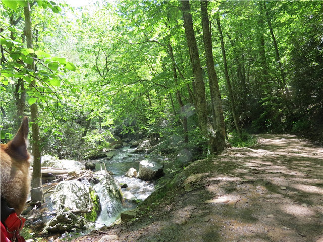
The trail follows along the left side of Little Stony Creek.
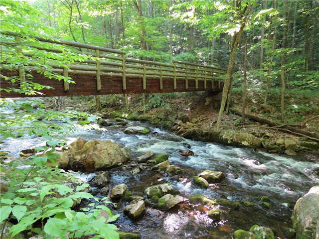
At the first bridge, the trails split.  The Upper Cascades Trail (return route) continues straight ahead.  Turn right and cross the bridge to the other side of Little Stony Creek for the Lower Cascades Trail.
Lovely small cascades all along Little Stony Creek.
A lot of old stonework and steps along the way.  The second bridge leads back to the other side of Little Stony Creek, still on the Lower Falls Trail.  The Upper Falls Trail is now at a higher elevation and can be reached via short connector trails to the left if the hike needs to be cut short.
Trail signs are etched in stone.  This is the half way point to the falls.
More old steps leading up to the falls.
At the end, the Cascades.  The wooden steps on the left lead to an observation deck by turning right part of the way up the steps, or left to the Upper Cascades Trail and the continuation to the Upper Falls and Barney's Wall.
Taking the left branch of the steps, ascend to an intersection where the Upper Cascades Trail is to the left for the 4 mile hike, or turn right to continue on to Barney's Wall. 
Just before reaching the Conservancy Trail, a short side trail to the right leads to the upper falls.
Although it takes a few different trails to reach Barney's Wall, they are all blazed yellow so instead of the blazes denoting individual trails, the yellow blazes lead the way to Barney's Wall.  It is a relentless ascent until the trail finally levels out at the top.
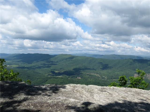
View from Barney's Wall.
Rocks at Barney's Wall make a nice break spot.
Returning on the Upper Falls Trail.

HIKE SUMMARY:
[0.00]    Start on the unblazed trail to right of restroom at far end of parking lot
[0.20]    Turn right and cross bridge (Upper Cascades Trail continues straight not crossing the bridge)
[1.05]    Cross second bridge and turn right; connector trail from Upper Cascades Trail joins in from the left
[1.40]    Cross bridge running parallel to creek
[1.70]    Cross bridge running parallel to creek
[2.15]    Arrive at lower cascades; go up wooden steps and at t-intersection turn right to observation deck; retrace
[2.20]    Coming from observation deck continue straight when steps to the left lead back down to the Lower Cascades Trail
[2.30]    At clearing turn right on fire road towards Conservancy Trail and Barney's Wall  (For a 4 mile hike, turn left on fire road which is the Upper Cascades Trail back to the parking lot.)
[2.70]    Continue on fire road as it turns left, unmarked trail leaves to the right (short trail with no view)
[2.75]    Turn right on unmarked trail leaving fire road, switchback down to upper falls
[2.85]    Upper falls; retrace
[2.95]    Turn right to continue on fire road short distance then turn left on yellow-blazed Conservancy Trail
[3.40]    Go through rhododendron tunnel and rock hop creek
[4.10]    Turn left at intersection on Barney's Wall Trail (still blazed yellow) when Conservancy Trail goes right
[4.40]    At circle keep right and turn right on first trail before fire pit, descent to Barney's Wall (trail blazed yellow but blazes not visible until on the trail)
[4.50]    Barney's Wall; retrace
[4.60]    Turn left at circle then left on Barney's Wall Trail
[4.90]    Turn right on the Conservancy Trail at intersection
[5.60]    Go through rhododendron tunnel and rock hop creek
[6.10]    Turn right at intersection on fire road towards Cascades Trail
[6.50]    Keep straight on fire road which is now the Upper Trail
[6.70]    Keep straight when trail to left connects to Lower Trail
[7.25]    Keep straight when trail to left connects to Lower Trail
[8.10]    Keep straight at bridge
[8.30]    Back at parking lot

Thursday, May 10, 2012

Appalachian Trail, VA - Andy Layne Trail to Tinker Cliffs to McAfee Knob


ABOUT THE PARK:
The Appalachian Trail in Virginia - Appalachian Trail Conservancy

DIRECTIONS:
This hike was done as a shuttle hike.  I parked at Lot A (Appalachian Trail parking lot on Hwy 311) and hired a very nice gentleman from the Appalachian Trail Shuttle List to shuttle myself and my dog to Lot B (Andy Layne Trail parking) where we started the hike.

Lot A (Appalachian Trail parking lot on Hwy 311)
GPS Coordinates 37.380017,-80.089887

View Larger Map

Lot B (Andy Lane Trail Parking Lot)
GPS Coordinates 37.457589, -80.017241

View Larger Map


TRAIL MAP:
Trails Illustrated Map #788 Covington Alleghany Highlands - National Geographic
Picture of trail map in kiosk at AT parking on Rt. 311

PEAK BAGGING:
Tinker Mountain - Peakery.com
McAfee Knob - Peakery.com
Catawba Mountain - Peakery.com

APPALACHIAN TRAIL SECTION HIKING:
TrailHeadFinder.com - AT section miles 708.6 to 698.7

HIKE DISTANCE:  14 miles

THE HIKE:
Take the yellow-blazed Andy Layne Trail from the parking lot.
Plaque on the rock at the beginning of the trail.
A kiosk a little farther along the trail.  There are 4 stiles on this trail (the wooden ladder over barbed wire fencing).  The first stile by the kiosk can be walked around as there is no fencing in place.
You will probably encounter cows.  This little calf had been frolicking around and leaping in the air.  It was too darned cute.  In that moment I realized just how happy I am being vegetarian.
First bridge crossing over Catawba Creek
Lots of mud if it's been raining recently.
Unique rock walls at Catawba Creek.
Second bridge crossing over Catawba Creek.
If you have a dog along, the stiles will most likely present a challenge.  My dog in particular, is scared to death of climbing them and I was concerned about this hike as I knew there were 4.  Fortunately, I found a solution...
I carry a small fleece blanket to sit on for breaks and it worked beautifully to cover the barbed wire so Shawnee could belly crawl under.
The trail goes around the gate so it's OK to trespass if you are a hiker on the trail.
The trail will start to ascend steeply...
... and switchback up...
... to the Appalachian Trail.  The sign at this intersection says Hwy 311 is 9.1 miles but it's about 2 miles more than that.
Coming up on Tinker Cliffs.
Outstanding views from Tinker Cliffs.
Waiting for someone to fall off the cliffs?
The Appalachian Trail passes right along the edge of the cliffs but there is also a trail a few feet into the woods that provides an alternative for those of us who get shaky in the knees. 
The hike follows this entire ridge all the way over to McAfee Knob, the high point on the right.
The hike along the ridge is mostly through woods but there will be another view to the east along the way.
Nearing McAfee Knob, the AT touches briefly on a power cut with views before reentering the woods.
Getting closer as the AT winds through rock formations.
Just off the trail to the right is a nice rock outcrop but it's not McAfee Knob yet, although it's a lot less crowded.
You'll be approaching this sign from behind so it's easy to miss.  You'll need to turn right on a short side trail to get to...
McAfee Knob!
Our McAfee Knob photo was taken by AT thru-hikers "Sugarplum" from Georgia and "Mad Hat" from Minnesota.  They had left Georgia in early March and had just completed 700 miles, 1/3 of the Appalachian Trail.
From Mc Afee Knob, looking back along the ridge over to Tinker Mountain on the left.
Continuing on towards our car that we left at the AT lot on Highway 311.
A kiosk shortly before the parking lot.

HIKE SUMMARY:
[ 0.00]    Start on the yellow-blazed Andy Layne Trail at the rear of the parking; no fence by first stile
[ 0.55]    Cross second stile (dogs can get under barbed wire) then cross bridge over Catawba Creek
[ 0.75]    Cross third stile (large dogs cannot get under wire unless covered and lifted) then another bridge over Catawba Creek
[ 0.85]    Cross forth fence style (dogs can get under wire on the left side
[ 1.20]    Follow trail to left of gate with no trespass sign
[ 1.60]    As trail turns right, Roanoke Cement Company to the left but hard to see with foliage
[ 3.15]    Right on white-blazed Appalachian Trail at huge boulder
[ 3.85]    Views of Catawba Valley begin at Tinker Cliffs
[ 5.70]    Trail dips into a saddle where a woods road crosses over - keep straight uphill
[ 5.85]    Partial view to left
[ 6.40]    Nice break spot with views on top of rocks to left of trail
[ 6.65]    Views of to the left
[ 8.85]    Shelter on left
[ 9.00]    Campsite with picnic table on left
[ 9.20]    Trail comes out into power cut briefly for views before reentering woods to the right
[ 9.75]    Small rock outcrop (not McAfee Knob yet) with view on right
[ 9.90]    Turn right on rock surface side trail just before parking lot distance sign (McAfee Knob sign faces other way); retrace and continue south on AT
[10.70]   Cross power cut
[11.30]    Cross over fire road
[11.60]    AT turns right where campsite is on left; shortly after side trail to left leads to shelter
[12.90]    Shelter on left
[13.60]    Kiosk on right, short side trail to left to views, continue straight on AT
[14.00]    Cross Route 311 to parking lot