ABOUT THE PARK:
Pequannock Watershed - Newark Watershed Conservation and Development Corporation
DIRECTIONS:
View Larger Map
 |
| Parking along west side of Route 513 (map shows parking on east side) |
IMPORTANT:
A permit is required to hike in the Pequannock Watershed. Permits must be purchased in person at the Newark Watershed office. Click here for information on obtaining permits.TRAIL MAP:
Jersey Highlands Trail Map 125 - NY/NJ Trail Conference
PEAK BAGGING:
Green Pond Mountain - New Jersey 1K Club
Mount Newfoundland - New Jersey 1K Club
HIKE DISTANCE:
Out and back on Four Birds Trail with Green Pond Mountain summit - 10 miles
Out and back on Four Birds Trail wiithout Green Pond Mountain - 8 miles
Four Birds Trail/Railroad Loop with Green Pond Mountain summit - 9.15 miles
Four Birds Trail/Railroad Loop without Green Pond Mountain summit - 7.15 miles
THE HIKE:
 |
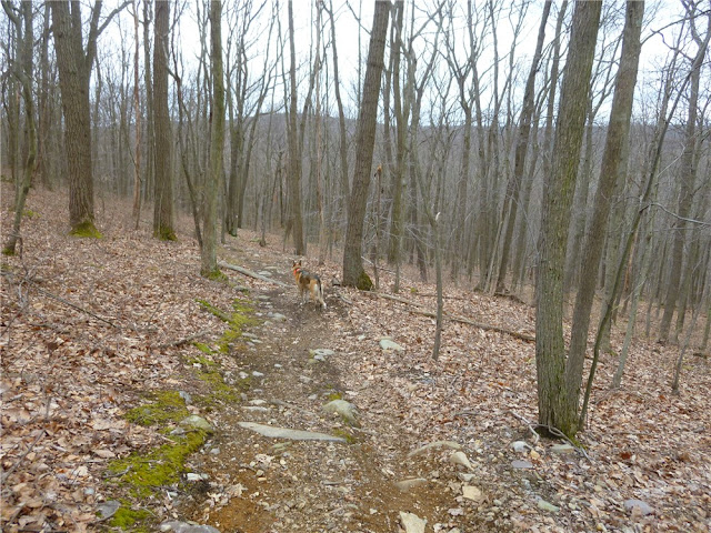
| At the beginning of the hike the white-blazed Four Birds Trail heads towards Green Pond Mountain. |
 |
| A creek crossing... |
 |
| ... with some small waterfalls. |
 |
| A Wild Turkey. |
 |
| A Black-capped Chickadee. |
 |
| Woods road to Green Pond Mountain summit. |
 |
| A House Wren. |
 |
| Green Pond from Green Pond Mountain. |
 |
| The Four Birds Trail follows along the top of the cliffs. |
 |
| Looking back south with Green Pond in the distance. |
 |
| Creek crossing on the way to Mount Newfoundland. |
 |
| Northern terminus of the Four Birds Trail at small parking area on Bigelow Road. |
 |
| Bigelow Road with apartments on the right and old railroad cars on the left. |
 |
| Newfoundland Station built in 1872, has been used as a location for filming movies. |
 |
| Just the other side of Route 513 conflicting signs almost next to each other. I have my permit so I entered. Apparently so did many others based on the amount of litter and old tires in the area. |
 |
| There is room to walk next to the railroad tracks. This space is also used by parents teaching their young children to drive ATVs. Ugh. |
 |
| On the other side of the railroad tracks, Old Newfoundland Cemetery, with tombstones dating in the 1800's. |
 |
| Most tombstones cannot be read but somebody put many of them online HERE. |
 |
| Some of the graves are still being cared for. |
 |
| I backtracked some and tried to find a way around the creek but did not want to go back the full mile and walk along the tracks so.... |
 |
| ... I broke out my 6 mil plastic boot covers that I carry in my backpack for just such an occasion... |
 |
| ... and forded across. |
 |
| Turn right just before this bridge and follow the trail to an abandoned rail bed. |
 |
| Wharton and Northern Railroad abandoned rail bed. |
 |
| A well-defined but VERY steep trail (shown with red dashes on the map) connects back with the white-blazed Four Birds Trail at the top just before an overlook. |
 |
| Overlook of Charlotteburg Reservoir shortly after unmarked trail meets back up with Four Birds Trail. |
 |
| Just a little farther along the Four Birds Trail, even better views of Charlotteburg Reservoir. |
 |
| A turkey vulture at the Charlotteburg Reservoir overlook. |
 |
| From the overlook it is all downhill on the Four Birds Trail back to the car. |
HIKE SUMMARY:
[ 0.00] Walk south 100 feet on Route 513; turn right on white-blazed Four Birds Trail
[ 0.30] Rock hop over creek; short distance ahead cross another creek on logs
[ 0.40] Rock hop over a very small creek
[ 0.50] After crossing swampy area on rocks, trail veers very slightly left then uphill (blazes missing in this area and trail not well defined because of rocky terrain)
[ 1.00] Trail turns right on gravel road at power cut
[ 1.05] Trail leaves gravel road as footpath to the right
[ 1.35] Left at fire pit on woods road with old painted over white blazes
[ 1.60] At power cut; keep straight on woods road
[ 2.60] Summit of Green Pond Mountain; retrace
[ 3.60] At fork just before power cut, keep left; cross power and continue back to fire pit
[ 3.85] Left on white-blazed Four Birds Trail at fire pit (not woods road rather trail along top of cliff)
[ 4.10] Trail crosses woods road (on map)
[ 4.45] Trail crosses woods road (on map)
[ 4.50] Rock hop over creek
[ 4.75] Cross small creek/wet area
[ 5.15] Views
[ 5.35] Trail goes through old stone fence
[ 5.45} Trail goes through old stone fence
[ 5.95] Kiosk almost at end of trail
[ 6.00] End of white-blazed Four Birds Trail; retrace or turn right on Bigelow Road
[ 6.10] Old railroad cars and Newfoundland Station
[ 6.20] Cross Route 513
[ 6.40] Old Newfoundland Cemetery on left side of railroad tracks
[ 6.75] Right at fork if taking woods road
[ 6.95] After having veered away from tracks, tracks now directly ahead when woods road turns left through blowdowns - this is where you need to look for a place to ford creek to get over to railroad tracks; at tracks, cross over and turn left
[ 7.10] Turn left just before railroad bridge
[ 7.15] Veer left onto abandoned rail bed
[ 7.25] Right on unmarked trail steeply uphill
[ 7.95] Unmarked trail ends at white-blazed Four Birds Trail; turn left to overlook; continue short distance to second overlook
[ 8.05] Second overlook; leaving overlook cross over Four Birds Trail on woods road
[ 8.15] Veer left on white-blazed Four Birds Trail when woods road ends
[ 8.55] Cross woods road
[ 8.80] Rock hop creek
[ 8.90] Rock hop creek
[ 9.15] Back at parking


