ABOUT THE PARK:
Shohola Recreation Area - Discover Pike PA
DIRECTIONS:
GPS Coordinates 41.390598, -74.969041
View Larger Map
 |
| Although there are many parking lots, this one was open on a Sunday in winter when others were gated. Trails for the falls are accessed directly from this parking lot. |
TRAIL MAPS:
I found it helpful to have both of these maps as they differ slightly. Trails are not marked or maintained. Expect to have to maneuver through some blow downs. Even though maps show trail names, no signs exist with these names. The trails along the falls are not shown on the maps and several paths branch off. It is pretty obvious where to go once there and hard to get lost since the lake is always nearby and makes a great reference point.
State Game Lands 180 - Pike County, PA
State Game Lands 180 - Pennsylvania Game Commission
HIKE DISTANCE:
Shohola Falls - Overlook Tower - Chucks Trail and Horseshoe Trail: 8 miles
Shohola Falls - Overlook Tower: about 4 miles
Shohola Falls only: about 1.5 miles
THE HIKE:
For orientation purposes:
 |
| Heading west, turn left before the Route 6 bridge towards Shohola Falls Inn (A) to paved the parking lot; Come out from the falls/gorge trail in the small gravel lot (b); Cross to the other side of Shohola Creek via the Route 6 bridge (c) |
 |
| From the parking lot, facing the dam, take the trail at the right corner of the lot where my dog is to get to the lower falls. |
 |
| Descend on a series of wooden steps. |
 |
| Shohola Falls after descending steps. |
 |
| Retrace from this point back to the parking lot. (From what I read, the icy section is slippery even when there is no ice but the trail does not continue on the other side so you have to go back to get to the upper level. |
Back at the parking lot, walk a few steps along the left side (with your back to the dam) and look for paths going into the woods that will run parallel to Shohola Creek up above the gorge.
 |
| A view of the lower level steps from the upper level trail. |
 |
| The trail will follow on a ledge with a steep drop down into the gorge through a beautiful hemlock forest. |
 |
| Come out into a small gravel parking area, walk around the guardrail and turn left to cross over Shohola Creek on the Route 6 bridge. |
 |
| A view of the gorge from the Route 6 bridge. |
Keep walking along Route 6 a short distance to the end of the guardrail and turn left. You might see faint paths in this area but if not, it's a short distance before coming out on a wide grassy clearing with an overlook to the left. On your way to the overlook, note where to access the trail for the other side of the falls on your way:
 |
| The overlook is at the split rail fencing to the far left, my dog is sitting at the entrance of the trail which is about half way between the overlook and the utility pole. It is obstructed by a blow down. I broke away as many branches as I could to make it a little more obvious. |
 |
| The trail will follow a fence along the other side of the gorge heading upstream back towards the falls and dam. |
 |
| Another series of steps lead to a stone walled overlook at the other side of the falls. |
 |
| Beyond the dam trails, the service road and woods roads lead to an observation deck. |
 |
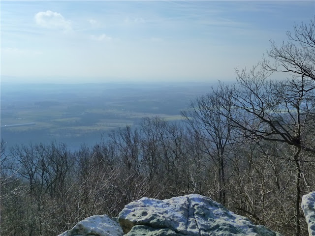
| View from the observation deck. |
 |
| Entrance to Chucks Trail (not marked) from the gravel service road. |
 |
| The named paths on the maps which are not signed by name in the game lands, are grassy woods road, sometimes very swampy. |
 |
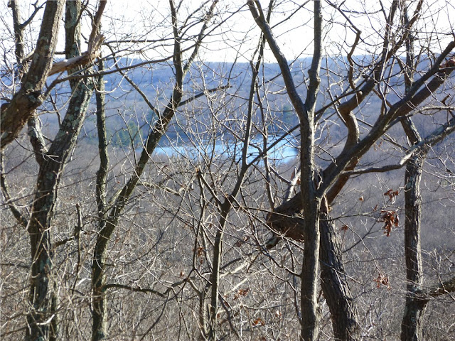
| A nice view of Shohola Lake and the countryside descending on the Horseshoe Trail. |
 |
| Shohola Lake |
 |
| Return to the parking lot by crossing the bridge on Route 6, turning right into the gravel parking lot, then accessing the trail at the left side of the fence. |
 |
| Follow the trail along the upper rim of the gorge through the hemlock forest. |
 |
| Shohola Falls from the upper trail. |
HIKE SUMMARY:
[ 0.00] Take the trail from the right corner of the parking lot facing the dam; descend step to bottom of falls, at end of trail retrace back to parking lot. Take path into woods from parking lot to left and follow upper trail along ridge above gorge through hemlock forest
[ 0.35] Trail ends at gravel parking lot, turn right to end of guardrail, turn left on Route 6 and cross over bridge continuing to end of guardrail
[ 0.50] Turn left at end of guardrail and continue briefly through woods to clearing then veer left to overlook at fence; retrace a few steps and turn left on path before utility pole
[ 0.60] Keep to the right along fence and down steps to falls overlook
[ 0.75] Falls overlook; retrace a few steps then go up steps to the left continuing towards dam; at dam veer right across open area on mowed path
[ 1.00] At paved parking lot, turn left and walk along pavement
[ 1.10] Turn left at picnic and trail sign opposite parking lot entrance on right; at clearing turn right on path into woods at "boating" sign
[ 1.30] Turn left at T-intersection (right goes back to paved road); at paved boat ramp, turn right, proceed a few steps then turn left on path into woods
[ 1.50] Left at fork
[ 1.75] Trail veers slightly away from lake, come out at clearing behind yellow game commission building, continue right on gravel road passing the yellow building, at the gravel service road, turn left
[ 2.20] Turn left at the woods road (Hill Trail on Game Commission map) - if you miss this, the next woods road has a "observation tower" sign and you can turn left there also
[ 2.40] Observation tower; descending tower steps, continue straight then turn left on the woods road; turn left at next woods road
[ 2.65] Continue through clearing to gravel service road; turn left on gravel road (turn right if only hiking out to observation tower)
[ 2.80] Gravel parking lot on right and boat launch on left (shown on map); continue on gravel road through gates
[ 3.20] Gravel road crosses creek (shown on Pike County map, not game lands map)
[ 3.45] At top of hill as gravel road levels out, turn right on grassy woods road (Chucks Trail on both maps)
[ 3.85] Trail veers left and becomes somewhat more narrow
[ 4.05] Turn left at T-intersection (Horseshoe Trail) (shown as 4-way intersection on maps)
[ 4.30] At next T-intersection turn left; as trail descends view of Shohola Lake ahead
[ 4.70] Turn left on gravel service road
[ 4.80] Parking lot on right (shown on map)
[ 4.85] Pass Chucks Trail on left
[ 5.10] Gravel road crosses creek
[ 5.70] Continue through gates with gravel parking lot on left and boat launch on right
[ 6.10] Straight on gravel road at observation trail sign on right
[ 6.70] Continue as gravel road becomes paved at yellow building on right
[ 6.95] Turn right on paved road at Shohola Falls sign
[ 7.00] As pavement widens into parking lot watch on left for trail into woods; turn left and follow trail through picnic tables - trail branches off, keep along contour of lake
[ 7.30] Continue right around dam on mowed grass path towards falls trails
[ 7.45] Falls overlook; turn around and go up steps to right
[ 7.60] Go through clearing then through woods briefly towards guardrail and turn right on Route 6 and cross bridge; turn right at other end of guardrail then right again into gravel parking lot; take trail to left of wooden fence along hemlock gorge
[ 8.00] Back at parking lot


