ABOUT THE PARK:
The BMECC Section of The Appalachian Trail - Blue Mountain Eagle Climbing Club
Out on the Trail - The Reading Eagle
DIRECTIONS:
GPS Coordinates 40.537671, -76.123345
View Larger Map
 |
| Parking on either side of road just before gate. |
TRAIL MAPS:
PA Appalachian Trail Map Sec. 1-6: Delaware Water Gap to Swatara Gap - Keystone Trails Association
HIKE DISTANCES:
Tom Lowe Trail - AT - Eagle's Nest - Eagle's Nest Shelter - Sand Spring: 11 miles
Tom Lowe Trail - AT - Eagle's Nest - Sand Spring: 9 miles
Tom Lowe Trail - Sand Spring: 5 miles
APPALACHIAN TRAIL SECTION HIKING:
TrailHeadFinder.com - AT section miles 1191.9 to 1193.6
THE HIKE:
 |
| First rock hop crossing over Northkill Creek. |
 |
| Several more creek crossings along the way. |
 |
| The orange-blazed Tom Lowe Trail ascends a gorge through hemlock forests. |
 |
| A tricky creek crossing in the gorge - the logs are slippery so finding a rock hop a little up stream seems to work better. |
 |
| Climb up out of the gorge steeply on rocks. |
 |
| At the top, the last part of the Tom Lowe Trail is flat. |
 |
| The Tom Lowe Trail ends at Sand Spring. Left on the blue-blazed Sand Spring Trail leads to the Appalachian Trail. Right on the Sand Spring Trail returns to the parking lot. |
 |
| The Appalachian Trail leads to the Eagle's Nest Trail which is almost flat until the end just before the overlook. |
 |
| Rock scramble to Eagle's Nest Overlook. |
 |
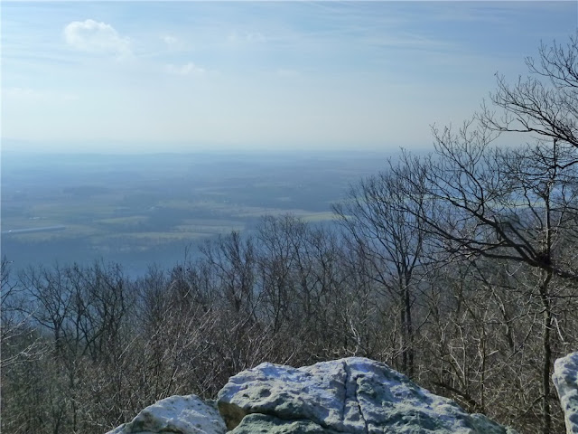
| View south from Eagle's Nest Overlook. |
 |
| A service road which is used for snowmobiling from January 15 through April 1and runs parallel to the Appalachian Trail can be taken as an alternate route to the Eagle's Nest Shelter. |
 |
| Blue-blazed side trail off the Appalachian Trail towards the Eagle's Nest Shelter and a view north. |
 |
| Eagle's Nest Shelter |
 |
| Continue a short distance beyond the shelter to the end of the blue trail for a view north. |
 |
| The Sand Spring Trail is very rocky and full of roots for a while. |
 |
| The Sand Spring Trail follows along the spring-fed creek and crosses over several times. |
 |
| Waterfalls along the Sand Spring Trail. |
HIKE SUMMARY:
[ 0.00] Walk back along the road the way you drove in to the start of the orange-blazed Tom Lowe Memorial Trail. If trailhead is inaccessible due to blow down, continue along the road until you can cut over as trail runs between road and Northkill Creek
[ 0.20] Rock hop over Northkill Creek
[ 1.30] Trail turn right on woods road
[ 1.35] Keep straight towards clearing (old gravel quarry) when woods road goes right
[ 1.50] Cross creek and be careful to follow orange trail to left when, faded white blaze trail goes straight
[ 1.60] Trail makes sharp right turn at old Tom Lowe sign on tree (If you keep straight here, trail becomes difficult to follow even though there are orange blazes but they are sloppy orange blazes, not the neatly painted blazes of the correct trail.)
[ 2.00] Trail goes slightly uphill through gorge
[ 2.30] Cross over creek either on logs or find rock hop
[ 2.60] Trail veers to right away from gorge and begins to ascend steeply on rocks
[ 2.80] Trail flattens out at top of climb
[ 3.10] Tom Lowe Trail ends at Sand Spring; turn left on blue-blazed Sand Spring Trail
[ 3.30] Left on white-blazed Appalachian Trail when blue Sand Spring Trail goes straight
[ 4.15] Stretch of very rocky trail
[ 4.40] Turn left on blue-blazed Eagles Nest Trail
[ 5.40] Rock scramble to Eagles Nest Overlook; retrace
[ 6.40] Straight on blue Eagles Nest Trail when white-blazed Appalachian Trail crosses over
[ 6.70] Turn right on gravel service road with sporadic orange diamond blazes
[ 7.20] Keep straight on gravel service road when blue-blazed Sand Spring Trail goes right
[ 7.70] Turn left on white-blazed Appalachian Trail
[ 7.80] Left on blue-blazed trail to Eagles Nest Shelter
[ 8.00] Trail turn sharply left downhill to cross stream then turns right uphill
[ 8.10] Continue beyond Eagles Nest Shelter following blue blazes downhill to view; retrace
[ 8.50] Turn right on white-blazed Appalachian Trail
[ 8.60] Keep straight on Appalachian Trail crossing over gravel service road
[ 9.20] Left on blue-blazed Sand Spring Trail
[ 9.35] At Sand Spring keep straight on the blue-blazed Sand Spring Trail when orange-blazed Tom Lowe Trail goes right
[ 9.60] Keep left on blue when unmarked goes right, several creek crossings
[ 9.80] Trail veers away from creek and becomes less rocky, gradually descends
[10.85] Turn right on gravel service road
[ 11.00] Back at parking


