ABOUT THE PARK:
Eagle Rock Reservation - Essex County Parks
Eagle Rock Reservation - Eagle Rock Reservation Conservancy
DIRECTIONS:
GPS Coordinates 40.804199, -74.238107
View Larger Map
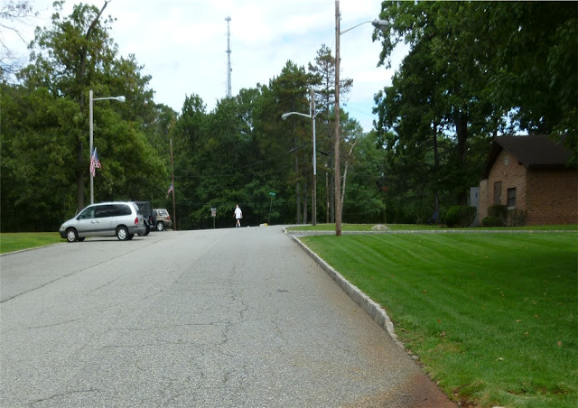
Drive around the loop (one way) and pass the Highlawn Pavillion on the right. Park on the left just beyond the Highlawn Pavillion and across from the brown restroom building. The Lenape Trail starts on the other side of the restroom building at the intersection of the roads.
TRAIL MAP:
Eagle Rock Reservation Print Map - Essex County Parks (not a very good map)
Eagle Rock Reservation Map - Eagle Rock Reservation Conservancy (much better color map)
HIKE DISTANCE: 6.15 miles
PEAK BAGGING:
Stony Hill - Peakery.com
THE HIKE:
 |
| Start on the Lenape Trail off of Crest Drive just beyond the parking area. |
 |
| A couple of curious adolescent deer on the Lenape Trail. |
 |
| The yellow-blazed Lenape Trail. |
 |
| Blue-blazed Trail |
 |
| The green-blazed trail hugs a small creek. |
 |
| Stone bridge creek crossing. |
 |
| The white-blazed trail follows along the rim of a small but pretty ravine. |
 |
| If you are peakbagging on Peakery.com, this is considered a peak: Stony Hill at 587 feet elevation. The white trail goes up to and over the summit. |
 |
| The other end of the Lenape Trail brings you back around to the 9/11 Memorial and incredible views of the New York City skyline. |
 |
| The day of our hike, 9/10/11, they were setting up for the 9/11/11 memorial ceremony. |
 |
| Stopped for a couple of sunrise pictures of the New York City skyline before the hike. |
 |
| A 7,400-pound piece of steel from the World Trade Center foundation, dedicated during the 9/11/11 ceremony, frames the space where the Twin Towers once stood. |
HIKE SUMMARY:
[ 0.00] Walk to the intersection with the one-way road coming in from the right, turn right and walk along the road briefly then right on the yellow-blazed Lenape Trail.
[ 0.50] Cross paved Cress Drive and continue on yellow trail (blue joins also) through parking lot and to the left of the kiosk.
[ 0.60] At fork keep right on yellow when blue goes left
[ 1.05] Turn left on red when yellow goes straight towards houses
[ 1.25] Turn right on red/blue at last house when green starts to the left
[ 1.30] Turn left on blue when red goes right
[ 1.55] Cross woods road (Underhill Trail on map)
[ 1.70] Cross woods road (Broad Woods Trail on map)
[ 2.00] Turn right on white at deer exclosure when blue goes straight
[ 2.10] Summit of Stony Hill
[ 2.35] White trail ends, turn right on blue (blue is to the left of woods road - Edgewood Trail on map)
[ 2.45] Left on blue trail when it comes out on woods road at cairn, cross stone bridge then immediately turn left on green
[ 2.90] Cross woods road (Glen Trail on map)
[ 2.95] Rock hop over creek
[ 3.20] Cross woods road (Stony Brook Trail on map)
[ 3.40] Green turns left on woods road for a few steps then leaves woods road to the right; keep straight on green when white crosses over
[ 3.50] Cross woods road (Glen Trail on map)
[ 3.65] Just before creek crossing at end of green trail, turn right on blue (if you get to the intersection with the red trail, you went too far)
[ 3.85] Cross woods road (Crest Trail on map)
[ 4.00] When blue turns right at old blowdown and the three blazes of the beginning of the white trail are straight ahead, turn around and make a hairpin turn to the right around the small boulder with the white blaze to continue on the white trail
[ 4.10] Cross woods road (Crest Trail on map)
[ 4.20} Cross over green trail staying on white
[ 4.30] Cross woods road (Afterglow Trail on map)
[ 4.35] Rock hop over creek
[ 4.40] Cross woods road (Stony Brook Trail on map)
[ 4.50] Cross woods road (Glen Trail on map) with stone bridge to left
[ 4.80] White turns left merging with woods rood (Stony Brook Trail on map) coming in from right
[ 4.85] Left on blue at deer exclosure when white goes straight
[ 5.00] Stay on blue when it turns left when the white trail comes in from the right and terminates
[ 5.20] At cairn blue turns left and joins woods road then crosses bridge; stay on blue when green goes left and unmarked goes right
[ 5.50] Cross woods road (Crosswood Trail on map)
[ 5.60] Left on yellow-blazed Lenape Trail when blue ends
[ 5.80] Continue beyond gate and when the yellow trail goes left, turn right and follow paved circle road around to 9/11 memorial and views of the New York City skyline; continue around towards the Highlawn Pavillion
[ 6.15] Back at car


