Saturday, June 11, 2011

Mt. Everett State Reservation, MA (Race Brook Falls, Mt. Race to Sages Ravine via the Appalachian Trail)


ABOUT THE PARK:
Mt. Everett State Reservation - Massachusetts Department of Conservation and Recreation

DIRECTIONS:
GPS Coordinates 42.089478, -73.411248

View Larger Map
Off-road parking for about 5-6 cars.
TRAIL MAP:
South Taconic Trails Map (check for new edition Spring 2015) - NY/NJ Trail Conference
Mt. Washington State Forest Map - Massachusetts DCR
South Taconic Range Map - Berkshire Natural Resources Council, Inc.

HIKE DISTANCE:  13.75 miles out and back

HIKE DESCRIPTION:

Pick up the blue triangle-blazed Race Brook Falls Trail from the information board at about the mid point of the parking area.
Some things to note about the trail blazes:  For the most part they are blue triangles although there are some blue rectangles - all are part of the same trail.  Sometimes triangles are used point to the direction of a turn.  In other words, if the triangle is on it's side, that indicates a turn and it is sometimes hard to notice so you have to pay close attention.  Sometimes a "tail" is drawn in to make the turn more obvious.
I had read several accounts of how poorly the trail is blazed but it appears as through there has been recent reblazing and I had no trouble at all staying on the trail. If you aren't seeing blazes, you missed a turn.

The first fork gives  the option of seeing the lower falls via a .35 mile side trail to the right.
Race Brook Falls - Lower Falls
The only way to see the lower falls is to take the side trail and retrace back to the intersection then continue on the left branch of the trail.  At another fork about .35 mile ahead, there is another option to see the lower falls from the opposite side of the creek but the view is much better from the first fork.

The trail ascends and crosses the creek at the bottom of the upper falls.
Race Brook Falls - Upper Falls
Race Brook Falls Trail terminates at the Appalachian Trail
Appalachian Trail
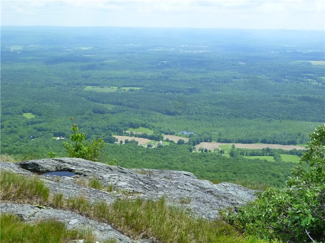
The south bound Appalachian Trail ascends to the summit of Mt. Race.  Once at the top, the trail follows along the edge of the eastern side of the ridge for continuous panoramic views over a distance of over 1/2 mile.
Mt. Everett to the north as seen from Mt. Race
View of Massachusetts countryside to the east from Mt. Race
Twin Lakes in Connecticut from Mt. Race
Descend from Mt. Race, cross over Bear Rock Stream, descend into Sages Ravine:
Bear Rock Stream
Before crossing Sages Ravine Brook there is a "Welcome to MA" sign but you will still be in MA all along Sages Ravine.
Sages Ravine Brook
Sages Ravine

Where the Appalachian Trail starts to ascend to the left away from Sages Ravine Brook is a good turn around point.  The picture of the Sages Ravine sign is from up at the top of that hill but there is nothing else worth climbing up for unless you are doing a shuttle hike to parking areas in that direction.
Returning via Mt. Race

HIKE SUMMARY:
[  0.00]  From parking area take trail starting at kiosk (sign trail register)
[  0.30]  Right at fork towards lower falls
[  0.65]  Lower falls; retrace
[  1.00]  Back at intersection take left fork towards upper falls; trail parallels creek; watch for unmarked left turn to rock hop over creek short distance ahead
[  1.15]  Ascend two sets of log steps
[  1.35]  Keep left towards Race Brook Campsite (right trail to lower falls does not provide as good of a view as the first trail to the lower falls)
[  1.60]  Rock hop over creek at top of lower falls; trail turns left away from creek and ascends more steeply
[  1.75]  Trail levels out with views to the east through the trees
[  1.85]  Trail reaches creek, turns right and follows along right side of creek
[  1.95]  Cross creek to left over log bridge
[  2.10]  Rock hop over feeder stream
[  2.25]  Continue through Race Brook Campsite
[  2.50]  Trail switchbacks up short flight of stone steps
[  2.60]  Turn left on white-blazed Appalachian Trail at intersection
[  3.45]  360 degree views at top of rock scramble
[  4.10]  Trail leaves ridge into woods and descends
[  4.25]  Cross small stream
[  5.15]  Cross Bear Rock Stream
[  5.35]  Keep straight when trail to right goes to Laurel Ridge Campsite
[  6.05]  Keep straight when trail merges in from left (easy to miss veering left on the return route so be sure to turn around and make note of this area as a fork going in the opposite direction)
[  6.15]  Keep left when unmarked woods road goes right
[  6.25]  Rock hop across Sages Ravine Brook
[  6.35]  Ascend rock steps where trail parallels ravine from higher up
[  6.45]  Cross feeder stream on log bridge
[  6.75]  Keep left on white-blazed trail when log bridge crosses over on blue-blazed trail to Sages Ravine Campsite
[  7.00]  Turn around to head back when trail ascends uphill to the left
[  7.25]  Keep right on white-blazed trail when log bridge crosses over on blue-blazed trail to Sages Ravine Campsite
[  7.50]   Cross feeder stream on log bridge
[  7.70]   Rock hop across Sages Ravine Brook
[  7.85]  Keep straight on white-blazed trail when woods road comes in from left
[  7.95]  Left at unmarked fork when woods road goes right
[  8.70]  Straight on white-blazed trail when trail to Laurel Ridge Campsite goes left
[  8.85]  Cross Bear Rock Stream
[10.00]  Exit woods on to ridge with views
[10.40]  Summit of Mt. Race
[10.60]  360 degree views with Mt. Everett straight ahead before descending from Mt. Race
[ 11.55]  At intersection, right on blue triangle-blazed Race Brook Falls Trail
[ 11.80]  Follow trail through Race Brook Falls Campsite
[12.25]  Cross over log bridge
[12.35]  Watch for left turn over creek where trail appears to go straight
[12.70]  Cross creek at bottom of upper falls
[13.00]  Keep straight when side trail to lower falls goes left
[13.25]  Descend two sets of wooden steps
[13.35]  Trail turns left and rock hops over creek
[13.50]  Keep right at intersection where left goes to lower falls
[13.65]  Trail exits woods and skirts small field
[13.75]  Arrive at parking area

Saturday, June 4, 2011

Ricketts Glen State Park, PA - Falls Trail, Cherry Run Loop and Evergreen Loop


ABOUT THE PARK:
Ricketts Glen State Park - PA Dept. of Conservation and Natural Resources
Ricketts Glen State Park - Wikipedia

DIRECTIONS:
Lake Rose Trailhead Parking
GPS coordinates 41.329576, -76.291308
The GPS gets a little wonky entering the park from Route 487 so follow the signs for the Lake Rose parking lot.

View Larger Map


TRAIL MAP:
Ricketts Glen State Park Map - Pennsylvania DCNR
For the Cherry Run Loop portion see Midatlantichikes.com

HIKE DISTANCE:
Falls Trail - Cherry Run/Hall of the Hemlocks - Evergreen Trail - 15.1 miles
  Individual Hikes:
Falls Trail - 3.5  miles
Cherry Run/Hall of the Hemlocks Loop - 13.3 miles
Evergreen Loop - 1 mile

HIKE DESCRIPTION:
From the Rose Lake parking lot, pick up the trail at the information boards to begin with the Falls Loop.  The trail will descend along Ganoga Glen, cross Waters Meet, then ascend along Glen Leigh for a total of 18 waterfalls.
Ganoga Glen Falls from top to bottom (click on picture to enlarge)
Waters Meet with Ganoga Glen to the left, Glen Leigh on the right.
Glen Leigh Falls from bottom to top (click on picture to enlarge)
Steps going up Glen Leigh.
After ascending Glen Leigh, a left on the Highlands Trail brings you back to the parking lot.  Keep going towards the Cherry Run Trail which starts beyond the dam.
Cherry Run Trail
For the Cherry Run/Hall of the Hemlocks Circuit, please refer to the Midatlantichikes.com instructions.  (The day after I did this hike I received the new edition of Jeff Mitchell's "Hiking the Endless Mountains" where he has a very detailed description of the Cherry Run Circuit on page 103.)

You leave the Cherry Run trail to the right at a log and cairn to access unofficial trails.  This is very difficult to find.  I passed by it and found a trail to the right with initials carved into trees on either side of the trail.  I went farther in case that was not the right trail but found nothing else so I backtracked.  Just as I was getting ready to turn on the trail with the carved initials to see where that went, a trail maintainer with a local hiking club appeared so I asked him if that was the right trail.  It was not so he helped me find it.  Turns out the cairn was knocked over so it is basically a log with a few larger rock lined up along the log and you really have to be looking for it to see it.  The trail maintainer offered to escort me through that part of the hike since he is familiar with the maze of unofficial trails and he was kind enough to lead me through that entire part over to the Mountain Spring Lake Trail.  He not only shared lots of information with me about the surrounding area but also told stores of his Appalachian Trail thru-hike and Pacific Crest Trail hike.  What luck to have run into him and how nice of him to give me a tour of the unofficial trails!
Giant Conk
Cherry Run
A Cherry Run Waterfall
Mountain Spring Lake Trail
Intersection with Old Bulldozer Trail
Rocky Section of Old Bulldozer Trail
Midway Crevasse along the Highland Trail.
Leaving the park, turn left on Route 487 then left on Route 118 and watch for parking on the right at the pedestrian crossing sign for the Evergreen Trail.  This trail is only 1 mile long and definitely worth stopping for.
Follow the trail to the 36' Adams Falls.


Continue on the loop trail passing several very interesting interpretive signs such as:

HIKE SUMMARY:

[  0.00]  Take trail at trailhead information boards
[  0.10]  Right towards Ganoga Glen at intersection (left is return route)
[  0.30]  Cross bridge, turn left on Falls Trail when Old Beaver Dam Trail goes straight
[  0.65]  Straight on Fall Trail when Old Beaver Dam and Ganoga View Trails go right
[  1.40]  At Waters Meet turn left and cross bridge
[  2.10]  Keep right when shortcut trail to Highland Trail goes left
[  2.30]  Keep right when Highland Trail goes left (or for 3.5 mile hike turn left)
[  2.70]  Right on grassy road towards orange diamond and yellow rectangle-blazed Cherry Run Trail at info boards when gravel road goes left
[  2.80]  Follow along dam and keep straight on Cherry Run when Mountain Springs goes right (coming in from right is return route)
[  5.50]  Look for trail right  - missed turn if you reach trail with initials carved in trees; follow Midatlantichikes.com instructions for directions through this section.

To continue after exiting unofficial trails:
[ 10.75]  After crossing Bowman Creek, right on orange diamond-blazed Mountain Spring Trail
[ 12.00]  At intersection with multiple signs, right on red diamond-blazed Old Bulldozer Trail towards Lake Leigh
[ 12.60]  Turn left at dam when Cherry Run Trail goes right
[ 12.70]  Turn left at intersection towards Glen Leigh
[ 13.00]  At intersection right on Highland Trail when Falls Trail goes straight
[ 13.20]  Keep right on Highland Trail when shortcut trail goes left
[ 13.60]  Midway Crevasse
[ 14.00]  At intersection turn right towards Lake Rose parking lot when trail to Ganoga Glen goes left
[ 14.10]  Back at parking lot

Monday, May 30, 2011

Glen Onoko Falls (TRAIL CLOSED AS OF 5/1/2019)/Broad Mountain - Lehigh Gorge State Park and SGL 141, PA


ABOUT THE PARK:
Lehigh Gorge State Park - Pennsylvania Department of Conservation & Natural Resources
Glen Onoko Falls - Pocono Record
The Legend of Glen Onoko - Pennsylvania Haunts and History
Turn Hole Tunnel - Wikipedia
The Pennsylvania Game Commission today announced that most of the Glen Onoko Falls Trail on State Game Lands 141 near Jim Thorpe is closed due to hazardous trail conditions. The 0.4-mile closed portion of the trail runs from the trail head to the Upper Falls.

The Game Commission cites stormwater damage, unstable surfaces and a history of accidents along the trail as factors that prompted closure. Severe injuries and fatalities have occurred over the years despite posted signs warning visitors to be cautious, wear appropriate footwear and avoid dangerous areas near the three major falls.

“Volunteer emergency personnel spend significant time rescuing people that hike the Glen Onoko Falls Trail,” said Game Commission NE Region Land Management Group Supervisor Michael Beahm. “A typical rescue for an injured hiker will involve 20 to 25 volunteer first responders and require a minimum of four to six hours.”

Heavy rainfall during the past year changed trail conditions considerably and several areas are washed out below the middle and lower falls. Sections of the trail are now unrecognizable and have become part of the stream channel. Hikers have been using alternate routes around these areas – negatively impacting soils and vegetation.

Signage and physical barriers will warn visitors of the trail closure at the Glen Onoko Falls trailhead and at other appropriate locations.

Other hiking trails in the area remain open, including the Overlook and Shortcut Trails that connect to form a 1.6-mile loop offering a panoramic view of Jim Thorpe. The Upper Falls can be accessed via Overlook Trail.


DIRECTIONS:
GPS coordinates to Glen Onoko Access parking 40.883555, -75.760422


The parking lot above is the last lot just on the other side of the bridge over the Lehigh River with direct access to the Glen Onoko Falls Trail and it fills up quickly.  You will notice many other parking lots on the drive in.  If this lot is full, drive back out to the next lot with available space and walk back on the Lehigh Gorge Rail Trail which runs parallel to the road.

TRAIL MAP:
I have not been able to find any trail maps for this area. I roughly drew in trails for this hike but it is completely unofficial and is by no means accurate, just intended to give an idea of how this hike plays out.
Official maps that do not show hiking trails:
The Lehigh Gorge State Park map will give you an idea of the surrounding area but does not show trail detail for this hike.

HIKE DISTANCE: 5.9 miles

HIKE DESCRIPTION:
As you drive into the last parking lot, just after crossing the bridge, there will be a picnic table on the right with a sign to the Falls Trail and information boards.  Go down the steps at the Falls Trail sign. The maps at the sign are Lehigh Gorge State Park maps which do not show the trails for this hike.

At the bottom of the steps you will see the sign above.  While the trail is indeed steep and treacherous at times, wearing proper hiking shoes that provide good traction on wet rock surfaces, carefully watching your footing and staying away from edges of steep drops is all it takes to navigate safely.  I was worried about how my dog would handle it but she had no problems with the trail at all.  Keep in mind this is an unmaintained trail with inconsistent blazing and lots of erosion.  At times you will be walking on stone steps, remnants of stairways built into the mountain at the turn of the 20th century by a hotel/resort which was destroyed by fire in 1911.

Turn right at the sign, go under the railroad tracks, turn right taking the trail parallel to the tracks until it turns sharply left leading away from the tracks.  The trail starts out deceivingly smooth and easy:
You will notice a variety of trail markings, where they exist.  There are many orange blazes that have been blacked out - do follow those anyway. The trail is obvious and the arrows do help so be sure to watch for them.  I read that the trail crosses the creek several times.  I did not find this to be the case at all as I was on the same side of the creek throughout entire hike.  In fact, it seems kind of dangerous to be crossing over.
Various types of trail markers.
The trail becomes rockier as it follows next to the falls.
Remnants of old stone steps.
Eroded trail section.
Chameleon Falls
Looking down from the top of Chameleon Falls - better view on clear days
You can stand behind these falls - orange "UNDER" with arrow painted on rock directs you to behind the falls.
Upon reaching the fire ring at the top of the falls, turn right and follow the trail up stone steps along large rock formations.  This foot path follows the rim of Broad Mountain to views.  At the first view below, make note of a trail that makes a sharp right heading down the mountain. This will be the return route.
First view of the Borough of Jim Thorpe with mountains in the background on a hazy day.
Second view of Lehigh River at end of foot trail along Broad Mountain rim.
Woods road through State Game Lands 141 popular for mountain biking.
Power Cut
Oxbow Bend view reached by side trail on right just beyond the pipeline.
View of the Lehigh Gorge Rail Trail from above.
For this hike, the Oxbow Bend view is the turnaround point.  The hike can be made much longer by continuing on the woods roads to form a loop but you might find the woods roads boring after having already experienced the best part of this hike so why not revisit the views on the way back? Returning to the first view of the Borough of Jim Thorpe, take the trail that bends sharply to the right to descend from Broad Mountain.  You will notice many more stone step remnants as will as old stone wall ruins.
Eastern Milk Snake on Trail
After rejoining the Falls Trail from the beginning of the hike, go under the railroad tracks and continue a short distance ahead along the river to see the opening of the Turn Hole Tunnel.
To enter this tunnel go back up the steps to the parking lot, turn left and cross over the bridge you drove in on.
 A short distance ahead, turn left into the first gravel parking lot.  Walk through that end of the lot to a wide trail on the left which brings you to the tunnel entrance.  It is very dark - step carefully over old railroad ties still in place.
Inside dark tunnel.
View from tunnel opening.

LITTER REPORT:
Please take a piece of carelessly discarded litter out with you.  This is what my dog packed out in her backpack so you won't have to look at it.


HIKE SUMMARY:
THE FALLS TRAIL IS CLOSED AS OF MAY 1, 2019
[  0.00]  Follow Falls Trail sign down steps; turn right at warning sign, go under railroad tracks; turn right parallel to railroad tracks; follow trail to left away from railroad tracks at top of hill
[  0.15]  At fork turn left up stone steps (trail on right is return route); left at T intersection top of stone steps
[  0.25]  Follow large blue arrow on tree as trail reaches the waterfalls
[  0.45]  Orange tape shows to follow badly eroded section, can be bypassed to the right;
[  0.50]  Chameleon Falls (wall of water coming straight down); trail veers right away from falls
[  0.55]  Top of Chameleon Falls - blue arrow says to cross over falls - no not cross, follow orange arrow straight to stay on same side; go up steps; continue following blacked out orange blazes
[  0.60]  Arrow pointing left indicates "Under" to go behind falls; retrace and take right fork with arrow to "Top"
[  0.65]  Top of falls at "You Made It" painted on rock; continuing straight, stream forks, take trail to right of the smaller right fork of the stream following blacked out orange blazes
[  0.70]  At fire ring turn right and go up stone steps to the right of large rock formations***
[  1.00]  View at right down stone steps; make note of trail veering sharply right for return route but go back up stone steps to continue on unmarked foot trail along mountain rim
[  1.05]  Left at fork
[  1.40]  Continue straight over rock field; trail continues on other side
[  1.60]  Right at fire pit to view; retrace and continue straight past fire pit on rock/gravel road
[  1.75]  At grassy intersection, turn right on woods road; blue blazes painted on trees
[  2.00]  Rock hop to left over small stream
[  2.20]  Cross power cut; stay on woods road with blue blazes go right
[  2.40]  Follow woods road to left when narrower path goes straight (path goes to limited views blocked by foliage)
[  2.55]  Cross petroleum pipeline (sign on right)
[  2.60]  Turn right on trail shortly after crossing pipeline; keep left at split
[  2.70]  View of Oxbow Bend; retrace
[  2.80]  Left on woods road
[  2.85]  Cross petroleum pipeline
[  3.00]  Follow woods road to right when trail to limited views goes to left
[  3.10]  Stay on woods road when blue blazes go to left
[  3.25]  Cross power cut; blue blazes along woods road
[  3.45]  Rock hop to right over small stream
[  3.65]  At grassy intersection, turn left on narrower rocky road leaving woods road
[  3.75]  Back at view beyond fire pit; turn right at fire pit on foot path along rim of mountain
[  4.25]  Keep right at fork
[  4.40]  Go down stone steps to left to view; continue downhill where trail goes sharply to the right - return route noted from earlier in the hike
[  4.75]  At bottom of steps at T intersection turn left (trail coming in from right comes down directly from the top of the falls at the fire ring from what hikers coming down that way told me)
[  5.15]  After going down stone steps and passing wall ruins, left at T intersection, hop over log, turn left at next intersection - this is the Falls Trail where the hike started
[  5.20]  Make sharp right at railroad tracks, follow downhill, turn left under railroad tracks; pass steps up to parking lot to side trails on right for river view; return to parking lot
[  5.40]  Back at parking lot turn left and cross bridge over river
[  5.55]  Left into gravel lot, left to railroad tunnel entrance and continue through tunnel; retrace
[  5.75]  Exit tunnel, right through gravel parking log, right on park road, cross bridge over river
[  5.90]  End at parking lot

*** This picture provided by Anonymous of July 15, 2012 for further clarification of where to go from the fire ring.  Thank you!
Per Anonymous of 7/15/2012:
"After making right and up after fire pit, if you don't see large rock formations and rock steps within 5 minutes (one landmark: two big, almost rectangular rocks standing 4-5 feet apart, a tree right in the middle, but on top of one of the rocks), you are going the wrong way. Retrace to fire pit and try to find these rock formations and steps."