ABOUT THE PARK:
John Boyd Thacher State Park - NY State Parks
DIRECTIONS:
GPS Coordinates 42.638692, -74.015090
View Larger Map
 |
| The park charges a seasonal parking fee. Parking at the pullout on Beaver Dam Road at the southern end of the park is free. |
TRAIL MAP:
It is useful to have both of these maps handy as they differ slightly.
John Boyd Thacher Trail Map North and South - NY State Parks (shows numbered white connector trails, references trails by name)
John Boyd Thacher Trail Map - NY-NJ Trail Conference (free map - does not show connector trail numbers, references trails by color)
HIKE DISTANCE:
Southern and Northern Loops Combined - 11.35 miles
Shorter Loops for New York/New Jersey Trail Conference Hikes:
~ Southern Loop with Cliff Edge Overlook and Indian Ladder - 5.7 miles
~ Northern Loop with Hang Glider and High Point Overlooks - 4.45 miles
THE HIKE:
 |
| The hike starts on the aqua-blazed Long Path for a few steps before turning on to a blue-blazed trail through the woods running parallel to Beaver Dam Road. |
 |
| White-blazed connector trails are numbered to correspond to the park map. The NY-NJ Trail Conference map does not reference these numbers. |
 |
| A sign post in a field just before a park maintenance building shows where to turn to pick up white connector trail W5. |
 |
| Heading towards Cliff Edge Overlook. |
 |
| The aqua-blazed Long Path follows between the stone wall and the cars. |
 |
| First views along the Helderberg Escarpment. |
 |
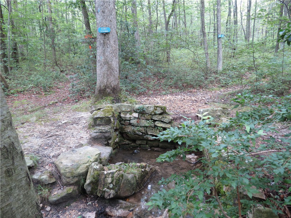
| You'll see this sign quite often along this route. |
 |
| Aqua Long Path blaze on sign. |
 |
| The unmarked Escarpment Trail follows along a fence the entire way, the Long Path follows the route of the Escarpment Trail up to the Indian Ladder Trail. |
|
 |
| Entrance to the Indian Ladder Trail, open May 1 through November 15. |
 |
| Metal steps descending the Indian Ladder Trail. |
 |
| You'll need to duck to fit under the rock overhang. |
 |
| There should have been a waterfall pouring down from above that you walk behind but in mid-July it was bone dry. Regardless, still a stunningly beautiful area. To appreciate the enormity of this rock outcrop, note the interpretive sign in the gap to the left - you can easily stand upright in that gap. |
 |
| A tiny but of water was trickling out from underneath the rock formations. |
 |
| Looking out from underneath the rock overhang. |
 |
| Trail behind second waterfall which is also dried up. |
 |
| Scenic break spot along the Escarpment Trail. |
 |
| A dragonfly perched out over the escarpment |
 |
| A drinking fountain at the end of the Escarpment Trail in the Hailes Cave picnic area. |
 |
| Continue across the gravel circle at the drinking fountain towards the stone pillar above, turn right at the stone pillar to connect back up with the aqua-blazed Long Path. Blazes come into view a few steps on to the trail. |
 |
| Leave the Long Path at the intersection with the red-blazed Hang Glider Road and follow to the end... |
 |
| ... for more great views with no crowds. |
 |
| High Point from the overlook at the end of Hang Glider Road. |
 |
| From Hang Glider Overlook follow an unmarked but well-defined trail along the edge of the escarpment all the way over to High Point. There will be no fencing or warning signs along this remote section of the park. |
 |
| View from High Point Overlook. |
 |
| Hang Glider overlook from High Point overlook. |
 |
| Very pretty pond on the yellow-blazed trail with a bench. If you sit on the bench quietly for a minute... |
 |
| I know, frog overload, but there were sooooo many watching me, they were so darned cute, and OK, just one more... |
 |
| ... a toddler "frogpole." |
 |
| Last one, I promise, three for the price of one. |
 |
| Heading back along the Escarpment Trail/Long Path up over the Indian Ladder Trail. |
 |
| If there were water, this would be the top of one of the waterfalls that flow down over the Indian Ladder Trail. |
 |
| A little trickle in the Paint Mine waterfall area. |
 |
| A pretty swamp off of a short side trail near the end of the hike (not on map). |
 |
| Love these small farms with self-service produce tables in their front yards on country roads the way home. This particular farmer was sitting on his front porch and told me he does not use pesticides - yay! |
HIKE SUMMARY:
[ 0.00] From Beaver Dam Road, take aqua-blazed Long Path north briefly, turn right on blue at T-intersection when aqua turns left (no blue blazes at intersection)
[ 0.35] Left on white connector W6 when blue goes straight
[ 0.55] Left on blue at end of white when blue goes right also
[ 0.70] Straight on blue when yellow comes in from right; few steps then right on yellow as it leaves blue
[ 0.75] Left on orange when yellow/orange goes right
[ 0.90] Right on orange when white goes left; turn left at directional arrows in field, cross footbridge on white connector W5, turn right after bridge
[ 1.00] Turn right at intersection then left at fork following "Overlook" sign.
[ 1.25] Cross Thacher Park Road and pick up the aqua-blazed Long Path at the aqua blaze on speed limit sign; continue through parking lot/overlook area
[ 1.45] Descend steps at end of parking lot and follow split rail fence
[ 1.75] When aqua leaves to the left, turn right and descend stone steps to the entrance of the Indian Ladder Trail
[ 2.10] Ascend metal steps to exit Indian Ladder Trail
[ 2.20] At top of stone steps, turn right at picnic area and continue along Escarpment Trail along fence
[ 2.45] Picnic table with open view
[ 2.85] Escarpment Trail descends and ascends again
[ 3.00] Come out at Hailes Cave picnic area clearing
[ 3.15] Open views
[ 3.20] At 2 picnic tables and end of fence, turn left towards water fountain, cross gravel circle and keep straight towards stone pillar
[ 3.30] Turn right at stone pillar - no blazes but will see aqua blazes after a few steps and then enter a clearing
[ 3.40] Turn right into woods at turn blaze almost at the end of the clearing
[ 3.50] Keep straight on aqua when woods road crosses over
[ 3.60] Right at T-intersection when unmarked woods road goes left
[ 3.90] Right on aqua Long Path when the yellow-blazed Perimeter Trail goes left
[ 4.60] Turn right on aqua Long Path when white connector W1 goes straight
[ 4.70] At 4-way intersection, keep straight on red-blazed Hang Glider Road when unmarked goes right and aqua Long Path/red goes left
[ 5.00] Hang Glider clearing with views; left on unmarked footpath into woods - after few steps keep left at fork then turn right at T-intersection
[ 5.30] Keep right at fork
[ 5.60] Keep right at fork along edge of escarpment
[ 5.75] Come out at intersection with Long Path coming in from left; right a few steps to High Point Overlook; retrace on Long Path; few steps ahead keep right on red/aqua when red/aqua also goes left
[ 6.00] Left on white connector W3 when aqua/red goes straight
[ 6.35] Straight on red at end of white connector W3 when white W4 goes right and red goes left
[ 6.50] At cairn with red arrow, turn left on white connector trail W2 (you need to turn around to see the sign)
[ 6.70] Keep left at unmarked fork
[ 6.80] Left on yellow at end of white W2
[ 7.10] Keep left at unmarked fork
[ 7.15] Keep straght uphill when the red Hang Glider Road goes left
[ 7.30] Straight on yellow when white connector W1 crosses over
[ 7.55] "Junction Ahead" sign; junction unmarked, keep right - yellow blazes continue ahead
[ 7.65] Pond with bench; continue along pond
[ 7.70] At end of pond keep straight on yellow-blazed woods road then straight when a yellow-blazed footpath (not on map) goes right
[ 7.85] Keep left at unmarked fork
[ 8.00] Continue left on yellow through parking on Ryan Road
[ 8.10] Keep straight on yellow when a woods road crosses over
[ 8.20] Cross wooden footbridge
[ 8.35] At end of yellow turn right on aqua Long Path
[ 8.65] Just before clearing, aqua Long Path leaves woods road to the left as footpath into the woods
[ 8.75] Cross woods road
[ 8.85] Come out at clearing and follow aqua left through field on mowed grass
[ 8.95] Turn right at stone pillar, after a few steps turn left, then left again into woods on footpath at double aqua turn blazes
[ 9.05] Cross gravel road, continue on aqua
[ 9.35] Come out at clearing and keep right staying to the right of park road (blazes scarce in this area)
[ 9.40] Long Path leaves clearing and enters woods (double turn blaze visible)
[ 9.55] Come out at clearing at Hailes Cave park entrance, keep straight walking parallel to Eoute 15, cross park road and keep straight towards a parking lot (almost no blazing here)
[ 9.70] Just beyond restroom in parking lot, turn left towards Indian Ladder Trail/Tory Cave; continue straight past Tory Cave sign to fence with aqua blaze, turn right along fence and resume following aqua blazes
[ 9.90] Top of waterfalls, cross on bridge to the right
[10.10] Cross bridge over top of second waterfall then turn right on unmarked paved path leaving the aqua Long Path; at restrooms turn right then cross paved park road to the left on crosswalk towards Paint Mine Picnic Shelter
[10.20] After picnic shelter cross bridge to parking lot, turn left through parking lot to path at kiosk
[10.30] At fork by 3 picnic tables where right crosses a bridge, turn left on the unmarked trail and follow along bank of creek with waterfalls
[10.35] At paved road turn left to fork then keep left, then straight on aqua Long Path/lime Nature Trail when same goes left over bridge; red will join in
[10.70] Keep straight when red goes left
[10.80] Keep left at fork following sign to Beaver Dam Road; keep straight when white goes left
[10.85] Keep right at fork
[10.90] Turn right for short trails to swamp; left fork for view above swamp, right fork for view at ground level; retrace and continue right on aqua
[11.00] Keep straight when blue joins in from the left
[11.20] Turn left just before gate at picnic table
[11.30] Turn right at double aqua turn blaze
[11.35] Back at Beaver Dam Road parking