Friday, March 18, 2011

Mt. Minsi, Delaware Water Gap National Recreation Area, PA


ABOUT THE PARK:
Delaware Water Gap NRA - National Park Service
Hikes on Mt. Minsi, PA - National Park Service

DIRECTIONS:
GPS Coordinates 40.979776, -75.141934

View Larger Map
This is the Lake Lenape parking lot at around 1:30 pm on a Thursday.  The lot was empty at 8 am.  You might want to plan on getting there early on weekends.

TRAIL MAP:
NY/NJ Trail Conference - Kittatinny Trails Map #120
National Park Service - Hikes at the Gap

HIKE DISTANCE:
5.4 miles - Lake Lenape/Mt. Minsi Loop
9.1 miles - Lake Lenape/Mt. Minsi/Totts Gap

HIKE DESCRIPTION:
Although it was the warmest day of the year so far and dry, there was fog on the horizon so the pictures do not do the views justice at all.  I-80 traffic noise can be heard all along this hike but it can easily be forgiven by the stunning scenery.  The first two miles will be pretty consistently uphill. 

Begin by the information boards on the white-blazed Appalachian trail which ascends with views of Mt. Tamanny on the New Jersey side of the Delaware Water Gap and Mt. Minsi on the Pennsylvania side of the Delaware Water Gap. 
Mt. Tammany, NJ as seen from Mt. Minsi, PA
View of the Delaware River with New Jersey to the left and Pennsylvania to the right.
If hiking on to Totts Gap, the Appalachian Trail continues as a pleasant, fairly level woods road before veering off as a foot path with more uphills and downhills:
Views at the pipeline cut.

Returning via the unmarked Mt. Minsi fire road, you could continue straight through back to the parking lot but it's worth taking a couple of small detours.  An unmarked woods road to the right circles around Lake Lettini:
A little farther along the Mt. Minsi fire road, an unmarked trail to the left will go to waterfalls,  Table Rock, along an escarpment and around the back of Lake Lenape to return to the parking lot.
Table Rock
View of the fire road below from just beyond Table Rock above.
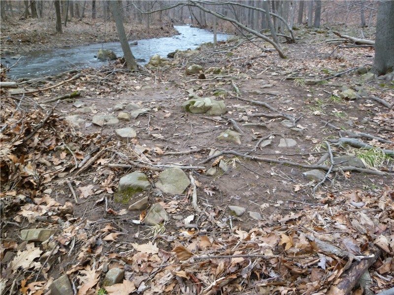
Lake Lenape

HIKE SUMMARY:
Lake Lenape to Mt. Minsi Loop
[  0.00]  Take the white-blazed Appalachian Trail starting at the information boards
[  0.15]  Lenape Lake on the right; trail changes from paved to gravel and ascends
[  0.35]  The white-blazed trail leaves the gravel road to the left as a foot path
[  0.45]  Rock hop over small stream
[  0.50]  Council Rock on left
[  0.60]  Rock hop over small stream and shortly thereafter another; trail ascendsl Mt. Tammany and Mt. Minsi come into view
[  0.85]  Rock hop over small stream
[  1.05]  Cross Eureka Creek
[  1.20]  Keep straight when white trail turns left to view at dead end; retrace and turn left on white trail up stone steps; trail switchbacks uphill
[  1.75]  Turn left on fire road briefly then turn right on white trail
[  1.80]  At unmarked T intersection turn right - white blazes continue ahead
[  1.90]  View of Mt. Tammany to the left
[  2.15]  Pass cinder block shed inside chain link fence and old footings; Mt. Minsi sign on tree on the right
[  2.20]  Unmarked trails to the left to views; retrace steps on white trail
[  2.50]  View of Mt. Tammany to the right
[  2.60 ]  Keep straight on unmarked fire road when white trail goes left at unmarked intersection; follow woods road as it loops around to the left
[  2.70]  Keep straight on unmarked fire road as white trail crosses over
[  2.75]  Rock hop over stream
[  4.05]  Turn right on unmarked woods road (just prior to this turn it looks like a trail goes right then another left but they do not go anywhere - watch for the obvious wide woods road)
[  4.10]  Keep straight as unmarked goes left (may have to hop over blowdowns)
[  4.20]  Unmarked trail turns left
[  4.30]  Lake Lettini on left; turn left at intersection
[  4.45]  Keep straight when unmarked goes left
[  4.50]  Turn right on unmarked fire road
[  4.60]  Turn left on unmarked trail; short unmarked trail to the left to waterfalls
[  4.80]  Table Rock; veer left on open rock surface
[  4.90]  View on right at old chain link fence
[  5.20]  Trail descends towards Lake Lenape
[  5.30]  Turn left at lake and picnic bench
[  5.35]  Turn right over old dam
[  5.40]  Trail veers away from lake towards houses; turn right at gravel road which leads to parking lot

Lake Lenape to Mt. Minsi to Totts Gap
[  0.00]  Take the white-blazed Appalachian Trail starting at the information boards
[  0.15]  Lenape Lake on the right; trail changes from paved to gravel and ascends
[  0.35]  The white-blazed trail leaves the gravel road to the left as a foot path
[  0.45]  Rock hop over small stream
[  0.50]  Council Rock on left
[  0.60]  Rock hop over small stream and shortly thereafter another; trail ascendsl Mt. Tammany and Mt. Minsi come into view
[  0.85]  Rock hop over small stream
[  1.05]  Cross Eureka Creek
[  1.20]  Keep straight when white trail turns left to view at dead end; retrace and turn left on white trail up stone steps; trail switchbacks uphill
[  1.75]  Turn left on fire road briefly then turn right on white trail
[  1.80]  At unmarked T intersection turn right - white blazes continue ahead
[  1.90]  View of Mt. Tammany to the left
[  2.15]  Pass cinder block shed inside chain link fence and old footings; Mt. Minsi sign on tree on the right
[  2.20]  Unmarked trails to the left to views
[  3.50]  White trail leaves woods road to the left at a cairn
[  3.75]  Pipeline cut
[  4.00]  Pass tower on right
[  4.05]  Gravel road at Totts Gap (sign on tree before gravel road); turn around and head back
[  4.35]  Pipeline cut
[  4.60]  White trail joins woods road
[  5.90]  Views at Mt. Minsi; continue on white trail
[  6.20]  View of Mt. Tammany to the right
[  6.30]  Keep straight on unmarked fire road when white trail goes left at unmarked intersection; follow woods road as it loops around to the left
[  6.40]  Keep straight on unmarked fire road as white trail crosses over
[  6.75]  Rock hop over stream
[  7.75]  Turn right on unmarked woods road (just prior to this turn it looks like a trail goes right then another left but they do not go anywhere - watch for the obvious wide woods road)
[  7.80]  Keep straight as unmarked goes left (may have to hop over blowdowns)
[  7.90]  Unmarked trail turns left
[  8.00]  Lake Lettini on left; turn left at intersection
[  8.15]  Keep straight when unmarked goes left
[  8.20]  Turn right on unmarked fire road
[  8.30]  Turn left on unmarked trail; short unmarked trail to the left to waterfalls
[  8.50]  Table Rock; veer left on open rock surface
[  8.60]  View on right at old chain link fence
[  8.90]  Trail descends towards Lake Lenape
[  9.00]  Turn left at lake and picnic bench
[  9.05]  Turn right over old dam
[  9.10]  Trail veers away from lake towards houses; turn right at gravel road which leads to parking lot

Sunday, March 13, 2011

Watchung Reservation, NJ - Sierra Trail


ABOUT THE PARK:  Watchung Reservation - Wikipedia

DIRECTIONS:
GPS Coordinates 40.682817, -74.372920

View Larger Map

TRAIL MAP:  
Watchung Reservation Trail Map - County of Union, NJ

HIKE DISTANCE:
10 miles

HIKE DESCRIPTION:
The entire hike follows the white-blazed Sierra Trail.  The trail appears to have been recently reblazed as it was very well blazed and easy to follow.  Due to I-78 which runs through the northern edge of the park, there is constant traffic noise throughout the entire hike.

From the Trailside Nature and Science Center parking lot, face the way you drove in and you should see blazes which indicate following the road to the right.
A very short distance along that road, the trails begin on the left side:
The first part of the hike goes through pleasant ravines and gorges.
After about 2 miles the trail goes through a pine forest:
The trail will follow to the right of Green Brook but expect traffic noise from heavily traveled New Providence Road just on the other side of Green Brook.
Escarpment to the right of the trail along Green Brook:
Around 5 miles, a stretch of boardwalk:
At the end of the boardwalk, turn right on the pink-blazed trail briefly to the site of historic Drake Farm then backtrack and continue on the white-blazed trail.  The pink trail, which I believe is the Watchung Reservation History Trail, is a new trail which is not on the map.  It sometimes runs concurrently with the white-blazed Sierra trail. 
Arrive at the historic Deserted Village of Feltville around 5.8 miles.
Continue along the white-blazed trail which brings you behind the historic buildings to an old cemetery with tombstones dating back to 1776:
In about 1/2 mile the trail will run along Lake Surprise:
The trail then passes by Watchung Stables:
After following briefly along the perimeter of the traffic circle, the trail goes back into the woods along a ridge and loops around a water tower:
At the end of the hike, the trail passes Trailside Nature and Science Center and brings you back to the parking lot.

Saturday, March 5, 2011

Schiff Nature Preserve, Mendham, NJ


ABOUT THE PARK:  Schiff Nature Preserve


DIRECTIONS:
GPS Coordinates 40.753111, -74.625967

View Larger Map
My GPS told me to turn before the entrance which was incorrect, so be watching for the entrance sign on Pleasant Valley Road where you should turn if your GPS is telling you otherwise.

TRAIL MAP:  Schiff Nature Preserve Trail Map

HIKE DISTANCE: 
5.85 miles - Schiff Nature Center Loop
8.50 miles - Schiff Nature Center with Patriot's Path

HIKE DESCRIPTION:
The white-blazed Great Meadow Loop trail starts at the steps between the nature center and kiosk:
Great Meadow
Historic Site
North Conservation Pond
South Conservation Pond
Red Trail to Lookout Point
Lookout Point

HIKE SUMMARY:
[  0.00]  Take the white-blazed trail starting between the nature center and kiosk
[  0.15]  Cross over grass road continuing straight; trails turn right on pavement at Great Meadow
[  0.30]  Continue left on white trail leaving paved road; follow trail around Great Meadow
[  0.50]  Right on red trail leaving Great Meadow
[  0.70]  Keep straight on red when green goes left
[  0.80]  Red trail veers left on paved trail
[  0.90]  Make first right turn on yellow trail at intersection where 6 trails come together
[  1.00]  Keep straight on yellow as unmarked trail (gray on map) goes left to Dan Beard cabin
[  1.05]  Keep straight as unmarked trail (not on map) goes left; historic site on right; at split keep right on yellow
[  1.15]  Turn right on purple Ann's Trail as yellow goes straight
[  1.20]  North Conservation Pond on right, turn left down steps on orange Farrelly Trail
[  1.60]  Orange trail turns left at South Conservation Pond
[  1.65]  Turn right on orange/white as white Franklin Parker Trail comes in from the left; continue on white-blazed Franklin Parker Trail (**see below)
[  1.90]  Cross over small creek
[  2.05]  Turn around to retrace when orange trail comes in from right (***see below)
[  2.40]  Keep right on white when orange comes in from the left
[  2.50]  Cross over bridge
[  2.65]  White trail leaves woods road to the right
[  2.80]  White trail splits; take the left fork (right goes to parking lot)
[  2.90]  Cross woods road and go up short hill; stay on white as woods roads intersect
[  3.60]  Keep straight at intersection with purple Ann's trail past picnic tables and lodge; keep right on white trail when the green trail then the purple trail go left
[  4.00]  Cross over red-blazed gravel road keeping straight on white trail
[  4.05]  Left on green where white goes right (****see below)
[  4.60]  Left on yellow/green briefly then right on green as it leaves the yellow trail
[  4.75]  Revolutionary War Encampment
[  4.85]  Turn right on red-blazed gravel road
[  5.05]  Keep right at Great Meadow when the red trail ends
[  5.10]  Turn right on the red-blazed trail leaving Great Meadow
[  5.45]  Red ends at Lookout Point on right; turn left on blue
[  5.55]  Turn right on red when blue goes straight
[  5.65]  Red ends at paved road; left on paved road
[  5.85]  Arrive back at parking lot at nature center

** The map shows that the orange Farrelly trail leaves the white Franklin Parker Trail to the right and meets back up at the southern end.  I was, however, not able to find this continuation of the orange trail to form a loop so it might still be under construction as of this writing.

*** At the southern end of the Franklin Parker Trail, there is an orange blazed trail but it goes a short distance towards Lake Therese and ends.

**** To the right, the white trail is a connector trail which leads to the Patriot's Path in 1/2 mile.  After crossing over Roxiticus Road the white-blazed trail becomes blue-blazed. 
There is a rock hop over India Brook:
Turn left after crossing India Brook - no blazes but there will be a blue blaze around the bend.  When you get to the intersection with this post, this is the Patriot's Path although there are no signs to identify it as such.

Turning left on the Patriot's Path, it ends at Burnett Brook in .15 mile where there is no crossing.  According to the Patriot's Path map, there is a proposed continuation which apparently does not yet exist.  A bridge to the right leads to unmarked paths for another .15 miles until there is a stream with no way to get to the other side.

Turning right, the Patriot's Path goes through the Ralston Recreation and Natural Area.  The first sign that this is the Patriot's Path is .4 mile ahead on the gate just before Route 510:

I continued on another .4 mile on the other side of Route 510 until it appeared the Patriot's Path was following a paved road (could not find markers).  According to the maps, the Patriot's Path should continue on farther in this direction.
Patriot's Path Map Section 1
Patriot's Path Map Section 2

This site has maps that work with Google Earth: http://www.patriotspathtrailmaps.org/ 
Thank you for that link, Bpez!