

ABOUT THE PARK:
Black Rock Forest - Black Rock Forest Consortium
DIRECTIONS:
NOTE: There is no longer any parking allowed along Mineral Springs Road.
 |
| Parking on Old Mineral Springs Road - CLOSED - as of March 2020 parking here is not allowed. |
TRAIL MAP:
West Hudson Trails Map 113 - New York New Jersey Trail Conference
Powered by Wikiloc
HIKE DISTANCE: 9.1 miles
THE HIKE:
 |
| Highlands Trail/Scenic Trail from Old Mineral Springs Road. |
 |
| The trail starts out as a wide woods road. |

 |
| Just a short distance in, waterfalls. |
 |
| The trail continues up parallel to the waterfalls. |
 |
| Nearing the top, a quieter Mineral Spring Brook. |


 |
| Rock hop over Mineral Spring Brook. |


 |
| Lots of saplings at the top. |

 |
| Off to the right the sign says "Blueberry Overlook - not a connecting trail - marked but not mapped." |
 |
| It's not a very long trail. |
 |
| It comes out at a clearing where the markers stop ... |
 |
| ... and there are a few cairns to the left ... |
 |
| ... but not much in the way of views. Maybe when the leaves are down. |
 |
| Continuing on to ... |
 |
| Jupiter's Boulder |
 |
| Much better views here ... |
 |
| ... but the Gunks and Catskills are under early morning low clouds so we'll have to stop again later in the day on our way out. |


 |
| At a T-intersection the Highlands Trail goes left, the Scenic Trail goes right; we turned right. |

 |
| The Scenic Trail leaves the woods road to the left. |
 |
| It's a rugged trail along a swamp in this section. |
 |
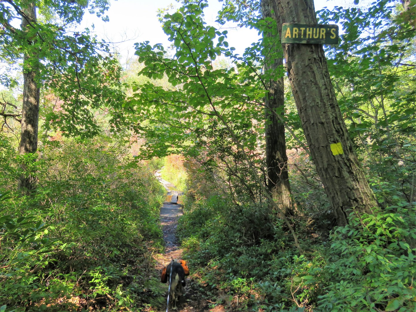
| At a T-intersection, white turns left joining the yellow Arthur Trail which is the way I was going to go but ... |
 |
| ... Brodie tried crossing and those boards went right under so we turned right on yellow instead. |


 |
| Yellow ends at Jim's Pond Road where we turned left. |
 |
| Jim's Pond Road |

 |
| Jim's Pond |

 |
| Looking back at Jim's Pond. |
 |
| Jim's Pond Road continues on then veers left ... |
 |
| ... on Continental Road |
 |
| A left at the Chatfield Stone House on Chatfield Road. |
 |
| Stillman memorial at the intersection. |
 |
| Chatfield Road to ... |
 |
| Tammarack Pond |
 |
| A belted kingfisher on that little island out in the pond. |

 |
| A little farther along Chatfield Road, a left on the blue Chatfield Trail. |


 |
| The trail comes out on an open rock slab ... |
 |
| ... with some views. |
 |
| At the end of the Chatfield Trail, right on the Scenic Trail... |
 |
| ... then right on a different section of the Arthur Trail. |


 |
| At the end of the Arthur Trail, left on the Highlands Trail ... |
 |
| ...then right at the fork when the white Scenic Trail joins in. |
 |
| Now retracing on the Highlands Trail/Scenic Trail. |

 |
| An open rock slab to the right ... |
 |
| ... with a helicopter ... |
 |
| ... a red-tailed hawk ... |
 |
| ... and a turkey vulture. |
 |
| Then back to Jupiter's Boulder ... |
 |
| ... where the low clouds are gone and the Gunks and Catskills are visible. |
 |
| Heading back down. |


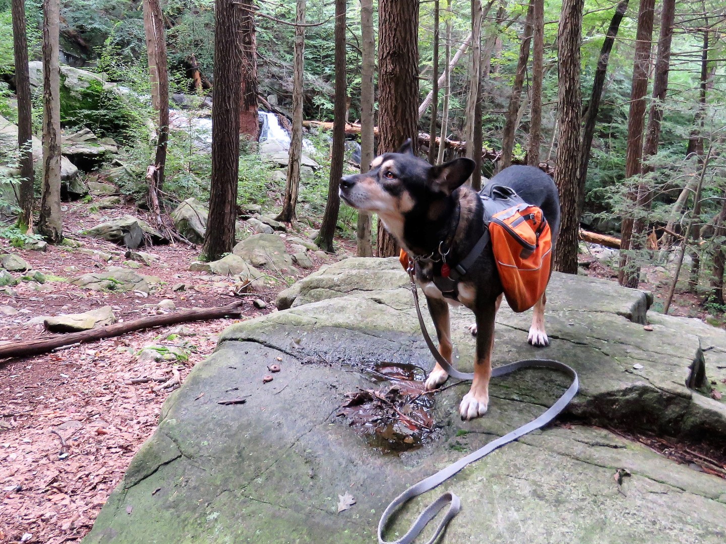 |
| The top of the falls before descending .... |
 |
| ... to the large falls. |
