ABOUT THE PARK:
Wayne National Forest Scenic River Trailhead - U. S. Department of Agriculture
DIRECTIONS:
GPS Coordinates 39.44378, -81.16148
 |
| Brown House Trailhead Parking |
TRAIL MAP:
Wayne National Forest Trails - U. S. Department of Agrigulture (scroll to bottom of page 2)
 |
| Snapshot of portion of map used for this hike. |
HIKE DISTANCE: 10 miles
THE HIKE:
Hike #2 on the drive home from St. Louis. For this trip we drove a total of 2,354 miles, did 6 hikes in 5 states over 8 days for a total of 56.5 miles of hiking. So why, I ask, did I gain a pound?
 |
| The trail starts on the right side of the brown house. |
 |
| It's one trail that will split a short distance ahead. The trail is always open to hikers but closed to mountain bikers from 12/16 to 4/14. |
 |
| The trail switchbacks up one way ... |
 |
| ... then the other way. |
 |
| The Ohio River become visible although I bet we were there on the last weekend that it could actually be seen before all of the leaves are out. |
 |
| The Scenic River Trail switchbacks to the right when the Green Wood Trail continues ahead. The Green Wood Trail is blazed with a yellow diamond with a green circle in the middle although some of the green circles are missing. The Scenic River Trail is blazed with yellow diamonds but we won't be running back into that trail for 7 more miles. |
 |
| Some glimpses of the Ohio River with West Virginia on the other side of the river. Hi Linda and Jim who are over there somewhere hiking! |
 |
| The trail starts to veer away from the river and becomes even more scenic with interesting terrain. |
 |
| Is that... Could it be ...? |
 |
| I tied Brodie to a tree and bushwhacked down to the creek to retrieve my first Ohio balloon, balloon #38 of the year. |
 |
| A little farther along, crossing the balloon-free creek. |
 |
| And climbing back up. This whole trail is a series of ups and downs but there is so much to look at you barely notice the climbs. |
 |
| Coming around a bend, a final glimpse of the Ohio River from this trail. |
 |
| Crossing a gravel road which appears to be someone's driveway. |
 |
| On the other side, two-toned purple flowers that look blue in the picture, but they are two shades of purple ... |
 |
| EVERYWHERE! |
 |
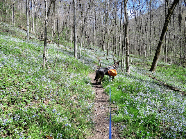
| It's a sea of purple flowers ... |
 |
| ... along a babbling brook where we just stopped in the middle of the trail as to not disturb the flowers, to sit for a few and take a break. |
 |
| A female Eastern Towhee, I believe. She only allowed me one shot and she was gone. |
 |
| Old stone farm wall on the left. |
 |
| Ovenbird |
 |
| The blue-blazed North Country Trail joins in briefly then leaves at 5.5 miles. |
 |
| Stone chimney and hearth from a pioneer homestead (according to the description in the map link, above). |
 |
| Coming off the Green Wood Trail from the left and turning right on the Scenic River Trail at about 7 miles. |
 |
| Another balloon. |
 |
| The Scenic River Trail follows a ridge but is not near as scenic as the Green Wood Trail until it gets closer to the Ohio River. |
 |
| The Ohio River is coming into view. |
 |
| The trail starts to switchback down steeply, sometimes on narrow ledges. |
 |
| Back to where we had picked up the Green Wood Trail at the beginning of the hike. |
 |
| Now retracing all the way down. |
 |
| This was Brodie for the next 7 hours all the way home. |
 |
| Litter from the hike. The beer cans and bottle weren't until the last mile. The rest of the hike was litter free except for the wrapper and the balloons. |


