Sunday, October 31, 2010

Stonetown Circular Hike, Ringwood, NJ


ABOUT THE PARK:
The Stonetown Circular Loop passes through 3 different properties:
     - North Jersey District Water Supply Commission
     - Long Pond Iron Works State Park
     - Passaic River Coalition - scroll down to page 11, Tory Rocks

DIRECTIONS:

View Larger Map
From Stonetown Road, turn on to Mary Roth Drive which ends at the Stonetown Recreation Area with a large parking lot.


NEW JERSEY 1K CLUB HIGH PEAK:  Windbeam Mountain

HIKE DISTANCE:  10.5 mile loop

HIKE DESCRIPTION:
Walk out of the recreation center on Mary Roth Drive the way you drove in.  At Stonetown Road, cross over, turn right and walk along the road a short distance to the guardrail.  Turn left into the woods just before the guardrail.
You will be following the red triangle on white markers throughout the entire hike.
At .60 miles the teal diamond-blazed Highlands Trail joins in from the right and you will be on the combined paths for the next 6 miles following double markers:
The Highlands Trail leaves the Stonetown Circular trail at the Harrison Mountain summit.

This is said to be the most strenuous hike in New Jersey.  You will be climbing and descending four different mountains with lots of ups and downs in between.  There are many woods roads crossing through this hike so be sure to pay close attention to the markers.  The trail is very well marked throughout.
Bear Mountain seen from Windbeam Mountain
Wanaque Reservoir (very low after summer drought) seen from Windbeam Mountain
August 2010 Fire Damage on Windbeam Mountain
Monksville Reservoir seen from Bear Mountain
View from Bear Mountain
Monksville Reservoir from Board Mountain
View from Harrison Mountain
Tory Rocks
Descending Tory Rocks
Lots of leaves down covering the rocky trail
HIKE SUMMARY:
See NJ Hiking's Stonetown Circular page - their notes are much better than mine were.  I was too busy trying to keep my footing on slippery leaves that had come down and covered rocks on the trail.

Wednesday, October 27, 2010

Shenandoah National Park, VA - Mary's Rock Via Appalachian Trail


ABOUT THE PARK:  Mary's Rock - Wikipedia

DIRECTIONS:
Thornton Gap Entrance to Skyline Drive, south to Pinnacles Picnic Area parking between mile posts 36 and 37.  Look for the Appalachian Trail sign between the restrooms along the northern end of the parking lot. 


View Larger Map
TRAIL MAP:  Panorama Area Road and Trail Map

HIKE DISTANCE:  7.20 miles out and back

HIKE DIRECTIONS:
From facing the Appalachian Trail sign between the restrooms at the north side of the parking lot, turn right and follow along the edge of the parking lot which is the Appalachian Trail. 
As the Appalachian Trail goes through the woods behind Jewell Hollow Overlook it follows along a ledge with views of the Shenandoah Valley and mountain to the north.  It was hazy on this particular morning so nothing was visible to the east when there should be views on a clear day.

The trail will descend between the mountains then ascend again heading towards Mary's Rock.

At 3.5 miles turn left to Mary's Rock .1 miles ahead when the Appalachian Trail turns right.
Mary's Rock
View to the North
View to the West
Thornton Gap Entrance Station from Mary's Rock
View to the West
Retrace your steps back to finish the hike.

HIKE SUMMARY:
[0.00]  Take the white-blazed Appalachian Trail north from the Pinnacles Picnic Area
[3.50]  Turn left to Mary's Rock; Appalachian Trail turns right
[3.60]  Mary's Rock
[3.70]  Retrace steps turning right on white-blazed Appalachian Trail
[7.20]  Arrive back at Pinnacles Picnic Area

Sky Meadows State Park, VA


ABOUT THE PARK:  Sky Meadows State Park

DIRECTIONS:

View Larger Map
TRAIL MAP:  Sky Meadows State Park Trail Guide

HIKE DISTANCE:  8 miles

HIKE DIRECTIONS:
From the visitor center parking lot, with the Mount Bleak House behind you, walk across the road towards the kiosk where the hiking trails begin.  Take the gravel road out passing cow pastures on the right where the red-blazed Piedmont Overlook and blue-blazed North Ridge Trails terminate.
When the gravel road turn right, keep straight on the Snowden Interpretive Trail, a 1.14 mile loop.
After completing the loop, continue to the left on the gravel road.  A short distance ahead at 1.60 miles, turn left on the yellow-blazed South Ridge Trail.  At 1.80 miles a short side trail to the right leads to a scenic overlook with a bench.
Backtrack and continue on the yellow-blazed South Ridge Trail arriving at the Snowden Manor Ruins at 1.90 miles.
At 2.15 miles arrive at a bench with scenic views.
Turn left on the blue-blazed North Ridge Trail at 3.00 miles.  Turn right on the white-blazed Appalachian Trail at 3.50 miles.  After a short distance turn left on the purple-blazed Old Trail, the original Appalachian Trail before it was rerouted.  At 5.40 miles arrive back at the white-blazed Appalachian Trail, turn right.
At 6.00 miles turn left on the light-blue blazed Ambassador Whitehouse Trail which leads over meadows with views.
At 7.00 miles turn left on the dark blue-blazed North Ridge Trail briefly then left on the red-blazed Piedmont Overlook Trail and over steps.
At 7.25 miles arrive at the Upper Piedmont Overlook
where the trail descends to the Lower Piedmont Overlook
At 7.80 miles go up and over another series of steps, turn left and down a short flight of steps, then left on the gravel road which lead back to the trailhead.  Arrive back at the visitor center parking lot at 8.00 miles.

HIKE SUMMARY:
[0.00]  From visitor center parking lot cross road to trailhead proceeding up gravel road
[0.40]  Stay straight on Snowden Interpretive Trail when gravel road turns right
[1.50]  Exit Snowden Interpretive Trail; continue left on gravel road
[1.60]  Turn left on yellow-blazed South Ridge Trail
[1.80]  Side trail on right to scenic overlook with bench
[1.90]  Snowden Manor ruins
[2.15]  Bench at scenic overlook
[3.00]  Left on blue-blazed North Ridge Trail
[3.50]  Right on white-blazed Appalachian Trail
[3.58]  Left on purple-blazed Old Trail
[5.40]  Right on white-blazed Appalachian Trail
[6.00]  Left on light blue-blazed Ambassador Whitehouse Trail
[6.40]  Scenic overlook
[7.00]  Left on dark-blue blazed North Ridge Trail
[7.10]  Left on red-blazed Piedmont Overlook Trail
[7.25]  Upper Piedmont Overlook
[7.80]  Go up and over steps, turn left down short flight of steps, left on gravel road
[8.00]  Arrive back at visitor center parking lot

Tuesday, October 26, 2010

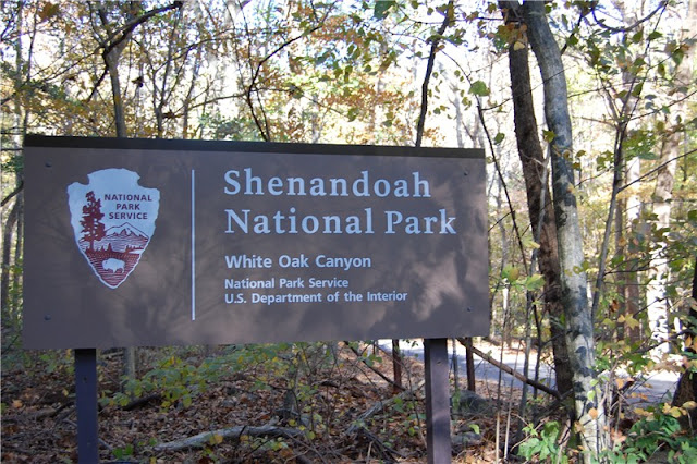
Shenandoah National Park, VA - Whiteoak Canyon/Hawksbill Mountain/Cedar Run


ABOUT THE PARK:
Whiteoak Canyon and Cedar Run
Hawksbill Mountain

DIRECTIONS:

View Larger Map

TRAIL MAPS:
Whiteoak Canyon and Cedar Run
Hawksbill Mountain
This map consists of two differently scaled maps pieced together for illustration purposes only.

HIKE DISTANCES:
Whiteoak Canyon/Cedar Run Loop - 8.5 miles
Hawksbill Mountain Loop - 2.9 miles
Whiteoak Canyon/Hawksbill Mountain/Cedar Run - 11.4 miles

HIKE DIRECTIONS:
For this hike I used Trail Blazes, an audio hiking guide that greatly enhanced an already fantastic hike.  I loaded the guide on my iPod which is virtually weightless to take along.  You simply stop and listen at various points along the hike for interesting information you would otherwise not know about where you are, what you are looking at, or what happened in that spot long ago.  The audio is then turned off and you proceed to the next point.  Trail Blazes starts at a different parking lot so for this hike, simply begin the audio at 7.25 minutes for the Whiteoak Canyon Trail then start the audio from the beginning on the Cedar Run Trail.  I prefer to hike uphill early on rather than at the end of a hike so I started this hike at the lowest point, the Whiteoak Canyon parking lot.  Starting from Skyline Drive means you descend first, then climb back up. The total elevation gain for this combined hike was around 3,000 feet.  I did this hike on a Friday and it was not crowded.  Apparently, these hikes are hugely popular on weekends.

At the trailhead , use the self registration to pay for and obtain a pass to enter Shenandoah National Park if you do not already have one.
Head out on the blue-blazed Whiteoak Canyon Trail, almost immediately crossing a bridge; keep right at the split.  At 1.35 miles arrive at Lower Whiteoak Falls.
Lower Whiteoak Falls
Higher up along the trail a view down Whiteoak Canyon.
Upper Whiteoak Falls
At 2.75 miles, arrive at a dirt road, turn left crossing over the river and continue on the yellow-blazed Whiteoak Fire Road.
The Whiteoak Canyon Fire Road climbs steadily up until you reach the Cedar Run Trail intersection.  Turn left here to complete the Whiteoak Canyon/Cedar Run loop.  Continue straight to cross over Skyline Drive and on to Hawksbill Mountain, the highest peak in Shenandoah National Park at 4,050 feet.

Cross Skyline Drive and veer to the right side of the parking lot (not the trail at the information board straight ahead - that will be the return route).  Take this trail a short distance to the white-blazed Appalachian Trail.  Turn left on the Appalachian Trail.  This is the longer but very scenic route up Hawksbill Mountain.
At 6.15 miles turn left on the blue-blazed Salamander Trail and pass some great views along the way.
Arrive at an intersection and turn left on the gravel road to Hawksbill summit.
After retracing your steps on the gravel road, turn left on the Lower Hawksbill Trail to return to the parking lot at Skyline Drive.  Cross over Skyline Drive and continue on the Cedar Run Trail which descends along more waterfalls.
At 10.85 miles turn right to return to the parking lot where the Cedar Run Link Trail goes to the left.  At 11.25 miles turn right as the Whiteoak Canyon Trail goes left.  Cross back over the bridge and arrive back at the parking lot at 11.40 miles.

HIKE SUMMARY:
[   0.00]  From parking lot start on blue-blazed trail; cross bridge; keep right at split
[   1.35]  Lower Whiteoak Falls
[   2.55]  Hiker warning sign not to exceed hiking ability
[   2.75]  At dirt road turn left, cross creek, continue on yellow-blazed Whiteoak Fire Road
[   4.35]  Stay left at fork where fire road becomes foot trail
[   5.00]  At intersection with Cedar Run Trail keep straight; cross Skyline Drive; take trail to right of parking lot
[   5.15]  At intersection turn left on the white-blazed Appalachian Trail
[   6.15]  Turn left on the blue-blazed Salamander Trail; white-blazed AT goes right
[   6.90]  Scenic view on Salamander Trail
[   6.95]  Second scenic view on Salamander Trail
[   7.00]  Turn left on gravel road to Hawksbill Overlook
[   7.20]  Leaving overlook backtrack to intersection; turn left on Lower Hawksbill Trail
[   8.10]  Arrive back at parking lot; cross Skyline Drive; continue on blue-blazed Cedar Run Trail
[   9.70]  Turn right to cross over creek at Upper Cedar Run Falls
[ 10.70]  Turn left to cross over creek at Lower Cedar Run Falls
[ 10.85]  Keep right on trail to parking lot as Cedar Run Link Trail goes left
[ 11.25]  Keep right when Whiteoak Canyon Trail goes left; cross bridge
[ 11.40]  Arrive back at parking lot