Sunday, September 26, 2010

Hunter Mountain, Catskill Forest Preserve, NY

ABOUT THE PARK:  
Hunter Mountain - New York Department of Environmental Conservation
Hunter Mountain - Wikipedia

TRAIL MAP:  
Northeastern Catskill Trails Map #141 - NY/NJ Trail Conference

DIRECTIONS:
GPS Coordinates:  42.18454, -74.27265

View Larger Map
Should this lot be full, there are two more lots on the right a little farther up Spruceton Road.  You will pass those two parking lots at the end of the hike so regardless of where you park, the hike will take you back to the right lot.  If you park in one of the other lots, walk back to the first lot to start the hike.

HIKE DISTANCE:
Hunter Mountain Loop without Colonel's Chair - 8.30 miles
Hunter Mountain Loop with Colonel's Chair - 10.50 miles

HIKE DIRECTIONS:
Click here for NY/NJ Trail Conference hike directions.

From the parking lot take the blue Spruceton trail which will be a woods road for 3.4 miles, mostly uphill, all the way to the fire tower at the summit.  Be sure to sign in at the trail register at the beginning of the trail.
 

At .5 miles cross over a bridge.

At 2.1 miles a hitching post and water for horses on the right.

At 2.4 miles, arrive at the intersection with the Colonel's Chair trail which goes to the Hunter Mountain Ski Area.  This adds 2.2 miles to the hike and involves descending and ascending again on the return trip.
At 3 miles the yellow trail turns from a footpath to a woods road as it levels out
 
There are several mountain bike trails near the ski area.  Watch for a side trail to the right with boulders straight ahead for a view beyond the boulder.
 
 Arrive at Hunter Mountain Ski Area at 3.5 miles.
New high speed 6 passenger chair lift installed with helicopters August 2010
 
Head back on the yellow trail arriving back at the blue Spruceton trail at 4.6 miles; turn left.
Turn left on side trail at 4.9 miles to a view.
At 5.6 miles arrive at the fire tower at the summit of Hunter Mountain, the second highest peak in the Catskills at 4,040 feet.  I was only able to make it up to the third level of the fire tower to get some shots from above the trees while hanging on for dear life - that fear of heights thing.  Views from the very top must be incredible.


At 5.9 miles arrive at an intersection that bring you to the site of the original fire tower on the left and a short yellow trail to the right to a great break area at a rock outcropping with nice views.
 
Return to the intersection and turn right on the yellow Hunter Mountain Trail.  At 7.25 miles, at the end of the yellow trail, turn right on the red Devil's Path.  While this part of the Devil's Path is rocky and does descend steeply at times, there are no rock scrambles and it is the easiest part of the Devil's Path, which is very challenging to the east.
 
 At 8 miles at a fork in the trail, go left briefly to views at Geiger Point then return to continue.
Continue on the red Devil's Path to Diamond Notch Falls at the intersection with the blue Diamond Notch trail.
Turn right on the blue Diamond Notch trail which runs parallel to multiple smaller falls on the left.
At 10.2 miles the trail ends at a barrier, beyond which is Spruceton Road and a parking lot on the left.  Continue along Spruceton Road past another parking lot on the left, arriving at the first parking lot on the right at 10.5 miles.
Early fall colors in the Catskills.
HIKE SUMMARY:
[  0.00] Blue trail from parking lot; sign trail register
[  0.50] Cross over bridge
[  1.60] Blue trail makes right turn then steeper uphill
[  2.10] Hitching post and water for horses on right
[  2.25] Yellow trail to right goes to a shelter
[  2.40] Left on yellow Colonel's Chair trail
[  3.00] Yellow trail becomes woods road and levels out
[  3.50] Arrive at Hunter Mountain Ski Area; retrace back to blue trail
[  3.90] Yellow trail turns left and becomes footpath and goes uphill
[  4.10] Trail register on left, on right opposite register short side trail to view
[  4.60] Left on blue Spruceton trail
[  4.90] Side trail to left goes to view
[  5.60] Fire tower
[  5.90] Intersection with old fire tower site, trail to view and yellow Hunter Mountain trail
[  7.25] Right on red Devil's Path
[  8.00] Fork in trail; Geiger Point to left, trail continues to right
[  9.50] Arrive at Diamond Notch Falls; turn right on blue Diamond Notch trail
[10.20] Trail ends at Spruceton Road; follow Spruceton Road
[10.50] Arrive at parking lot on right

Sunday, September 19, 2010

Delaware Water Gap NRA, PA - McDade Recreational Trail from Milford Beach to Conashaugh


ABOUT THE PARK:  
McDade Trail - National Park Service
History of the McDade Trail - Milford Beach to Pitman Orchard
Update:  Where there were two sections of the McDade Trail completed previously, all sections are now complete and connected and will be dedicated on September 25, 2010.  See article here.

TRAIL MAPS:  McDade Recreational Trail - National Park Service

DIRECTIONS:  Parking is available at the beginning of the trail at Milford Beach but this is a fee area as there are beach facilities and boat launches.  There are multiple free parking areas/pullouts along Route 209.  For this hike the parking lot on the east side of Route 209 north of mile post 18 was used.
GPS coordinates:   41.297348,-74.823503

HIKE DISTANCES:
McDade Trail from Pitman Orchard north to Milford Beach out and back - 5 miles
McDade Trail from Pitman Orchard south to Conashaugh out and back - 4.2 miles

HIKE DIRECTIONS:
McDade Trail from Pitman Orchard North to Milford Beach
Take the short connector trail from the parking lot to the McDade trail.  Turn left and follow the trail through open fields.  There will be no shade for the first mile and even on a cool day, it gets hot in full sunshine.
To the left, the cliffs of the Cliff Park Trail System
On the right, an old silo, the only farm building to survive a fire in 1950.
At 1.0 mile start entering the woods where there will be minor elevation changes.

At 1.9 miles go under the Route 206 bridge which crosses over the Delaware River from New Jersey to Pennsylvania:
 

At 2.5 miles arrive at the Milford Beach parking lot where there is a restroom a short distance ahead.

The Route 206 bridge from the Milford Beach parking area.
From this point turn around and retrace back to where you parked.  Although this part of the trail was interesting in that it went through diverse landscape and I could see the cliffs where we had just hiked earlier from down below, I was disappointed that there were no river views.  The trail surface is gravel and is more of a bike trail.  So when I arrived back at the parking lot, I decided to continue farther south so see if any of the trail had been completed that had been shown on the map as under construction.

McDade Trail from Pitman Orchard South to Conashaugh
From the parking lot take the access trail to the McDade Trail and turn right.  At 0.4 miles cross a bridge over a creek.
Newer section of gravel trail before second bridge.
Cross over a second bridge and soon the gravel trail turns to a dirt foot path heading towards the river.  From this point on there will be many nice views of the river while the trail goes up and down and twists and turns to conform to the landscape.
I ran into a forest ranger working on this part of the trail.  He was doing some finishing touches before the dedication the following Saturday.  He was thrilled that people had already been using his trail.  He said he tried to build it to take advantage of the views and that he did.  It's a really nice trail and enjoyable to hike.  Lots of traffic noise from Route 209 but the views are so nice you can almost ignore the traffic sounds.

At 2.1 miles the foot trail comes to the Conashaugh parking lot on Route 209 where the trail continues along the road as the gravel trail it was previously.  This was the point where I turned around and headed back north on the foot trail.

These sections of the McDade Trail can be hiked in conjunction with the Cliff Park Trails, hike details here.  It is a very short drive but there are no trails connecting to two so you do have to drive from one to the other.

Cliff Park, Delaware Water Gap National Recreation Area, PA

ABOUT THE PARK:  Cliff Park, Delaware Water Gap NRA, PA   (GPS coordinates for Hackers Trailhead are incorrect on the web site, should be GPS 41.290300 -74.840100 not GPS 41.290300 -74.480100

TRAIL MAP:
Cliff Park Trail System (A couple of corrections to the map - there is no restroom at the Hackers Trailhead and the blue Pond Loop trail is .5 miles total, not .5 miles on each side of the pond.)
NY/NJ Trail Conference Northern Kittatinny Maps 122 and 123 each show part of the trails but no details.

DIRECTIONS:
GPS Coordinates to Hackers Trailhead on Raymondskill Road:  41.290300 -74.840100

View Larger Map

HIKE DISTANCE:  6.8 miles  (can be hiked in conjunction with McDade Recreational Trail for additional mileage)

HIKE DIRECTIONS:
This Pennsylvania part of the Delaware Water Gap is easily reached from Route 206 through New Jersey, only about 10 miles beyond Stokes State Forest.  This is a fairly easy hike, mostly on woods roads with minimal elevation changes, but with huge payoffs in scenery that you usually have to work a lot harder for.

Start at the Hackers Trailhead directly across Raymondskill Road from the parking lot.

Follow the yellow Hackers Trail keeping to the left a short distance ahead where the white Cliff Trail leaves to the right.  At .5 miles stay left on the yellow Hackers Trail as the yellow/white Logger's Path goes to the right.

At 1.0 mile arrive at Hackers Falls:

The next two forks beyond Hacker's Falls are unmarked.  Keep to the right at both.  At the T-intersection there are trail markers, turn left to stay on the yellow trail heading towards the pond.

At 1.3 miles turn left on the orange trail which is a fairly unattractive woods road.  Arrive at a clearing at 1.6 miles with a dilapidated barn and trailer straight ahead with piles of old tires.  (No more uglies after this point.)

Just beyond the trailer come out into the Cliff Park Trailhead parking lot where there is a restroom.  Continue through the parking lot to the blue Pond Loop trail.

You can go either way on the blue Pond Loop trail coming out at almost the same spot.
The north side of the blue Pond Loop brings you along the back side of the Cliff Park Golf Course.

If you take the north side, turn left on the orange trail at the end.  If you take the south side, turn left at the blue/orange trail which takes you to the orange trail where the north blue trail comes in on the left.  A short distance ahead turn left on the white Cliff Trail.

At 2.8 miles a short side trail to the right brings you to a fence at the Riverview Overlook.
View North from Riverview Overlook
View South from Riverview Overlook
From this overlook you can backtrack to the white Cliff Trail and continue by turning right on that trail or you can take a much more scenic foot path along the cliffs which is not shown on the map and is umarked.  This trail starts at the north end of the overlook fence.
High Point Monument in New Jersey from the unmarked foot trail along the cliffs.
From the National Park Service website, a little history of what took place along these cliffs:

Whether you take the white Cliff Trail or the unmarked trail, they both converge with the white/green Quarry Path at 3.1 miles.  You may continue north on the white Cliff Trail or for a prettier hike, descend steeply down the white/green Quarry Path.  Just remember you will have to ascend again but it is worth it.

At 3.6 miles turn left on the green Milford Knob Trail.  (Right goes to the Milford Knob Trail parking lot.)  Stay left at an unmarked intersection.  The gravel road then starts to climb steeply.  At the top, turn right when you meet back up with the white Cliff Trail.  A short distance ahead you will see the clearing at the Milford Knob Overlook.
View North and of Milford, PA from the Milford Knob Overlook
Turn around and retrace your steps heading south on the white Cliff Trail.  At 4.7 miles arrive back at the intersection where you can either continue on the white Cliff Trail or take the unmarked foot path to the left along the cliffs.  Either way, come back out at the Riverview Overlook at 4.9 miles.  Continue south along the white Cliff Trail.
At 5.8 miles a short side trail to the left comes out at the fence for the Minisink Overlook.
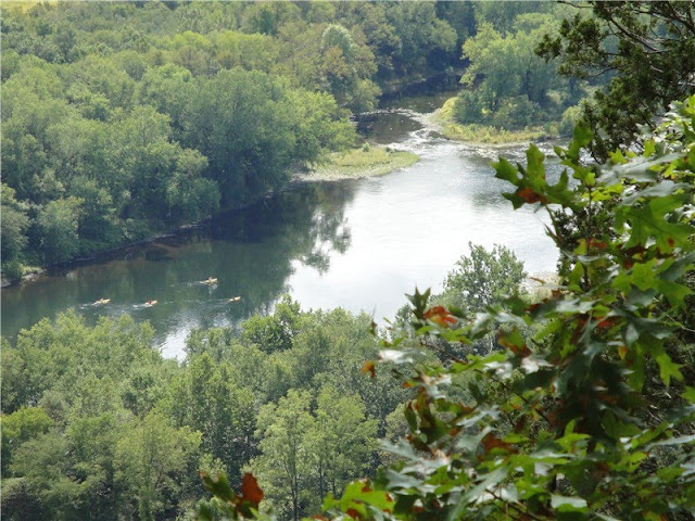
View south of the Delaware River from the Minisink Overlook.
View of Snyder Farm Silo and McDade Recreational Trail
View of the Route 206 Bridge over the Delaware River from New Jersey
Continue heading south on the white Cliff Trail to the last view at Tri State Overlook at 6.2 miles.


Continue south on the white Cliff Trail as it descends to a bridge.  Cross the bridge, about 100 feet ahead turn left at the T-intersection, cross over Raymondskill Road and arrive back at the parking lot at 6.8 miles.

For additional hiking on the McDade Recreational Trail you will need to drive a short distance as there is no connection for hiking there.  Turn right on Raymondskill Road.  At Route 209 turn left and immediately on the right is a pullout for the McDade Rec Trail.  You won't be able to see the connecting path easily and have to look for it along the perimeter of the pullout.

Alternatively, drive a very short distance farther north on Route 209 to a parking lot on the right with a proper, more visible access trail.

Click here for McDade Recreational Trail hike details.