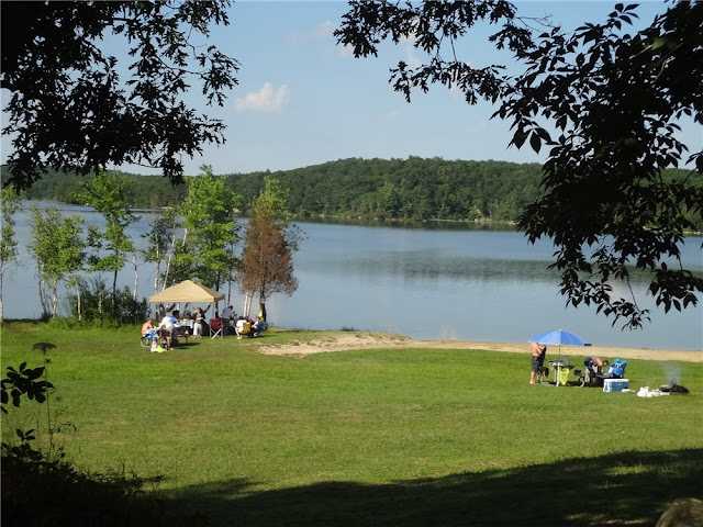
ABOUT THE PARK:
Wawayanda State Park - NJ Department of Environmental Protection
DIRECTIONS:
GPS Coordinates to parking for about 10 cars, 5 on either side of Warwick Turnpike: 41.201500, -74.391610
(There is no fee to park here - from Memorial Day through Labor Day a fee is charged to use lots inside the park.)
View Larger Map
TRAIL MAP:
North Jersey Trails Map #116 - NY/NJ Trail Conference
Wawayanda State Park Map - NJ Department of Environmental Protection
HIKE DISTANCE: 12.35 miles
HIKE DESCRIPTION:
Some of the trails are fairly unattractive woods roads but they are necessary to get to the pretty trails to form a loop.
 |
| Appalachian Trail access from parking on Warwick Turnpike. |
 |
| Appalachian Trail |
 |
| Parker Lake off of the Appalachian Trail. |
 |
| Kazmar Pond off of the Appalachian Trail. |
 |
| 1890's Iron Bridge over Double Kill |
 |
| Iron Mountain Trail |
 |
| Black Bear Conservation Project Along Iron Mountain Trail |
 |
| Wawayanda Lake parking lots already packed on Sunday at 8:50 am. Although this area is very busy, there is lots of solitude on the hiking trails. |
 |
| Wawayanda Lake |
 |
| Wawayanda Lake Beach |
 |
| Pumphouse Trail |
 |
| Wawayanda Lake from an unmarked woods road off of the Pumphouse Trail. |
 |
| Cherry Ridge Road |
 |
| Lake Lookout |
 |
| Red Dot Trail |
 |
| Nature Jim's Bridge |
 |
| Wawayanda Swamp |
 |
| Double Pond Trail |
 |
| William Hoeferlin Trail |
 |
| Blue Heron |
 |
| Dragonfly |
 |
| Tiny Frog |
 |
| Turtle climbing on rock (lower left) and Canada geese. |
 |
| Monarch Butterfly |
 |
| Swimming Turtle |
HIKE SUMMARY:
[ 0.00] Take the white-blazed Appalachian Trail south from the parking area
[ 0.20] Parker Lake on left; keep right at fork
[ 0.25] At 4-way intersection veer left and take center trail, staying on Appalachian Trail
[ 0.40] Keep straight on AT when blue goes right to a shelter
[ 0.60] Cross straight over gravel road
[ 0.85] Cross over woods road
[ 1.05] Kazmar Pond on left
[ 1.20] Left on woods road which is now combined white-blazed AT and blue-blazed Iron Mountain Trail; power cut; cross bridge over Double Kill
[ 1.25] When AT goes right, keep left on blue-blazed Iron Mountain Trail
[ 2.25] Cross over paved park road
[ 2.50] Go through parking lot, turn right just before Wawayanda Lake; turn right to second parking lot, then turn left through lot along fence
[ 2.80] From second lot left on orange Pumphouse Trail; turn right and cross gravel bridge (not wooden bridge by picnic tables)
[ 3.40] Pumphouse Trail leaves woods road to the left on foot trail
[ 4.15] Trail to left not worth taking to lake - overgrown and not well defined
[ 4.30] Woods road to left leads to Wawayanda Lake
[ 4.55] Woods road ends at Wawayanda Lake at old rusty pipes; retrace
[ 4.75] Continue left on orange Pumphouse Trail
[ 5.45] Pumphouse Trail ends, go through gravel lot, left on gravel road
[ 5.60] Left at fork on Cherry Ridge Road when Cabin Trail goes right
[ 5.85] Keep right at fork
[ 5.95] Unmarked trail to right at other end of parking area goes to Lake Lookout but closed summer 2011 due to gas pipeline construction; keep straight on Cherry Ridge Road
[ 6.25] Right on white-blazed Lookout Trail (also goes to Lake Lookout but not posted as closed)
[ 6.80] Lake Lookout (unmarked trail coming in from right is where trail from parking lot comes in had it not been posted as closed); continue left around pond
[ 7.00] At fork with cairn on left, keep straight on woods road when trail goes right
[ 7.20] Lookout Trail ends, left on red-blazed Old Coal Trail (this trail is closed for gas pipeline construction but it is not posted until the end of the trail)
[ 7.55] Old Coal Trail ends, right on Cherry Ridge Road
[ 7.70] Left on red-blazed Red Dot Trail
[ 8.10] Nature Jim's Bridge
[ 8.30] Right at fork when unmarked goes straight (not on map)
[ 8.35] Red Dot Trail goes both left and right - either way merges back together; for this hike, turn left
[ 9.00] At T-intersection turn left when other side of Red Dot Trail comes in from right
[ 9.30] Cross bridge
[ 9.40] Red Dot Trail ends; right on yellow Double Pond Trail
[ 9.80] Left on yellow Double Pond Trail when blue Cedar Swamp Trail goes right
[10.25] Yellow Double Pond Trail ends, turn left on blue-blazed William Hoeferlin Trail
[11.30] Keep right on blue William Hoeferlin Trail when Black Eagle Trail goes left
[11.75] Cross park road with park office on right, head towards maintenance building, turn right through parking lot to other end of lot near park road; left on continuation of blue-blazed William Hoeferlin Trail
[12.00] At T-intersection, right on white-blazed Appalachian Trail
[12.35] Back at parking area on Warwick Turnpike


