

Minnewaska State Park Preserve - New York State Parks
Long Path Section 14 - NYNJ Trail Conference
DIRECTIONS:
GPS Coordinates 41.76020, -74.32544
 |
| Parking for 2-3 cars on Foordemoor Road. |
TRAIL MAP:
Shawangunk Trails Map #104 - New York New Jersey Trail Conference
HIKE DISTANCE: 11.4 miles
THE HIKE:
This hike is in the remote northern part of Minnewaska State Park where you can avoid the crowds in the rest of the park and have the entire hike to yourself. I saw nobody else the entire time.
 |
| The white-blazed Lower Mine Hole Trail starts from the parking area. |

 |
| This is where we were headed. It's mostly uphill, more so for the first 2 miles then not as noticeable the last mile. |


 |
| The white trail ends at the Long Path that comes in from the right. This is now the Upper Mine Hole Trail. |
 |
| Following teal Long Path blazes the rest of the way. |


 |
| Higher up views start to appear from behind but I would get to see them all better on the way down later. |
 |
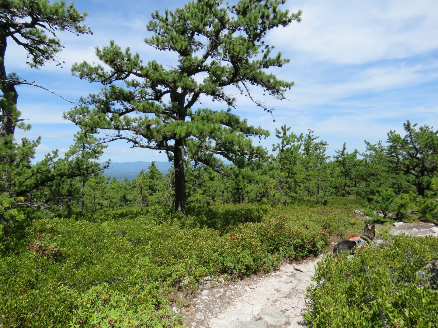
| The terrain changes from woods to rock slab, blueberries and pitch pine then alternates back and forth a few times. |


 |
| The Catskills |
 |
| To the right it looks like Jacob's Ladder Trail might still exist as there is a huge cairn and a trail marker on the tree. It was shown on the 2008 edition of the map in a slightly different place, after Panther Rock instead off before. It is no longer on the 2019 map. The Gaia app shows it as "Jacob's Ladder Trail - No Access" so I didn't go that way. |
 |
| A little farter along, a white-blazed trail leads a short distance to Panther Rock. |

 |
| Views from the top of Panther Rock. |

 |
| Back on the Long Path/Upper Mine Hole Trail. |


 |
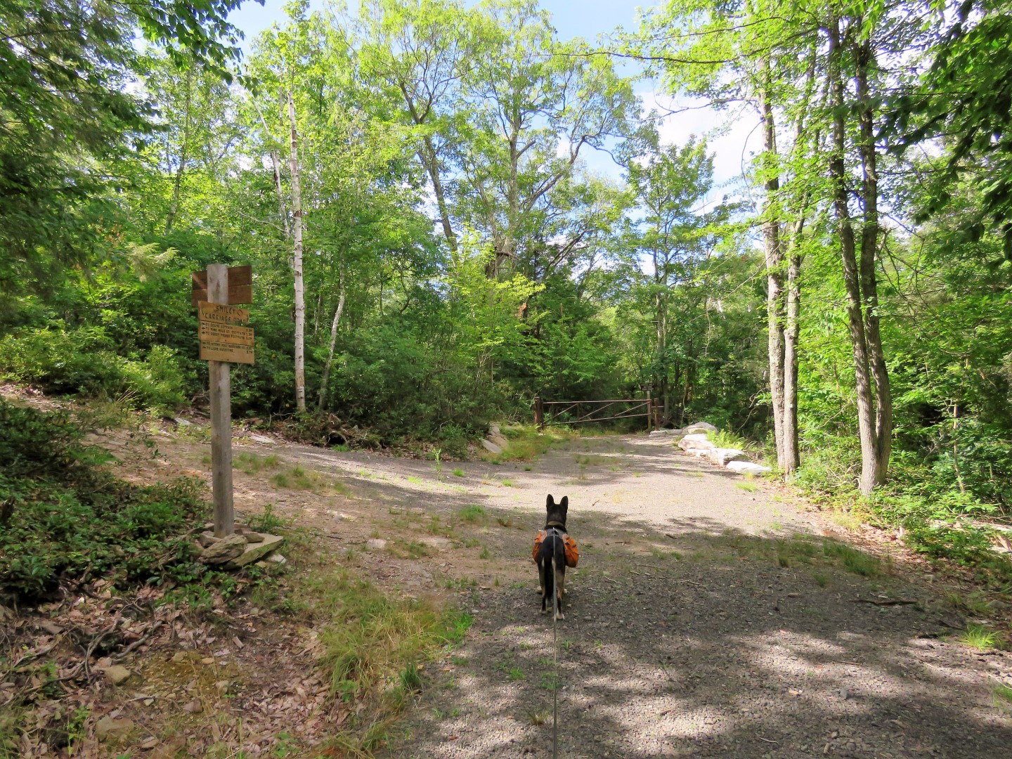
| The Upper Mine Hole Trail ends at Smiley Carriage Road. The Long Path turns left and we would be returning that way. For now we turned right to make a loop. |
 |
| Looking back at the Upper Mine Hole Trail. |
 |
| Smiley Carriage Road |
 |
| Coming up on ... |
 |
| Napanoch Point |


 |
| The manicured part of the Smiley Carriage Road ends. It continues as a trail straight ahead. We turned left on ... |
 |
| High Point Carriage Road which is not manicured at all like the other carriage roads in the park. |
 |
| I am guessing this is what the manicured carriage roads would look like in their natural state. |


 |
| I was a little concerned about being able to get through a swampy area I had heard about on this trail but turns out all of the wet areas were easy crossed on rock hops. |


 |
| When I see bear scat on a hike it is usually one time. I saw bear scat five times throughout this hike. No bears sightings, though, although based on the sound in the woods we might have spooked one or two. |


 |
| At the next intersection after a fairly steep uphill, we turned left on the red-blazed High Point Footpath. |
 |
| This leads to ... |
 |
| ... open views on rock slabs. |


 |
| This is were we connected back to the Long Path which now runs along with the blue-blazed Berrypicker Trail. The Berrypicker Trail was the most rugged trail of the hike. |


 |
| Mohonk Mountain Mouse |


 |
| The Berrypicker Trail ends at Smiley Carriage Road where we turned left. |


 |
| Following the Long Path off of Smiley Carriage Road to the right to start retracing downhill. |

 |
| Now the views are ahead of us. |


 |
| Back to the woods at the lower level. |
 |
| Right on the white-blazed Lower Mine Hole Trail when the Long Path continues to the left. |


 |
| The produce I bought a few weeks ago at this stand was really good and it was only a few miles away so I stopped by again along with another roadside farm stand to do my grocery shopping before heading home. |
