Sunday, September 19, 2010

Cliff Park, Delaware Water Gap National Recreation Area, PA

ABOUT THE PARK:  Cliff Park, Delaware Water Gap NRA, PA   (GPS coordinates for Hackers Trailhead are incorrect on the web site, should be GPS 41.290300 -74.840100 not GPS 41.290300 -74.480100

TRAIL MAP:
Cliff Park Trail System (A couple of corrections to the map - there is no restroom at the Hackers Trailhead and the blue Pond Loop trail is .5 miles total, not .5 miles on each side of the pond.)
NY/NJ Trail Conference Northern Kittatinny Maps 122 and 123 each show part of the trails but no details.

DIRECTIONS:
GPS Coordinates to Hackers Trailhead on Raymondskill Road:  41.290300 -74.840100

View Larger Map

HIKE DISTANCE:  6.8 miles  (can be hiked in conjunction with McDade Recreational Trail for additional mileage)

HIKE DIRECTIONS:
This Pennsylvania part of the Delaware Water Gap is easily reached from Route 206 through New Jersey, only about 10 miles beyond Stokes State Forest.  This is a fairly easy hike, mostly on woods roads with minimal elevation changes, but with huge payoffs in scenery that you usually have to work a lot harder for.

Start at the Hackers Trailhead directly across Raymondskill Road from the parking lot.

Follow the yellow Hackers Trail keeping to the left a short distance ahead where the white Cliff Trail leaves to the right.  At .5 miles stay left on the yellow Hackers Trail as the yellow/white Logger's Path goes to the right.

At 1.0 mile arrive at Hackers Falls:

The next two forks beyond Hacker's Falls are unmarked.  Keep to the right at both.  At the T-intersection there are trail markers, turn left to stay on the yellow trail heading towards the pond.

At 1.3 miles turn left on the orange trail which is a fairly unattractive woods road.  Arrive at a clearing at 1.6 miles with a dilapidated barn and trailer straight ahead with piles of old tires.  (No more uglies after this point.)

Just beyond the trailer come out into the Cliff Park Trailhead parking lot where there is a restroom.  Continue through the parking lot to the blue Pond Loop trail.

You can go either way on the blue Pond Loop trail coming out at almost the same spot.
The north side of the blue Pond Loop brings you along the back side of the Cliff Park Golf Course.

If you take the north side, turn left on the orange trail at the end.  If you take the south side, turn left at the blue/orange trail which takes you to the orange trail where the north blue trail comes in on the left.  A short distance ahead turn left on the white Cliff Trail.

At 2.8 miles a short side trail to the right brings you to a fence at the Riverview Overlook.
View North from Riverview Overlook
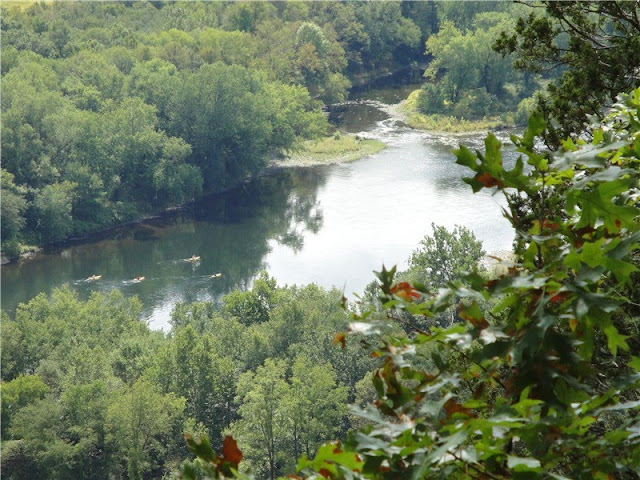
View South from Riverview Overlook
From this overlook you can backtrack to the white Cliff Trail and continue by turning right on that trail or you can take a much more scenic foot path along the cliffs which is not shown on the map and is umarked.  This trail starts at the north end of the overlook fence.
High Point Monument in New Jersey from the unmarked foot trail along the cliffs.
From the National Park Service website, a little history of what took place along these cliffs:

Whether you take the white Cliff Trail or the unmarked trail, they both converge with the white/green Quarry Path at 3.1 miles.  You may continue north on the white Cliff Trail or for a prettier hike, descend steeply down the white/green Quarry Path.  Just remember you will have to ascend again but it is worth it.

At 3.6 miles turn left on the green Milford Knob Trail.  (Right goes to the Milford Knob Trail parking lot.)  Stay left at an unmarked intersection.  The gravel road then starts to climb steeply.  At the top, turn right when you meet back up with the white Cliff Trail.  A short distance ahead you will see the clearing at the Milford Knob Overlook.
View North and of Milford, PA from the Milford Knob Overlook
Turn around and retrace your steps heading south on the white Cliff Trail.  At 4.7 miles arrive back at the intersection where you can either continue on the white Cliff Trail or take the unmarked foot path to the left along the cliffs.  Either way, come back out at the Riverview Overlook at 4.9 miles.  Continue south along the white Cliff Trail.
At 5.8 miles a short side trail to the left comes out at the fence for the Minisink Overlook.
View south of the Delaware River from the Minisink Overlook.
View of Snyder Farm Silo and McDade Recreational Trail
View of the Route 206 Bridge over the Delaware River from New Jersey
Continue heading south on the white Cliff Trail to the last view at Tri State Overlook at 6.2 miles.


Continue south on the white Cliff Trail as it descends to a bridge.  Cross the bridge, about 100 feet ahead turn left at the T-intersection, cross over Raymondskill Road and arrive back at the parking lot at 6.8 miles.

For additional hiking on the McDade Recreational Trail you will need to drive a short distance as there is no connection for hiking there.  Turn right on Raymondskill Road.  At Route 209 turn left and immediately on the right is a pullout for the McDade Rec Trail.  You won't be able to see the connecting path easily and have to look for it along the perimeter of the pullout.

Alternatively, drive a very short distance farther north on Route 209 to a parking lot on the right with a proper, more visible access trail.

Click here for McDade Recreational Trail hike details.

Sunday, September 12, 2010

Pomperaug Trail, CT (Fiddlehead Preserve - Jackson Cove Park - Kettletown State Park)

ABOUT THE PARKS:
Fiddlehead Preserve/Oxford Land Trust
Jackson Cove Park
Kettletown State Park
Pomperaug Trail - part of the Connecticut Blue-Blazed Hiking Trail System

TRAIL MAPS:
Kettletown State Park - only covers northern half of the hike and map is somewhat outdated
Connecticut Walk Book West - pages 63 through 72; binder book with removable maps, highly recommended

DIRECTIONS:
GPS Coordinates: 41.396298,-73.184016

View Larger Map

The parking area for hikers is the gravel section to the right at the end of Fiddlehead Road  This is a no fee parking area.  This hike is also accessible from parking at Kettletown State Park (northern end) and Jackson Cove Park (middle of hike) where seasonal fees apply.

HIKE DISTANCE:
This hike is 12 miles long incorporating all trails but there are many options for shorter hikes.  The Pomperaug Trail is 4.5 miles one way.  This can be combined with any or all side trails along the way - Miller Trail at the northern end in Kettletown State Park (2 miles), Crest Trail (1 mile) at the southern end of Kettletown State Park and the Oxford Loop Trail (0.6 miles) south of Jackson Cove.

HIKE DIRECTIONS:
Although this is a lovely hike through beautiful woods and forests, it would probably be more enjoyable when the leaves are down and motorboats are put away during off-season.  Out of the 10 vistas shown on the map, only 3 offer up views during full summer foliage.  Lake Zoar allows motorboats and the resulting noise pollution can seriously disrupt an otherwise peaceful hike, especially since most of this hike runs parallel to Lake Zoar.

From the parking area at Fiddletown Road, head straight into the woods to the left of the parking sign through a very short overgrown section.  Once on the other side of the weeds, start to follow the light blue-blazed Pomperaug Trail uphill to the left.  Stay on the Pomperaug Trail for its entire 4.6 miles.  The blazes are faded early on so pay close attention.  Farther along the blazes have been refreshed and are easier to follow.
At 0.6 miles take a short unmarked side trail to the left for a view of Lake Zoar.

At 1.6 miles another blue-blazed trail splits to the left.  This is the Oxford Loop Trail (the return route) which is supposed to be blazed blue/white but is only blazed the same shade of light blue so be sure not to confuse it with the blue-blazed Pomperaug Trail.

At 2.3 miles, after rock hopping over a stream, descent towards Lake Zoar:
The blue-blazed Pomperaug Trail continues to the right through a very short overgrown section emerging at Jackson Cove.  (Facing the water, the blue-blazed trail to the left is the start of the Oxford Loop Trail which will later be the return route.)

Found a baseball cap on the trail mid way between Fiddlehead Road and Jackson Cove.  Brought it along and put it on a post in the Jackson Cove parking lot by the porta potties, in case anyone is looking for it...

Walk straight through Jackson Cove to the continuation of the blue-blazed Pomperaug Trail directly across the paved road where it immediately crosses a bridge:
The trail will skirt along Lake Zoar with some short side trails up to the lake.
Stay on the blue-blazed trail as you pass the northern and southern intersections for the Crest Trail.  Where the previous intersections with the Oxford Loop Trail were not marked with signage, from this point forward all intersections are very well identified.
After the Pomperaug Trail becomes a wide woods road in Kettletown State Park, it comes out at a paved park road, this being the end of the Pomperaug Trail.  Cross straight over the park road to pick up the blue/yellow-blazed Brook Trail which runs to the left between Kettletown Brook and the park road.
Even after a long drought, small waterfalls still running in Kettletown Brook.


At 4.7 miles turn right on the blue/pink Miller Brook Connector Trail. (Maps show this as blue/red or blue/purple, but looks pink to me...)
Cross over a bridge...
 ...and follow the trail along picnic areas and across two paved park roads, turning left on the second paved road.  Head beyond the "One Way" sign then turn right on the blue-blazed Miller Trail.
The blue-blazed Miller Trail is about a 2 mile woods road loop.
After a few steps arrive at the loop where you can go in either direction ending up right back at this spot.  Along the Miller Trail you will see a blue/orange side trail.  This is a short trail which splits into two directions, each one coming out at vista.  With summer foliage, however, there isn't much to see.
Vista from southern blue/orange side trail.

Vista from northern blue/orange side trail.
After finishing the loop, head back along the blue/pink Miller Brook Connector trail crossing back over the bridge, then turning right at the blue/yellow Brook Trail.  This trail crosses the park road and ascends up a series of steps.
At 8.1 miles pass a huge glacial boulder on the right.
Go straight at the intersection on the blue/white Crest Trail.

Watch for a short unmarked side trail at 8.4 miles which brings you to views of the lake and has a nice shady break spot.

At 9.1 miles merge on to the blue-blazed Pomperaug Trail to the right.  Follow this trail back to Jackson Cove at 9.7 miles.  Walk straight through the parking lot parallel to the lake, continuing on the dirt road through the high weeds.
On the other side of the weeds, cross over the log bridge and turn right on the blue-blazed Oxford Loop Trail.  (The blue-blazed Pomperaug Trail that you came in on goes left.)  Follow the Oxford Loop Trail until it joins back up with the blue-blazed Pomperaug Trail at 10.4 miles. Turn right and return to the parking area arriving at 12 miles.