Showing posts sorted by relevance for query Harriman. Sort by date Show all posts

Saturday, October 13, 2012

Harriman State Park, NY - Claudius Smith's Den to Lake Skenonto


ABOUT THE PARK:
Harriman State Park - The Palisades Parks Conservancy
Harriman State Park - New York State Parks

DIRECTIONS:
GPS Coordinates 41.180246, -74.163658

View Larger Map
Johnstown Road ends at a circle with parking all around the circle.


TRAIL MAP:  NY/NJ Trail Conference Southern Harriman Bear Mountain Trails Map 118

PEAK BAGGING:
Pound Mountain - Peakery.com
Smith Rock - Peakery.com
Black Ash Mountain - Peakery.com
Parker Cabin Mountain - Peakery.com

HIKE DISTANCE:  8.2 miles

THE HIKE:
Walk back out Johnstown Road a short distance to the start of the Blue Disc Trail on the right.
At the time of this hike, it was believed that a man who shot and killed his daughter-in-law on September 24, 2012 was in hiding in Harriman State Park.  The park was closed to hikers for a while as a manhunt was underway but hikers are allowed back in now.
Although I was not all that concerned about it, it is a tad unnerving when your dog keeps going into full alert mode like this.
And like this.  Turns out it was just some other hikers with their dogs she was alerting on.  They caught up, all got to play and everyone was happy.
View from Almost Perpendicular.
Reeves Meadow Visitor Center from the overlook.
Early morning frost.
Elbow Brush
To get to Claudius Smith's Den you need to turn left and leave the Blue Disc Trail before the rock scramble.  The cave is around on the other side of the boulders.  Retrace back to the Blue Disc Trail.
Claudius Smith's Den
Back on the Blue Disc Trail on top of Claudius Smith's Den.
The Catskills in the distance.
More Catskills with the Gunks in front.
Black Ash Swamp
A frost survivor.
The summit of Black Ash Mountain on the Ramapo-Dunderberg Trail (red dot on white).
Views from Parker Cabin Mountain on the Ramapo-Dunderberg Trail.
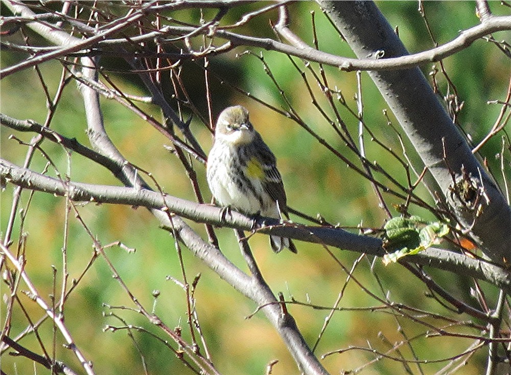
Myrtle Warbler
Lake Skenonto
An unnamed woods road to the White Bar Trail.

HIKE SUMMARY:
[  0.00]  Walk back out Johnstown Road from parking circle
[  0.05]  Turn right on paved road at the 3 blue circle on white blazes of the start of the Blue Disc Trail
[  0.50]  The white-blazed Kakiat Trail joins in briefly from the right then leaves to the left
[  0.80]  Views at Almost Perpendicular
[  1.40]  Cross gas pipeline
[  1.60]  Pass to the right of pipeline
[  1.70]  Elbow Brush
[  2.05]  At intersection with red dash on white Tuxedo-Mt. Ivy trail leave the Blue Disc Trail to the left of the rock scramble to go around to Claudius Smith's Den; retrace to continue up rock scramble on the Blue Disc Trail
[  2.15]  Views on top of Claudius Smith's Den
[  2.50]  Views
[  2.95]  At 4-way intersection veer right on red dot on white Ramapo-Dunderberg Trail and cross power cut
[  3.20]  Black Ash Mountain summit
[  3.90]  This is where the White Bar Trail should cross over but I missed it
[  4.20]  White Cross Trail starts to the right
[  4.35]  Views going up Parker Cabin Mountain
[  4.40]  Yellow Triangle Trail joins from the left, keep right on Yellow Triangle Trail when red dot on white continues straight and descend steeply
[  5.10]  Cross power cut; keep right and right again going parallel to power lines
[  5.30]  Left on woods road briefly for view of Lake Skenonto; retrace back to intersection
[  5.40]  Back at intersection with the Victory Trail, continue on Yellow Triangle 
                *** A short distance ahead watch for a fork and keep left on Yellow Triangle - this is very easy to miss, especially with yellow leaves on the trees and the sun in your eyes.  It is the second time I missed this.  I stayed with the woods road which meets up with the White Bar Trail so whether you stay with Yellow Triangle or the woods road, you come out at the White Bar Trail.  Just be careful at the end of the woods road because it is not clear which way to go on White Bar and it looks like your only option is to go straight when you should make a left turn.  If you start going uphill, you are going the wrong way.  Turn around and follow the White Bar Trail and it is easier to see where to go in this direction ending up at ...
[  6.70]  Dutch Doctor Shelter on left off of White Bar Trail; red dash on white Tuxedo-Mt. Ivy Trail comes in from the right
[  8.20]  White Bar Trail ends at Johnstown Circle parking

Friday, February 10, 2012

Harriman State Park, NY: Island Pond and Lemon Squeezer


ABOUT THE PARK: 
Harriman State Park - The Palisades Parks Conservancy
Harriman State Park - New York State Parks

DIRECTIONS:
GPS Coordinates 41.264792,-74.15426
NOTE:  My GPS did not recognize the turn on Arden Valley Road from Route 17 and took me to Arden Road so you might have to watch for it.  You want to turn off Route 17 at the Harriman State Park sign on Arden Valley Road, not Arden Road which leads to private property with no park access.

View Larger Map
Elk Pen Parking

TRAIL MAP:
Northern Harriman Bear Mountain Trails Map #119 - NY/NJ Trail Conference

HIKE DISTANCE:
10.7 miles
7.5 miles - Island Pond/Lemon Squeezer Loop - NY/NJ Trail Conference
4 mile and 8.5 mile options - Lemon Squeezer Loop - NJ Hiking

PEAK BAGGING:
Green Pond Mountain - Peakery.com
Island Pond Mountain - Peakery.com
Hogencamp Mountain - Peakery.com

APPALACHIAN TRAIL SECTION HIKING:
TrailHeadFinder.com - AT section miles 1366.0 to 1369.9

THE HIKE:
Starting on the Appalachian Trail after crossing field from parking lot.
The Appalachian Trail climbs to the top of Green Mountain.
Limited view to the west on top of rock to left of trail at summit of Green Mountain.
Descending the other side of Green Mountain to Island Pond.
Island Pond Road, built in 1905, through hemlock grove.
Stone spillway construted by the CCC in the 1930's, part of a dam that was never completed.
Island Pond
Entrance to the Lemon Squeezer
Looking back after going through the Lemon Squeezer - it's a tight squeeze at an angle.
After going through the Lemon Squeezer you have a choice of the "Easy Way" to the left or up a rock wall to the right.  My dog was VERY clear on which way she wanted to go.
The "Easy Way" is a rock scramble, too, but doable for a dog.
Island Pond from the top of the Lemon Squeezer.
Intersection of the Appalachian Trail and the Long Path.
Surebridge Brook
Watch for the red dot on white turn painted on the rock on Fingerboard Mountain.  If you start seeing white blazes with red dot on white blazes together, you just missed the turn.
Red dot on white Ramapo-Dunderberg Trail
Times Square at the Ramapo-Dunderberg and Arden-Surebridge intersection.
360 degree views from Hogencamp Mountain
Ship Rock
Goldthwaite Memorial
Boston Mine
The red triangle on white Arden-Surebridge Trail follows along a ledge high up before following a switchback down.
Elk from Yellowstone Park were kept in a huge pen in the 1920's but they failed to thrive.
Path through field back to parking lot.

HIKE SUMMARY:
[  0.00]  Take path through field from about the middle of the parking lot
[  0.15]  Turn right on red triangle on white trail a few steps then turn left on white-blazed Appalachian Trail when red triangle on white goes straight
[  1.55]  Cross gavel road leading to Island Pond
[  1.65]  Cross footbridge at old partially constructed dam
[  1.70]  Views of Island Pond to right off trail
[  2.15]  Red triangle on white comes in from right, few steps ahead red triangle on white leaves to the right; keep left on AT through Lemon Squeezer
[  3.00]  Keep straight when aqua-blazed Long Path crosses over
[  3.80]  Cross Surebridge Brook
[  4.50]  Make sharp right turn on red dot on white (Ramapo-Dunderberg Trail) where turn blaze is painted on rock surface
[  6.00]  Times Square; veer left staying on red dot on white
[  6.30]  360 degree views at top of Hogencamp Mountain
[  6.80]  Keep straight on red dot on white when blue L on white (Lichen Trail) goes right
[  6.90]  Goldthwaite Memorial
[  7.30]  Turn right on yellow-blazed trail at cairn
[  7.70]  Just before creek turn left on yellow when the white bar trail joins in from the right
[  8.00]  Turn right on yellow at cairn when white bar goes straight
[  8.60]  Boston Mine on right
[  8.65]  Turn right on unmarked woods road when yellow goes left on woods road
[  8.95]  Turn left on red triangle on white (Arden-Surebridge Trail) when woods road goes straight
[  9.10]  Keep left on red triangle on white at cairn when unmarked Island Pond Road goes right
[  9.50]  Short side trail on right to view as trails starts to descend
[10.25]  Red triangle on white turn right on woods road at elk pen when red bar on white (Nurian Trail) starts to the left
[10.55]  Keep straight when white-blazed AT goes right; at end of red triangle on white trail turn left on path through field to parking lot
[10.70]  Back at parking lot