ABOUT THE PARK:
Allamuchy Mountain State Park - NJ Division of Environmental Protection
Rutherford Hall - Allamuchy Township School District
DIRECTIONS:
GPS Coordinates 40.91461, -74.81519
 |
| Turn in at the entrance to Mountain Villa School/Rutherford Hall then ... |
 |
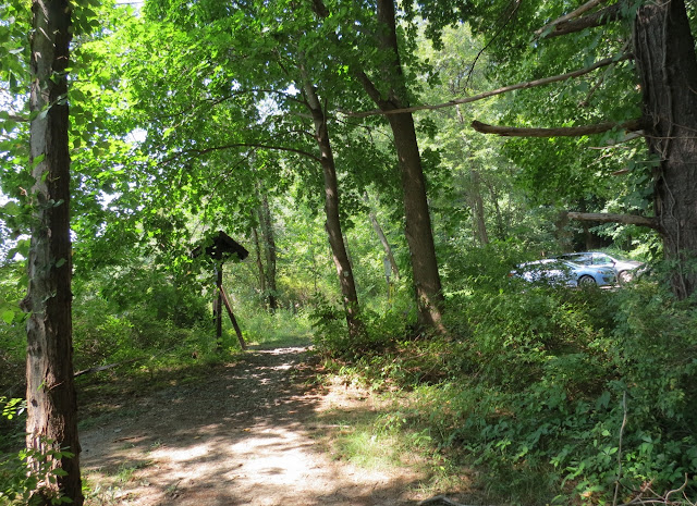
| ... make the first right (where my car is - this picture is exiting the lot) at the Allamuchy Pond Trail sign to ... |
 |
| ... the parking lot at the trail head. |
TRAIL MAP:
Jersey Highlands Trail Map 126 - New York New Jersey Trail Conference
Allamuchy Mountain State Park Map - NJ DEP
Allamuchy Mountain State Park, NJ - Allamuchy and Deer Park Ponds at EveryTrail
HIKE DISTANCE: 9.2 miles
(8.2 miles without backtracking looking for overlook)
THE HIKE:
 |
| Allamuchy Pond at sunrise. |
 |
| Kiosk at the trail head. The silver Allamuchy Pond Trail goes either way around Allamuchy Pond and the map shows a complete loop around but according to Dan Balogh's expedition of July 2011, the western side became impassibly overgrown about 1 mile in. I decided to start on the eastern side and attempt the western side on the return route so there would not be as much backtracking if I did find it to be overgrown approaching from the other way. |
 |
| Heading out east of Allamuchy Pond... |
 |
| ... over a mowed section past Rutherford Hall on the left. |
 |
| Allamuchy Pond to the right with Rutherford Hall on the left. |
 |
| A Great Blue Heron enshrouded in morning fog on the opposite side of the pond. |
 |
| After crossing the mowed area the trail heads back into the woods ... |
 |
| ... then follows a gravel road for a short distance ... |
 |
| ... before crossing the dam. |
 |
| Allamuchy Pond from the dam. |
 |
| After the dam it is all footpath through lovely woods with glimpses of the pond to the right. |
 |
| When the silver trail comes to a T-intersection, it continues to the right (which will be our return attempt) but we turned left on a well-defined unmarked trail. |
 |
| At the intersection with white, turn right (left is return route) then left on blue. |
 |
| On the blue Lake View Trail, a woods road through a pretty forest. |
 |
| Deer Park Pond |
 |
| Continuing around Deer Park Pond. |
 |
| The dam that we will be crossing. |
 |
| I would have never noticed this Great Blue Heron had I not seen him land way over on the far end of Deer Park Pond. |
 |
| Crossing the dam. |
 |
| A break spot. |
 |
| Continuing on ... |
 |
| ... to another pretty access spot. |
 |
| Water bugs. |
 |
| Blue heads away from Deer Park Pond... |
 |
| ... and ends at white. |
 |
| On the white Deer Path Trail. |
 |
| According to the trail conference map, there are woods roads that go the the overlook of the Delaware Water Gap on I-80. The woods roads are there but the western one soon became impassable. We backtracked to try to find the eastern side... |
 |
| ... and this would be it, overgrown and loaded with blow downs. |
 |
| It also appears that the area is fenced off, probably to keep those up to no good who can drive to the overlook from entering the park. |
 |
| So much for getting to the overlook. Continuing on Deer Path Trail. |
 |
| We retraced on the unmarked trail to the silver Allamuchy Pond Trail. Instead of turning right to head back the way we came at that T-intersection, we continued straight in an attempt to loop around the western side of Allamuchy Pond and soon ran right into a trail maintainer! He said he was clearing a 100-yard section of overgrowth but beyond that it was clear sailing to Route 517. I asked him if the silver trail was cleared all the way around and he said he did not know as he had never been that way. He thought it would involve a road walk on Route 517 and going across a farm field. It was getting hotter and this was the longest hike Shawnee had done in a long time so I decided best to retrace through the woods in the shade than be in full sun. |
 |
| Very tired dog heading back in the shade. |


