Sunday, December 6, 2015

Glades Wildlife Refuge, NJ - Tat Starr Trail


ABOUT THE PARK:
Glades Wildlife Refuge - Natural Lands Trust

DIRECTIONS:
GPS Coordinates for Tat Starr Trail - 39.26500, -75.16577
There is a parking lot beyond the gate but since the gate was closed I parked off the side of the road where there was ample space.

TRAIL MAP:
Glades Wildlife Refuge Trail Map - Natural Lands Trust


HIKE DISTANCES:
All hikes combined with short drives from one to the other - 8.4 miles
Bald Eagle Trail - 1.6 miles
Maple Street Trail - 4 miles
Warfle Farm Trail .7 miles
Tat Star Tail - 2.1 miles

THE HIKE:
She was getting very tired having hiked over 6 miles already.  If I had any thoughts about making her sit this one out, that look clearly said "Don't you even think about it."
So off we went.  This hike was a couple of miles from the others but turned out to be our most favorite one of the day.
In the holly forest on a nice December day you could almost imagine it was spring already.
The trail is well blazed.
A short section of Russell Road.
Huge old trees.
Leaving Russell Road into the phragmite maze
The observation tower 1 mile out at the end of the trail.
Not coming up those steps.
Flocks of hundreds of birds flew right over.  They did not make a sound other than the collective wing flaps which sounded like a huge gust of wind was coming.
She found herself a soft spot and made herself comfortable.
Can't think of a better place for a snack.
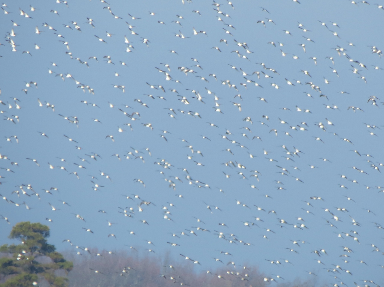
Seemed like there were two flocks of different birds that kept coming over.
Yes, she is tired.
But she perks right back up to finish.

Glades Wildlife Refuge, NJ - Warfle Farm Trail


ABOUT THE PARK:
Glades Wildlife Refuge - Natural Lands Trust

DIRECTIONS:
GPS Coordinates for Warfle Farm Trail - 39.27198, -75.12382
Roadside parking at the trail head.

TRAIL MAP:
Glades Wildlife Refuge Trail Map - Natural Lands Trust


HIKE DISTANCES:
All hikes combined with short drives from one to the other - 8.4 miles
Bald Eagle Trail - 1.6 miles
Maple Street Trail - 4 miles
Warfle Farm Trail .7 miles
Tat Star Tail - 2.1 miles

THE HIKE:
The trail is only .7 mles so not a whole lot to see.
It ends here.
Heading back.

Glades Wildlife Refuge, NJ - Maple Street Trail


ABOUT THE PARK:
Glades Wildlife Refuge - Natural Lands Trust

DIRECTIONS:
GPS Coordinates for Maple Street Trail - 39.26229, -75.12364
No parking lot but room off of the side of the road.

TRAIL MAP:
Glades Wildlife Refuge Trail Map - Natural Lands Trust


HIKE DISTANCES:
All hikes combined with short drives from one to the other - 8.4 miles
Bald Eagle Trail - 1.6 miles
Maple Street Trail - 4 miles
Warfle Farm Trail .7 miles
Tat Star Tail - 2.1 miles

THE HIKE:
This trail head has the main information kiosk.
Maps were available but always bring your own just in case!
The start of the trail.
Ruins to the right.
It appears as tough the trail stops here but it does not.
It is just that when they mow the path the mower can't get through here because ...
... there is a creek that you can't see until you get through the overgrowth.
Only saw one trail marker along the way but the trail is easy to follow.
Coming out into a clearing with some views.
Because I become so annoyed at finding helium balloons on every hike I decided to start collecting them and this hike did not disappoint.  This balloon had been shredded by the mower but I picked up enough pieces ...
... to piece it back together at home and find a picture of it online to add to my collection.  (I now have 4 balloons from the last 4 hikes in a row.  My quest continues...)
Poor turtle :( 
I had intended to come out on Gandy Road and walk to the Maple Street Viewing Area but ...
... I misjudged and thought this might be it so I turned right...
... and there was parking before this gate so I continued on.
And on.
And on.
Only to find hunting blinds EVERYWHERE!  But thank goodness it was a Sunday and there was nobody else around.  I am pretty sure I had left Glades Wildlife Refuge since I no longer saw boundary signs and I must have been in a WMA although there is none indicated on the map in this area.
Two ducks were happily swimming and I got them just as they took off.  One doesn't hang around in a WMA when humans are present :(
But it was a gorgeous day and we walked along for a while before heading back.
Exiting at the gate we continued straight to the stop sign and turned right.  That is Maple Street.
Walking along Maple Street to the viewing point with very light traffic this time of year.  The entire time only 2 cars passed.
Views from the Maple Street Viewing Area.
Not fond of road walks but heading all the way back to the car along Maple Street.
Almost there.