

ABOUT THE PARK:
Pequannock Watershed - City of Newark
Highlands Trail Guide - NYNJ Trail Conference
PERMIT REQUIRED FOR HIKING IN THE PEQUANNOCK WATERSHED.
See THIS hike for permit details.
DIRECTIONS:
GPS Coordinates 41.080871, -74.492434
 |
| Large parking lot at Route 23 and Canistear Ave. I had only seen two cars in this lot in the afternoon driving by the weekend prior. Requiring a permit makes for lightly used parking lots and trails. |
TRAIL MAP:
North Jersey Trails Map 116 - NYNJ Trail Conference
There is a map without elevation contours in the brochure which is given with the permit and car sticker.
Powered by Wikiloc
HIKE DISTANCE: 10.7 miles
THE HIKE:
 |
| Exit the parking lot. turn right on Canistear Road ... |
 |
| ... and immediately go under the one lane underpass. |
 |
| Immediately after going through the underpass, right into the woods. |
 |
| It will be the Highlands Trail for most of this hike. |


 |
| Little red efts everywhere. |

 |
| There are short sections of rocky trail ... |
 |
| ... but for the most part it's pretty smooth. |

 |
| Crossing a woods road where we would be accidentally coming from the left on the return route. |

 |
| Descending to a creek crossing. |
 |
| This was tricky so Brodie had to find his own way not tethered to me. He has been really good about waiting for me on the other side. I had a log to walk on and another as a handrail and that worked very well. |
 |
| But take one last look back at that "bridge" because it would look different on the return route. |
 |
| Just before Dunker Pond the trail goes up steeply to the right but we kept straight for a bit to get a better look. |
 |
| Dunker Pond |
 |
| Climbing up to the top ... |
 |
| ... to a bench for another view. |

 |
| The trail continues along Dunker Pond with some wet sections here and there. |
 |
| Heading away from Dunker Pond, lots of old stone walls. |
 |
| The trail turns right briefly on a woods road before leaving left. We would be coming in from the right on this woods road later. |


 |
| Coming up over a rise with Clinton Reservoir ahead. |
 |
| The Highlands Trail turns left joining in with yellow coming from the right. |

 |
| Clinton Reservoir |


 |
| On my old 2009 map the yellow trail used to be a white trail so there are still some white blazes visible. |


 |
| Veery |

 |
| Where Clinton Reservoir ends and Buckabear Pond begins, old white blazes show a right turn that no longer exists. That flooded out years ago and is no longer a trail. |
 |
| Buckabear Pond |


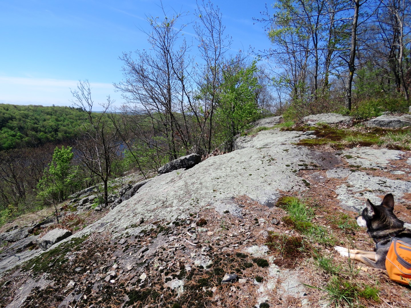 |
| At a rock slab above Buckabear Pond, a break ... |
 |
| ... at the overlook before heading back. |


 |
| Red-eyed Vireo |

 |
| Buckabear Pond with beaver lodges. |
 |
| Coming back up on Clinton Reservoir. |
 |
| While taking this picture I noticed a path on my left ... |
 |
| ... that came out on this rock in the reservoir. |
 |
| While sitting here taking a break ... |
 |
| ... a Baltimore Oriole flew into the tree not even 5 feet from us chatting up a storm. |
 |
| I read later that it was an intruder alert. There must have been a nest nearby. Sorry! |
 |
| Continuing along Clinton Reservoir. |


 |
| Where the Highlands Trail turns right, the way we had come, we stayed left on yellow. |

 |
| Many more nice views along the way on the yellow trail. Only problem is where we had total peace and quite up to now, this trail leads to parking so there is chatter, yelling, music, partying... Ugh. There were people sunbathing down below this rock slab and we has to climb up a hill to get away from a group of about 10 VERY loud people on their way to find a party spot. Of course when I passed where they had parked not a single car had a permit sticker. Nor did they have New Jersey plates. Hope the City of Newark was patrolling and handing out tickets. |
 |
| It was peaceful again once that obnoxious group passed. |


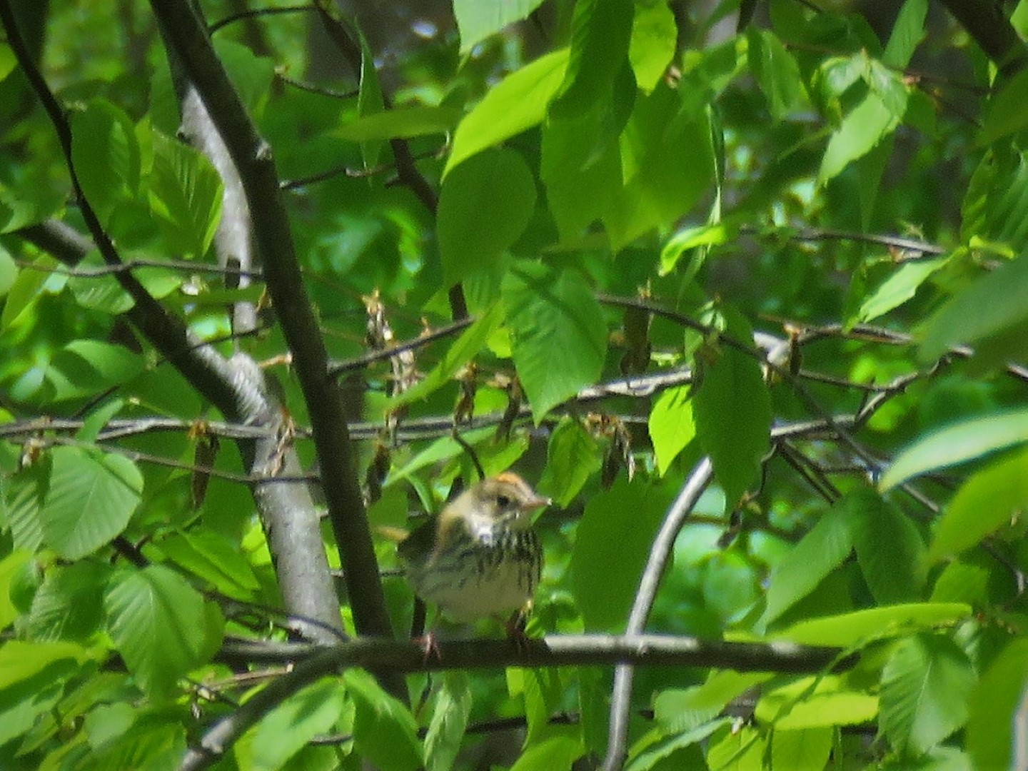 |
| Ovenbird |
 |
| Crossing an earthen dam ... |

 |
| ... then turning right on the road where those cars were parked illegally. |
 |
| Continuing on Schoolhouse Cove Road for a short distance ... |
 |
| ... to right at the T-intersection on a gravel road. |
 |
| Passing parking lot P9 which was empty. |
 |
| Then at the top of the hill, right on the woods road. |
 |
| The Highlands Trail will come in from the right but there are no blazes visible so watch for ... |
 |
| ... the turn blazes on the left. |
 |
| Back to retracing on the Highlands Trail. |

 |
| This is a poor little porcupine frantically trying to become invisible under a rock because Brodie charged him. It was so fast I did not see what happened until the leash yanked and I saw the porcupine run for his life. Bad, bad Brodie. I apologized profusely on his behalf. Someday he is going to try to stick his nose up the wrong porcupine then he'll be one sorry dog. |
 |
| Coming back up on Dunker Pond. |

 |
| We stopped at that bench at the overlook because I heard voices coming our way. We waited until a group of 4 hikers passed, the only other hikers we had seen all day. |
 |
| Heading back down to that log bridge crossing. |
 |
| Uh oh. What the heck happened? The part you walk on - broken! |
 |
| I did run into one of those 4 hikers I had passed at the end of the hike and I asked him about it. He sheepishly said that yes, the other man in their group had "tested" the log to see if it would hold and well, it didn't. So maybe I was just lucky I made it across the first time. |
 |
| Coming up around the other side of Dunker Pond I realized I had missed a left turn and was no longer on the Highlands Trail. Figured I would go with it hoping I would end up on that first woods road that had crossed over. |
 |
| We just kept following woods roads to the left up the hill ... |
 |
| ... and indeed, ran right into the Highlands Trail crossing over. |

 |
| Descending steeply ... |
 |
| ... to Canistear Road ... |
 |
| ... under the overpass ... |
 |
| ... and back to the parking lot where there was only one other car belonging to those hikers I had encountered. |
 |
| This must have been an exhausting hike because he didn't even make it out of the parking lot. |
Beautiful place and beautiful photos. Thank you.
ReplyDeleteThanks, Bill. Hope you and the "kids" are well.
Delete