Wednesday, March 14, 2012

Rockaway River Wildlife Management Area, NJ - Beaver Brook Trail


ABOUT THE PARK:
The Beaver Brook Trail - Morris Trails Partnership (scroll down to bottom of page 1)

DIRECTIONS:
GPS Coordinates 40.955402, -74.570797

View Larger Map


TRAIL MAP:
Jersey Highlands Trails Map #126 - NY/NJ Trail Conference

HIKE DISTANCE:
Entire Beaver Brook Trail with some side trails - 9.25 miles
To Lost Lake and back - 6 to 6.5 miles depending on how far you go around the lake

THE HIKE:
The sun rising over Green Pond Mountain to the east.
The moon was still visible.
Beaver Brook Trail
Valley View Vista
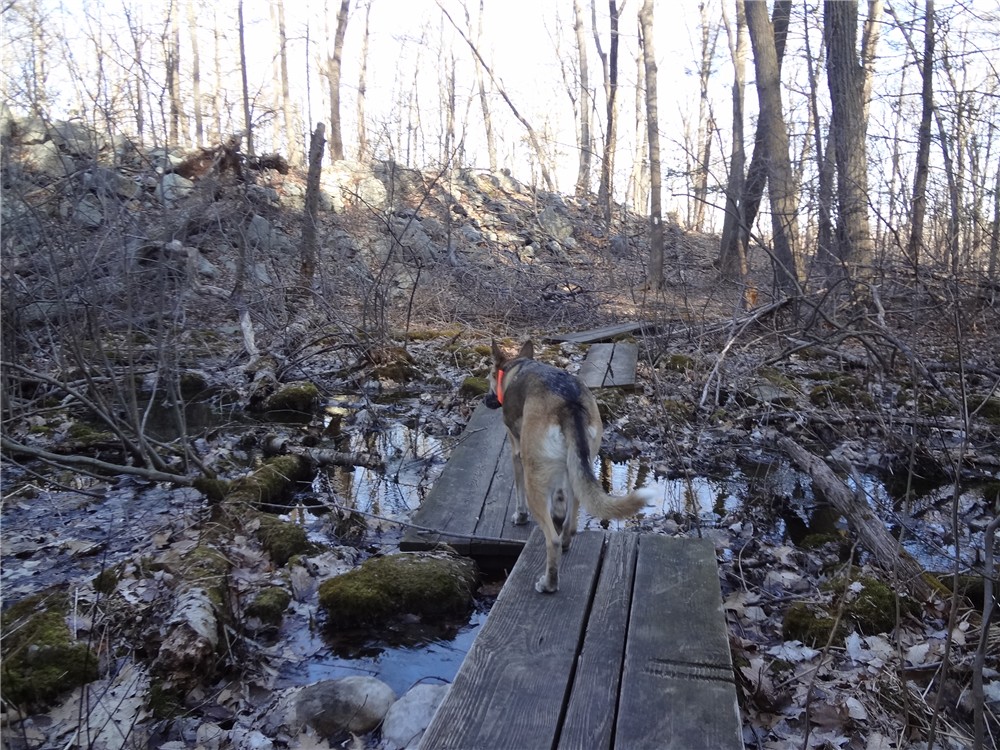
Creek crossing in power cut.
Lost Lake
A tufted titmouse at Lost Lake
A wood duck in Lost Lake
Beaver lodges in Lost Lake.
Leave the yellow trail to the left on an unmarked trail where the turn blaze is painted over.
The unmarked trail is very well defined and painted over blazes can still be followed.
View to the south on return route.
Turkey Vulture
Eastern Bluebird


HIKE SUMMARY:
[  0.00]  With your back to Berkshire Valley Road, turn left to the start of the white-blazed Beaver Brook Trail
[  0.55]  View south
[  1.25]  Rock hop over creek
[  1.35]  Rock hop over creek
[  1.50]  Valley View Lookout at cairn on rock slab
[  1.90]  Rock hop over a very small creek
[  2.30]  Cross woods road
[  2.45]  Cross over old rock wall
[  2.50]  Cross woods road then pass a large hunter's stand in tree
[  2.60]  Rock hop over creek
[  2.70]  Cross woods road
[  2.75]  Cross power cut and rock hop creek in power cut
[  2.95]  Arrive at Lost Lake
[  3.30]  Turn right on unmarked woods road
[  3.40]  Rock hop over creek
[  3.60]  Rock hop through swamp over woods road
[  3.80]  Keep straight when the white-blazed Beaver Brook Trail crosses over at cairns
[  3.95]  At intersection entering Mahlon Dickerson Reservation turn right on yellow
[  4.10]  Cross white-blazed Beaver Brook Trail at kiosk staying on yellow
[  4.40]  Turn left on unmarked trail (blazes grayed out)
[  4.60]  At the intersection with the teal Highlands Trail, turn left on the beginning of the white-blazed Beaver Brook Trail
[  5.00]  Cross over yellow trail at the kiosk
[  5.40]  Cross woods road at cairns
[  5.85]  Cross over woods road with Lost Lake straight ahead
[  6.45]  Rock hop creek in power cut
[  6.50]  Cross woods road
[  6.60]  Rock hop over creek
[  6.70]  Pass hunter's blind in tree then cross woods road
[  6.75]  Cross over old rock wall
[  6.90]  Cross woods road
[  7.70]  Valley View Lookout at cairn on rock slab
[  7.90]  Rock hop over creek
[  8.00]  Rock hop over creek
[  8.70]  View south
[  9.25]  Back at parking lot

Sunday, March 11, 2012

Appalachian Trail NJ: Pochuck Mountain to Wallkill River National Wildlife Refuge


ABOUT THIS PARK:
Appalachian Trail - NY/NJ Trail Conference
Wallkill River National Wildlife Refuge - US Fish and Wildlife Services

DIRECTIONS:
Appalachian Trail Parking on Route 565
GPS Coordinates 41.249825,-74.497962

View Larger Map
Pull-out parking for 2-3 cars

TRAIL MAPS:
Appalachian Trail Guide to New York-New Jersey - NY/NJ Trail Conference
Wallkill River NWR Brochure - US Fish and Wildlife Services

APPALACHIAN TRAIL SECTION HIKING:
TrailHeadFinder.com - AT section miles 1335.9 to 1330.8

HIKE DISTANCE:
9.7 miles total out and back if not hiking with a dog
10.2 miles total out and back if hiking with a dog
Can be done as a 5.25 mile shuttle hike by spotting a car at Wallkill River NWR (41.283434, -74.526079)

THE HIKE:
The Appalachian Trail on Pochuck Mountain.
Partial views from one of the Pochuck Mountain summits (apparently there are several summits).
You will encounter several swamp crossings on boards.
Almost 2 miles into the hike, open views of the Wallkill Valley and High Point Monument in the distance.
High Point Monument

An almost continuous .4 mile section of boardwalk over swamps just before entering Wallkill River National Wildlife Refuge.
Entering the Wallkill River National Wildlife Refuge.
There is conflicting information regarding the dog policy online but this is what the sign says.  The fact that dogs are allowed at all on a portion of this trail is probably due to Appalachian Trail thru-hikers with dogs so please, leash your dog while here!  This area is a quiet haven for birds.
Being a model canine citizen and not disturbing the birds.
Looking back across Liberty Marsh towards Pochuck Mountain.
Taking a break where the AT leaves Wallkill River NWR and heads back across Pochuck Mountain.

HIKE SUMMARY:
[0.00]    Route 565 pullout parking; head south on white-blazed Appalachian Trail (same side of road as parking)
[0.10]    Cross wooden bridge over stream
[0.35]    Pass through red cedars
[0.40]    Cross swampy area on boards then rock hop over stream
[0.60]    Cross dirt road
[0.90]    Cross swampy area on boards 
[1.15]    One of the summits of Pochuck Mountain; side trail on right to limited views
[1.35]    Cross dirt road
[1.85]    Overlook of Wallkill Valley and High Point
[2.15]    Cross woods road
[2.45]    Summit of western ridge of Pochuck Mtn; begin to descend
[2.65]    Blue blazed side trail to Pochuck Mountain Shelter
[3.10]    Cross open field on hillside
[3.20]    Cross paved Lake Wallkill Rd, turn right on road then left into woods
[3.30]    Cross swamp on boards for next .4 miles
[3.70]    Left on Liberty Loop Trail into Wallkill NWR and around Liberty Marsh
[5.10]    At Oil City Road, retrace back to start of hike (can finish Liberty Loop back to AT if not hiking with a dog)

Wednesday, March 7, 2012

Appalachian Trail PA - Totts Gap to Wolf Rocks


ABOUT THE PARK:
Appalachian Trail in Pennsylvania - Keystone Trails Association

DIRECTIONS:
GPS Coordinates 40.9508, -75.1639

View Larger Map

Looking back at Totts Gap Road after starting hike on gravel road beyond gate - driving in on Totts Gap Road, parking is on the right before the gate.

TRAIL MAPS:
PA Appalachian Trail Map Sec. 1-6: Delaware Water Gap to Swatara Gap - Keystone Trails Association

HIKE DISTANCE:  8.5 miles

APPALACHIAN TRAIL SECTION HIKING:
TrailHeadFinder.com - AT section miles 1269.2 to 1273.2

THE HIKE:
Totts Gap Road continues beyond gate as a gravel road.  At the top, the white-blazed Appalachian Trail crosses over.
The Appalachian Trail at Totts Gap
At Lunch Rocks Vista views north of the communications tower at Totts Gap, Mount Minsi and Mount Tammany.
Nelson Overlook
Views to the east at Nelson Overlook
A nice section of trail where rocks are moved off to the side.
Kirkridge Shelter
Appalachian Trail kiosk in Fox Gap at Route 191.
Crossing over Route 191 to the left of the guardrail.
Sign at Fox Gap
Woods roads almost all the way to Wolf Rocks.
A rock scramble over a jumble of boulders up to Wolf Rocks.
The AT follows the jagged rock slabs jutting out along Wolf Rocks.  You can catch occasional views to the west along these rock slabs but the open view is a short distance ahead.
View to the West at Wolf Rocks.
From the open view at Wolf Rocks, retrace back to Totts Gap.  You can continue on before turning around.  I went out another mile.  The trail descends off of Wolf Rocks then becomes much rockier.
The Appalachian Trail beyond Wolf Rocks - this is why it's called Rocksylvania.
A little patch of snow on a 60 degree day.

HIKE SUMMARY:
[  0.00]  Walk beyond gate and follow the gravel road uphill
[  0.25]  At intersection continue straight on gravel road to top of incline; turn right on white-blazed Appalachian Trail before the gravel road starts to descend
[  0.35]  Cross power cut
[  0.40]  Cross power cut
[  0.95]  View to the west at small clearing on right as AT turns left
[  1.00]  Short side trail on left to Lunch Rocks overlook of Mt. Minsi and Mt. Tammany
[  1.85]  Nelson Overlook at grassy open area
[  2.00]  Blue-blazed side trail on right to Kirkbridge Shelter
[  2.15]  Blue-blazed side trail on right leads back to AT from Kirkbridge Shelter
[  2.25]  Cross power cut
[  2.60]  Kiosk at Fox Gap
[  2.65]  Cross Route 191 and proceed on AT through parking area
[  4.00]  Cross power cut
[  4.20]  Rock scramble up to Wolf Rocks
[  4.25]  Open view at Wolf Rocks; retrace back to Totts Gap

Sunday, March 4, 2012

Pequannock Watershed, NJ: Clinton Reservoir


ABOUT THE PARK:
Pequannock Watershed - Newark Watershed Conservation and Development Corporation

DIRECTIONS:
GPS Coordinates to parking P1:  41.075339,-74.445161

View Larger Map
There are several roadside pullouts near the trail head.  The P1 sign is at the intersection of Clinton Road and Van Orden Road.
IMPORTANT:
A permit is required to hike in the Pequannock Watershed.  Permits must be purchased in person at the Newark Watershed office.  Click here for information on obtaining permits.

TRAIL MAPS:
North Jersey Trails Map #116 - NY/NJ Trail Conference

HIKE DISTANCE:   8.75 miles

THE HIKE:
A lot of ruins along the first blue connector trail.  Hanks Pond in the distance.
Red and white-blazed Fire Tower Ridge Trail.
Second blue connector trail.
Yellow-blazed Fire Tower West Trail.
Yellow Fire Tower West Trail intersects with the white Two Brooks and teal Highlands Trails.
First brook rock hop crossing.
Second brook crossing on split log bridge.
Mossman's Brook
Crossing Mossman's Brook on Clinton Road bridge.
Clinton Reservoir from white-blazed Clinton West Trail
Break time at Clinton Reservoir Overlook.  (She had her snack but snarfed it down too quickly.)
The white-blazed Clinton West Trail ends where the Highlands Trail used to turn left.  This area was flooded out by a beaver dam and has been closed and  rerouted.  You can see painted over teal Highlands Trail blazes all along the Clinton West Trail.  Turn right here on the red-blazed Buckabear Pond Trail.
Buckabear Pond from the white trail and red trail intersection.
Clinton Reservoir from Clinton Road walk.
After 3/4 of a mile road walk on Clinton Road, turn left at P2 on the yellow-blazed trail.


HIKE SUMMARY:
[  0.00]  From the intersection of Clinton Road and Van Orden Road, walk beyond the gate a the start of the white-blazed Hanks East Trail
[  0.20]  When white leaves the woods road to the right and the woods road continues straight, turn left on the blue connector trail a few steps ahead
[  0.45]  Rock hop over creek; blue trail ends uphill short distance ahead; turn right on the red/white blazed Fire Tower Ridge Trail (woods road)
[  0.55]  Straight on red/white when blue/white goes right
[  0.75]  Turn left on blue connector trail (easy to miss - if you end up on field with cairn you missed the turn)
[  1.10]  Right on yellow Fire Tower West Trail when blue ends at T-intersection
[  2.20]  When yellow goes right joining with teal Highlands Trail, turn left on white Two Brooks Trail/teal Highlands Trail
[  2.40]  Rock hop over first brook then two small creeks
[  2.80]  Cross second brook on split log bridge
[  3.25]  At Clinton Road parking P4, go to guardrail, turn left, cross Clinton Road bridge and continue a short distance on Clinton Road
[  3.35]  Turn right off of Clinton Road on teal Highlands Trail
[  3.55]  At top of incline, turn left on white-blazed Clinton West Trail when the teal Highlands Trail continues straight
[  4.60]  View of Clinton Reservoir
[  4.80]  Cross over red-blazed Buckabear Pond Trail
[  5.35]  View of Clinton Reservoir
[  6.15]  When white ends, turn right on red
[  6.45]  Cross over white staying on red
[  6.65]  Red turns left on woods road
[  6.85]  Red ends at P3 parking, turn right on Clinton Road
[  7.60]  Turn left on yellow leaving Clinton Road at P2 parking
[  7.65]  Turn right on blue connector trail
[  8.00]  Turn right on red/white
[  8.20]  Keep straight on red/white when blue/white goes left
[  8.25]  Turn left on blue when red/white continues straight
[  8.30]  Rock hop over creek
[  8.55]  Right on woods road; continue following white on woods road when white comes in from the left
[  8.75]  Back at parking