ABOUT THE PARK:
Rocky Knob/Rock Castle Gorge Trails - Virginia Birding and Wildlife Trails
Rocky Knob Trails - Virtual Blue Ridge
DIRECTIONS:
Where this hike generally starts at the higher elevation of the Blue Ridge Parkway, I wanted to get the steepest climb out of the way first so I started low in the gorge. These directions are for that parking area.
View Larger Map
 |
| Parking for 4 cars on the left (2 on either side) and additional parking to the right all the way to the dead end. |
TRAIL MAP:
Rocky Knob Trails - National Park Service
HIKE DISTANCE:
Everything says this hike is 10.8 miles although I measured it out at 11.3 miles with the first third and last third of the hike jiving with given mileage - something was different along the Blue Ridge Parkway section - the difference is probably from circling around cows and crossing over the Blue Ridge Parkway for views on the other side.
PEAK BAGGING:
Rocky Knob - Peakery.com
Grassy Knoll - Peakery.com
THE HIKE:
 |
| From the parking area, cross the barrier and bridge and continue straight on the fire road. |
 |
| Make a sharp right turn on the green-blazed. Rock Castle Gorge Trail. |
 |
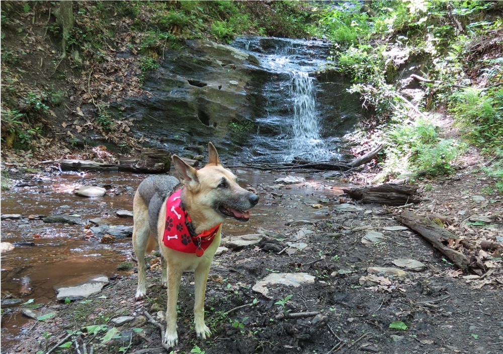
| The trail starts out very easy along the creek through beautiful forests. |
 |
| During mid-May an explosion of wildflowers throughout most of this hike. |
 |
| The trail will start to climb more steeply. |
 |
| And more steeply. |
 |
| After crossing a challenging blowdown (you have to climb over the top of the huge tree trunk that slants down into the gorge so you keep sliding down the trunk while trying to get over it) the trail becomes intensely steep for a bit. After passing a bench on the right, things smooth out and it becomes a stroll in the park. |
 |
| The trail ascends more gently through pastures along the Blue Ridge Parkway. Posts mark the way. |
 |
| An interesting tree growing out of a rock in the mountaintop meadow. |
 |
| There were many cows in the pastures we hiked through. |
 |
| The cow on the right was standing in the middle of the trail and had no intention of moving so we made a wide circle around her and she kept her eye on us. |
 |
| There will be several stiles to cross - some with steps like this... |
 |
| ... and a couple of walk-through stiles |
 |
| The trail traverses The Saddle at the Blue Ridge Parkway. |
 |
| On the opposite side of the Blue Ridge Parkway from The Saddle overlook, Buffalo Mountain. |
 |
| An old shelter from when the Appalachian Trail used to pass this way before being rerouted. |
 |
| View from the old AT shelter. |
 |
| View from Rocky Knob |
 |
| View from the Grassy Knoll |
 |
| Starting the descent back into the gorge. |
 |
| Descending through Catawba Rhododendrom |
 |
| Going down is easier than coming up was. |
 |
| Passing through Bare Rocks. |
 |
| Old fireplace and chimney in the woods. |
 |
| Cascades in Rock Castle Creek |
 |
| The trail becomes an old woods road following along the creek with several bridge crossings. |
 |
| The Austin House, built in 1916, privately owned. |
 |
| Final stretch through a campground. |
 |
| Driving back to the cabin at Fairy Stone State Park I saw a bird sitting in the middle of the highway and she did not fly away when I passed her. There was no traffic so I put on my flashers, backed up, jumped out and scooped her up. I held in my hand the Virginia State Bird. It appeared as though she had been clipped by a car and was dazed. |
 |
| Back at Fairy Stone State Park I was consulting with the park rangers over what to do with her when she started protesting at being held. I opened my hand and she flew away and landed in the parking lot. She would not let the rangers catch her so that was a very good sign that she was coming around. She flew into a fire wood box and we decided that was a good place for her to rest and hopefully take off when she was ready. |
HIKE SUMMARY:
[0.00] From parking cross barrier and bridge, continue straight on fire road
[0.10] Make sharp right turn on to green-blazed Rock Castle Gorge Trail
[0.50] Trail becomes steeper
[1.25] Cross over huge blowdown; trail becomes much steeper
[1.40] Trails levels out some and beyond bench on right becomes very smooth and level
[2.00] Cross two bridges
[2.80] Rock hop over creek
[3.00] Cross fence on stile
[3.15] Rocky Knob Campground on right other side of Blue Ridge Parkway
[3.70] Leave cow pasture via walk through stile
[3.90] Saddle Overlook
[4.00] Keep left at fork - no blazes through this area which goes over Rocky Knob
[4.15] Former Appalachian Trail shelter from before the AT was relocated; continue other side of shelter following ledge when other unmarked trails go right towards the parkway; top of incline is Rocky Knob
[4.40] Green blazes start again
[4.65] Turn left at T-intersection
[5.05] Rock Castle Gorge Overlook
[5.40] Keep left when a trail goes up steps to right
[5.45] Twelve O'Clock Knob; trail now blazed both green and blue
[5.55] Straight on green/blue when unmarked comes in from right
[6.05] Cross fence on stile
[6.40] Grassy Knoll; just beyond bench keep left on green when blue leaves to the right
[7.10] Cross fence on stile
[7.75] Rock hop over creek
[8.30] Trail goes over boulders of Bare Rocks
[8.65] Old chimney on left
[8.70] Cross bridge
[8.75] Turn left on woods road at T-intersection
[9.50] Cross bridge
[9.65] Cross bridge and rock hop creek
[9.90] Austin house, built in 1916 on right (privately owned)
[10.10] Cross bridge
[10.90] Campground
[11.20] Keep straight when Rock Castle Gorge Trail goes left
[11.30] Back at parking