Saturday, September 3, 2011

Jenny Jump State Forest, NJ - Jenny Jump Trail and Ghost Lake


ABOUT THE PARK:
Jenny Jump State Forest - NJ Department of Environmental Protection

Click for Hope, New Jersey Forecast


DIRECTIONS:
GPS Coordinates for Jenny Jump Trail Parking 40.912126, -74.925036

View Larger Map
Keep right at park sign then almost immediately turn right on the gravel drive with picnic tables to the right.
Large parking lot at end of gravel drive.

TRAIL MAPS:
Jenny Jump State Forest Trail Map - NY/NJ Trail Conference

HIKE DISTANCE:
Ghost Lake - 5.40 miles
Jenny Jump Trail to views - 3.2 miles

PEAK BAGGING:
Jenny Jump Mountain #1 - New Jersey 1K Club
Jenny Jump Mountain - Peakery.com

THE HIKE:
From the parking lot, walk back out to the road, turn left, then right at the intersection following the sign to the park office.  Keep right at the fork with the park office on the left.  Pass a couple of cabins and a stone restroom building on the left.  The trailhead for the red-blazed Swamp Trail and yellow blazed Summit Trail is straight ahead.  There is also a parking lot on the right to park at if you want to skip the Jenny Jump Trail portion.

Stay on the yellow Summit Trail and watch for side trails to multiple views along the ridge.
View east of farm fields flooded by Hurricane Irene a week earlier.
View west of the Delaware Water Gap.
At the end of the yellow-blazed Summit Trail, turn right on the turquoise-blazed Ghost Lake Trail.
A side trail on the right leads to a view at an old foundation.
Large blowdown .2 miles from Ghost Lake.  Park has it on their "to do" list (they have cleaned up A LOT of Irene damage over the past week) but you can get around/under the blowdown to the right.
Ghost Lake

From Ghost Lake backtrack on the turquoise-blazed Ghost Lake Trail staying on as the yellow-blazed Summit Trail merges in from the left, all the way to where it ends at a road.  Turn left on the road then right on the white-blazed Orchard Trail.
Orchard Trail
To the right of the Orchard Trail, a pretty field with a view of the Delaware Water Gap.
A blowdown on the Orchard Trail from Hurricane Irene, also on the park's "to do" list.  We were able to climb right through this one so it was not quite as dense as it looks in the picture.
At the end of the Orchard Trail, turn left on the paved road (the road you drove in on), follow to the intersection at the park sign and keep right back to the parking lot.

The blue-blazed Jenny Jump Trail starts at the opposite end of the parking lot.
There were multiple blowdowns on the Jenny Jump Trail from the storm but we were able to get over/under all of them.  I am listing them here as documentation for the Trail Conference as well as to show the damage the storm did in western New Jersey.
Blowdown at .15 mile.
Wet section (passable) at .3 mile
Dangling limb at .55 mile but appears to be hung up on another branch.
Blowdown with blaze at .7 mile.
Blowdown at .75 mile.
Blowdown at .8 mile
At a seasonal view at 1.25 miles a map shows where you are.
Blowdown at 1.3 miles.
At 1.55 miles take the right fork which is a short side trail to a view.
Large rotten log blowdown across side trail to view - a little tricky to climb over because it is mushy but it's doable.
End of side trail at view.
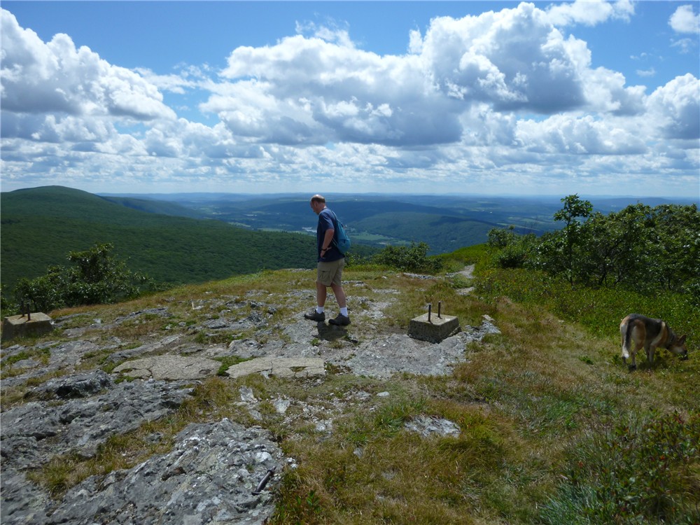
View of the Delaware Water Gap.
From the view side trail you can continue right on the Jenny Jump Trail but we turned left and headed back to the parking lot.

You might want to check if these people have produce for sale.  Make a right out of the parking lot and drive a short distance up the hill.  It will be on the right.  If there is produce available there should be a table out at the road with a sign.

HIKE SUMMARY:
Ghost Lake:
[  0.00] Walk out of parking lot, turn left on road, then turn right heading towards park office at the park sign; at park office keep right following sign for shelters 1-8 and camp sites 9-11
[  0.20]  Restrooms in stone building on left; trailhead for Summit/Swamp Trails straight ahead; turn left on yellow and red-blazed Summit/Swamp Trails
[  0.35]  At fork keep left (blazes do not indicate which fork to take); short distance ahead turn right on yellow Summit Trail when red Swamp Trail goes left
[  0.50]  At fork keep right on short side trail to view
[  0.65]  Short side trail on right to view and another shortly after
[  0.90]  View to left
[  0.95]  Keep straight on Summit Trail when Spring Trail crosses over
[  1.35]  Right on turquoise-blazed Ghost Lake Trail when Summit Trail ends
[  1.90]  Woods road to right goes to view at old foundation
[  2.60]  Ghost Lake
[  3.00]  Back track on Ghost Lake Trail after exploring Ghost Lake
[  3.60]  Woods road to left goes to view at old foundation
[  4.15]  Yellow-blazed Summit Trail joins in from left; keep straight on yellow/turquoise
[  4.40]  Turn left on paved road when yellow/turquoise trail ends
[  4.50]  Turn right on white-blazed Orchard Trail (trailhead sign is on left by a bench)
[  4.65]  Short side trail to right to meadow with view of Delaware Water Gap
[  5.00]  Orchard Trail joins gravel road
[  5.15]  Keep right at the fork
[  5.25]  Orchard Trail ends at paved State Park Road, turn left then keep right at fork at park sign
[  5.40]  Turn right on gravel road at picnic area back to parking lot

Jenny Jump Trail:
[  0.00]  Begin at trailhead at the far end of parking lot
[  0.10]  Cross creek
[  0.95]  Cross over woods road
[  1.25]  Seasonal view
[  1.55]  Right at fork on side trail to view; retrace
[  1.85]  Seasonal view
[  2.15]  Cross over woods road
[  3.00]  At fork keep left on blue when white goes right (white not on map)
[  3.10]  Cross creek
[  3.20]  Back at parking lot

Wednesday, August 24, 2011

Taconic State Park, NY and Mt. Washington State Forest, MA: Alander Mountain to Brace Mountain


ABOUT THE PARKS:
Taconic State Park, NY - New York State Office of Parks and Recreation
Mt. Washington State Forest, MA - Massachusetts DCR
Alander Mountain - Wikipedia
Brace Mountain - Wikipedia
Paragliding and Hang Gliding on Brace Mountain - Mount Brace Outdoor Club

DIRECTIONS:
This is a two car shuttle hike - see notes at bottom***

Leave car #1 at end of hike:
GPS Coordinates for Alander Brook Trail Parking: 42.065784, -73.515586

View Larger Map
Note that the trailhead is not at this parking lot - it is a short distance west around the bend of Undermountain Road on the right.  Although there is space, there are no parking signs at the trailhead.
Signs at the trailhead.

Drive car #2 to the beginning of the hike:
GPS Coordinates for Taconic State Park parking lot: 42.117150, -73.507789

View Larger Map
Pick up the South Taconic Trail to the right of the porta-potties in the parking lot.

TRAIL MAPS:
Mt. Washington State Forest Trail Map - Massachusetts DCR (does not show entire hike)
South Taconic Trails - NY/NJ Trail Conference (does not show car #1 parking)
South Taconic Range Map - Berkshire Natural Resources Council, Inc.

HIKE DISTANCE:  11.2 miles

PEAK BAGGING:
Alander Mountain
Brace Mountain

THE HIKE:
Starting along the path leaving the parking lot to the left of the porta-potties, you will soon see the white blazes of the South Taconic Trail.  Follow to the left towards Bash Bish Brook.  At the T-intersection just before Bash Bish Brook, turn left on the gravel road and proceed over a bridge towards cabins.
The gravel road bridge as seen from the parking lot.
Just before the cabins, the South Taconic Trail enters the woods to the right on a footpath.
The trail ascends steeply but with no rock scrambles.  In just a little over a mile, a short blue-blazed side trail to the left leads to a view:
Click twice to enlarge.
In another .15 mile, arrive at an intersection with a blue-blazed trail, noted as "SIDE TRAIL" on the sign below.  This trail leads to Bash Bish Falls.  We had intended to park car #2 in the Bash Bish Falls parking lot and begin the hike there but were unable to locate the trailhead for this blue-blazed trail.  A hiker we ran into later told us it starts beyond the metal gate to the left of the parking lot - the only place we hadn't looked.
Be sure to turn around at the 3.1 mile point for a view to the north.  On a clear day you should be able to see Mount Greylock, the highest mountain in Massachusetts.
Mt. Greylock in the far center.
In another 10th of a mile, views to the west:

A little farther along arrive at the top of Alander Mountain with great views.
Old fire tower footings at the top of Alander Mountain; Brace Mountain to the left.
Click twice to enlarge.
At 5.1 miles, make note of the red-blazed Robert Brook Trail which goes to the right.  From this point it will be an out-and-back to Brace Mountain as the Robert Brook Trail leads to where car #1 is parked. 

At 6.3 miles the trail splits.  The forks merge back together a short distance ahead but the right fork will bring you to a view.  Be careful when the forks merge back together because a blue-blazed trail also comes in at this point and the blazes are not very obvious. Be sure to stay on the white-blazed trail, coming from the view you would turn right.
You might see paragliders just before reaching Brace Mountain.

 You will catch a glimpse of Mount Brace soon and it looks like a steep climb but amazingly, it is not.  It is actually a very easy .4 mile to the summit and you are there before you know it.
Brace Mountain summit from less than 1/2 mile away.
Brace Mountain Summit
Views from Brace Mountain:
The Hudson Valley and Catskills
Head back the way you came on the South Taconic Trail turning left on the red-blazed Robert Brook Trail.
Pass two different NY/MA state boundary markers.
The Robert Brook Trail descends through pretty forests with a ravine to the left.

HIKE SUMMARY: 
[  0.00]  Pick up white-blazed South Taconic Trail to the right of the porta-potties
[  1.10]  Left on blue side trail to view; retrace
[  1.20]  Continue left on white South Taconic Trail after returning from view
[  1.35]  Stay on white trail when blue-blazed trail goes left
[  3.10]  Turn around for view to the north
[  3.20]  View to the west
[  3.40]  Continue on white-blazed South Taconic Trail at intersection where trails to left go to park headquarters at the top of Alander Mountain
[  4.65]  Keep straight on South Taconic Trail when blue-blazed Alander Loop Trail comes in from the left
[  5.10]  Keep straight on South Taconic Trail when red-blazed Robert Brook Trail goes right
[  6.30]  When trail splits, take the right fork to a view; come out at an intersection with a blue-blazed; keep right on the white-blazed South Taconic Trail
[  7.40]  Summit of Brace Mountain; retrace heading north on South Taconic Trail
[  8.40]  Keep straight when blue-blazed trail goes right
[  9.70]  Turn left on the red-blazed Robert Brook Trail
[  9.90]  Two state line markers
[ 11.05]  At T-intersection Robert Brook Trail ends, turn left on blue-blazed Alander Brook Trail
[ 11.10]  Turn left on paved Undermountain Road and follow around sharp curve
[ 11.20]  Parking area on left

***We had intended to park car #1 at the southern trailhead of the South Taconic Trail here:

View Larger Map
Although I am confident we had the correct spot (across from a house, near the quarry, gravel pullout for parking) we could not find the trail going into the woods, only private property signs and a sign that the land is for sale.  It seems as though the southern trailhead no longer exists so we left the car at the Alander Brook Trail parking area and hiked out and back to Brace Mountain instead of straight through.