Monday, May 30, 2011

Glen Onoko Falls (TRAIL CLOSED AS OF 5/1/2019)/Broad Mountain - Lehigh Gorge State Park and SGL 141, PA


ABOUT THE PARK:
Lehigh Gorge State Park - Pennsylvania Department of Conservation & Natural Resources
Glen Onoko Falls - Pocono Record
The Legend of Glen Onoko - Pennsylvania Haunts and History
Turn Hole Tunnel - Wikipedia
The Pennsylvania Game Commission today announced that most of the Glen Onoko Falls Trail on State Game Lands 141 near Jim Thorpe is closed due to hazardous trail conditions. The 0.4-mile closed portion of the trail runs from the trail head to the Upper Falls.

The Game Commission cites stormwater damage, unstable surfaces and a history of accidents along the trail as factors that prompted closure. Severe injuries and fatalities have occurred over the years despite posted signs warning visitors to be cautious, wear appropriate footwear and avoid dangerous areas near the three major falls.

“Volunteer emergency personnel spend significant time rescuing people that hike the Glen Onoko Falls Trail,” said Game Commission NE Region Land Management Group Supervisor Michael Beahm. “A typical rescue for an injured hiker will involve 20 to 25 volunteer first responders and require a minimum of four to six hours.”

Heavy rainfall during the past year changed trail conditions considerably and several areas are washed out below the middle and lower falls. Sections of the trail are now unrecognizable and have become part of the stream channel. Hikers have been using alternate routes around these areas – negatively impacting soils and vegetation.

Signage and physical barriers will warn visitors of the trail closure at the Glen Onoko Falls trailhead and at other appropriate locations.

Other hiking trails in the area remain open, including the Overlook and Shortcut Trails that connect to form a 1.6-mile loop offering a panoramic view of Jim Thorpe. The Upper Falls can be accessed via Overlook Trail.


DIRECTIONS:
GPS coordinates to Glen Onoko Access parking 40.883555, -75.760422


The parking lot above is the last lot just on the other side of the bridge over the Lehigh River with direct access to the Glen Onoko Falls Trail and it fills up quickly.  You will notice many other parking lots on the drive in.  If this lot is full, drive back out to the next lot with available space and walk back on the Lehigh Gorge Rail Trail which runs parallel to the road.

TRAIL MAP:
I have not been able to find any trail maps for this area. I roughly drew in trails for this hike but it is completely unofficial and is by no means accurate, just intended to give an idea of how this hike plays out.
Official maps that do not show hiking trails:
The Lehigh Gorge State Park map will give you an idea of the surrounding area but does not show trail detail for this hike.

HIKE DISTANCE: 5.9 miles

HIKE DESCRIPTION:
As you drive into the last parking lot, just after crossing the bridge, there will be a picnic table on the right with a sign to the Falls Trail and information boards.  Go down the steps at the Falls Trail sign. The maps at the sign are Lehigh Gorge State Park maps which do not show the trails for this hike.

At the bottom of the steps you will see the sign above.  While the trail is indeed steep and treacherous at times, wearing proper hiking shoes that provide good traction on wet rock surfaces, carefully watching your footing and staying away from edges of steep drops is all it takes to navigate safely.  I was worried about how my dog would handle it but she had no problems with the trail at all.  Keep in mind this is an unmaintained trail with inconsistent blazing and lots of erosion.  At times you will be walking on stone steps, remnants of stairways built into the mountain at the turn of the 20th century by a hotel/resort which was destroyed by fire in 1911.

Turn right at the sign, go under the railroad tracks, turn right taking the trail parallel to the tracks until it turns sharply left leading away from the tracks.  The trail starts out deceivingly smooth and easy:
You will notice a variety of trail markings, where they exist.  There are many orange blazes that have been blacked out - do follow those anyway. The trail is obvious and the arrows do help so be sure to watch for them.  I read that the trail crosses the creek several times.  I did not find this to be the case at all as I was on the same side of the creek throughout entire hike.  In fact, it seems kind of dangerous to be crossing over.
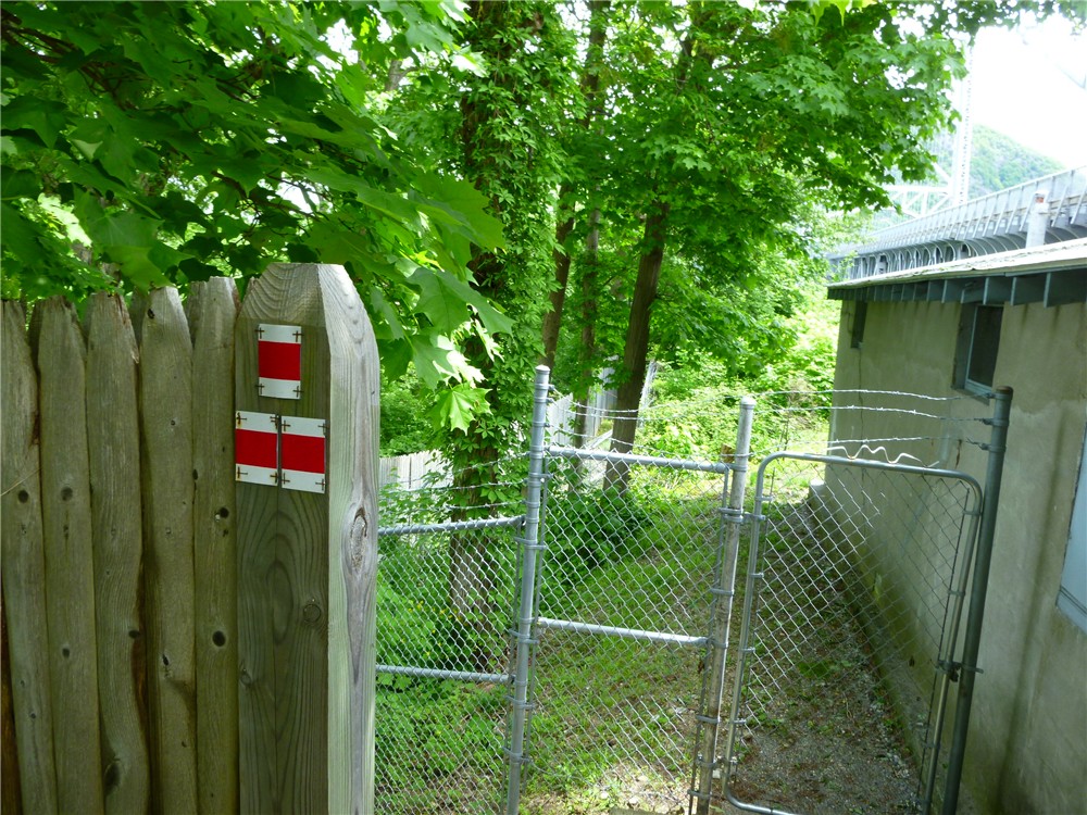
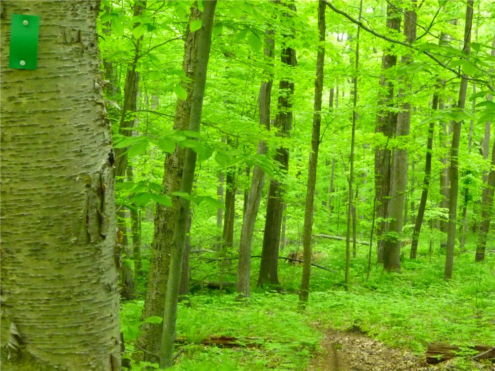
Various types of trail markers.
The trail becomes rockier as it follows next to the falls.
Remnants of old stone steps.
Eroded trail section.
Chameleon Falls
Looking down from the top of Chameleon Falls - better view on clear days
You can stand behind these falls - orange "UNDER" with arrow painted on rock directs you to behind the falls.
Upon reaching the fire ring at the top of the falls, turn right and follow the trail up stone steps along large rock formations.  This foot path follows the rim of Broad Mountain to views.  At the first view below, make note of a trail that makes a sharp right heading down the mountain. This will be the return route.
First view of the Borough of Jim Thorpe with mountains in the background on a hazy day.
Second view of Lehigh River at end of foot trail along Broad Mountain rim.
Woods road through State Game Lands 141 popular for mountain biking.
Power Cut
Oxbow Bend view reached by side trail on right just beyond the pipeline.
View of the Lehigh Gorge Rail Trail from above.
For this hike, the Oxbow Bend view is the turnaround point.  The hike can be made much longer by continuing on the woods roads to form a loop but you might find the woods roads boring after having already experienced the best part of this hike so why not revisit the views on the way back? Returning to the first view of the Borough of Jim Thorpe, take the trail that bends sharply to the right to descend from Broad Mountain.  You will notice many more stone step remnants as will as old stone wall ruins.
Eastern Milk Snake on Trail
After rejoining the Falls Trail from the beginning of the hike, go under the railroad tracks and continue a short distance ahead along the river to see the opening of the Turn Hole Tunnel.
To enter this tunnel go back up the steps to the parking lot, turn left and cross over the bridge you drove in on.
 A short distance ahead, turn left into the first gravel parking lot.  Walk through that end of the lot to a wide trail on the left which brings you to the tunnel entrance.  It is very dark - step carefully over old railroad ties still in place.
Inside dark tunnel.
View from tunnel opening.

LITTER REPORT:
Please take a piece of carelessly discarded litter out with you.  This is what my dog packed out in her backpack so you won't have to look at it.


HIKE SUMMARY:
THE FALLS TRAIL IS CLOSED AS OF MAY 1, 2019
[  0.00]  Follow Falls Trail sign down steps; turn right at warning sign, go under railroad tracks; turn right parallel to railroad tracks; follow trail to left away from railroad tracks at top of hill
[  0.15]  At fork turn left up stone steps (trail on right is return route); left at T intersection top of stone steps
[  0.25]  Follow large blue arrow on tree as trail reaches the waterfalls
[  0.45]  Orange tape shows to follow badly eroded section, can be bypassed to the right;
[  0.50]  Chameleon Falls (wall of water coming straight down); trail veers right away from falls
[  0.55]  Top of Chameleon Falls - blue arrow says to cross over falls - no not cross, follow orange arrow straight to stay on same side; go up steps; continue following blacked out orange blazes
[  0.60]  Arrow pointing left indicates "Under" to go behind falls; retrace and take right fork with arrow to "Top"
[  0.65]  Top of falls at "You Made It" painted on rock; continuing straight, stream forks, take trail to right of the smaller right fork of the stream following blacked out orange blazes
[  0.70]  At fire ring turn right and go up stone steps to the right of large rock formations***
[  1.00]  View at right down stone steps; make note of trail veering sharply right for return route but go back up stone steps to continue on unmarked foot trail along mountain rim
[  1.05]  Left at fork
[  1.40]  Continue straight over rock field; trail continues on other side
[  1.60]  Right at fire pit to view; retrace and continue straight past fire pit on rock/gravel road
[  1.75]  At grassy intersection, turn right on woods road; blue blazes painted on trees
[  2.00]  Rock hop to left over small stream
[  2.20]  Cross power cut; stay on woods road with blue blazes go right
[  2.40]  Follow woods road to left when narrower path goes straight (path goes to limited views blocked by foliage)
[  2.55]  Cross petroleum pipeline (sign on right)
[  2.60]  Turn right on trail shortly after crossing pipeline; keep left at split
[  2.70]  View of Oxbow Bend; retrace
[  2.80]  Left on woods road
[  2.85]  Cross petroleum pipeline
[  3.00]  Follow woods road to right when trail to limited views goes to left
[  3.10]  Stay on woods road when blue blazes go to left
[  3.25]  Cross power cut; blue blazes along woods road
[  3.45]  Rock hop to right over small stream
[  3.65]  At grassy intersection, turn left on narrower rocky road leaving woods road
[  3.75]  Back at view beyond fire pit; turn right at fire pit on foot path along rim of mountain
[  4.25]  Keep right at fork
[  4.40]  Go down stone steps to left to view; continue downhill where trail goes sharply to the right - return route noted from earlier in the hike
[  4.75]  At bottom of steps at T intersection turn left (trail coming in from right comes down directly from the top of the falls at the fire ring from what hikers coming down that way told me)
[  5.15]  After going down stone steps and passing wall ruins, left at T intersection, hop over log, turn left at next intersection - this is the Falls Trail where the hike started
[  5.20]  Make sharp right at railroad tracks, follow downhill, turn left under railroad tracks; pass steps up to parking lot to side trails on right for river view; return to parking lot
[  5.40]  Back at parking lot turn left and cross bridge over river
[  5.55]  Left into gravel lot, left to railroad tunnel entrance and continue through tunnel; retrace
[  5.75]  Exit tunnel, right through gravel parking log, right on park road, cross bridge over river
[  5.90]  End at parking lot

*** This picture provided by Anonymous of July 15, 2012 for further clarification of where to go from the fire ring.  Thank you!
Per Anonymous of 7/15/2012:
"After making right and up after fire pit, if you don't see large rock formations and rock steps within 5 minutes (one landmark: two big, almost rectangular rocks standing 4-5 feet apart, a tree right in the middle, but on top of one of the rocks), you are going the wrong way. Retrace to fire pit and try to find these rock formations and steps."

Sunday, May 22, 2011

Bear Mountain State Park, NY - Popolopen Torne over Bear Mountain Bridge to Anthony's Nose


ABOUT THE PARK: 
Bear Mountain State Park - NY State Office of Parks, Recreation and Historic Preservation

DIRECTIONS:
GPS coordinates 41.324232, -74.007425

View Larger Map
There is room for 2-3, maybe 4 cars depending on how people park. Turn into the parking area at the mailbox with number 284.

TRAIL MAP:
Northern Harriman Bear Mountain Trails Map #119 - NY/NJ Trail Conference

HIKE DISTANCE:  9.65 miles
Some shorter versions:
5 miles - Popolopen Torne and Popolopen Gorge Loop - NY/NJ Trail Conference
4.3 miles - Camp Smith Trail to Anthony's Nose - NY/NJ Trail Conference

HIKE DESCRIPTION:

PLEASE NOTE:  TRAILS USED FOR PART OF THIS HIKE WILL BE CLOSED FROM FALL 2011 THROUGH SPRING 2012 AND THE BRIDGE OVER POPOLOPEN CREEK WAS DESTROYED BY HURRICANE IRENE - CLICK HERE FOR MORE INFORMATION

UPDATE:  As of 12/6/2012 a new bridge is in placeCLICK HERE FOR DETAILS. 

The hike starts by crossing Mine Road and ascending Popolopen Torne on the blue-blazed trail.
Bear Mountain Bridge and Anthony's Nose from Popolopen Torne
Tribute to American Soldiers on Popolopen Torne
 The trail descends very steeply into Poplopen Gorge, also known as Hell Hole.
Raging water after 5 days of rain completely drowns out nearby traffic noise.


Red on White Popolopen Gorge Trail Along Popolopen Creek
Appalachian Trail Sign at Bear Mountain Bridge Tollbooths
Crossing Bear Mountain Bridge on the Appalachian Trail
Hudson View from Bear Mountain Bridge
Appalachian Trail Leaves Rt. 9D and Ascends Anthony's Nose
View From First Side Trail on Anthony's Nose
View From Anthony's Nose
View South From Anthony's Nose
After retracing and crossing back over Bear Mountain Bridge, make a sharp right turn just beyond the end of the bridge railing opposite the toll booths and descend on the red on white trail.
Left on the blue line on white trail brings you to the suspension footbridge.

View From Suspension Footbridge
The blue line on white trail ends at Fort Montogomery where you pick up the historic 1777/1779/blue-blazed trails.
A scenic loop around Brooks Lake brings you back to the 1777/1779/blue trail to finish up above along the Popolopen Gorge.

HIKE SUMMARY:
[  0.00]  Cross Mine Road, turn left and walk along Mine Road 50 feet, turn right on blue-blazed trail up stone steps
[  0.60]  American Soldiers Tribute on top of Popolopen Torne
[  0.80]  Cross straight over paved Mine Road and continue under guardrail on blue-blazed trail
[  0.90]  Cross straight over dirt road; after short distance right on 1777/1779/blue-blazed trail parallel to Popolopen Creek
[  1.00]  Trail turns left down rock steps to bridge over Popolopen Creek
[  1.05]  Turn left on red on white-blazed Popolopen Gorge Trail
[  1.80]  Trail turns left before small creek and switchbacks down towards Popolopen Creek
[  2.30]  Clearing to left with view of falls
[  2.45]  Come out at small clearing and veer left towards Route 9W; right on Route 9W, at end of guardrail turn left and carefully cross side street then VERY CAREFULLY cross 9W - traffic zooms FAST here; continue on sidewalk towards traffic circle following around to the left to Bear Mountain Bridge
[  2.70]  Tollbooths on Bear Mountain Bridge; continue across Bridge following white Appalachian Trail blazes
[  3.20]  Veer left on 9D after crossing bridge; stay on left side
[  3.30]  Cross over to right at pedestrian crossing sign
[  3.40]  Turn right into woods where white-blazed A.T. leaves Route 9W at the A.T. sign and kiosk
[  3.75]  Turn right on woods road blue-blazed trail when white goes left; trail register on left after turn
[  4.25]  Side trail to right to views beyond old footings; retrace and continue right on blue trail
[  4.50]  Right to rock outcrop views; retrace and turn left on blue to proceed back to bridge
[  5.10]  Blue trail ends at register, left on white-blazed A.T.
[  5.55]  Left on Route 9W at kiosk, stay on left side of road; cross to other side when shoulder becomes wider where cars are parked
[  6.20]  Other side of bridge opposite toll booths at end of railing, make sharp right down steps on red on white trail
[  6.30]  Left on blue on white trail at NO TRESPASSING sign
[  6.40]  Cross small bridge over creek
[  6.50]  Cross suspension footbridge
[  6.70]  Fort Montgomery; keep to the left through the parking lot, veer left up stone steps on to 1777/1779/blue-blazed trail
[  6.80]  Trail goes under Route 9W
[  6.95]  Turn left on Mine Road briefly then keep straight on trail into woods as Mine Road turns right
[  7.15]  Turn left on Mine Road short distance then turn right as trail leaves Mine Road
[  7.25]  Keep straight on red square on white trail when 1777/1779/blue trails go left over boards; loop around Brooks Lake
[  8.20]  Right on 1777/1779/blue trail when left goes over boards
[  8.40]  Right on Mine Road
[  8.50]  Left on trail just past intersection with Wildwood Ridge Road
[  9.25]  A trail goes sharply to the right but blazes blacked out***;  a little farther along, blue trail leaves to the right up stone steps - have to watch carefully for turn (this is the trail from beginning of the hike}
[  9.45]  Cross gravel road
[  9.55]  Go under guardrail, turn right on Mine Road and follow back to parking area on right
[  9.65]  Arrive back at parking area

*** This might be the other side of the blue trail that comes out in the parking lot.  I did not take it since the blazes were blacked out at the intersection.

Sunday, May 15, 2011

Allamuchy Mountain State Park North, NJ - Cranberry Lake/Highlands Trail Loop


ABOUT THE PARK:  Allamuchy Mountain State Park - Village of Allamuchy

DIRECTIONS:
GPS coordinates 40.955553, -74.736748

View Larger Map
Heading north on Route 206 makes for a very awkward left turn into the parking lot.  A better approach might be to continue just past the parking lot, turn left on North Shore Road, use the gravel pull-out on the right to make a U-turn, turn right on Route 206, then use the right exit lane to smoothly enter the Cranberry Lake park and ride area. 
Park & Ride Lot between Route 206 and Cranberry Lake

TRAIL MAPS:
Jersey Highlands Trails, Trail Map 126 - NY/NJ Trail Conference
Allamuchy Mountain State Park - North - JORBA

HIKE DISTANCE:  9.8 miles

HIKE DESCRIPTION:
Although it does not look like it, the Sussex Branch Trail (a rail trail) goes right through the parking lot between Route 206 and Cranberry lake.  Facing the lake, turn left and walk beyond the barrier at the end of the parking lot.
Continue through the gravel lot of the Cranberry Lake Community Club passing the foot bridge on the right.
At the far end of this parking lot, the trail will become more defined and follow along Cranberry Lake.
The trail crosses a dam, turns left, crosses a paved road then the gravel overflow boat trailer parking lot before "officially" entering Allamuchy Mountain State Park as the Sussex Branch Trail .6 mile into the hike.  (The overflow boat trailer parking lot can also be used for this hike.)
Follow the rail trail about another half mile, then turn right on the blue-blazed Iron Mine Trail just after crossing a bridge.

A short, 1/10ths of a mile unmarked trail connects over to the red-blazed trail.
The red-blazed trail joins up with the more rugged and strenuous teal-blazed Highlands Trail which leads to a rock outcrop overlook with views 4 miles into the hike.

The loop completes by following yellow to white to green then a short section of the Sussex Branch Trail back to the parking lot.

The green trail, named the Waving Willie Trail after a man who waved at commuters on Route 206 for 40 years, terminates behind his house at the Sussex Branch Trail.  Click here for the Weird NJ story of Waving Willie.
Waving Willie sat in front of the white house in the background waving at traffic on Route 206.
Turn right on the Sussex Branch Trail which will run parallel to Route 206 a short distance back to the parking lot.

HIKE SUMMARY:
[  0.00]  Facing Cranberry Lake, turn left and proceed through parking lot, wooden barrier, gravel Cranberry Lake Club parking lot, continue along Cranberry Lake
[  0.35]  Cross dam
[  0.40]  Trail turns left as mowed grass trail
[  0.45]  Cross paved road at Overflow Boat Trailer Parking sign staying on gravel road
[  0.60]  Cross barrier at far end of the overflow boat trailer parking lot; keep straight on Sussex Branch Railtrail
[  1.05]  Immediately after crossing bridge, turn right on the blue-blazed Iron Mine Trail
[  1.35]  At rusty wood chipper, keep straight when unmarked comes in from right (unmarked trail not on map)
[  1.40]  Blue trail turns sharply to left when unmarked comes in from right (unmarked trail not on map)
[  1.50]  Blue trail turns right when unmarked goes straight
[  1.80]  After switchbacks blue trail turns left when unmarked comes in from right, trail straightens out
[  1.90]  Turn right on blue trail when unmarked goes left
[  2.05]  After trail snakes briefly, turn right on unmarked trail at T intersection when blue goes right (shown on map but not as a T intersection)
[  2.10]  Turn left on red-blazed trail when unmarked ends at the red trail
[  2.50]  Teal-blazed Highlands Trail merges in from the left, after 10 steps, turn right on the teal-blazed trail leaving red trail
[  3.10]  Teal trail turns left merging with other side of red loop trail
[  3.20]  Turn right on teal trail leaving the red trail
[  3.25]  Straight on teal as it crosses over yellow/white trail
[  3.90]  Straight on teal as it crosses over yellow trail
[  4.10]  Straight on teal to overlook as unmarked comes in from right; after overlook retrace and turn left on unmarked when teal goes right
[  4.30]  Unmarked trail ends at bend of yellow trail; keep straight/left on yellow trail
[  5.00]  Right on yellow when unmarked comes in from the left
[  5.30]  Left on white when yellow/white goes right
[  5.40]  Left on white when unmarked goes right, shortly thereafter unmarked comes in from left
[  5.50]  Keep right on white when unmarked goes left
[  5.65]  Keep straight on white when unmarked goes left
[  5.85]  Keep left on white at fork when unmarked goes right
[  5.90]  Cross wooden bridge
[  5.95]  Left at fork on white when unmarked goes right
[  6.45]  Left on what as unmarked comes in from right
[  6.60]  Shortly after crossing smooth rock section, right on white when unmarked (with old white circle blaze on tree) comes in from left
[  6.70]  Keep right on white when unmarked trail goes left marked with "Ice Cream Trail" sign
[  6.85]  Keep straight on right when unmarked comes in from right
[  7.00]  At intersection where many trails come together, green goes right but head straight towards tree with white blazes turning left AND green blazes turning right, follow these green blazes to the right
[  7.20]  At the next multi-trail intersection, keep straight turning right on the second to last trail on the right (green marker hard to see from intersection but it is a short distance ahead on tree on left)
[  7.70]  Keep left on green when unmarked goes right; at top of hill keep right on green when unmarked comes in from left
[  7.85]  Keep straight on green when crossing unmarked trail
[  8.60]  Keep left on green when unmarked comes in from right (unmarked trail not on map)
[  8.80]  Keep right on green when umarked comes in from left (trail not well defined at intersection)
[  8.95]  Keep straight on green trail over smooth rock section; at unmarked fork keep left (not on map); at next fork either right over rocks or left around rocks
[  9.10]  Trails merge back together and green markers continue
[  9.55]  Green trail ends as Sussex Branch railtrail; turn right on Sussex Branch trail
[  9.75]  Cross North Shore Road
[  9.80]  Arrive at parking lot