Friday, February 18, 2011

Hartshorne Woods Park, Middletown, NJ


ABOUT THE PARK:  Hartshorne Woods Park - Monmouth County Parks

DIRECTIONS:
Buttermilk Valley Entrance:  GPS Coordinates 40.401525, -74.012600

View Larger Map

TRAIL MAP:  Hartshorne Woods Park Trail Map and Brochure

HIKE DISTANCE:
3 miles - Buttermilk Valley section
6 miles - Buttermilk Valley and Monmouth Hills sections
9 miles - Buttermilk Valley, Monmouth Hills and Rocky Point sections

HIKE DESCRIPTION:
The trails are not blazed but most of the intersections are marked with posts.  Just off the parking lot is a kiosk which was stocked with maps when I was there and a water fountain for both humans and canines.
The green Candlestick Trail starts in this immediate area.  To pick up the blue Laurel Ridge Trail, head towards the porta potty on the right to find the Laurel Ridge Trail just to the left of the porta potty.
Laurel Ridge Trail
The view from the side trail off of the blue square Laurel Ridge trail has limited views in the winter, most likely no view in the summer:
Views are somewhat better at the Rocky Point Trail viewing area:

Black Fish Cove Pier
Black Fish Cove

HIKE SUMMARY:
[  0.00]  Take the blue square Laurel Ridge Trail to the left of the porta potty
[  0.70]  Keep left at the fork where right goes to ranger's residences
[  1.00]  Turn right on green overlook trail
[  1.15]  Overlook with limited view; follow around and loop back to intersection
[  1.30]  Right on blue square to continue on Laurel Ridge Trail
[  2.30]  Right on black diamond Grand Tour Trail
              *** keep left to continue on Laurel Ridge Trail for 3 mile hike ***
[  2.75]  Keep left on black diamond trail; woods road to maintenance area goes right
[  3.20]  At T-intersection turn right staying on black diamond Grand Tour Trail
[  3.50]  Turn left where sign indicates right turn to Hartshorne Road (not on map)
[  3.75]  Turn right at unmarked intersection where black Grand Tour continues to the left
              *** turn left to continue on Grand Tour Trail for approx 6 mile hike ***
[  4.00]  Cross straight over paved trail to black diamond Rocky Point Trail (Command Loop to right on paved trail)
[  4.25]  Cross paved trail to continue on black diamond Rocky Point Trail (Bunker Loop to right on paved trail)
[  4.75]  Turn right and go beyond wooden barrier for side trail to view; return to Rocky Point Trail
[  4.90]  Continue right on Rocky Point Trail
[  5.45]  Cross bridge, turn right on paved trail towards restroom; follow around to steps on right down to Black Fish Cove; leave Black Fish Cove uphill on paved trail to right of steps; turn right to continue on Rocky Point Trail just after fork in paved trail (unmarked)
[  6.00]  Turn right on paved trail to view; backtrack
[  6.15]  Continue to the right on black diamond Rocky Point Trail (unmarked but opposite marker on left)
[  6.75]  Cross over bridge
[  6.95]  Right on paved road and proceed between pillars with sign for authorized vehicles only; green water tank on right (parking lot on left); straight when paved Bunker Loop goes left
[  7.05]  Right on blue square Cuesta Ridge Trail
[  7.25]  Keep straight on Cuesta Ridge Trail where umarked trail goes left
[  8.00]  Turn right on black diamond Grand Tour Trail at intersection with log bench on left; keep left at split with water tower straight ahead (not on map)
[  8.05]  Cross straight over gravel road (not on map)
[  8.15]  Keep left at fork (not on map) then cross gravel road (not on map)
[  8.50]  Turn right on Laurel Ridge (woods road) where sign says Laurel Ridge straight ahead (right will be the other direction of Laurel Ridge but no sign stating that just arrow to parking)
[  9.00]  Arrive back at parking lot

Sunday, February 13, 2011

White Clay Creek State Park, DE and White Clay Creek Preserve, PA


ABOUT THE PARKS:
White Clay Creek State Park, Delaware State Parks
White Clay Creek Preserve, Pennsylvania State Parks

DIRECTIONS:
Delaware Side Parking:
Directions for this hike are from this parking lot (parking fee applies March 1 - November 30)
GPS Coordinates 39.733245, -75.760314

View Larger Map


Pennsylvania Side Parking:
This hike passes by two parking areas on the Pennsylvania side (no parking fees).

Park Office GPS Coordinates 39.746852, -75.774100

View Larger Map

Parking Lot #2 GPS Coordinates  39.749642, -75.771119

View Larger Map 

TRAIL MAPS:
White Clay Creek Preserve Trail Map - Pennsylvania DCNR
White Clay Creek Watershed Trails - Delaware State Parks

HIKE DISTANCE:
These directions offer 3 options:
3.85 miles - from DE along White Clay Creek into PA historical area and back
4.90 miles - same as above with DE Nature Center option
6.70+ miles - same as above with visit to historic Arc Monument at The Wedge

HIKE DESCRIPTION:
The trail blazes/markers do not necessarily correspond with the map so I will try to clarify that in the summary below.  The hike starts to the left of the information board in the Delaware parking lot.  The trail will be marked in blue in various ways with posts or blazes:

After following along a clearing, the trail will join up with White Clay Creek.
The trail crosses into Pennsylvania
The trail continues to follow scenic White Clay Creek.
PA park office with indoor heated restroom open year round.
London Tract Meeting House (1729) with old cemetery.
Back along White Clay Creek.
Continue back into Delaware.
The yellow/blue-blazed Twin Valley Trail goes through fragrant pine forests.
The Arc Monument dated 1892.
Additional hiking on Twin Valley trail not included in directions - see *** below.
Back to the parking lot along the Nature Preserve trail.
HIKE SUMMARY:
  • Trails do not always coincide with names/colors on map.
  • Trail names are, for the most part, not shown on trail markers.
  • Almost every trail marker has the round blue Mason-Dixon Trail emblem so this refers to just more than the Mason-Dixon Trail along White Clay Creek as shown on both maps.
  • The trails along White Clay Creek are consistently marked with blue posts or blazes (Nature Preserve and Creek Road trails on DE map).
  • Where the blue/yellow trail is referenced below, not all intersections are marked, sometimes trail markers have both colors, other times just blue or just yellow, sometimes old faded yellow blazes on trees - referred to as Twin Valley Trail on map in yellow/purple.
[  0.00]  Facing the information board at end of parking lot turn left on blue trail (referred to as red/white Nature Preserve Trail DE on map)
[  0.55]  Post indicating state line
[  0.65]  PA park sign; keep straight on blue-blazed trail
[  1.35]  Turn right over bridge; orange Edwin Leid trail goes straight
[  1.65]  2 mile marker
[  1.75]  Turn left at intersection towards parking lot #2 then left at fork
[  1.85]  At end of trail turn left then immediately right; left on paved road/orange Edwin Leid trail
[  2.25]  Park office with restrooms on right then the historic London Tract Meeting House (1729) with cemetery; left on South Bank Road/orange Edwin Leid trail
[  2.40]  Trail turns left off of paved road just over bridge
[  2.50]  Keep straight on blue trail where bridge is to the left
[  3.20]  DE park sign; at split keep right on blue Pendell Trail (shown as Peltier Road on PA map, red Creek Road on DE map)
     ~ ~ ~ turn left at split to return to parking lot for 3.85 mile hike ~ ~ ~
[  3.30]  State line marker on post indicating green Creek Trail marker but still blue-blazed trail
[  3.60]  Cross over paved Chambers Rock Road
[  4.00]  Keep left on blue-blazed dirt road (still red Creek Road on DE map) beyond barrier where private drive goes right (private drive not on map)
[  4.10]  Keep straight on dirt road when trail goes to left (return route later); Nature Center on right
     ~ ~ ~ turn left on trail opposite Nature Center back to parking lot for 4.9 mile hike ~ ~ ~
[  4.30]  Cross over paved Hopkins Road; turn right up steps into pine forest on unmarked trail shortly after crossing barrier (if you cross the bridge you missed it)
[  4.45]  Turn right at intersection on blue/yellow trail (yellow/purple Twin Valley Trail on DE map); some old yellow blazes on trees
[  4.75]  Arc Monument on right, turn left uphill
[  4.90]  Keep straight at interection on unmarked where blue/yellow goes right
[  5.05]  Arrive at clearing with picnic tables; turn left on unmarked trail
[  5.10]  Turn right on yellow/blue trail where sign indicates trail to left goes to #32
[  5.20]  Trail veers right through stone building ruins
[  5.40]  After crossing over bridge*** then turn left on unmarked trail (some trees have white blazes)
[  5.60]  Turn Left over bridge on wide blue blazed trail along White Clay Creek (red Creek Road on DE map)
[  5.70]  Cross over paved Hopkins Road
[  5.90]  Turn right on trail (referred to as red/white Nature Preserve Trail DE on map) leaving dirt road at Nature Center
[  6.65]  Cross over paved Chambers Rock Road
[  6.70]  Arrive back at parking lot

*** Turn right additional hiking.  I had intended to include a longer loop through this section in the hike summary but because the trails were not well marked I ended up hiking an additional 5 miles with no cohesive way of including it for others to follow. It is certainly worth exploring if you want to and add some miles.

Sunday, February 6, 2011

Brendan T. Byrne State Forest, NJ - Mt. Misery Trail


ABOUT THE PARK:  Brendan T. Byrne State Forest - NJ Division of Parks and Forests

DIRECTIONS:
Pakim Pond picnic area parking lot:
GPS coordinates 39.880188, -74.533664

View Larger Map


TRAIL MAP:  
This park used to be called Lebanon State Forest and the map currently in use is still the Lebanon State Forest Trail Map.  There were trail maps available in the kiosk at the trailhead but that might not always be the case.  I could not find the map online so this is a scan of the Mt. Misery Trail (white-blazed trail) portion.  Click on the image to enlarge.
The yellow trail on the map, which shown as a bike trail, is actually the same as a paved road (Shinns Road) which goes through the park.  This road was plowed and drivable from the park office to Pakim Pond during snow cover, but not plowed much beyond Pakim Pond.  The map made more sense to me once I figured out that the yellow trail, Shinns Road and the paved road I kept crossing over were one and the same. 

HIKE DISTANCE:
The white-blazed Mt. Misery Trail is 8.5 miles but it does not form a complete loop so there is an additional mile of hiking to form a loop of 9.5 miles total.

HIKE DESCRIPTION:
Facing Pakim Pond, go to the far left corner of the parking lot to access the trails.  A short distance ahead, rest rooms are to the right (open in the winter), veer left following white/red/pink trail markers to the split.  Where the pink-blazed Batona Trail goes left, turn right on the white-blazed Mt. Misery Trail.
Pakim Pond
When there was no snow, much of the Mt. Misery trail was covered with pine needles.
White trail along road through densely packed trees.
Old wrecked car along trail.
Trail is marked with plastic posts and white blazes on trees, some new but most old and faded.

I
Cranberry Bogs
White trail follows sand roads through cranberry bogs and reservoirs.


HIKE SUMMARY:
[  0.00]  From the far left corner of parking lot, access white/pink/red trails which will veer left
[  0.15]  Turn right on the white-blazed Mt. Misery Trail at the split where pink goes left; take boardwalk over Pakim Pond
[  0.85]  Trail turns left on to a wider trail
[  1.00]  Trail crosses over wider road with yellow blaze to the left and green blaze to the right (not shown on map)
[  1.10]  Keep straight where unmarked trail goes right - tree has both white and orange blaze
[  1.15]  White trail goes right at plastic post marker; white and orange blaze on tree
[  1.50]  A few steps beyond a green blaze on tree, white trail turns left on foot path
[  1.85]  Turn left at T-intersection (unmarked) just before the paved (orange trail) road
[  2.15]  White trail turns left and joins paved (orange trail) road
[  2.30]  Cross intersection with composting toilet on right; turn white on white trail just beyond intersection
[  2.50]  Right on white trail when unmarked trail goes left (not on map)
[  2.55]  Up and over hill, turn left (no blazes or markers indicating left turn); continue through pit, uphill out of pit then turn right (marked)
[  2.90]  Pass ruins of old car along right side of trail; trail turns right shortly beyond car
[  3.20]  White trail turns right on the paved (orange trail) road
[  3.30]  White trail leaves paved (orange trail) road to the left on foot trail at "Mt. Misery 2 miles" sign
[  3.70]  White trail turns left along paved (orange trail) road
[  3.75]  White trail leaves paved (orange trail) road to the right on a foot path
[  4.30]  Cross woods road (not on map)
[  5.20]  Arrive at Mt. Misery - three white blazes on tree indicate end of trail but this is not the case; cross road, veer to left behind brown house with NO TRESPASSING sign, turn left on white trail (by orange/yellow/blue blaze on tree)
[  5.25]  White goes left where blue/orange go straight (not on map)
[  5.35]  Jog right then left on to wider woods road
[  5.45]  Right at fork (not on map)
[  5.90]  White trail leaves woods road to the right
[  6.40]  Trail turns left at marked T-intersection (not on map) then right
[  6.60]  Cross over paved (orange trail) road
[  6.65]  Veer left as another trail merges in from the right
[  7.05]  Follow white trail through cranberry bogs
[  7.50]  Turn left on white trail at the end of the bog; keep right at split
[  7.65]  Left at split beyond field with electric fence
[  7.70]  Atlantic White Cedar Restoration sign on left
[  7.80]  White trail turns right on woods road
[  8.05]  Cross woods road to other side of brown wooden barrier and continue straight
[  8.50]  End of white-blazed Mt. Misery trail; turn left (not well blazed but will be red trail)
[  9.15]  Keep straight when pink Batona Trail joins the red trail
[  9.50]  Cross road and turn right beyond guardrail; pass Mt. Misery trailhead walking towards restroom building, turn left before restrooms back to parking lot

Monday, January 24, 2011

Estell Manor Park, Atlantic County, NJ


ABOUT THE PARK:  Estelle Manor Park, Atlantic County Recreation and Leisure

DIRECTIONS:
Nature Center parking lot:
GPS Coordinates: 39.396375,-74.743123


View Larger Map

TRAIL MAP:  Estell Manor Park Trail Map
Although the map shows names for all of the trails, names are inconsistently noted throughout the park.  All trails are blazed with the same white metal marker, not distinguished by color.  Be sure to print the map or grab a copy just inside the nature center on the left opposite the rest rooms.

HIKE DISTANCE:  9 miles; network of woods roads and boardwalks allow for various lengths

HIKE DESCRIPTION:
If hiking here during hunting season, be sure to hike on Sundays or call the park in advance to find out if the trails are open as most of the park is closed to hikers when hunting is taking place.

The hiking trails start at the far side of the Nature Center by turning right on a paved trail, heading towards the back of the Nature Center.  A short distance ahead the trail forks, the left fork goes to the 1.8 mile boardwalk, the right fork to the fitness trail.  For this hike take the right fork which leads to an observation deck at Stephen's Pond.
Paved trail next to nature center.
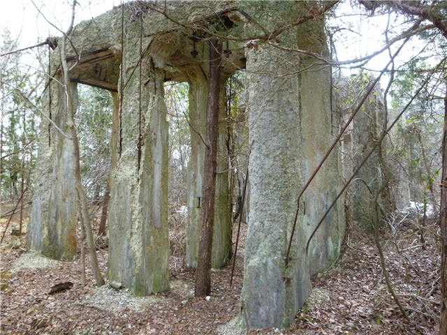
Ruins along trail.
Observation deck at Stephen's Pond.
Stephen's Pond view from observation deck.
The hike then follows a short distance along a fitness trail then out to the less manicured part of the park to a clearing which was the site of an old Native American village, along a field with several bird observation blinds, then to the 1.8 mile boardwalk over swamps.
Side sections of the boardwalk lead to views of the South River.
At the end of the boardwalk, Smith Ireland Cemetery on the left with tombstones dated in the early 1800's...
... and on the right, Artesian well ruins
Old packed sand roads run through the northern section of the park along with mountain bike trails.
This land was the site of a glassworks in the 1800's and later a munitions plant during World War 1.  Ruins and foundations along old sand packed roads are are found throughout the center section.


HIKE SUMMARY:
[  0.00]  Right on paved path at far side of nature center; right at split; right at second split on Pond Trail (unmarked) with pond on right
[  0.30]  Straight on Pond Trail when Laurel Trail goes left (marked); trail comes in from right; picnic area on right; trail veers left over bridge; keep right at intersection other side of bridge
[  0.50]  Keep left at split rail fence where bridge goes to the right and ruins ahead; fitness trail begins (called Exercise Trail on map)
[  0.60]  Right at intersection (Center Trail - unmarked); cross paved park road, proceed straight (sign with trail names as park road intersection)
[  0.75]  Turn left to observation deck at Stephen's Creek; retrace steps
[  0.95]  Cross paved park road; continue straight to right on fitness trail
[  1.55]  Right at intersection on ; cross paved park road; veer left briefly then right on Oak Barrel Tree Road (unmarked) trail
[  1.75]  Turn right at intersection (#23 on tree) on Cribbers Road (unmarked)
[  1.95]  Arrive at clearing of Native American village site; retrace
[  2.20]  Keep straight on Cribbers Road (unmarked) at intersection with Oak Barrel Tree Road (unmarked)
[  2.30]  Go either way at fork - comes back together on same trail
[  2.45]  Cribber's Field on left with bird blinds
[  2.85]  Turn right at intersection on to boardwalk; keep straight at split
[  3.10]  Keep straight on boardwalk when Sand Hole Road (marked) and an unmarked trail go left
[  3.50]  Keep straight when boardwalk splits to left
[  3.55]  Keep straight when Frog Pond Road (marked) goes left
[  3.95]  Right on side trail to South River view (not on map)
[  4.15]  Right on side trail to second South River view (not on map)
[  4.25]  Smith Ireland Cemetery on left (tombstones from early 1800's); back on boardwalk briefly to artesian well on right; walk straight by river access on gravel road; straight by road to right with metal barrier; keep straight on Smokeless Powder Trail (unmarked) when Camping Loop Road (unmarked) turns sharply to the left
[  4.55]  Go straight beyond two posts with wire barrier joining briefly with mountain bike trail
[  4.65]  Right at intersection on Duck Farm Road (marked)
[  4.95]  Keep straight on Duck Farm Road at intersection where North End Trail goes left (marked); at next split go either way - meets back up
[  5.40]  Turn left at intersection with mountain bike trail (turn left where tree has both park and mountain bike blazes); trail will follow between two mountain bike trails.  If you miss turn you will know right away as the trail becomes an obvious mountain bike track
[  5.90]  Left at intersection
[  5.95]  Keep straight as mountain bike trail crosses over; trail is hard packed sand covered with pine needles
[  6.30]  Right on Duck Farm Road at #200 on tree
[  6.60]  Keep straight at intersection
[  6.75]  Cross metal barrier and keep left on woods road, not mountain bike trails
[  6.90]  Cross Artesian Well Road following sign for North End Trail
[  7.00]  Stay on North End Trail through parking lot and beyond barrier
[  7.15]  Left at unmarked intersection on Store House Road
[  7.25]  Straight at unmarked intersection where Rabbit Square Trail comes in from left
[  7.40]  Straight at unmarked intersection where Change House Trail comes in from left; trail becomes swampy
[  7.50]  At t-intersection turn right on marked Oak Ridge Trail; pass ponds on right
[  7.70]  Trail becomes boardwalk; first intersection right on Frog Pond Road, next intersection, left on Crossover Trail (unmarked)
[  7.90]  Straight at unmarked intersection of Eight Inch Road; short distance ahead veer left as unmarked Tin Box Road goes right
[  8.05]  Straight over TNT Road at unmarked intersection
[  8.20]  Keep right at unmarked intersection when unmarked Highbank Trail goes left; few steps ahead left on unmarked Sand Hole Road at yield sign
[  8.35]  Left at intersection briefly then right on boardwalk
[  8.55]  Keep right on boardwalk as unmarked Cribbers Road trail is straight ahead
[  8.70]  Jog right off boardwalk then left back on to boardwalk
[  8.80]  Cross paved park road to continuation of boardwalk
[  9.00]  Arrive at paved trail behind Nature Center and follow to parking lot