Showing posts with label VA Blue Ridge Parkway. Show all posts

Friday, April 29, 2011

Apple Orchard Mountain - Blue Ridge Parkway/Jefferson National Forest, VA


ABOUT THE PARK:  Apple Orchard Mountain - Wikipedia

DIRECTIONS:
GPS Coordinates 37.507866, -79.524040

View Larger Map


TRAIL MAP:  
Apple Orchard Falls and Cornelius Creek Trails Brochure (partial: shows parking to A.T.) - US Forest Service

HIKE DISTANCE:  4.25 miles

HIKE DESCRIPTION:
This hike can be done in conjunction with the Apple Orchard Falls hike but since it was raining pretty hard at the higher elevations on the day I did the falls hike, I saved the mountain for a prettier day.  The mountain hike starts on the Blue Ridge Parkway at the Apple Orchard Falls sign.
Follow the paved trail next to the sign which soon turns veers right into a dirt trail then comes to an intersection with the white-blazed Appalachian Trail, the route to the summit of Apple Orchard Mountain.
FAA Radome at the summit.
Open grassy areas at the summit make for nice break spots with great views.

Continue across on the A.T. and descend about a quarter of a mile to see The Guillotine before heading back:

HIKE SUMMARY:
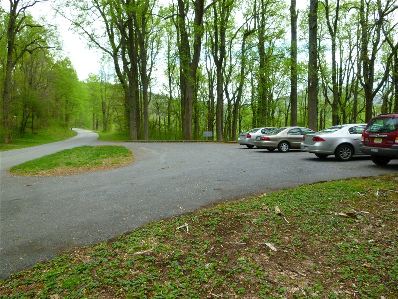
[  0.00]  Start on paved trail at overlook sign in parking lot
[  0.30]  Right on white-blazed Appalachian Trail at intersection
[  0.35]  Cross Parker Gap Road
[  1.85]  Summit of Apple Orchard Mountain; unofficial trails behind summit sign to views; continue on A.T.
[  2.05]  Stone steps descend
[  2.10]  Guillotine; retrace steps
[  2.35]  Back at summit; unofficial trails behind summit sign to views
[  3.90]  Cross Parker Gap Road
[  3.95]  At intersection turn left on Apple Orchard Falls Trail
[  4.25]  Back at parking lot

Flat Top Mountain, Peaks of Otter, Blue Ridge Parkway, VA


ABOUT THE PARK:
Peaks of Otter - National Park Service

DIRECTIONS:
GPS Coordinates for Flat Top Parking: 37.468368, -79.580441

View Larger Map
The Flat Top Trail can also be accessed from it's opposite end to be done in conjunction with the Sharp Top hike.

TRAIL MAP:  Peaks of Otter - National Park Service

HIKE DISTANCE:  5.65 miles

HIKE DESCRIPTION:
Sharp Top (left) and Flat Top (right)
Trail becomes more rugged and switchbacks up.
At 2.1 miles come to an intersection with a trail to Cross Rock.  This trail descends very steeply so remember you have to climb back up.  Other hikers told me it is not worth it so I did not take that trail.  Do look around the intersection for some rocks to scramble up on for views.
Apple Orchard Mountain (with white ball on top) from Cross Rock intersection.
View from Cross Rock intersection.
No views from the actual summit but wander around the maze of trails at the summit and scramble up rocks for views.
Rock scramble to western view.
Western View
Eastern View
Sharp Top from Flat Top
White-spotted Slimy Salamander
Eastern Towhee

HIKE SUMMARY:
[  0.00]  Start Flat Rock Trail from parking lot
[  2.10]  Intersection with trail to Cross Rock; rock scramble to views
[  2.55]  Short side trail to left to rock outcrop with view
[  2.65]  Keep right at multiple intersections to summit sign; right to rock scramble to view
[  2.80]  Explore maze of trails at summit for rock scrambles with views on both sides; start back from summit sign
[  3.15]  Intersection with trail to Cross Rock; rock scramble to views
[  5.65]  Back at parking lot

Tuesday, April 26, 2011

Sharp Top Mountain, Peaks of Otter, Blue Ridge Parkway, VA


ABOUT THE PARK:
Peaks of Otter - National Park Service

DIRECTIONS:
GPS Coordinates 37.443440, -79.609195

View Larger Map
Sharp Top Parking Lot

TRAIL MAP:  Peaks of Otter - National Park Service

HIKE DISTANCE:  3 miles
There are other trails accessible from this parking lot (see map) to make longer hikes and my intention was to hike both Sharp Top and Flat Top together.  Due to the drizzly and foggy conditions at the higher elevation, I saved Flat Top for a clearer day.

HIKE DESCRIPTION:
The Sharp Top Trail starts to the left of the building at the back of the parking lot.
Early on the trail crosses a paved road which is only for the bus which shuttles people to the top.
On this particular day, although the weather was nice driving to this area, Sharp Top was in a cloud and the fog became thicker as I ascended.
Buzzard's Roost supposedly has spectacular views but I did not bother taking that trail since I was pretty sure I heard the "thud, thud, thud" of a bear taking off in that direction and I was sure there would be no views in the fog.

At the summit...
These are the views I saw from the very top:
Click here to see what the views would look like on a clear day.

HIKE SUMMARY:
[  0.00]  Take the Sharp Top Trail up the steps to the left of building at the end of parking lot
[         ]  Buzzard's Roost Trail intersection (forgot to mark mileage)
[  1.40]  Keep left when bus shelter trail goes right
[  1.45]  Keep right at fork
[  1.50]  Summit of Sharp Top; retrace steps
[  3.00]  Arrive back at parking lot