Saturday, August 6, 2011

Fahnestock State Park, NY - School Mountain Road Loop


ABOUT THE PARK:
Clarence Fahnestock Memorial State Park - NY State Office of Parks and Recreation


Click for Carmel, New York Forecast

DIRECTIONS:
GPS Coordinates 41.442292, -73.915487

View Larger Map
There are many parking places along the right side of the road beyond the clearing on the right (one trailhead) opposite the house on the left.  Another way to access the trail is a little farther up the road to the right of the gate at the right of Hubbard Lodge.
First trailhead at open field beyond which parking starts.
Second trail access to the right of the gate and gazebo  next to Hubbard Lodge.
TRAIL MAP:
East Hudson Trails, Trail Map 103 - NY/NJ Trail Conference
Clarence Fahnestock Memorial State Park Trail Map - NY State Parks

HIKE DISTANCE:
12.5 miles
click here for the shorter 7.5 mile Round Hill/East Mountain Loop

PEAK BAGGING:
Round Hill
East Mountain

HIKE DIRECTIONS:
Several of the views are overgrown in the summer so to get the most out of the views, the best time for this hike would be when leaves are down.

Whether you begin at the clearing or at Hubbard lodge, the trails converge at a map.  If starting from the clearing, continue straight on the white/blue trail; if coming from Hubbard Lodge, turn left on the white/blue trail.
Map where trails come together.
School Mountain Road (white) combined with Fahnestock Trail (blue)
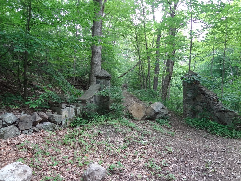
Old pillars just before the blue-blazed Fahnestock Trail leaves the white-blazed School Mountain Road
View south from summit of Round Hill
View from summit of Round Hill (click twice to enlarge)
Blue-blazed Fahnestock Trail
The Fahnestock Trail passes along a pond
Red-blazed Charcoal Burners Trail
View from side trail off of red-blazed Charcoal Burners Trail
View from Charcoal Burners Trail (click twice to enlarge)
Blue-blazed Wiccopee Trail
School Mountain Road is lined with old stone walls
Abandoned house on School Mountain Road
Old, rusty farm equipment on East Mountain Loop Trail
View of South Beacon Mountain from East Mountain
View of Fishkill RIdge from East Mountain

HIKE SUMMARY:
[  0.10]  Trails from clearing and Hubbard Lodge meet at map, continue on white/blue School Mountain Road
[  0.15]  Cross over two steel bridges
[  0.35]  Old stone wall, old stone pillars, cross bridge, turn right on blue as white goes straight
[  1.05]  Partial views at rock outcrop on right
[  1.85]  Views to the south at summit of Round Hill
[  3.65]  Right on blue/yellow when yellow goes left (for 7.5 mile version, turn left here)
[  4.00]  Left on blue when yellow goes right
[  4.25]  Pond on right but no access
[  4.60]  Cross over Clove Creek
[  4.75]  Right on blue at fork when left is unmarked
[  5.50]  Left on red-blazed Charcoal Burners Trail when blue/red goes right
[  6.35]  Side trail to right to view
[  6.45]  At intersection red ends; continue straight on blue-blazed Wiccopee Trail when unmarked goes left
[  7.20]  Left on blue when yellow goes right
[  7.35]  At fork keep right on blue when unmarked comes in from left
[  8.25]  Left on white-blazed School Mountain road when blue ends
[  9.50]  Keep right on white when unmarked comes in from left (not on map)
[  9.75]  Abandoned house on right; turn right on red-blazed East Mountain Loop Trail just beyond the house but before the bridge
[10.55]  Partial views of Fishkill Ridge
[11.25]  Cross wood beam bridge; right on white-blazed School Mountain road; cross another wood beam bridge
[11.80]  Cross steel bridge
[12.10]  Keep straight on white when blue goes left at old stone pillars and steel bridge
[12.30]  Cross steel bridge
[12.35]  Either straight or right at intersection with map
[12.50]  Back at parking

Sunday, July 31, 2011

Wawayanda State Park, NJ - Wawayanda Lake Loop


ABOUT THE PARK:
Wawayanda State Park - NJ Department of Environmental Protection
Click for Highland Lakes, New Jersey Forecast

DIRECTIONS:
GPS Coordinates to parking for about 10 cars, 5 on either side of Warwick Turnpike: 41.201500, -74.391610
(There is no fee to park here - from Memorial Day through Labor Day a fee is charged to use  lots inside the park.)

View Larger Map

TRAIL MAP:
North Jersey Trails Map #116 - NY/NJ Trail Conference
Wawayanda State Park Map - NJ Department of Environmental Protection

HIKE DISTANCE:  12.35 miles

HIKE DESCRIPTION: 
Some of the trails are fairly unattractive woods roads but they are necessary to get to the pretty trails to form a loop.
Appalachian Trail access from parking on Warwick Turnpike.
Appalachian Trail
Parker Lake off of the Appalachian Trail.
Kazmar Pond off of the Appalachian Trail.
1890's Iron Bridge over Double Kill
Iron Mountain Trail
Black Bear Conservation Project Along Iron Mountain Trail
Wawayanda Lake parking lots already packed on Sunday at 8:50 am.  Although this area is very busy, there is lots of solitude on the hiking trails.
Wawayanda Lake
Wawayanda Lake Beach
Pumphouse Trail
Wawayanda Lake from an unmarked woods road off of the Pumphouse Trail.
Cherry Ridge Road
Lake Lookout
Red Dot Trail
Nature Jim's Bridge
Wawayanda Swamp
Double Pond Trail
William Hoeferlin Trail
Wildlife along the trails:
Blue Heron
Dragonfly
Tiny Frog
Turtle climbing on rock (lower left) and Canada geese.
Monarch Butterfly
Swimming Turtle

HIKE SUMMARY:
[  0.00]  Take the white-blazed Appalachian Trail south from the parking area
[  0.20]  Parker Lake on left; keep right at fork
[  0.25]  At 4-way intersection veer left and take center trail, staying on Appalachian Trail
[  0.40]  Keep straight on AT when blue goes right to a shelter
[  0.60]  Cross straight over gravel road
[  0.85]  Cross over woods road
[  1.05]  Kazmar Pond on left
[  1.20]  Left on woods road which is now combined white-blazed AT and blue-blazed Iron Mountain Trail; power cut; cross bridge over Double Kill
[  1.25]  When AT goes right, keep left on blue-blazed Iron Mountain Trail
[  2.25]  Cross over paved park road
[  2.50]  Go through parking lot, turn right just before Wawayanda Lake; turn right to second parking lot, then turn left through lot along fence
[  2.80]  From second lot left on orange Pumphouse Trail; turn right and cross gravel bridge (not wooden bridge by picnic tables)
[  3.40]  Pumphouse Trail leaves woods road to the left on foot trail
[  4.15]  Trail to left not worth taking to lake - overgrown and not well defined
[  4.30]  Woods road to left leads to Wawayanda Lake
[  4.55]  Woods road ends at Wawayanda Lake at old rusty pipes; retrace
[  4.75]  Continue left on orange Pumphouse Trail
[  5.45]  Pumphouse Trail ends, go through gravel lot, left on gravel road
[  5.60]  Left at fork on Cherry Ridge Road when Cabin Trail goes right
[  5.85]  Keep right at fork
[  5.95]  Unmarked trail to right at other end of parking area goes to Lake Lookout but closed summer 2011 due to gas pipeline construction; keep straight on Cherry Ridge Road
[  6.25]  Right on white-blazed Lookout Trail (also goes to Lake Lookout but not posted as closed)
[  6.80]  Lake Lookout (unmarked trail coming in from right is where trail from parking lot comes in had it not been posted as closed); continue left around pond
[  7.00]  At fork with cairn on left, keep straight on woods road when trail goes right
[  7.20]  Lookout Trail ends, left on red-blazed Old Coal Trail (this trail is closed for gas pipeline construction but it is not posted until the end of the trail)
[  7.55]  Old Coal Trail ends, right on Cherry Ridge Road
[  7.70]  Left on red-blazed Red Dot Trail
[  8.10]  Nature Jim's Bridge
[  8.30]  Right at fork when unmarked goes straight (not on map)
[  8.35]  Red Dot Trail goes both left and right - either way merges back together; for this hike, turn left
[  9.00]  At T-intersection turn left when other side of Red Dot Trail comes in from right
[  9.30]  Cross bridge
[  9.40]  Red Dot Trail ends; right on yellow Double Pond Trail
[  9.80]  Left on yellow Double Pond Trail when blue Cedar Swamp Trail goes right
[10.25]  Yellow Double Pond Trail ends, turn left on blue-blazed William Hoeferlin Trail
[11.30]  Keep right on blue William Hoeferlin Trail when Black Eagle Trail goes left
[11.75]  Cross park road with park office on right, head towards maintenance building, turn right through parking lot to other end of lot near park road; left on continuation of blue-blazed William Hoeferlin Trail
[12.00]  At T-intersection, right on white-blazed Appalachian Trail
[12.35]  Back at parking area on Warwick Turnpike