ABOUT THE PARKS:
Macedonia Brook State Park
Pond Mountain Natural Area - no web site found, link gives contact information
TRAIL MAPS:
Macedonia Brook State Park
Pond Mountain Natural Area (large file - map takes a long time to download - copies were in the trail register but that may not always be the case.) The Appalachian Trail is shown incorrectly on this map. It was rerouted from Caleb's Peak to cross over Skiff Mountain Road below the terminus of the Red Gate Trail. The AT no longer runs parallel to Skiff Mountain Road then along Fuller Mountain Road as shown on the map. To reach the Appalachian Trail from the Red Gate Trail you need to turn right on Skiff Mountain Road at the end of the Red Gate Trail and walk along the paved Skiff Mountain Road until you reach the where the Appalachian Trail crosses over, about 0.1 miles away.
DIRECTIONS:
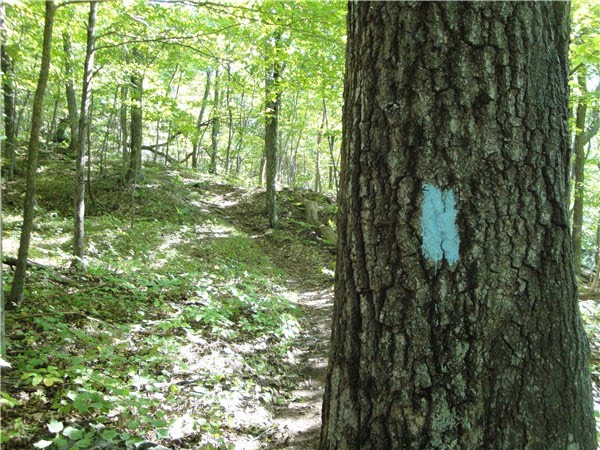
GPS Coordinates: 41.760535,-73.493924
View Larger Map
There is no actual parking lot at the trailhead. You will notice picnic tables along the road with space to park a car at each one. Just before crossing the bridge there is room for about 4 cars on the left. This is the parking area.
HIKE DISTANCE:
11.5 miles to do both parks in one hike. The parks can be hiked together using a paved road to connect. This hike can also be done as two separate hikes or driving from one to the other. The entire blue loop trail around Macedonia Brook State Park is 6.4 miles (I cut off the northern 1.5 mile section to reduce total mileage). The Pond Mountain Natural Area trails total 3.8 miles with the option of an out and back hike to Caleb's Peak on the AT which is about 0.7 miles each way.
HIKE DIRECTIONS:
The first 3 miles of the hike will have some challenging rock scramble sections but it is an absolutely gorgeous area and the views make it well worth the effort. From the parking area walk across the bridge on the gravel road. Immediately after the bridge turn left at the sign for the light blue-blazed trail.
The trail will cross a bridge and then start to climb uphill.
At 0.5 miles you will start to catch glimpses of views to the east. Rock scrambles bring you higher to better views to the east and north.
 |
| View to the east. |
 |
| The Taconics to the north. |
At 1.6 miles the white-blazed Cobble Mountain Trail comes in on the right. Stay left on the light blue-blazed trail as it climbs up a smooth rock surface - watch for blazes painted on the rocks.
The top of the climb brings you to the summit of Cobble Mountain (1350 ft.) with views to the west.
 |
| A little farther along the summit the Catskills come into view. |
The trail starts to descend steeply and will come to a couple of challenging almost vertical downhill sections. A dog will most likely have trouble with this. It took a long time but I was eventually able to get my dog down without having to turn back.
After passing the intersection with the green trail, continue on the light blue trail up a steep rock scramble to more views at the top at 1200 feet elevation.
The most difficult part of the hike is over. The trail will now descend more smoothly and switchback down to a gravel road. At the gravel road turn left and walk towards the paved road. You will see the continuation of the light blue trail on the other side of the road. Take that if you want to do the full light-blue loop. I turned right on the orange trail here to cut that section off since I knew my hike was going to be well over 10 miles without that part.
A short distance ahead to the left of the orange trail is a magnificent stone retaining wall which was built by the Civilian Conservation Corp in the 1930's.
 |
| The retaining wall does not look that impressive in the picture but it is HUGE in real life. |
After turning right and crossing a bridge, the orange trail turns left and goes up a mowed section between campgrounds to meet back up with the light blue-blazed trail.
 |
| Continuation of the blue trail is beyond the logs. |
Turn left on to this section of the light blue trail (shown as light blue/white on the map but there were no white blazes) if you stayed on the blue trail, or walk straight ahead if coming from the orange trail. At 3.2 miles the light blue trail turns right and becomes an easy, smooth foot path.
At 4.0 miles there will be a right turn blaze for the light blue trail just before stone wall remnants. Barely visible beneath the blazes is a dark green blaze. Keep straight on the blue trail to return to the parking lot. To go on to Pond Mountain Natural Area, turn left here on to the green-blazed trail. This trail is pretty much a woods road which is easy to follow but it is obviously not maintained, somewhat overgrown in places, blazes almost impossible to see and you do need to navigate around a few blowdowns. There are many old stone walls throughout this .3 mile trail.
At 4.3 miles arrive at a log barrier at Fuller Mountain Road. Make note of this barrier as it will be the return route later on coming from the opposite direction.
Turn right and walk along Fuller Mountain Road until you reach Pond Mountain Natural area on the left at 5.2 miles. If you were to drive from Macedonia Brook State Park, exit the park, make the first left and the Pond Mountain parking lot would be about 1 mile away on the right at the top of the hill.
Walk straight through the parking lot to the trail register at the white-blazed Entry Trail.
Take the white blazed trail to the intersection of the blue-blazed Pond Trail. Turn right on the blue-blazed trail.
Although you can see Fuller Pond through the trees, the Pond Trail does not actually go up to the pond. A few short unmarked side trails go to the edge of the pond for better views.
 |
| Fuller Pond is a spring-fed glacial lake at an elevation of 909 feet. |
At 5.8 miles turn right on the red-blazed Red Gate Trail. Follow this woods road trail to its terminus at Skiff Mountain Road. Turn right on Skiff Mountain Road and walk about 0.1 miles watching for the Appalachian Trail crossing. Turn left on the white-blazed AT.
After about 0.7 miles of going uphill, arrive at Caleb's Peak which offers outstanding views of Kent, CT and the Housatonic Valley.
Retrace your steps back to Skiff Mountain Road, turn right and walk back up Skiff Mountain Road to the Red Gate Trail on the left. Take the Red Gate Trail to the intersection with the green triangle-blazed Saturday P.M. Trail. Turn right on the Saturday P.M. Trail.
At 8.5 miles (about .3 miles along the Saturday P.M. Trail) turn left on an unmarked trail which brings you to a view of Fuller Pond from up above at 1130 feet.
We found this to be an excellent break spot. With quite a few people in the park in addition to an orienteering meet in progress, there was not another person around at this beautiful and peaceful spot.
Retrace your steps back to the Saturday P.M. trail, turn left and continue on. A short distance ahead at 8.7 miles, cross through three open, mowed fields.
At the end of the third field, keep right into an adjacent field, staying to the left of that field. Come out at an intersection and turn right towards the gate at Fuller Mountain Road.
Turn left on Fuller Mountain Road and follow it uphill then as it curves around sharply to the left. At the far end of the curve as the road starts to straighten and descend, look for the log barrier on the right to enter the woods on the green-blazed trail. You will not see any blazes so use the barrier to know where to turn.
Follow the green trail .3 miles back to the light blue-blazed trail. Turn left on the blue blazed trail. This trail will go along a ridge which offers glimpses through the trees to the right of Cobble Mountain from earlier in the hike. After a sharp turn to the right the trail descends back down to the road and parking area arriving back at the car at 11.5 miles.