

ABOUT THE PARK:
Wharton State Forest - NJ Department of Environmental Protection
Batona Trail Brochure - NJ Department of Environmental Protection
DIRECTIONS:
GPS Coordinates 39.645085, -74.646923
 |
| Batsto Visitor Center Parking Lot |
TRAIL MAP:
Batona Trail Brochure - NJ Department of Environmental Protection
Powered by Wikiloc
HIKE DISTANCE: 12.5 miles (6.25 miles each way)
THE HIKE:
 |
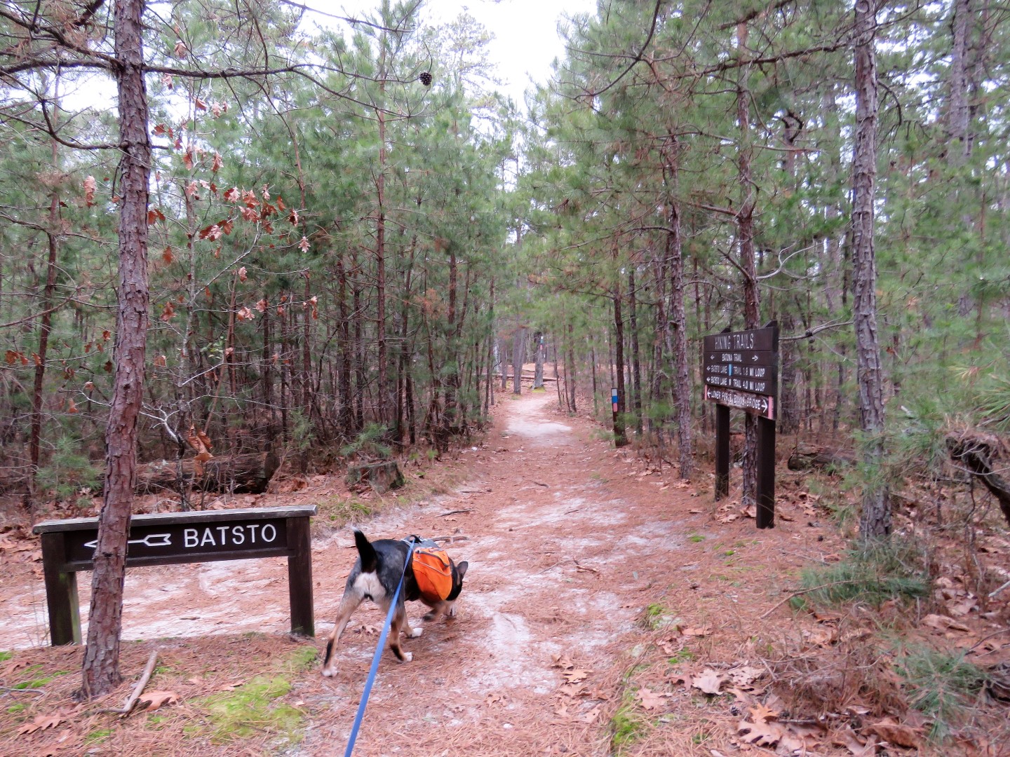
| To reach the Batona Trail, take the connector trail to the right of the building at the far end of the parking lot. |

 |
| At the sign, turn right to head south on the Batona Trail. |


 |
| Crossing Washington Turnpike. |


 |
| A right on Washington Turnpike ... |
 |
| ... for a very short distance ... |
 |
| ... then back into the woods. |


 |
| Where GoogleMaps shows the Batona Trail following named roads, this would be what those roads look like. |
 |
| A quick touch on Tylertown Road before heading back into the woods to the right. |

 |
| Birds were everywhere but were not very cooperative. |


 |
| After mile 16.5 there were several flooded spots but we were able to get around all of them. |

 |
| It took some convincing to get Mr. I-Don't-Like-Wet-Paws Brodie to cross. |
 |
| He eventually did. |


 |
| Side trail to Buttonwood Hill Camp. |


 |
| Crossing Bulltown Road. |


 |
| This bird off to the left ... |
 |
| ... only gave me this side to photograph. |

 |
| At mile marker 13, our turn around point. |

 |
| Taking a break at the 14.5 mile marker. |


 |
| The water crossing went better this time since he knew he would survive. |
 |
| And waaaaaaaay off to the right ... (It was more of a bushwhack to reach it than I realized.) |
 |
| Balloon #4 of the year. |
 |
| A glove that was not there before so I left it in case the owner was coming back that way. |

 |
| Another bird's behind. |


 |
| A left on the connector trail ... |

 |
| ... back to the parking lot. |
Hi Daniela -- back down my way again! Another excellent jaunt on the Batona, I see...one can't go wrong on this excellent trail, I suppose! I was just on this section last March, although I only went up to the Buttonwood Hill Camp turnoff before turning around. I'm guessing all the birds conspired to only give you the "butt shot" photo ops...hee hee hee! Congrats to Brodie for crossing that wet area via the tree branches; I (somehow) didn't have any of those issues last year. Although, I'm thinking that one small bridge you crossed is brand new, because I certainly don't remember that; the bridge I crossed was much "older" (although, it didn't seem to be in danger of breaking or anything.)
ReplyDeleteHey -- if you're ever down to Wharton/Batsto again (and I'm sure you will be; it's just a matter of when), there is another hike you could do; it may be closer to 14 miles round trip, and it may not be quite as exciting, but it still may be worth checking out. Not sure if you've ever heard of a place called Jemima Mount. It's actually a small hill in the middle of the forest, but it's fairly well-known to (unfortunately) ATVs and 4WD vehicles. However, I think I read that gates have been placed in various spots blocking vehicle access to this hill. (If you Google it up and view images, you can see the years' worth of ATVs and 4WD vehicles "climbing" up the hill via deep ruts on the one side of the hill.) I actually rode my bicycle there about 8 years ago (yes, there were spots where the sand was quite soft and I had to walk the bike, I admit! :) ) But all in all, I still think it's worth seeing; I'm sure "Pineys" wouldn't consider a person a "fellow" Piney unless they've visited this site; I'm thinking it may be a rite-of-passage even!
Anyway, if you do decide to give this adventure a whirl, here are some directions:
> Starting at the point where you did the road walk on Washington Turnpike (i.e. part of the Batona)...instead of turning right back into the woods to continue on the Batona, continue straight onto the sand road (which I believe is the continuation of Washington Turnpike.) Follow this for about 1.6 or 1.7 miles till you come to an intersection with another sand road -- note that a couple other sand roads come in from the left and end at WT, but the road you want actually intersects WT.
> Turn left onto the sand road, called Mount Road. (Not sure if there are signs there now; there certainly weren't when I was there, but I think of that hike you did from Carranza Memorial to Quaker Bridge, where roads like Hay Road and Push Line Road were actually labelled.)
> Follow Mount Road for 1.6 miles; you'll cross a sand road which I believe is also named Washington Road.
> Continue straight for another 2.1 miles; at this point, the sand road will have changed names to Devious Mount Road. (Once again, perhaps there are signs now.)
> After 2.1 miles, a sand road will come in from the left (i.e. ending at Devious Mount Road)...this is Jemima Mount Road. Turn left and follow for about 0.3 miles. The road will dead end at a hill...welcome to Jemima Mount!
Anyway, I just wanted to pass this onto you. I'll admit, it's probably not the most exciting scenery (especially since much of the surrounding trees along WT were cut down due to some newly installed firebreaks), but I still think the end result is worth it! (I can just see Brodie enjoying his jerky at the top of Jemima Mount!) :)
Looking forward to your next adventure!
Jim
Thanks, Jim! I will definitely have to stick your directions in my file for when I run out of Batona Trail. I have two more day hike sections to do and I started in 2009 so that might take a while, LOL. Unless, of course, the ice never thaws up north then I will be back sooner rather than later. I was wondering what was down Washington Turnpike when it turned to gravel. On the way back on that road walk part all of these Jeeps were zooming by in that direction on to the gravel part and I got a couple of good lung fulls of Jeep exhaust. ACK! Thanks for the directions!
DeleteI love that area for getting away from snowy NY. Actually we mostly have ice. My pup also doesn't like getting his feet wet at all! I noticed it immediately on our hikes. I'm taking him for some swim lessons at an indoor dog swimming facility, once a week or so. He absolutely hates it! He's had 4 sessions, and his swimming has improved, but his attitude has not. He pretty much sulks and tries to hide the whole time he's there. I'm hoping once it warms up he'll figure out that swimming in ponds is way fun!
ReplyDeleteLOL! When I was a teenager we had a black lab that was terrified of water. I kept taking him to the pond and throwing sticks in inch by inch, a little farther out each day until finally he had to swim for it. All it took was that one time and he was hooked. After that I couldn't walk him past a pond without letting him go in for a swim. There is hope!
DeleteI can't imagine a lab that doesn't like swimming! We shared a swim lesson with an obese lab this week. The dog was there more for exercise I guess - it swam fine. I'm hoping my pup is watching the dogs that actually like to swim, and is learning from them.
ReplyDelete