ABOUT THE PARK:
Monmouth Battlefield State Park - New Jersey Department of Environmental Protection
DIRECTIONS:
GPS Coordinates 40.26307, -74.32105
 |
| Huge parking lot by the visitor's center. The park opens at 8 and I arrived at 7:15. There are some spots for parking before the gate if it is still closed but on this morning the gates were open so I drove on in. |
TRAIL MAP:
Monmouth Battlefield Brochure and Map - New Jersey DEP
HIKE DISTANCE: 8.4 miles
THE HIKE:
 |
| We started on the path around the parking lot, heading in the direction of the park entrance, hoping to get to the red trail. |
 |
| And there it is, just before the park road. |
 |
| Brodie sees something. |
 |
| This would be what he saw. |
 |
| When the other trails starts merging in with red from the right ... |
 |
| The trails are nearing the end. It's only these trails in the vicinity of the visitor's center that are actually marked. |
 |
| Cross over the bridge to the left and nothing is marked even though the map shows different trail colors. |
 |
| We just kept to the left and followed around the fields. |
 |
| Balloon #1 of the day, #7 for the year. |
 |
| A short side trail down to Spotswood Middle Brook. |
 |
| Sleeping orchards across the way. |
 |
| Coming up on Battleview Orchards. |
 |
| Under the railroad tracks ... |
 |
| ... with balloon #2 of the day, #8 of the year. |
 |
| It looks like a trail continues directly across Route 522 but it dead ends. I vaguely remember following that to the dead end with Shawnee 8 years ago. |
 |
| What you are supposed to do is turn right then cross left at the crosswalk. |
 |
| That leads to a wide mowed path with some ruins. |
 |
| There used to be markers. |
 |
| A red-tailed hawk was sitting right there but he flew away before I could get a shot and a bluejay immediately took the hawk's place. How brazen of him. |
 |
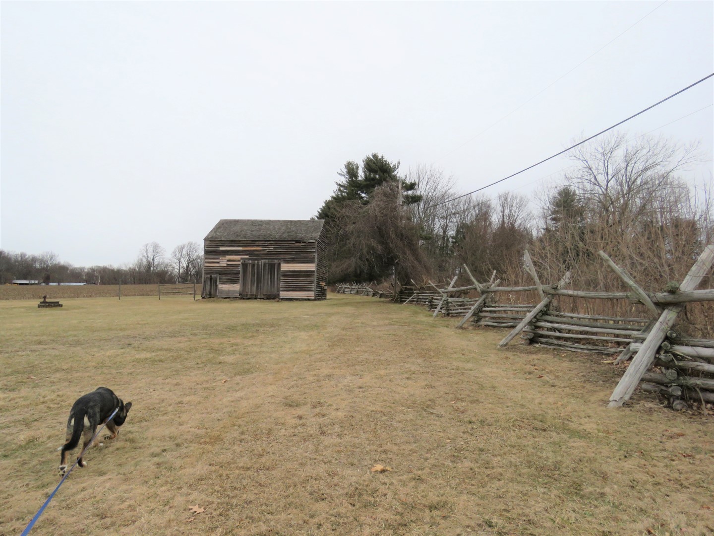
| Craig House |
 |
| Behind the Craig Barn ... |
 |
| ... balloon #3 of the day, #9 of the year. |
 |
| Again following the perimeter of fields. |
 |
| We turned left at this hedgerow instead of doing the entire perimeter because winter slime was on its way and I wanted to be finished before it hit. |
 |
| Conover-Perrine House |
 |
| And we had to come this way to retrieve balloon #4 of the day, #10 of the year. |
 |
| Retracing ... |
 |
| ... back to the crosswalk ... |
 |
| ... and heading back the proper way. |
 |
| Rotten apples everywhere in the orchard. |
 |
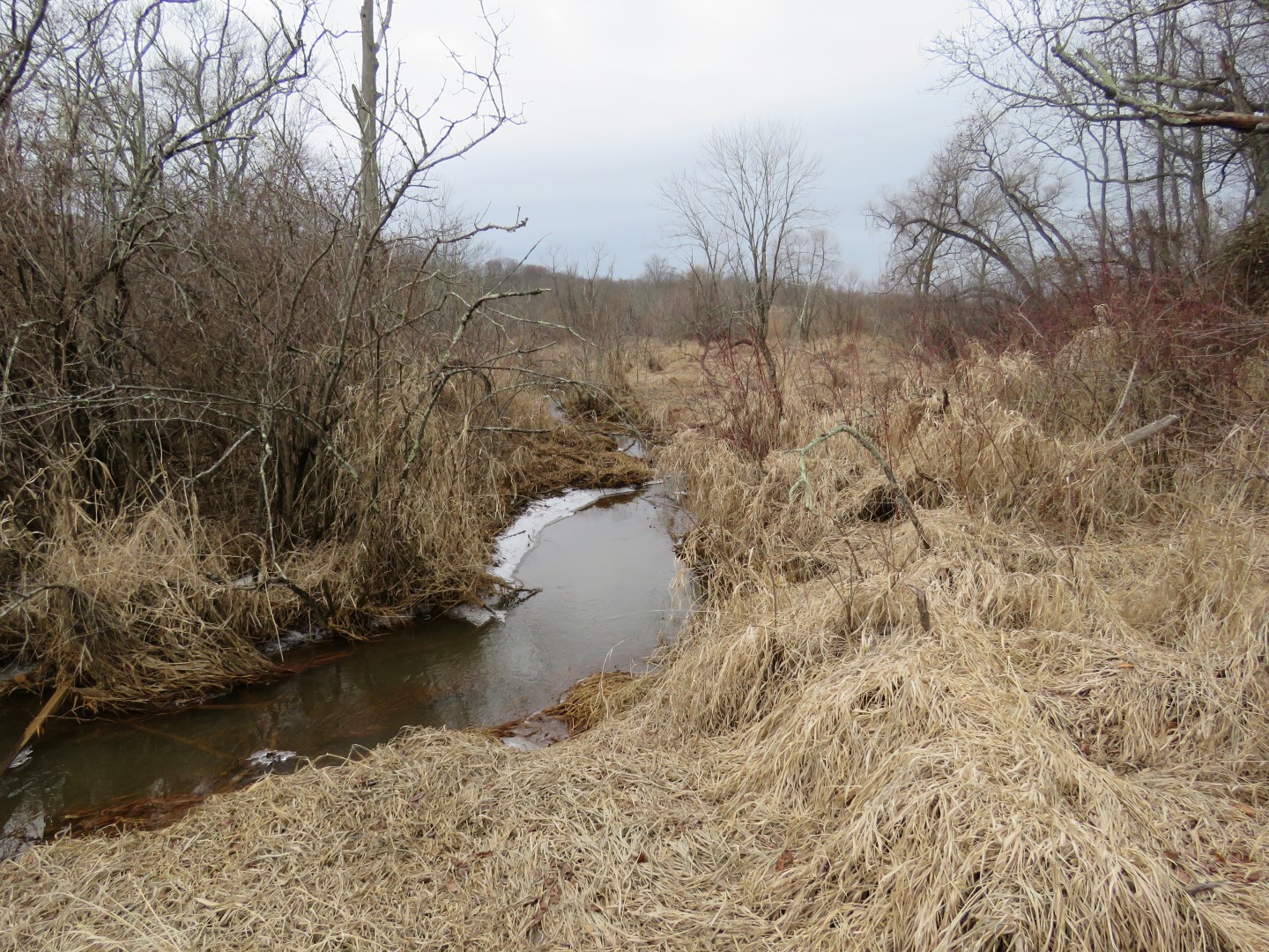
| A different bridge over Spotswood South Brook heading back to the visitor's center. |
 |
| Spotswood South Brook |
 |
| But first, taking the blue trail to the left to loop around back to the visitor's center and parking lot. |
 |
| And for balloon #5, 11th of the year. |
 |
| Then a short distance later, balloon #6, 12th of the year. I swear I wanted to finish with my eyes closed. These balloons were filled with ice and I could carry no more. |
 |
| Back at the visitor's center. |


Very cool! Love the old buildings and the orchards!
ReplyDeleteWe've hiked & snowshoed the 'hilly' trails & orchards many times, but never got across the road. Perhaps because we weren't exactly sure where to go. Not like we could've gotten lost. :( But your venture over there enables us to do a bit more next time we're there. Must admit, they've improved their blazing on the more-used side over the years. Used to be awful. Glad to see you were in our neck of the woods again. :)
ReplyDeleteOh, and I'd wager at the rate you're collecting them, you'll have to set aside a separate area at home to store your balloon collection for just this year alone!!!
Linda
It's not very clear how to get to that bridge under the railroad tracks to get to the other side. You have to kind of cut through the orchards for a bit to hook back up with what resembles a path. I had to put the map and GPS side-by-side to be sure I was going the right way when the path disappeared in the orchards. Or there are several spots to park on the other side also. And yes, a room addition for the balloon collection would be nice :)
DeleteIf I went hiking by myself at Monmouth Battlegrounds state park would I get lost?
ReplyDeleteIf your sense of direction is anything like mine, yes. Plus the trails are not well marked at all. You can download an app to your phone. Cairn and Gaia are good ones. Record your track and that way you can see where you are and find your way back. And always take a paper map with you. Print it out from the link above because you can never count on any being available at the park.
DeleteHey Daniela -- Jim here. Just hiked the Southern portion of this park today (Sun. 9/8/19). Great trails (Yellow, Green and Red/White), along with the "Washington Meets Lee" trail (off Wemrock Road). Saw those apple orchards...and (unlike February when you and Brodie went)...them apples were _ripe_ for pickin'! (Have _absolutely_ NO idea if I was allowed to pick them, but there were no signs that said one was prohibited to, so I ate one and picked 2 more and brought them home. And besides, no police cars crept up on me to pull me over for theft of apples as I headed back home to Southern NJ, so I guess I was O.K. to pick 'em!) Of course, as I had no time to explore the Northern section of the park, the only question that remains is: Do I make my return visit this year or next year?? ;-)
ReplyDeleteAs always, excellent pix from you, and I'm itching already to get back up there to visit the Northern section! (Already stumbled across a parking area for the "Perrine Trailhead" lot off Rt. 522, so I think I'll know where to start!) Happy Hiking!
Seriously? My blog is being followed by an apple thief? LOL! But really, considering the amount of rotten ones I saw on the ground I am sure nobody will miss a few. Bet it was much prettier yesterday than when we were there in drab February, which is coming around again really soon :(.
Delete