HIKE DESCRIPTION:
I don't recommend doing this hike on a frigid winter day with 20 mph winds and sub zero wind chill factor - in the woods it's not bad at all but there are multiple dams to cross where you are completely exposed with nothing to block the wind and that is brutal!
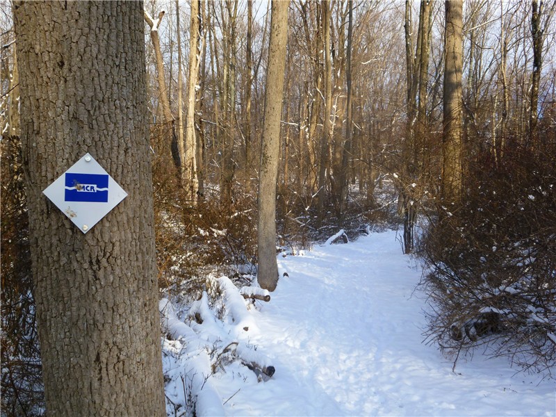
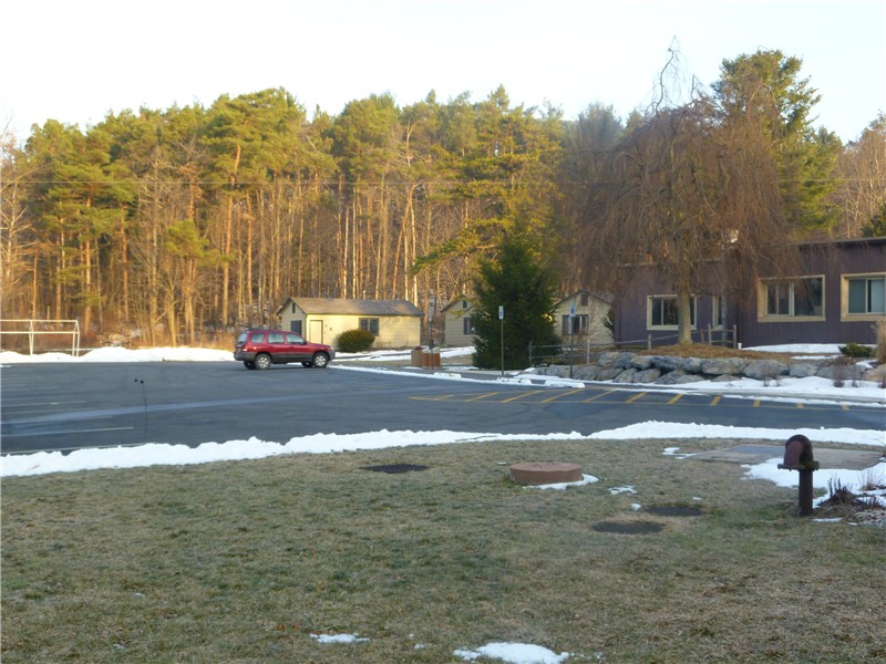
The trails start behind the visitor's center. On a less windy day I would have explored more of the trails but I ended up taking the more direct route to the black-blazed perimeter trail which was blue to yellow to black. Then it's simply following the black trail around the reservoir.
There are bird feeders outside the visitor's center. I noticed something odd out of the corner of my eye and went to investigate. There stood two small deer among all of the birds. They looked up at me briefly then continued eating bird seed from the ground.
HIKE SUMMARY:
[ 0.00] Take the blue trail from behind the visitor's center
[ 0.70] Right on blue/yellow when yellow joins in from left
[ 0.85] Right on yellow when blue goes left
[ 1.15] Left on black over bridge when yellow goes straight
[ 1.90] Cross NW2 Dike then NW1 Dike
[ 3.95] Cross main dam
[ 5.60] At boat ramp trail goes along road then across bridge and up steps
[ 5.70] Turn left on black as black/green goes right
[ 5.85] Visitor Center/Parking Lot
HIKE DESCRIPTION:
I had intended to follow the 8.4 mile Red Cross/Beech Trail and Long Path Loop from Lake Skannatati as described on the NY/NJ Trail Conference site but had to reroute to avoid following bear tracks in the snow, cutting off a little over 2 miles of the loop.
From the parking lot start steeply uphill on the inverted red triangle trail.
Near the top of the climb watch for the red cross trailhead and make note of where it is as you will be backtracking to that trail soon. Continue straight ahead to a view of Lake Skannatati.
Backtrack a very short distance and turn left on the red cross trail.
Cross over Seven Lakes Drive then past Lake Askoti on the right.
Cross the inlet stream to Lake Askoti:
At 2.3 miles reach an intersection with the Hansenclever Road (woods road). The water filled pit is what remains of the main opening of the Hansenclever Mine.
At this point to follow the NY/NJ Trail Conference directions you would turn left to continue on the red cross trail. The only prints in the snow going in that direction, however, were these...
Seems all of the human footprints turned around and headed back at this point. Not wanting to follow behind a bear I turned right on the unmarked Hansenclever Road instead. This cut off a little over 2 miles of the loop. At 3.05 miles I met up with the blue-blazed Beech Trail as it crossed over Hansenclever Road. A right turn on the blue trail put me where I needed to be to continue following the NY/NJ Trail Conference directions.
At 3.45 miles arrive at an old cemetery with tombstones dated in the 1800's.
At 5.05 miles turn right on the aqua-blazed Long Path.
At 6.10 miles cross over Seven Lakes Drive and walk along Lake Skannatati back to the parking lot.
HIKE SUMMARY:
[ 0.00] Take inverted red triangle trail (to the right of the aqua Long Path) from parking lot
[ 0.30] Arrive at scenic overlook; backtrack short distance to red cross trail
[ 0.35] Left on red cross trail
[ 0.85] Cross over Seven Lakes Drive
[ 1.60] Cross power cut
[ 2.05] Cross over wooden foot bridge
[ 2.10] Left on red cross trail where unmarked trail comes in from the right
[ 2.35] Hansenclever mine; turn right on Hansenclever Road (woods road)
[ 3.05] Right on blue-blazed Beech Trail
[ 3.45] Old cemetary on right
[ 4.40] Blue trail leaves woods road on foot path to the left
[ 4.50] Cross over Route 106
[ 5.05] Blue trail terminates; turn right on aqua-blazed Long Path
[ 5.65] Right on Route 106 for 250 ft then continue on aqua-blazed Long Path to the left
[ 5.90] Cross power cut
[ 6.10] Cross over Seven Lakes Drive
[ 6.20] Arrive back at parking lot
Be sure to bring some cash with you. If you are coming from New Jersey over the historic Dingmans Ferry Bridge, there is a $1 toll each way - no EZ Pass as this is a privately owned, old-fashioned kind of bridge. The PEEC also asks for 50 cents per trail guide - the guides are very informative and highly recommended. Numbers attached to trees, color coded to the trail and trail guide, are explained in the corresponding trails guides. If the office is closed there is a display and self pay outside the front door. For this hike you would need the orange, yellow and blue guides.
HIKE DISTANCE: 7.7 miles with many shorter options available
HIKE DESCRIPTION:
This hike starts on the combined yellow/red blazed trail just to the left of the yellow cabin (Cabin #1) in the picture below.
Stay on yellow as red leaves, merges back in and leaves again. The trail will follow along, then ascend the ridgeline to the left.
An outcrop on the ridge overlooking wetlands.
Steep descent from the ridgeline.
Looking back up the descent from about 1/3 way down.
Chimney from former homestead.
The red trail joins back in at 2.9 miles after crossing a bridge over small waterfalls. At the end of the yellow/red trail, turn left on the paved road then left again between any two of the brown cabins.
Walk straight through the field towards the fire pit where you will find the trailhead to the blue Fossil Trail to the left.
At 3.95 miles arrive at the Fossil Quarry. They ask that you leave fossils for others to enjoy and indeed, there are many displayed on a fallen tree trunk.
At 4.65 miles turn left on orange when orange/blue goes right.
Old fireplace with views of Kittatinny Ridge in New Jersey
View of the Delaware River Valley and Kittatinny Rige in NJ
At 5.95 miles take the side trail to left out and back which descends on steps and switchbacks down to the waterfalls (about .15 mile each way).
After retracing your steps back up to the orange trail, turn left. The trail will eventually merge with the white trail and go through pine plantations, trees planted in straight rows 50-60 years ago after logging, with the intention of harvesting before the land became protected.
The white/orange trail arrives at Pickerel Pond at 7.2 miles and follows along the pond.
A wildlife blind just before crossing the road back to the parking lot.
HIKE SUMMARY:
[ 0.00] Start at red/yellow trailhead to the left of yellow cabin #1
[ 0.45] Turn left on yellow as red goes right
[ 1.00] At #13 red trail joins briefly, cross creek on log bridge through hemlock forest
[ 1.20] Cross log bridge at #5 and ascend ridgeline
[ 1.30] Wetland overlook at ledge on right at #6
[ 1.50] Steep descent from ridge
[ 2.05] Chimney from old homestead at #10
[ 2.85] Cross bridge to right over creek
[ 2.95] Cross bridge over small waterfalls then immediate left on red/yellow along creek
[ 3.15] Trail veers to the right away from the creek
[ 3.20] Cross over 4 consecutive bridges
[ 3.55] End of red/yellow trail at #18; left on paved road; left between brown cabins; walk straight through field towards fire pit
[ 3.65] Left on blue Fossil Trail at far end of fire pit
[ 3.95] Fossil outcrop
[ 4.25] View of Kittatinny Ridge in New Jersey through trees if no foliage
[ 4.65] Left on orange where blue/orange goes right
[ 4.75] #4 Cedar Knolls with red cedars
[ 4.90] Cross over paved road; rock hop over creek; turn left then right on woods road
[ 5.10] Clearing at site of former landowner house
[ 5.25] Left at fork; trail ascends
[ 5.35] Mixed oak forest
[ 5.50] Stone fireplace with view of Kittatinny Ridge in New Jersey
[ 5.80] View of Delaware Valley and Kittatinny Ridge in New Jersey
[ 5.95] Turn left on side trail at #9 down steps and switchbacks to falls
[ 6.10] Arrive at falls; retrace steps up switchbacks
[ 6.25] Left on orange trail
[ 6.40] Left at intersection at #3
[ 6.85] Woods road through pine plantation
[ 6.95] Keep straight on orange as white joins in from the left
[ 7.10] Trail turns right and crosses two bridges
[ 7.20] Arrive at Pickerel Pond as trail turns left following along the pond
[ 7.30] Red pine plantation
[ 7.45] Cross road diagonally at curve in road to continuation of orange/white trail
[ 7.55] Rock hop over creek
[ 7.60] Cross clearing, turn right at intersection on boardwalk to wildlife blind
[ 7.70] Cross paved road arriving back at parking lot
HIKE DESCRIPTION:
From the hiker parking lot on Diltz Road, take the red dash on white trail beyond the barrier.
A short distance ahead turn right and follow the red on white trail along the power cut.
When the red on white trail leaves the power cut, stay with the red on white trail briefly then turn right on the unmarked trail to the left of the power cut; cross over a creek at .95 mile.
On the other side of the creek turn left on the unmarked File Factory Hollow trail which will run parallel to the creek. After rock hopping over the creek twice, the trail is intermittently marked with old horse trail disks. (According to the 2010 publication of the map, horses are no longer allowed in the park.)
At 1.8 miles turn left on unmarked Woodtown Road...
Then at 2 miles left on the yellow-blazed Suffern-Bear Mountain Trail:
The trail will now become more challenging with rock scrambles.
At Panther Mountain, views of the Hudson River and the New York City skyline:
At 3.9 miles turn left on the red square on white trail:
At 4.55 miles turn left on the power cut trail back to the parking lot:
HIKE SUMMARY:
[ 0.00] Start at red dash on white trailhead beyond barrier at Diltz Road hiker parking lot
[ 0.20] Left on red dash on white then immediately right on unmarked
[ 0.95] Cross over creek; turn left on unmarked File Factory Hollow
[ 1.20] Rock hop over creek; take either fork; rock hop back over creek
[ 1.40] After huge rock boulder on right, keep straight at intersection***
[ 1.80] Left on unmarked Woodtown Road
[ 2.00] Left on yellow-blazed Suffern-Bear Mountain trail
[ 2.10] Keep right on yellow as red arrow on white starts to the left
[ 2.80] Cross over red Tuxedo-Mt. Ivy trail keeping straight on yellow
[ 3.00] Cross over unmarked trail at cairns keeping straight on yellow
[ 3.70] Views at Panther Mountain
[ 3.90] Rock hop over creek; left on red square on white as yellow/red square goes right
[ 4.40] Turn right on red square at power cut (no access to power cut trail if you turn left without going through thick growth of thorny vines)
[ 4.55] Turn left; where red square goes right at a large cairn, turn left on power cut trail
[ 5.40] Turn right on red dash on white
[ 5.45] Arrive back at Diltz Road parking lot
*** In case you are wondering what lies to the right of the intersection beyond the huge boulder at 1.4 miles...
A right turn on the unmaintained Iron Mountain Trail would bring to you an intersection marked (as of this writing) by orange tape and three blue blazes in a vertical line on the other side of the tree at .4 mile.
Turn right here and follow the trail for .4 miles, sometimes marked by old white disks and some cairns, to views of the Hudson River and the New York City skyline (almost the same views you get at Panther Mountain).
I had originally intended to loop around here from the trail along the power cut but once the trail left the power cut, I lost it and had to backtrack.
Back at the intersection with the orange tape, left would bring you to a no trespassing sign .5 mile ahead just before Woodtown Road. This is not indicated as a restricted area on the map but apparently it is. In case the sign was maybe old and randomly left there, I turned left on Woodtown road heading towards Second Reservoir only to find many more NO TRESPASSING/KEEP OUT/WATERSHED PROPERTY signs so I turned around and headed back.


