ABOUT THE PARK:
The BMECC Section of The Appalachian Trail - Blue Mountain Eagle Climbing Club
DIRECTIONS:
GPS Coordinates to Bake Oven Knob Parking 40.744774, -75.738075
View Larger Map
 |
| My GPS did not tell me this, but when on paved Ulrich Road, at a fork where a gravel road goes to the left and the paved road continues right, turn left on the gravel road which switchbacks uphill to the parking lot. |
 |
| Huge parking lot on right to access the AT northbound. There is also a parking lot on the right. |
TRAIL MAP:
PA Appalachian Trail Map Sec. 1-6: Delaware Water Gap to Swatara Gap - Keystone Trails Association
HIKE DISTANCE:
From Bake Oven Knob parking - 10.55 miles
From Ashfield Road parking - 4.25 miles
APPALACHIAN TRAIL SECTION HIKING:
TrailHeadFinder.com - AT section miles 1234.0 to 1239.3
PEAKBAGGING:
Bake Oven Knob - Peakery.com
THE HIKE:
 |
| The AT northbound starts in the corner of the parking lot. Because Bake Oven Knob is only a short distance from this lot, expect a lot of graffiti and litter along the way. |
 |
| There are several old county boundary markers along the way. |
 |
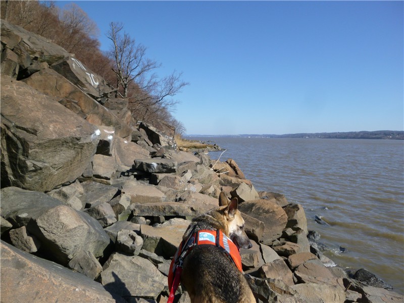
| Don't be fooled by the smooth trail leaving the parking lot. Although the elevation change on this hike is minimal since the entire hike is along the ridge, there will be several challenging boulder crossings and the trail, for the most part, will be pretty rocky. |
 |
| Graffiti announces the arrival at Bake Oven Knob |
 |
| View to the east. |
 |
| View to the north - the hike will be following this ridge on the AT northbound. |
 |
| View to the east. |


 |
| View to the west with the sun rising from behind over the ridge. |

 |
| The AT continues north from Bake Oven Knob along the rocky ridge... |
 |
| ... the over boulders with lots of rock hopping along the western side of the ridge. |
 |
| Blowdowns from Hurricane Sandy were minimal but I brought along some snippers to clear the way... |
 |
| ... because Shawnee doesn't do blowdowns if small branches are blocking her way. |
 |
| Cross a power cut where they saved the jumbled mass of boulders special for the AT to cross over! |
 |
| After the power cut, about a mile stretch of easier trail. |
 |
| Enjoy it while you can because... |
 |
| ... next up is the blue-blazed South Trail, if you dare. |
 |
| They aren't kidding! If you have ever hiked The Giant Stairs in the New Jersey Palisades, this is very similar. It took me 1 1/2 hours to do this 1-mile stretch. Shawnee demonstrates in the video below. |
 |
| Looking back to the south along the ridge where the AT resides. |
 |
| The relentless sea of often wobbly rocks and boulders continues on... |
 |
| ... and on ... |
 |
| But with rewards of great views. The views are better than at Bake Oven Knob and there is no graffiti or litter. |
 |
| Had to render a little first aid at the end but it looked worse than it was, just a scratch from the boulders. Be sure your first aid kit is stocked before heading out on this hike! |
 |
| The blue-blazed South Trail meets back up with the AT almost over the Lehigh Valley Tunnel at I-476 then southbound on the AT all the way back to the parking lot. |
 |
| To shorten this hike to about 4 miles and only do the nothern South Trail lollipop part you can park on Ashfield Road at the power cut where the AT crosses over. GPS coordinates are 40.7696,-75.694051 |
HIKE SUMMARY:
[ 0.00] From the northeastern corner of the northern parking lot, head north on the white-blazed Appalachian Trail
[ 0.15] County marker on left and side trail on right that goes to campsite; keep straight
[ 0.40] Bake Oven Knob with views on both sides
[ 0.90] Bake Oven Knob shelter on right
[ 2.85] Blue Eagle Mountain Climbing Club sign on the left
[ 2.90] Woods road crosses over diagonally coming in from the right and leaving to the left at red game commission boundary sign
[ 3.05] Enter power cut
[ 3.15] Cross Ashfield Road at AT parking area and communications tower
[ 3.35] Kiosk on left
[ 4.25] Concrete SGL boundary marker
[ 4.35] Keep left at unmarked fork then veer right at next fork at blue South Trail sign
[ 5.40] Turn left on white-blazed AT when blue ends
[ 6.30] Keep straight when beginning of blue South Trail goes left
[ 6.40] Concrete SGL boundary marker
[ 7.30] Kiosk on right
[ 7.40] Cross Ashfield Road at AT parking area and communications tower
[ 7.50] Enter power cut
[ 7.65] Woods road crosses over diagonally
[ 7.70] Blue Eagle Mountain Climbing Club sign on right
[ 9.65] Bake Oven Knob shelter on left
[10.15] Bake Oven Knob
[10.40] County marker on right and side trail to campsite on left
[10.55] Back at parking lot