

Harriman State Park - New York State Parks
DIRECTIONS:
GPS Coordinates 41.275333, -74.088773
 |
| Lake Tiorati Parking |
HIKE DISTANCE: 10.7 miles
THE HIKE:
 |
| Starting on the blue Lake Tioroti Trail from the parking lot. |

 |
| At the T-intersection with a water tower on the left, right on... |
 |
| ... the Appalachian Trail/Ramapo-Dunderberg Trail for a few steps ... |
 |
| ... then left on Arden Valley Road to a right on the Long Path at the bend up ahead. |
 |
| I had not done this 2-mile section of the Long Path yet so it was incorporated into this hike. |
 |
| As we were hiking along ... |
 |
| ... a little ruby crowned kinglet similar to this one landed on Brodie's leash - TWICE! - and I missed the shot both times. These kinglets were everywhere and they are FAST! |


 |
| At the intersection where yellow starts to the right, we turned left on an unmarked woods road. |


 |
| At the next intersection, right on Baileytown Road. I was in search of a cemetery shown on the map along this route. |

 |
| And here it is. It is surrounded by a stone wall so you can't miss it. |
 |
| There aren't very many tombstones left. |


 |
| Continuing on Baileytown Road. |

 |
| Coming up on Camp Lanowa which was boarded up for the winter. |
 |
| It was hard to find the right turn that I needed to make here but after some searching I finally found it. This is looking back at the camp so the entrance to this trail is directly opposite the large camp pavilion. |
 |
| The path becomes a little better defined but it is not as clear as the unmarked trails were up to this point. |

 |
| I completely lost the trail near the top but that is where it runs into the Long Path so it was not a problem. I was going to continue on this same unmarked path crossing over the Long Path but could not find that part at all so I turned right on the Long Path instead. |

 |
| Some manmade stonework in the rocks. |
 |
| It was a difficult scramble up because the sun was directly in my eyes and I could see nothing. |
 |
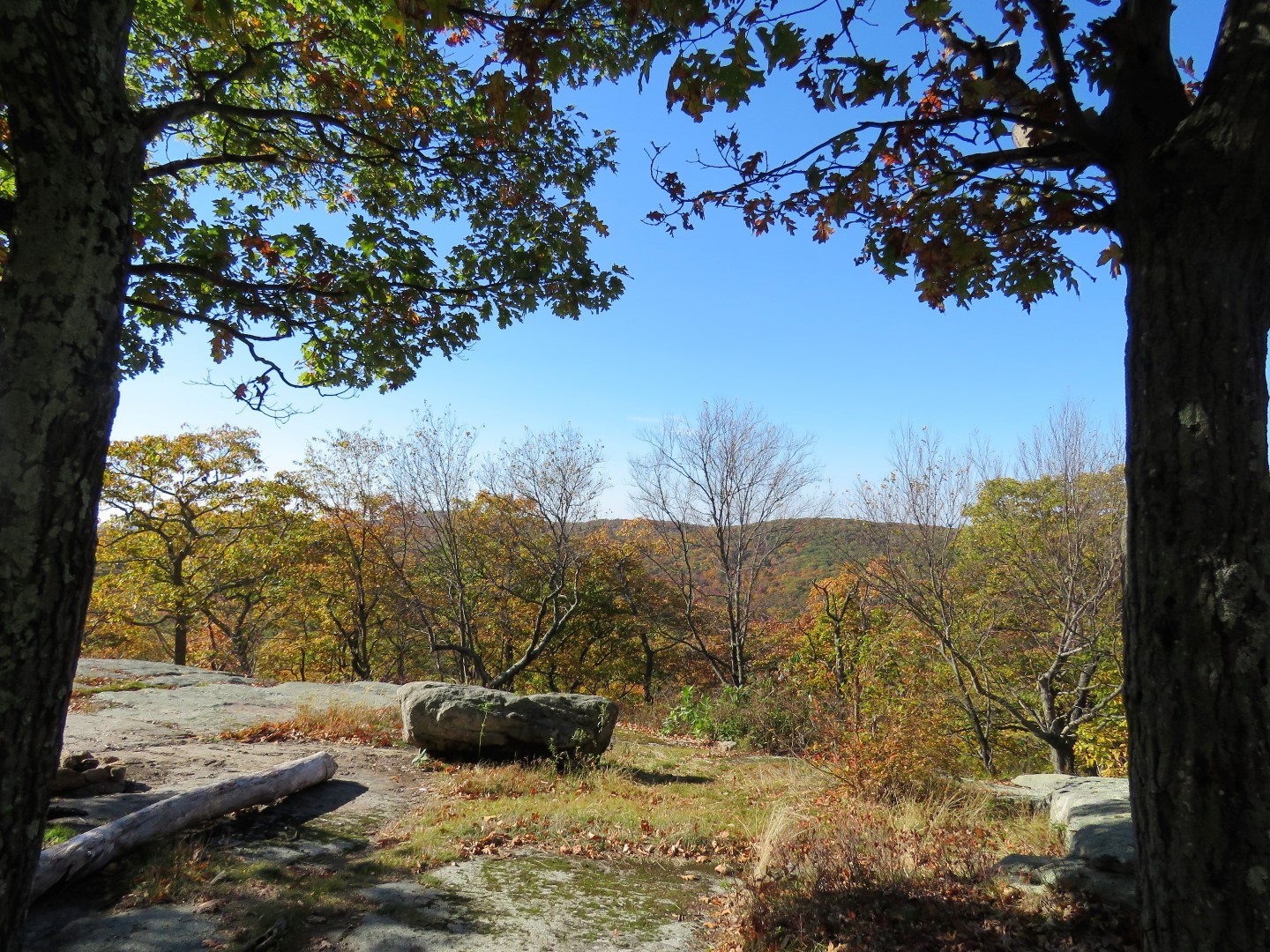
| At the top ... |
 |
| ... with some partial views. |

 |
| Coming up on the Stockbridge shelter. |
 |
| After descending a rocky section ... |
 |
| ... we turned left on yellow where we had gone the opposite way earlier down to that cemetery. |


 |
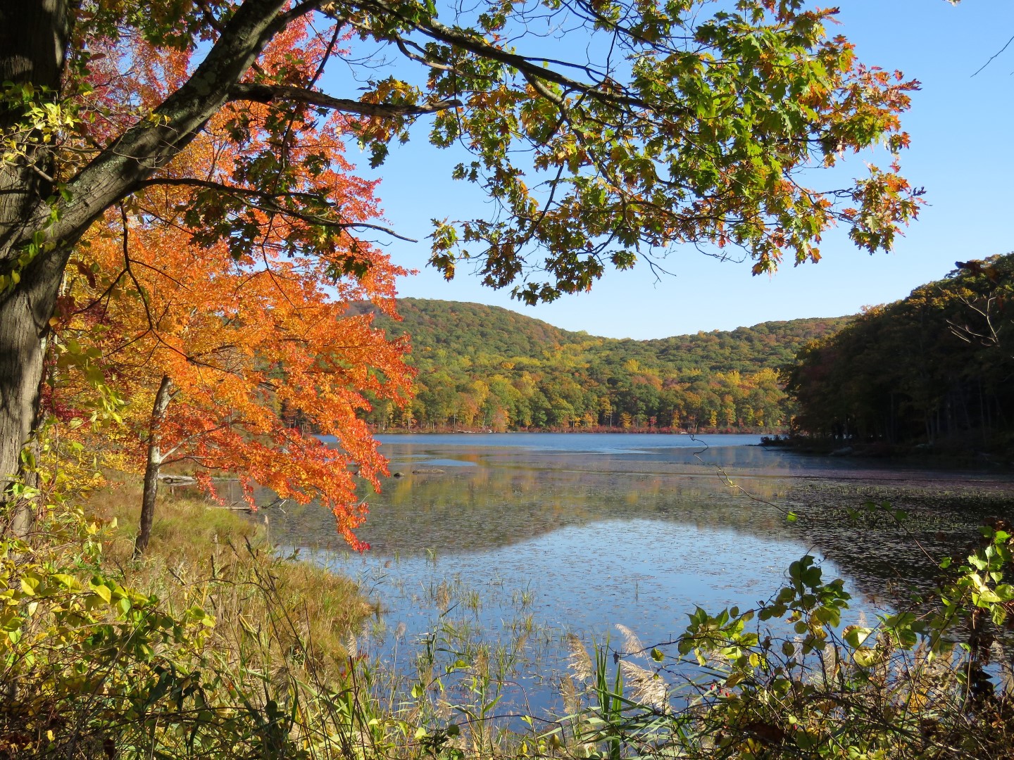
| Lake Nawahunta |
 |
| The yellow trail crosses the inlet ... |
 |
| ... and continues through a very pretty area along the other side of the lake. |


 |
| The yellow trail continues the other side of Seven Lakes Drive. |


 |
| Crossing through the Silvermine Lake parking lot. |
 |
| Silvermine Lake |
 |
| We followed the woods road along the north side of Silvermine Lake and crossed the dam. |

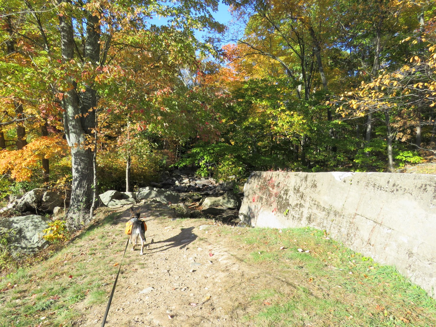 |
| At the end of the dam an unmarked trail descends steeply to the left ... |
 |
| ... then crosses the outlet. |
 |
| Continuing on a woods road along the eastern side of the lake. |

 |
| The woods road then leaves the lake. |

 |
| The Appalachian Trail/Ramapo-Dunderberg Trail crosses over; we turned right. |


 |
| William Brien Memorial Shelter |
 |
| A partial view of the Hudson River. |
 |
| I had gotten a later start than usual on this hike and the sun was setting so we needed to pick up our pace. |
 |
| Where the Appalachian Trail leaves to the right we stayed left on Ramapo-Dunderberg. |


 |
| Ramapo-Dunderberg turns right but that would take us away from the parking lot and add distance so we turned left on an unmarked trail blocked by branches. This trail was harder to follow and full of blow downs but it was not far to Lake Tiorati which was visible from this point. |
 |
| Coming out on Tiorati Brook Road at Lake Tiorati. |

 |
| Coming up on the Tiorati Circle. |

 |
| Back at the parking lot just before dark. It was completely dark by the time I pulled out of the lot. |