Showing posts with label MA Mount Everett State Reservation. Show all posts

Sunday, October 16, 2011

Mount Everett State Reservation, MA: Guilder Pond - Mount Everett - Jug End


ABOUT THE PARK:
Mount Everett State Reservation - Massachusetts Department of Conservation and Recreation
Click for South Egremont, Massachusetts Forecast

DIRECTIONS:
GPS Coordinates 42.103508, -73.452774

View Larger Map
Shortly after turning into the park at the park sign, there is a gate with parking before the gate.  The gate is generally open during the summer so people can drive up to the Guilder Pond picnic area, however, due to severe erosion from Hurricane Irene, at this date the road is gated.

TRAIL MAPS:
South Taconic Trails Map (check for new edition Spring 2015) - NY/NJ  Trail Conference
Mt. Washington State Forest Trail Map - Massachusetts DCR
South Taconic Range Map - Berkshire Natural Resources Council

HIKE DISTANCE:
Guilder Pond - Mount Everett - Jug End:  9.3 miles
Guilder Pond - Mount Everett:  3.85 miles
Guilder Pond - Jug End:  7.5 miles

PEAK BAGGING:
Mount Everett - Peakery.com
Mount Bushnell - Peakery.com

APPALACHIAN TRAIL SECTION HIKING:
Trailheadfinder.com - AT section miles 1490 - 1493.5

THE HIKE:
Walk beyond the barrier to begin the hike up the gravel road.
Erosion damage to the road from Hurricane Irene.
Turn left on the blue-blazed Guilder Pond Trail which loops around the pond.
Guilder Pond
Guilder Pond Panorama
The Guilder Pond Trail loops around and meets up with the white-blazed Appalachian Trail.  Turn left to Jug end, right to Mount Everett.  Heading towards Mount Everett, the AT comes out into the upper parking lot at a composting toilet with a large Appalachian Trail sign to the left.

Either continue left on the AT or straight beyond a barrier on a gravel road up Mount Everett.  For this hike I chose to ascend on the gravel road and descend on the Appalachian Trail.
A view of Mount Greylock from the gravel road up Mount Everett.
Going up the gravel road, a final sharp turn to the right brings you to a stone shelter with amazing panoramic views.  This view is not on the AT so if you don't take the gravel road, you need to leave the AT to get to it.
Stone shelter at views.
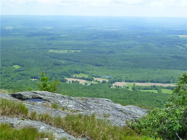
Panoramic view at stone shelter.  Mount Greylock is the tallest mountain in the distance.
Continue along the gravel road which meets up with the white-blazed Appalachian Trail.  Turn left on the AT to reach the summit of Mount Everett.
More views before reaching the summit.
Old fire tower footings at the summit of Mount Everett.
View south of Mount Race from Mount Everett.
From this point retrace back to the parking area either on the AT or the gravel road then continue north on the AT to Jug End.
Fall Foliage on the Appalachian Trail
Views on the way to Jug End.
Cairn at Jug End - continue on a few more steps for views.
View from Jug End
On the way back clouds had moved in so it gave the views along the AT a different look.
Retrace steps back to the upper parking lot, turn right beyond the composting toilet and take the gravel road back to the lower parking lot.


FALL HIKING SNACK RECOMMENDATION:
Super Moist Pumpkin Bread
Because I was in the process of having some dental work done, I was not allowed to eat anything crunchy so I had to come up with a soft hiking snack.  I made a few modifications to the Super Moist Pumpkin Bread recipe (used half the sugar, omitted walnuts, added 1/2 tsp. cloves, used whole wheat flour) and not only was it perfect for a fall hiking day, it was delicious and vegan!

HIKE SUMMARY:
[  0.00]  From parking area before gate, walk beyond gate and follow the gravel road
[  0.65]  Turn left on blue-blazed Guilder Pond Trail
[  1.20]  Unmarked side trail to right to rock outcrop with pond view
[  1.35]  Turn right on boardwalk on white/blue-blazed combined Appalachian Trail/Guider Pond Trail
[  1.45]  Straight through parking lot past composting toilet on right, cross barrier and follow unmarked gravel road
[  1.60]  Appalachian Trail joins gravel road briefly from left then leave to the right
[  2.05]  View at stone cabin, continue straight to white-blazed Appalachian trail and turn left
[  2.20]  View to the right at blue triangle marker
[  2.30]  Summit of Mount Everett at old fire tower footings; retrace
[  2.40]  View to the left at blue triangle marker
[  2.60]  Keep straight on AT when unmarked road to stone shelter comes in from right
[  2.85]  AT turns left on gravel road briefly then leaves to the right on stone steps
[  3.00]  Come out at upper parking lot at large AT sign, keep left towards composting toilet, turning right just before on the white/blue (combined AT/Guider Pond Trail)
[  3.15]  Continue straight on white-blazed AT on boardwalk when blue-blazed Guilder Pond Trail goes left
[  3.40]  Straight on AT at Hemlocks Shelter sign; rock hop over creek; straight on AT when blue-blazed trail goes right to Glen Brook Shelter
[  4.00]  Rock hop over small creek
[  4.15]  Keep left on AT when blue-blazed Elbow Trail goes straight; rock hop over creek
[  4.70]  AT crosses rock outcrop with views on summit of Mount Bushnell
[  5.00]  More views to the right
[  5.65]  Rock cairn at Jug End; continue briefly to views, retrace
[  8.45]  At upper parking lot turn right beyond composing toilet and follow gravel road back to lower parking lot
[  9.30]  Back at lower parking lot

Saturday, June 11, 2011

Mt. Everett State Reservation, MA (Race Brook Falls, Mt. Race to Sages Ravine via the Appalachian Trail)


ABOUT THE PARK:
Mt. Everett State Reservation - Massachusetts Department of Conservation and Recreation

DIRECTIONS:
GPS Coordinates 42.089478, -73.411248

View Larger Map
Off-road parking for about 5-6 cars.
TRAIL MAP:
South Taconic Trails Map (check for new edition Spring 2015) - NY/NJ Trail Conference
Mt. Washington State Forest Map - Massachusetts DCR
South Taconic Range Map - Berkshire Natural Resources Council, Inc.

HIKE DISTANCE:  13.75 miles out and back

HIKE DESCRIPTION:

Pick up the blue triangle-blazed Race Brook Falls Trail from the information board at about the mid point of the parking area.
Some things to note about the trail blazes:  For the most part they are blue triangles although there are some blue rectangles - all are part of the same trail.  Sometimes triangles are used point to the direction of a turn.  In other words, if the triangle is on it's side, that indicates a turn and it is sometimes hard to notice so you have to pay close attention.  Sometimes a "tail" is drawn in to make the turn more obvious.
I had read several accounts of how poorly the trail is blazed but it appears as through there has been recent reblazing and I had no trouble at all staying on the trail. If you aren't seeing blazes, you missed a turn.

The first fork gives  the option of seeing the lower falls via a .35 mile side trail to the right.
Race Brook Falls - Lower Falls
The only way to see the lower falls is to take the side trail and retrace back to the intersection then continue on the left branch of the trail.  At another fork about .35 mile ahead, there is another option to see the lower falls from the opposite side of the creek but the view is much better from the first fork.

The trail ascends and crosses the creek at the bottom of the upper falls.
Race Brook Falls - Upper Falls
Race Brook Falls Trail terminates at the Appalachian Trail
Appalachian Trail
The south bound Appalachian Trail ascends to the summit of Mt. Race.  Once at the top, the trail follows along the edge of the eastern side of the ridge for continuous panoramic views over a distance of over 1/2 mile.
Mt. Everett to the north as seen from Mt. Race
View of Massachusetts countryside to the east from Mt. Race
Twin Lakes in Connecticut from Mt. Race
Descend from Mt. Race, cross over Bear Rock Stream, descend into Sages Ravine:
Bear Rock Stream
Before crossing Sages Ravine Brook there is a "Welcome to MA" sign but you will still be in MA all along Sages Ravine.
Sages Ravine Brook
Sages Ravine

Where the Appalachian Trail starts to ascend to the left away from Sages Ravine Brook is a good turn around point.  The picture of the Sages Ravine sign is from up at the top of that hill but there is nothing else worth climbing up for unless you are doing a shuttle hike to parking areas in that direction.
Returning via Mt. Race

HIKE SUMMARY:
[  0.00]  From parking area take trail starting at kiosk (sign trail register)
[  0.30]  Right at fork towards lower falls
[  0.65]  Lower falls; retrace
[  1.00]  Back at intersection take left fork towards upper falls; trail parallels creek; watch for unmarked left turn to rock hop over creek short distance ahead
[  1.15]  Ascend two sets of log steps
[  1.35]  Keep left towards Race Brook Campsite (right trail to lower falls does not provide as good of a view as the first trail to the lower falls)
[  1.60]  Rock hop over creek at top of lower falls; trail turns left away from creek and ascends more steeply
[  1.75]  Trail levels out with views to the east through the trees
[  1.85]  Trail reaches creek, turns right and follows along right side of creek
[  1.95]  Cross creek to left over log bridge
[  2.10]  Rock hop over feeder stream
[  2.25]  Continue through Race Brook Campsite
[  2.50]  Trail switchbacks up short flight of stone steps
[  2.60]  Turn left on white-blazed Appalachian Trail at intersection
[  3.45]  360 degree views at top of rock scramble
[  4.10]  Trail leaves ridge into woods and descends
[  4.25]  Cross small stream
[  5.15]  Cross Bear Rock Stream
[  5.35]  Keep straight when trail to right goes to Laurel Ridge Campsite
[  6.05]  Keep straight when trail merges in from left (easy to miss veering left on the return route so be sure to turn around and make note of this area as a fork going in the opposite direction)
[  6.15]  Keep left when unmarked woods road goes right
[  6.25]  Rock hop across Sages Ravine Brook
[  6.35]  Ascend rock steps where trail parallels ravine from higher up
[  6.45]  Cross feeder stream on log bridge
[  6.75]  Keep left on white-blazed trail when log bridge crosses over on blue-blazed trail to Sages Ravine Campsite
[  7.00]  Turn around to head back when trail ascends uphill to the left
[  7.25]  Keep right on white-blazed trail when log bridge crosses over on blue-blazed trail to Sages Ravine Campsite
[  7.50]   Cross feeder stream on log bridge
[  7.70]   Rock hop across Sages Ravine Brook
[  7.85]  Keep straight on white-blazed trail when woods road comes in from left
[  7.95]  Left at unmarked fork when woods road goes right
[  8.70]  Straight on white-blazed trail when trail to Laurel Ridge Campsite goes left
[  8.85]  Cross Bear Rock Stream
[10.00]  Exit woods on to ridge with views
[10.40]  Summit of Mt. Race
[10.60]  360 degree views with Mt. Everett straight ahead before descending from Mt. Race
[ 11.55]  At intersection, right on blue triangle-blazed Race Brook Falls Trail
[ 11.80]  Follow trail through Race Brook Falls Campsite
[12.25]  Cross over log bridge
[12.35]  Watch for left turn over creek where trail appears to go straight
[12.70]  Cross creek at bottom of upper falls
[13.00]  Keep straight when side trail to lower falls goes left
[13.25]  Descend two sets of wooden steps
[13.35]  Trail turns left and rock hops over creek
[13.50]  Keep right at intersection where left goes to lower falls
[13.65]  Trail exits woods and skirts small field
[13.75]  Arrive at parking area