Saturday, February 27, 2021

Tatum Park, NJ - Meadow Run


ABOUT THE PARK: 
Tatum Park - Monmouth County Parks 

DIRECTIONS: 
GPS Coordinates 40.38934, -74.13681
Holland Activity Center Parking

TRAIL MAP: 
Tatum Park Brochure and Trail Map - Monmouth County Parks

HIKE DISTANCE:  2 miles
 
THE HIKE: 
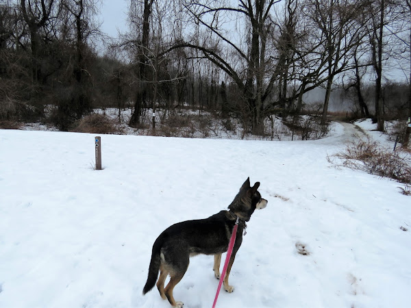
The trusty snow depth map showed no snow south of me.  My yard was 90% free of snow.  Could I have been more sure that 30 minutes south there would be little snow?  There was almost no slow until about a mile from Tatum Park when I started wondering why there was so much snow on the ground - EVERYWHERE!  The park was packed with snow, ice and slush.  Probably not my best idea to forge ahead in hopes I would find clear trails so it was very slow going as I had to watch every single step and foot placement because a fall at this point in my recovery could be devastating.  Fortunately I never slipped or fell but it was quite a leg muscle workout.

It had been raining all morning so there was fog floating over the snow.
The Meadow Run Trail was straight ahead but I turned left towards the maintenance road thinking that might have less snow and ice.
At times the snow was a good 6 inches deep and that is where I often had to step to avoid iced over footprints.
The maintenance road.
Ahhhh, if only more of the trail had been this clear.  It was nice to take a few normal steps in a row.
It was back and forth between snow/ice and clear sections.
Eastern Bluebirds hanging out with ...
.... robins.  There were even a couple of swarms of bugs.  Spring is coming.
We ended up circling a field that was unmarked and not on the map.
Meeting back up with the Meadow Run Trail.
A short stretch on a trail.  It felt good to be on a trail again, even if just for a few steps.
Retracing on the maintenance road.
Had there been no snow, I would have taken this trail leaving the maintenance road but just the steps going down were packed with ice.  Next time when everything has melted.
Back at the parking lot.

Wednesday, February 24, 2021

Perth Amboy Harbor Walk, NJ

ABOUT THE PARK:  

DIRECTIONS:
GPS Coordinates 40.500701, -74.276635
Public parking lot at the far western end.

TRAIL MAP: 
None

HIKE DISTANCE:  2.8 miles (1.4 miles each way)
 
THE HIKE: 
On a long awaited gorgeous, sunny, 51 degree day in the middle of the week, a long lunch hour was in order. 
We went out on the first pier where apparently dogs are allowed because there was no sign.  Dogs are not allowed on the other two piers along the way.
Perth Amboy Wildlife
The walkway splits and we intended to loop back from the left but it turned out to be too icy that way.
The back of a Veterans Memorial.
The would be that Great Beds Lighthouse across the Raritan Bay.
Another possibility to loop a section when the upper level is not icy.
Raritan Yacht Club
No dogs allowed on these piers.
This would be the end where we tried to loop around but ran into ice.
There were some clear steps to the upper level so we gave that a try.
You can see three different levels - the highest where we were and one on either side of the parking lot - some options when everything has melted.
Heading back down.
Back at the parking lot.