Lehigh Gap Nature Center - lgnc.org
A.T. Reroute Opens in Pennsylvania - Appalachian Trail Conservancy
DIRECTIONS:
GPS Coordinates 40.784222, -75.609287
 |
| Lehigh Gap Nature Center Parking |
TRAIL MAP:
Lehigh Gap Nature Center Trail System - lgnc.org
HIKE DISTANCE: 9.4 miles
THE HIKE:
For reference, I last hiked here in February 2012. The trails are the same but the Appalachian Trail was rerouted to the scenic side of the mountain. The Devil's Pulpit is now closed but it was open in 2012 so the pictures are at the link, above.
 |
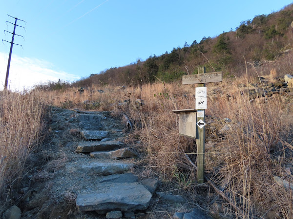
| Starting on the Prairie Warbler Trail from the parking lot. |
 |
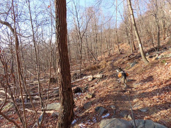
| Right on the Woodpecker Trail. |
 |
| This leads to the Appalachian Trail where we turned right to head south on the AT. |
 |
| Outerbridge Shelter |
 |
| Until 2022 the AT went left and the blue North Trail went right. Since 2022 it has been reversed with the AT to the right and the blue Bypass Trail to the left. We took the Bypass Trail. |
 |
| There is still an occasional faded AT blaze on the blue Bypass Trail. |
 |
| Crossing the access road for the communication towers. |
 |
| Coming up on the first communication tower ... |
 |
| ... the blue Bypass Trail ends at the Appalachian Trail where we turned right now heading north on the AT. |
 |
| Just a few steps after the trail veers to the right ... |
 |
| ... views begin that make it feel like you could walk off the edge of the earth. |
 |
| The Lehigh River with I-476 to the left. |
 |
| Coming up on the other two communication towers. |
 |
| Some old blue paint of the former North Trail peaking through. |
 |
| Here the AT turns right and that would take us back to where we had come off of the Woodpecker Trail. We turned left here on the orange Charcoal Trail. |
 |
| Note the sign stating that the Devil's Pulpit is closed. |
 |
| Just before this sign is where the trail to the Devil's Pulpit used to be. |
 |
| Now getting views going in the opposite direction. |
 |
| This trail is VERY rocky at times. |
 |
| Leaving all of that rockiness behind turning left on the yellow Prairie Grass Trail. |
 |
| Smooth and flat on this trail. |
 |
| The Chestnut Oak Trail is to the left. I believe that is the way I went the last time. We continued right on the Prairie Grass Trail. |
 |
| The Prairie Grass Trail ends at the LNE Trail where we turned right for a short distance ... |
 |
| ... to a right on the Three Ponds Trail. |
 |
| Either left or right here; we went left and returned from the right. |
 |
| The Three Ponds Trail comes out on the D & L Rail Trail briefly ... |
 |
| ... before leaving to the right. |
 |
| Towards the end the trail becomes narrower and gravelly. |
 |
| There is a split where a viewpoint is to the left |
 |
| Taking the left fork, the trail climbs up above the Lehigh River. |
 |
| The D&L Rail Trail is visible below. |
 |
| The trail continues all the way back to the parking lot. |


Brodie shows vey much interest looking here and there. It seems he is enjoying himself most of the time on his hikes.
ReplyDeleteLooks can be deceiving. He does enjoy it but when you see him turning his head focused on something 9 time out of 10, it is because of the sound gunfire which was the case on this hike along the ridge. He goes into "we are all going do die" panic mode and starts pulling which is so annoying. Woodpeckers have the same effect since that sounds like gunfire to him. I have to give him anxiety meds every time we hike to take the edge off. You would think after 7 years he would get over it but no such luck. I avoid hikes where I see shooting ranges nearby on the map but that doesn't necessarily mean somebody isn't shooting somewhere.
DeleteDo you have paw warmers for Brodie after hiking in the snow? Hard to get doggie snow boots. He is a real trooper. Must be really aggravating to hike peacefully until hearing gun fire from firing ranges.
DeleteI have never had to use anything on paws. They toughen up from hiking all the time and the snow does not seem to affect him. Brodie shivers when it is in the 20's so he wears his coat then. Yes, very aggravating when there is gunfire. Just as it stops and Brodie calms back down, it starts up again. Over and over and over. Don't understand the obsession with shooting. I think a lot of times it is just people target practicing on their property. I can tell when it is a shooting range - that's explosions of gunfire and why I now avoid Ringwood State Forest unless it is a rare day that the shooting range is closed. It is miserable to hike there with or without a dog in panic mode.
DeleteMy horse hates gunshots as well. Believe me.
ReplyDeleteI feel you :(
Delete