ABOUT THE PARK:
Delaware Canal State Park, PA - PA DCNR
DIRECTIONS:
GPS Coordinates 40.59390, -75.18923
 |
| Parking lot just south of the Riegelsville Bridge. |
TRAIL MAP:
Delaware Canal State Park, PA - PA DCNR
HIKE DISTANCE: 8.2 miles (4.1 miles each way)
THE HIKE:
The previous weekend we had hiked
a section north of the Riegelsville Bridge. For this hike we headed south.
 |
| Turning left out of the parking and walking towards the Riegelsville Bridge around the bend up ahead. |
 |
| I didn't get a picture of it but the lady in the bridge office on the left came running out when she saw us to give Shawnee a cookie. She had given her a cookie the weekend before when we had parked in the off street parking just slightly ahead. |
 |
| Heading across the Riegelsville bridge on the southern side with a new inner tube in the tire that was flat last week. |
 |
| The Delaware River to the south. |
 |
| A swallow resting on the power line. There were millions of these guys zooming over the water. I suppose they need to rest, too. |
 |
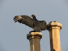
| Black vultures on top of the Riegelsville Inn across from the bridge. |
 |
| Coming off of the bridge you have to step out into the road, turn left in the road for a few steps, then continue on the concrete walk next to the Riegelsville Inn parking lot. |
 |
| The concrete walk leads to a footbridge where we turn right and go down the steps to the towpath. |
 |
| That wood at the bottom of the picture is the railing of the landing going down the steps - that is how close we were to the black vultures dining in the Riegelsville Inn dumpster. They made like they were going to take off on a moment's notice if I were to try anything funny but I assured them we were just passing by and they stayed put. |
 |
| Down at the towpath, left under the bridge. |
 |
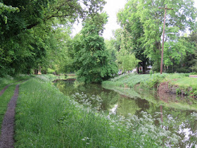
| This is a nice, quiet stretch away from traffic. |
 |
| Just a residential street on the other side of the canal. |
 |
| There were also a million gray catbirds on this particular day. |
 |
| After this restaurant the residential road ends at the the busy road so the next stretch follows along with traffic. |
 |
| Female and male American Goldfinches. |
 |
| Another gray catbird that was singing instead of meowing. |
 |
| A huge parking lot that is not on the map, accessible by the bridge over the canal up ahead. (40.58211, -75.19607) |
 |
| A little farther along, Lock 21 with parking. (40.57948, -75.19710) |
 |
| Quite fascinating how the canal flows over Cooks Creek. |
 |
| It was here that I noticed something was missing. Shawnee's left bootie. Fortunately the right one was still on because that is the paw she knuckles with. We would have to keep an eye out for it on the way back. |
 |
| A peek at the Delaware River. |
 |
| Now the towpath follows right between the Delaware River and the canal. |
 |
| Looking south down the Delaware River. |
 |
| What a fine looking family out for Sunday brunch. |
 |
| A farmer's market along the way.... |
 |
| ... accessible at the bridge. |
 |
| Just after the farm fields the towpath veers away from the busy road and all of the traffic noise. |
 |
| Yes, yet another gray catbird. |
 |
| Mr. Cardinal |
 |
| Mrs. Cardinal |
 |
| Hiking along kind of bummed at only finding the same birds over and over again (although I love them all) when I looked to the left and out on a dead tree on an island... |
 |
| ... way up there, the little black spot at the top, I zoomed in to find... |
 |
| Little did I know that not even this would turn out to be the highlight of the day. |
 |
| This isn't it but this is nice, too, because they usually fly away before you can get in a decent shot. |
 |
| More babies! |
 |
| Coming up on ... |
 |
| ... Nockamixon Cliffs, our turn around point. |
 |
| Heading back. |
 |
| He's still up there on his perch. |
 |
| Mom and dad goose usher the babies on by but Shawnee is no threat to them. |
 |
| Delaware River looking north. |
 |
| The hike back was difficult because Shawnee kept getting too close to the steep drop off into the canal and I had to keep pulling her back. Don't know what is up with that because had I wanted her to hike there teetering on the edge, she would have fought me and been all like "No, I'm scared...." We battled for 4 whole miles. |
 |
| In retrospect, the fact that I had to keep looking to my left to keep an eye on Shawnee enabled me to see something on a tree branch on the other side of the canal. What caught my eye was the outline of what looked like a bird prone on a tree branch. I zoomed in with the camera and indeed it was. But what bird was this? I had never seen anything like it. When I got home I posted the picture on a Facebook birding site for help in identifying it since I did not even have a clue how to begin Googling. Turns out it is a Common Nighthawk according to most (one birder thinks Whip-Poor-Will) but apparently getting a picture of one during the day while at rest is a very big deal because they camouflage so well. So this turned out to be my catch of the day! Sorry, Bald Eagle. |


 |
| The bootie! I had actually been asking bikers heading back towards Riegelsville if they would mind putting her bootie in the middle of the trail where I could see if if the happened to find it and looks like somebody did. It was smack in the middle! Thanks to whoever did that! |
 |
| Here is where we get off to head back to the Riegelsville Bridge. |
 |
| We are getting quite good with those steps. |
 |
| Delaware River looking south from the bridge. |
 |
| Back at the parking lot. |


No comments:
Post a Comment